Ticker for February 26, 2015
MESONET TICKER ... MESONET TICKER ... MESONET TICKER ... MESONET TICKER ...
February 26, 2015 February 26, 2015 February 26, 2015 February 26, 2015
Drought surges along with winter
What is there to say...I wish there was some good news somewhere. I guess the only
good thing going on is moisture, although I'm sure a lot of us are tired of
dealing with the frozen variety. Let's get the worst news out of the way first,
and that's the continuing, multi-year multi-billion dollar disaster known as the
2010-15 drought. After receiving some fairly significant input from ag producers
and officials across west central Oklahoma, we asked the U.S. Drought Monitor
to downgrade the drought intensity across that area to "Extreme" (D3) drought.
Word of continued dry conditions that have never really been alleviated since
2011, and exacerbated since August, left us little choice.
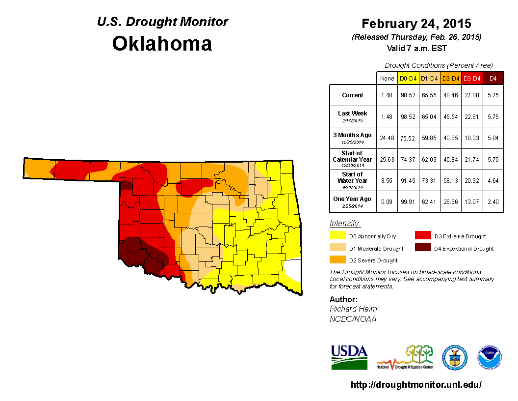
That ups the amount of D3-D4 drought to 28% from 23% last week.
One would think all this moisture would be a boon for the drought. Well, one would
be wrong! We need inches of rain, not inches of snow, although we do have some
fairly decent numbers across far SE and NE Oklahoma over the last 30 days.
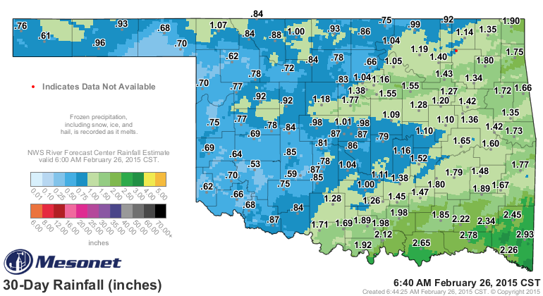
Before we go all googly-eyed over those totals, check out the percent of normal
map over that same period and that will bring you back to reality.
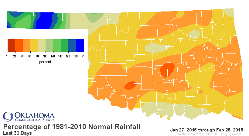
Not bad for the Panhandle! But, like much of western Oklahoma, they're dealing
with multi-years of deficits to overcome. That type of moisture will do wonders
for the topsoils, however, and the wheat and other crops needed a boost.
Speaking of moisture, what we have in store for the next several days looks
better across eastern Oklahoma, of course, but pretty sparse for western
Oklahoma.
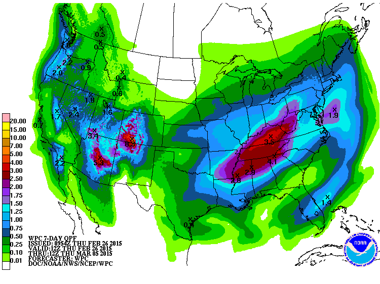
Depending on temperatures both above and near the ground, that moisture
is going to fall as either rain, freezing rain, sleet and snow. I'll just go
ahead and let you pick out whatever type you want, but with the cold front we
just had blast through, you can bet tomorrow is going to be snow. Temperatures
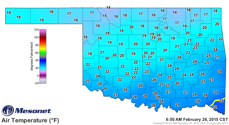
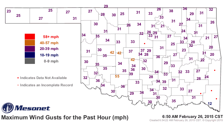
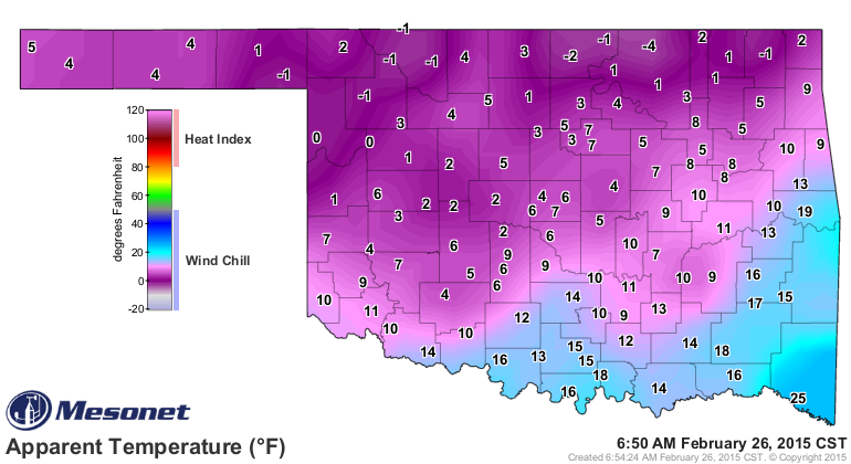
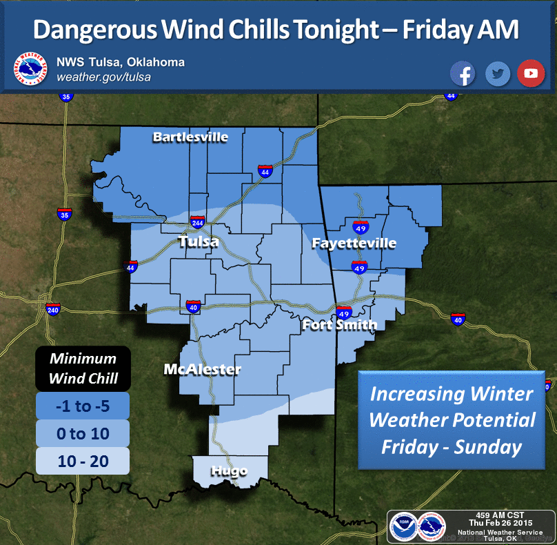
are in the teens and 20s across most of the state, and with winds gusting to
over 50 mph, wind chills are in the single digits.
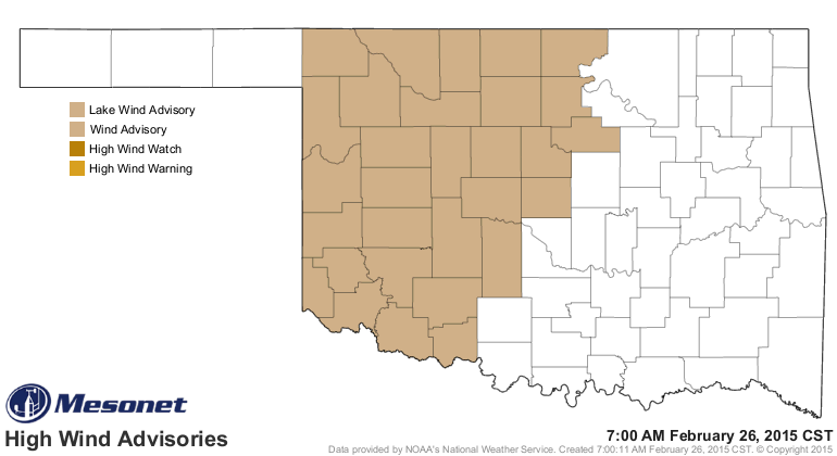
The winds have necessitated a wind advisory for the western half of Oklahoma
issued by the Norman NWS office.
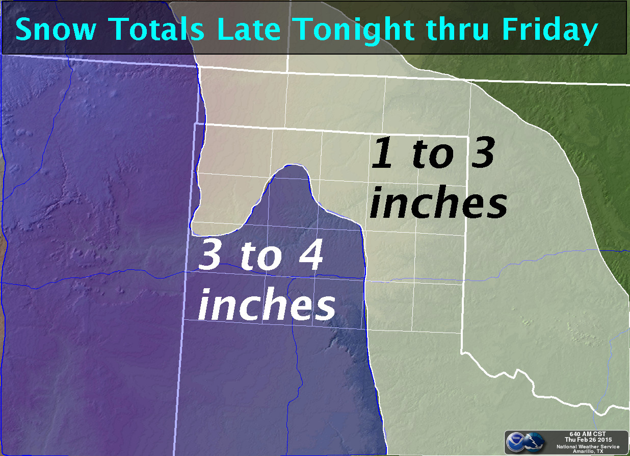
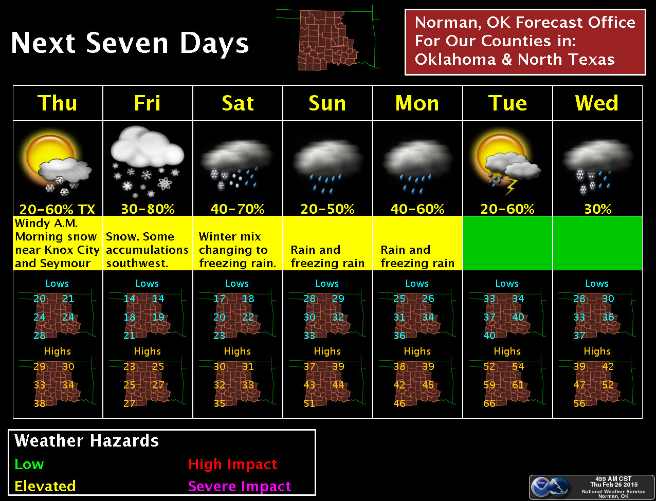
Okay, the trouble is it ain't gonna get much warmer by tomorrow when that storm
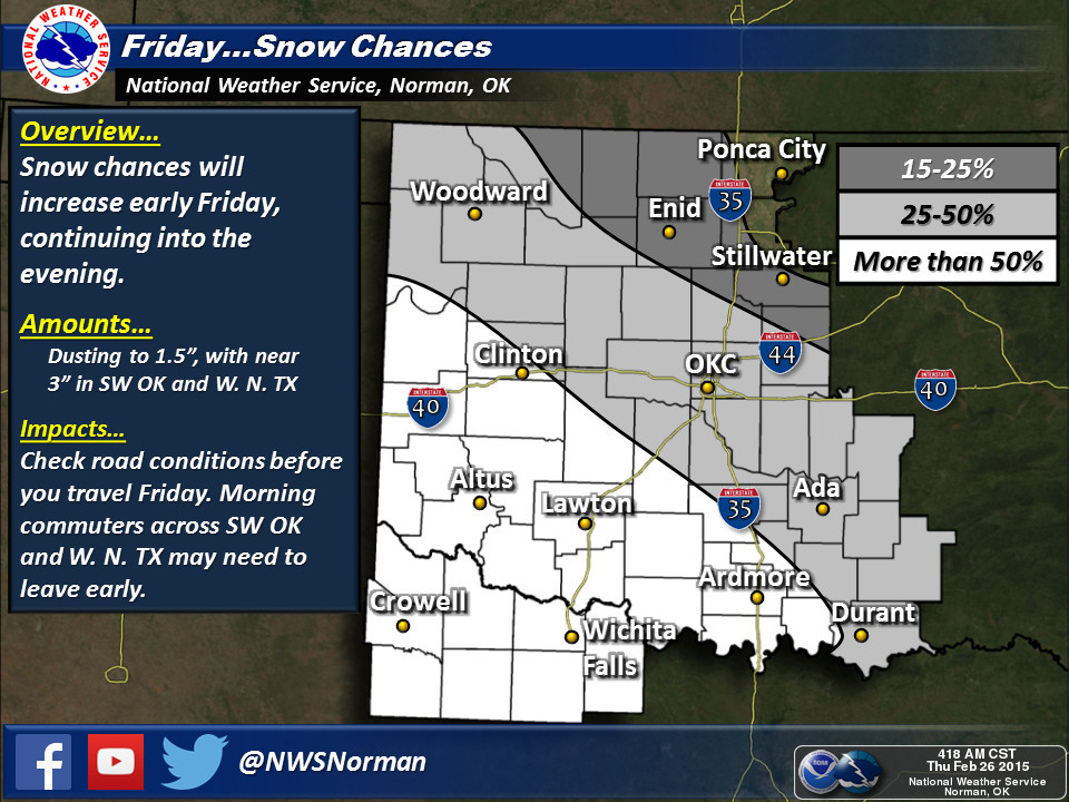
system comes across, so snow is a go. I'm gonna let the NWS tells us about it
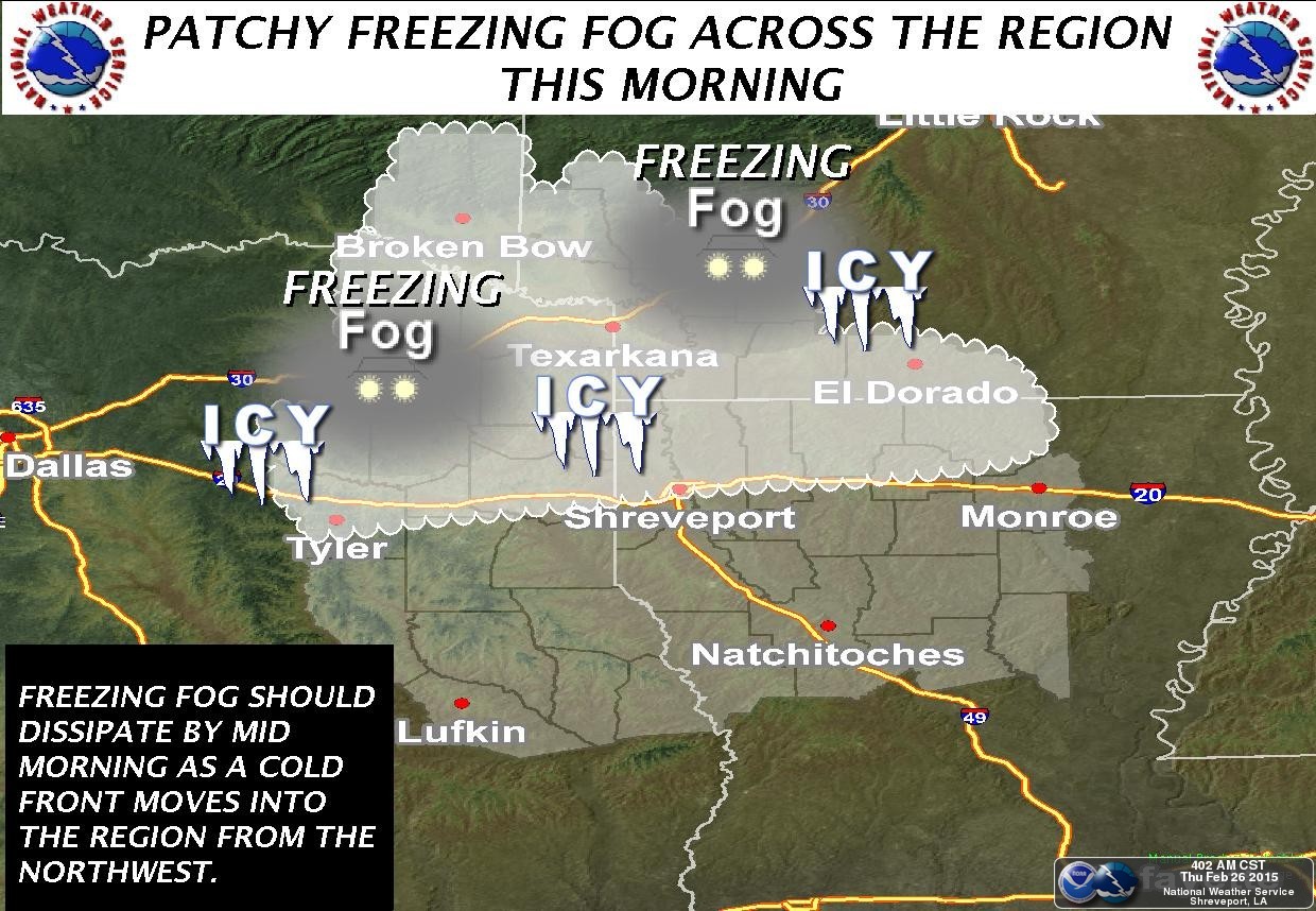
in pictures. Norman takes you out through the weekend while Tulsa and Amarillo
take us through today. Even Shreveport chimes in today with the chance for
freezing fog down across McCurtain County. Snow is not a guarantee for tomorrow,
especially as you go farther to the NE. Chances drop from more than 50% in
the SW to less than 25% in the NE, to basically nil the farther NE you go.
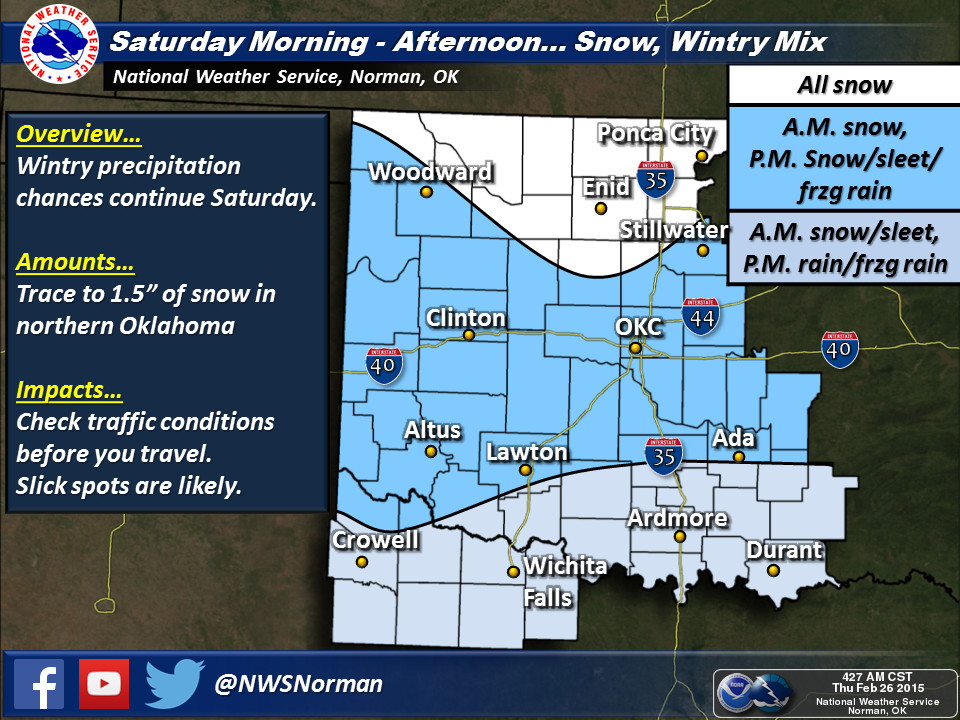
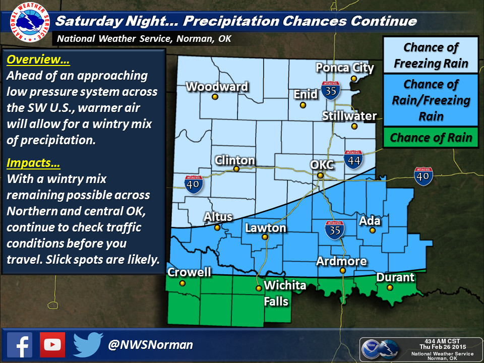
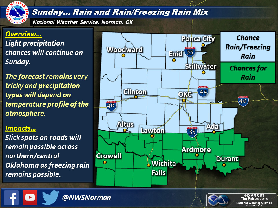
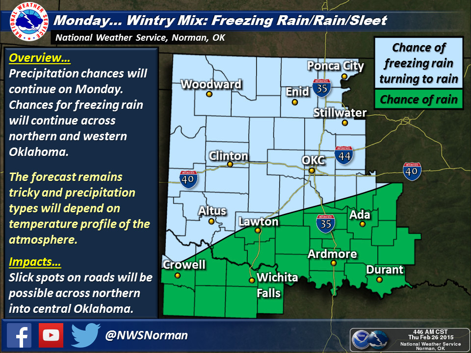
A very messy forecast, and pretty tough to pinpoint the precipitation types
right now (as the Norman NWS forecast discussion puts it: "...none of this
precip type nightmare stuff we have to deal with later in the weekend"), but
obviously it's gonna get messy a time or two through early next week. Norman's
7-day is lit up with just about everything, however...INCLUDING TEMPERATURES IN
THE 50S AND 60S NEXT WEEK!!
It seems that the highest chances for a heaver band of snow comes across
southern Oklahoma, much like Monday's storm earlier this week. There is a chance
for some higher amounts in the 1-3 inch range in that area, although a few
localized bands of higher amounts look possible as well.
With such a tough forecast, all depending on the vertical profile of temperature
and the placement of different boundaries as they move to the north and south,
best to keep appraised of the most current conditions from your local NWS
office and your favorite media outlet.
Someday it'll get warm again and this whole "winter" thing will finally blow
over.
Gary McManus
State Climatologist
Oklahoma Mesonet
Oklahoma Climatological Survey
(405) 325-2253
gmcmanus@mesonet.org
February 26 in Mesonet History
| Record | Value | Station | Year |
|---|---|---|---|
| Maximum Temperature | 93°F | MANG | 2024 |
| Minimum Temperature | 0°F | BOIS | 2002 |
| Maximum Rainfall | 1.61″ | NOWA | 1997 |
Mesonet records begin in 1994.
Search by Date
If you're a bit off, don't worry, because just like horseshoes, “almost” counts on the Ticker website!