Ticker for March 2, 2015
MESONET TICKER ... MESONET TICKER ... MESONET TICKER ... MESONET TICKER ...
March 2, 2015 March 2, 2015 March 2, 2015 March 2, 2015
Winter ain't over, but February is
We basically have 3 more days of crappy weather until glorious sunshine breaks
through the gray skies and Old Man Winter takes a bit of a break. The trick is
a bit of a warm up tomorrow before another arctic blast, then back into
warm up mode. The NWS folks can explain it better than I can, but I'll start
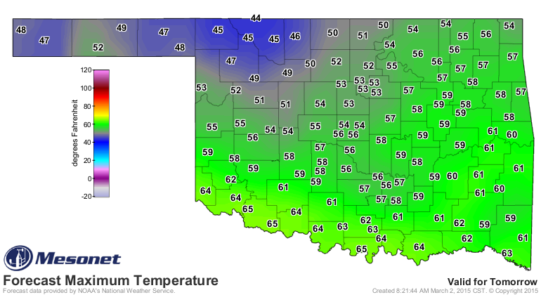
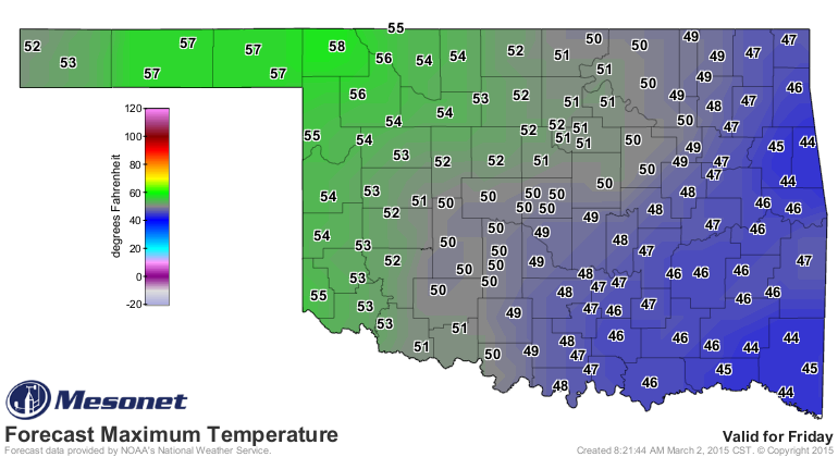
with two maps I'm looking forward to...tomorrow's high temps then Friday's, the
start of a really nice warming trend for the weekend.
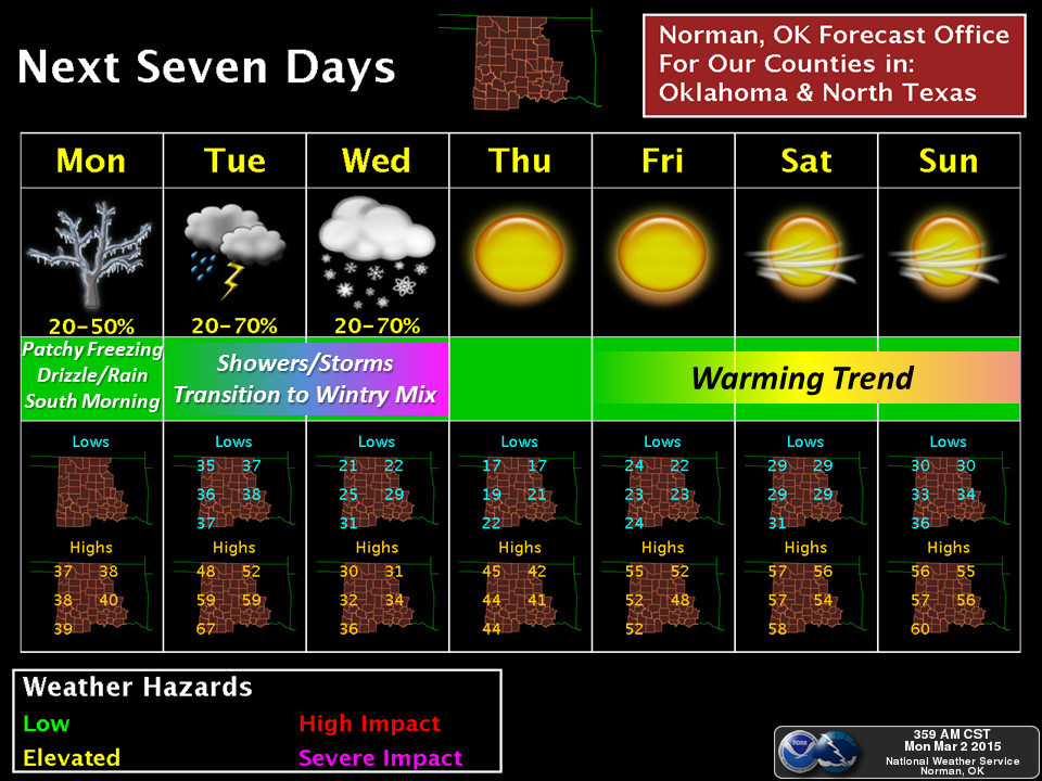
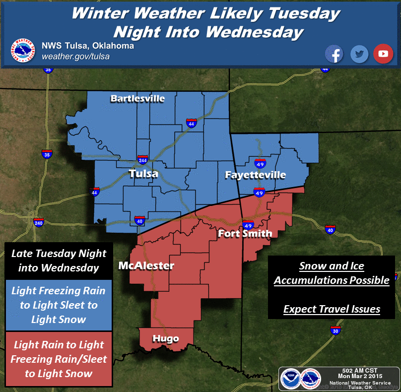
Here's the rest of the skinny from the Norman and Tulsa NWS offices (condensed
versions).
And now, a look back at February.
-------------------------------------------------------------------------------
The first two weeks of February in Oklahoma were a nice preview of spring with
temperatures rising at times into the 70s and 80s with just a few mildly cold
days scattered here and there. The final two weeks were a different story
altogether, however, as the frigid arctic air ensconced across the eastern half
of the country slid its way west and into the state. The forgotten season flexed
its muscles at that point with several rounds of wintry weather, punctuated
during the month's final few days with several rounds of snow, sleet and freezing
rain. Valentine's Day was the turning point as temperatures in the 70s and 80s
gave way to 30s and 40s the following day with little relief through the rest of
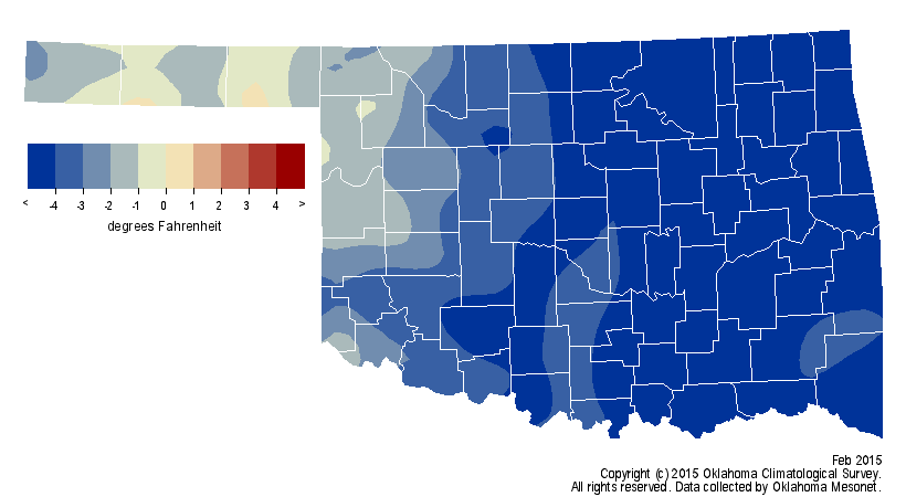
the month. That two week cold snap propelled the month to rank as the 25th
coolest on record with a statewide average of 37.1 degrees according to
preliminary data from the Oklahoma Mesonet, 5 degrees below normal.
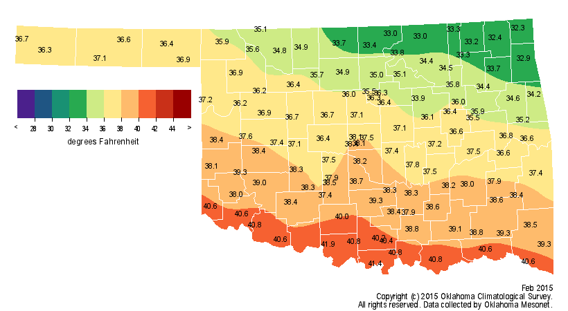
Arnett reached 85 degrees on the seventh to mark the month's highest
temperature while Kenton fell to 1 degree to claim the lowest reading. The
climatological winter season (December-February) ended as the 54th coolest on
record, a half-degree below normal.
The month was also drier than normal for most of the state, regardless of the
rain, snow and ice that fell. The Mesonet measured a statewide average of 0.7
inches, 1.13 inches below normal to rank as the 24th driest February since
records began in 1895.
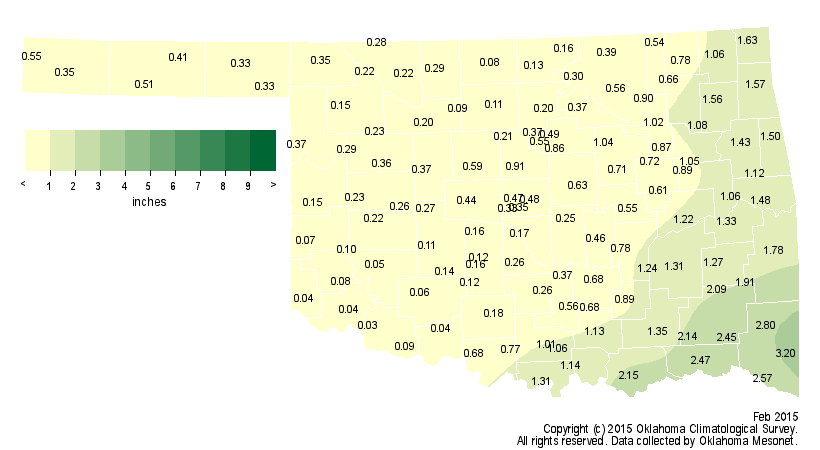
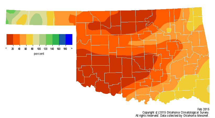
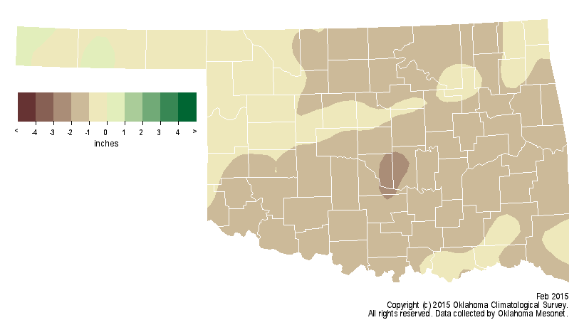
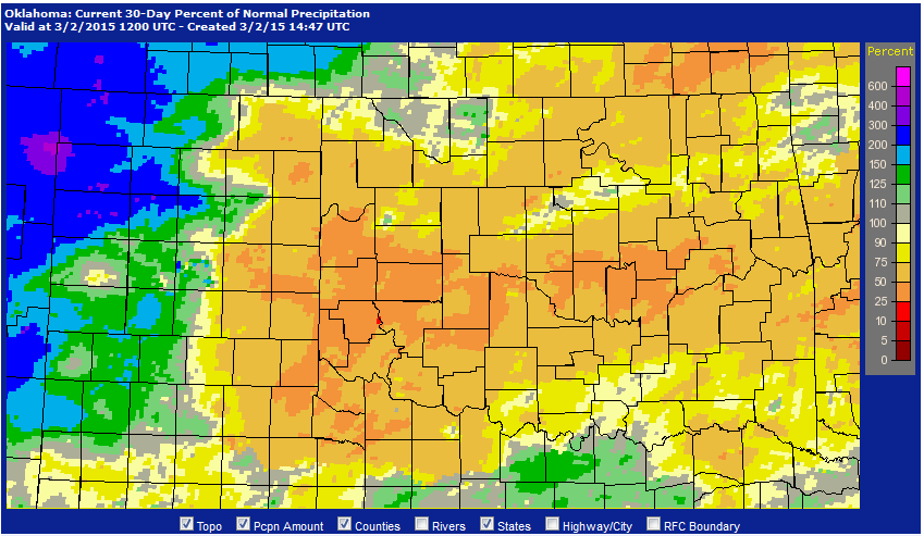
That should be considered an underestimate, however, since the snow and ice on
the month's final few days had yet to melt in the Mesonet's precipitation
gauges. Nevertheless, radar estimates confirm that for most of Oklahoma,
February's totals were from 75 percent to less than 50 percent of normal.
More than 10 inches of snow fell across the eastern Panhandle during February,
but significant totals fell over all sections of Oklahoma. The National Weather
Service (NWS) cooperative observer at Centrahoma in south central Oklahoma
reported 7 inches, and totals of 4 inches or greater were common throughout the
state. Boise City led all measuring sites across the state for the winter
season thus far with 28.1 inches, although Guymon was close behind at 21.3
inches. The climatological winter was the 22nd driest on record with a
statewide average of 1.68 inches, 1.71 inches below normal.
The disappointing winter moisture totals, along with the periods of unusually
warm and windy weather, led to bad news on the drought front during February
and the winter season. The amount of drought in the state increased from 61
percent at the end of January to 66 percent at the end of February according to
the U.S. Drought Monitor. At the end of November, 60 percent of the state was
considered in drought.
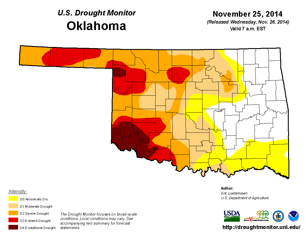
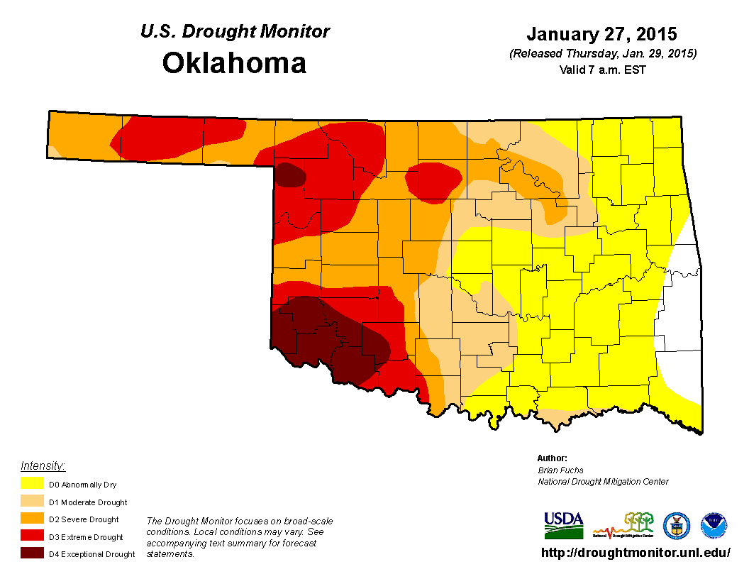
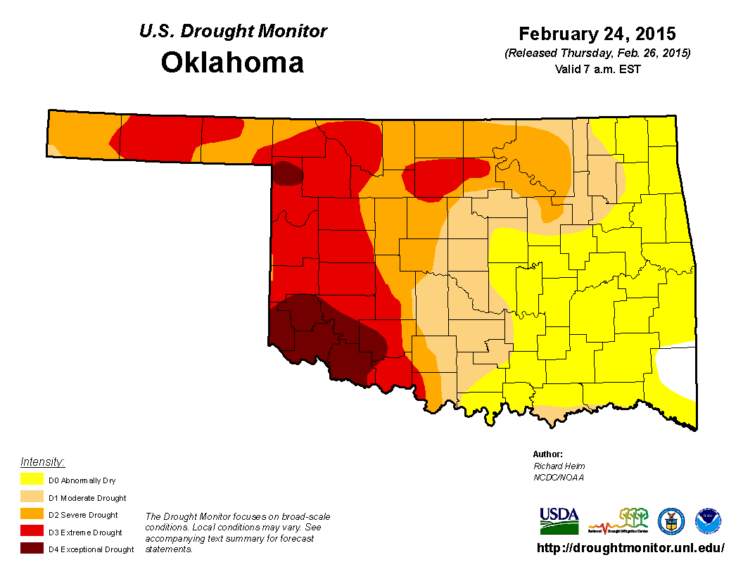
The amount of the state in extreme or exceptional drought rose from 18 percent
in November to 28 percent at the end of February. The Drought Monitor?s
intensity scale slides from moderate-severe-extreme-exceptional, with
exceptional being the worst classification. The percent of the state in
"abnormally dry" conditions, a precursor to drought, rose from 76 percent to
99 percent over that same period.
The dry winter leaves the state teetering on rapid drought intensification if
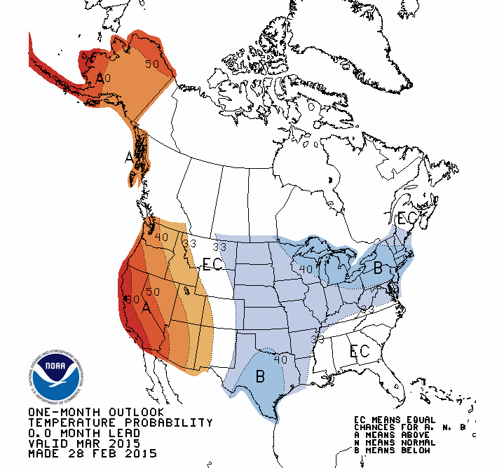
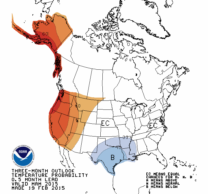
the spring rainy season disappoints once again. The temperature outlooks from
the NWS' Climate Prediction Center (CPC) for March and March-May both indicated
increased odds for below normal temperatures across the state.
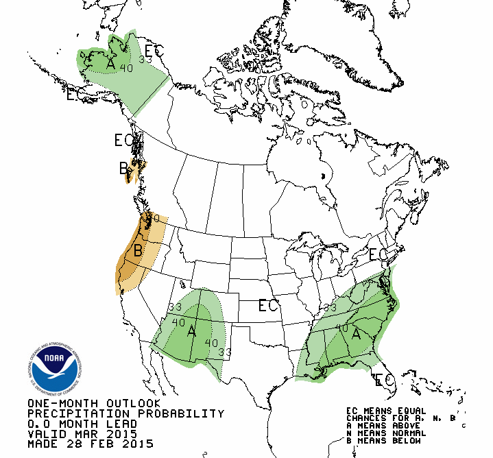
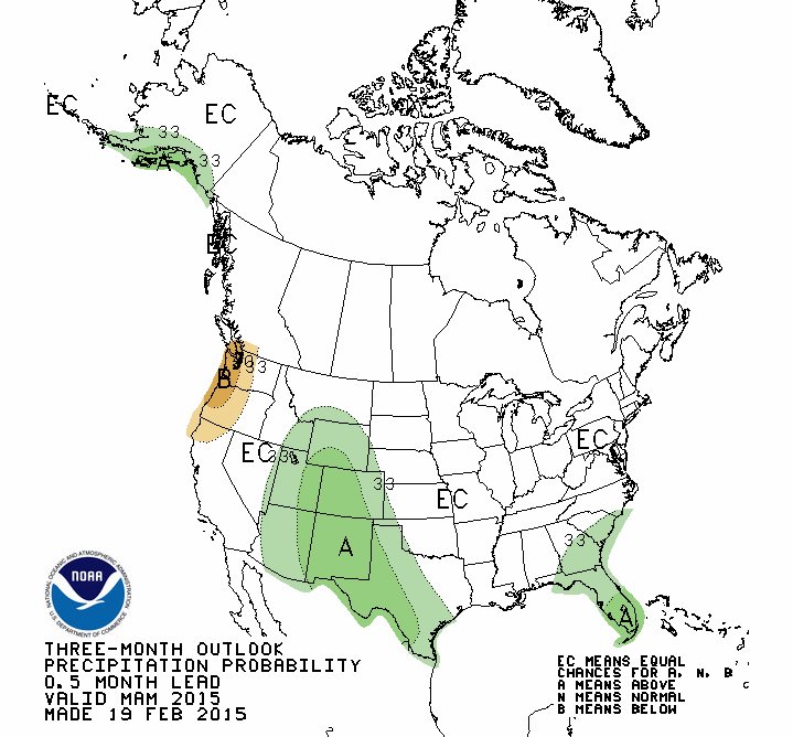
The precipitation outlooks were indeterminate for most of Oklahoma, however,
giving equal chances for above-, below- or near-normal moisture for those same
two periods. Only the Panhandle and far southwest saw increased odds for above
normal precipitation, and only during the March-May period.
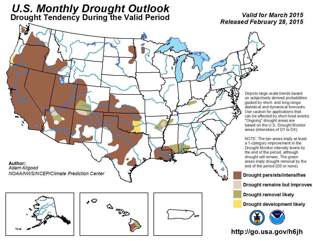
CPC's U.S. Monthly Drought Outlook calls for drought to persist or intensify
during March where it currently exists in the state, and drought development to
be likely across parts of central and southern Oklahoma.
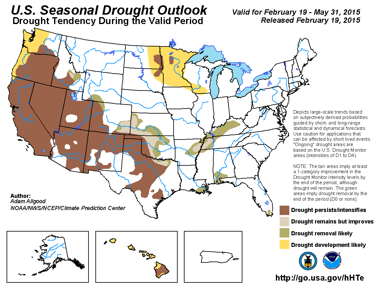
The U.S. Seasonal Drought Outlook, relying upon the climatological wet months
of April and May, see drought improvement or removal possible across much of
the eastern two-thirds of Oklahoma.
Gary McManus
State Climatologist
Oklahoma Mesonet
Oklahoma Climatological Survey
(405) 325-2253
gmcmanus@mesonet.org
March 2 in Mesonet History
| Record | Value | Station | Year |
|---|---|---|---|
| Maximum Temperature | 85°F | WOOD | 2024 |
| Minimum Temperature | -2°F | BOIS | 2014 |
| Maximum Rainfall | 3.21″ | HUGO | 2023 |
Mesonet records begin in 1994.
Search by Date
If you're a bit off, don't worry, because just like horseshoes, “almost” counts on the Ticker website!