Ticker for February 25, 2015
MESONET TICKER ... MESONET TICKER ... MESONET TICKER ... MESONET TICKER ...
February 25, 2015 February 25, 2015 February 25, 2015 February 25, 2015
You guys are dangerous!
As I watched the gentleman in the white 4-wheel drive pickup swing out around me
on south May a couple of days ago and gun his engine, only to spin sideways into
the curb, I thought "congratulations Vin Diesel" (shameless "Fast and Furious"
reference). But then I thought, who guns it to 50 mph on a residential street
covered by sleet and snow? Well, somebody way too confident in his driving. But
then I wondered what would have happened had I been next to him instead of
behind him. SO SLOW DOWN OUT THERE! For that reason and that reason alone,
knowing all of us "good" drivers are constantly in need of dodging the not so
good drivers...and given the forecast for the next several days that you'll see
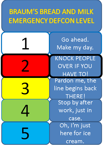
later, I'm keeping the BRAUM'S BREAD AND MILK DEF-CON level at TWO. I might
name it the BRAUM'S BREAD AND MILK PLEASE DON'T RUN INTO ME IN THE PARKING LOT
DEF-CON after what I saw the last few days. But, I digress...
The endless winter of 2014-15, now going on strong for almost 10 days (hey, it's
all relative!), is now promising another week or so of SOME type of frozen-ish
precipitation.
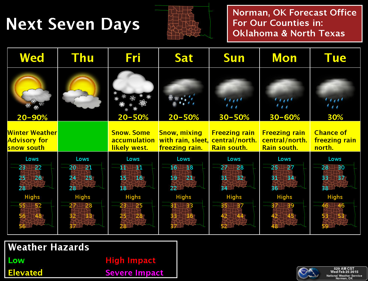
Now keep in mind that this is not necessarily the picture for the entire state
as a whole, but someplace in the state can expect possible wintry weather
throughout much of the coming week. In fact, it's snowing right now across
southern Oklahoma with 1-3 inches possible by the time it's over. The forecast
is quite complicated, as per usual when it comes to winter precipitation types.
But what we do know for certain is that a front is gonna come barreling through
here tonight and drop us back down into the teens and 20s for tomorrow with
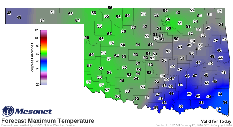
wind chills even lower than that. So today's highs look nice, and they will be,
but as night wears on, more and more of the state will be getting blasted by
that front.
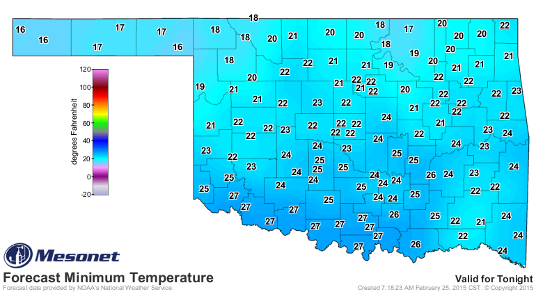
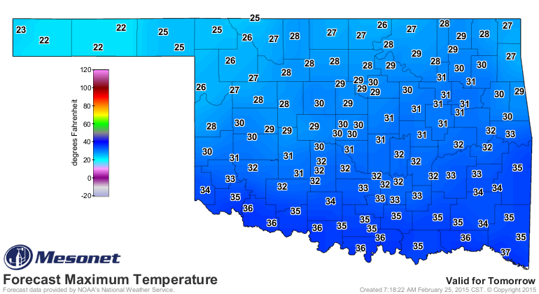
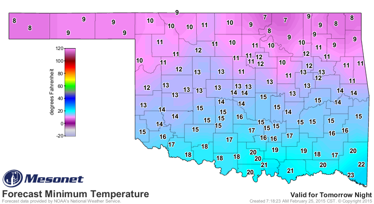
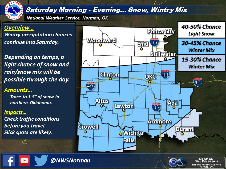
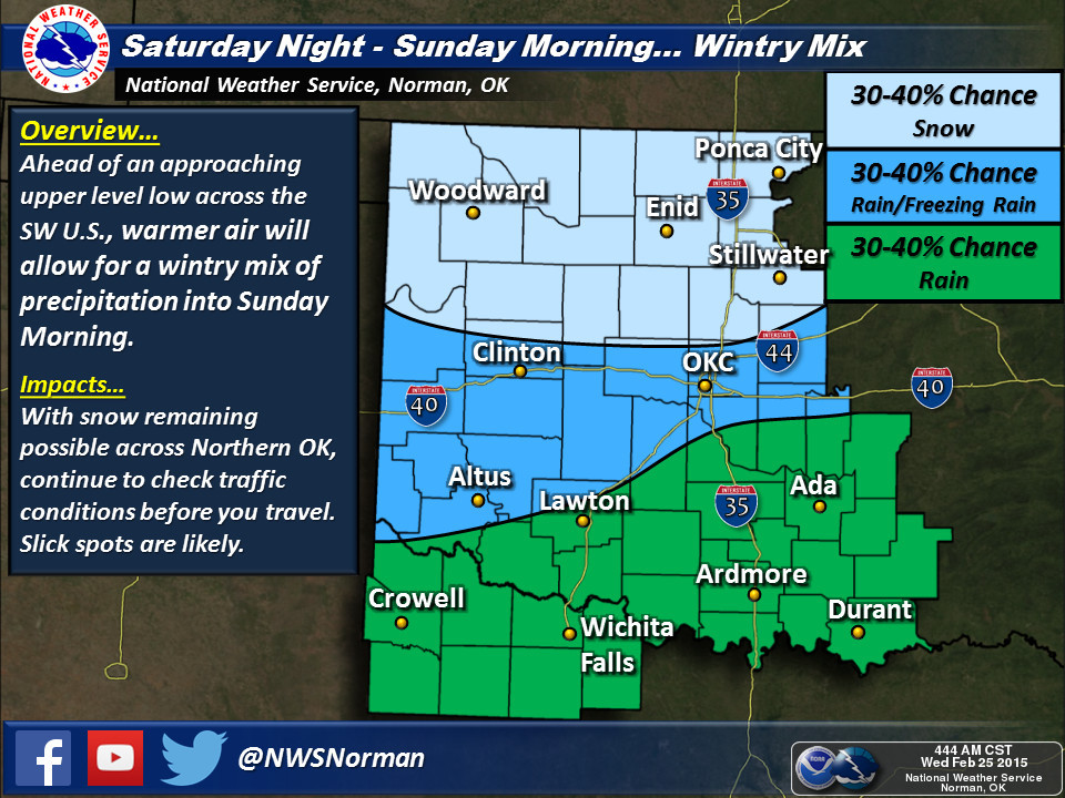
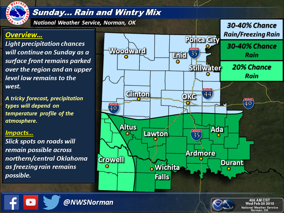
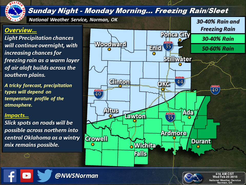
Our friends at the NWS Norman office have spelled out possible scenarios for
through the weekend, at least as best as they can with the current forecast
model data. Some will get snow, some will get rain, but some will get a mixture
of snow and freezing rain it appears. Oh, and let's not forget sleet!
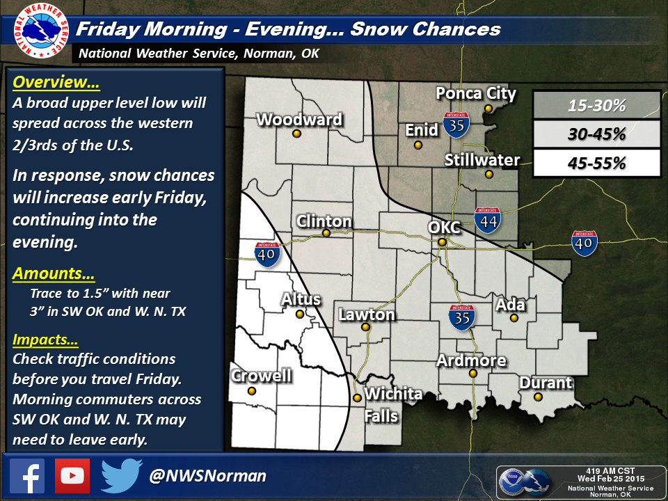
The best news out of all of this (especially for us cold-weather haters) is the
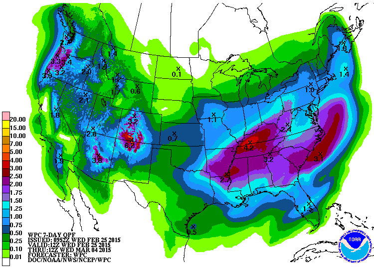
much needed moisture set to pummel us over the next week. The latest 7-day
moisture forecast shows more decent totals for late February (and early March).
Believe it or not, despite all the snow and ice we've had, most areas are
still lagging behind normal for the winter thus far, and even farther back
than that. Other than the western Panhandle, virtually the entire state has
had from 90 to less than 50 percent of normal rainfall since October 1, 2014.
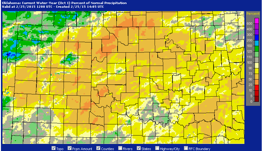
Lots more is needed, obviously. This snow and such is wonderful for the top
layers of the soil, but we really need to move into the springtime soakers we
used to be accustomed to as we transition into March and April. Those lakes
and farm ponds need some runoff.
Oh, my driving ability in the snow? Impeccable, of course! I get in the left
lane and drive 5 mph everywhere I go.
No, I'm not that guy either! Stay safe, stay warm, and stay away from me and
my car.
Gary McManus
State Climatologist
Oklahoma Mesonet
Oklahoma Climatological Survey
(405) 325-2253
gmcmanus@mesonet.org
February 25 in Mesonet History
| Record | Value | Station | Year |
|---|---|---|---|
| Maximum Temperature | 85°F | HOLL | 1999 |
| Minimum Temperature | -2°F | CHER | 2003 |
| Maximum Rainfall | 1.79″ | KIN2 | 2013 |
Mesonet records begin in 1994.
Search by Date
If you're a bit off, don't worry, because just like horseshoes, “almost” counts on the Ticker website!