Ticker for February 23, 2015
MESONET TICKER ... MESONET TICKER ... MESONET TICKER ... MESONET TICKER ...
February 23, 2015 February 23, 2015 February 23, 2015 February 23, 2015
It's too late for Braum's!

What a blow Mother Nature has given us, after such a nice February thus far (well,
a few ups and downs, but those 60s, 70s and 80s we had previously are but a fond
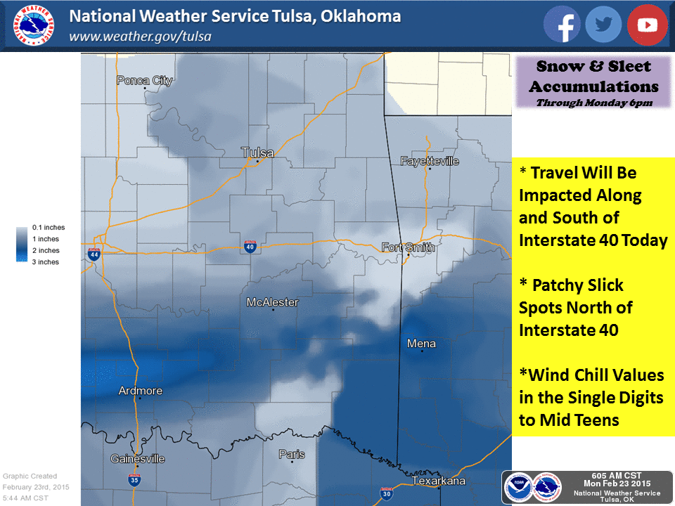
yet bittersweet memory right about now. Snow, sleet, and even a bit of freezing
rain hit the state yesterday and continues through this morning. We've really
had two blasts, one yesterday that hit northern and southern Oklahoma, and another
that began overnight, again hitting mostly southern Oklahoma. The current radar
image tells us those lucky (or UNLUCKY) enough to be getting all the frozen
precip.
http://radar.weather.gov/ridge/Conus/southplains.php
You can loop that image here to see the snow moving off to the east past I35 as
even more moves in from the Texas Panhandle.
http://radar.weather.gov/ridge/Conus/southplains_loop.php
The NWS continues to have much of southern and NW OK in a winter weather
advisory, which comes with all sorts of fun things like slick roads, so keep that
in mind.
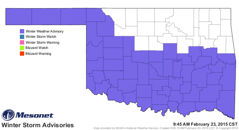
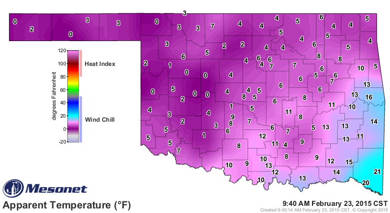
The big danger here, next to actual collisions, would be to get stranded and
then have to deal with the frigid air, which accompanied by the strong winds
is creating wind chills down in the single digits across most of the state.
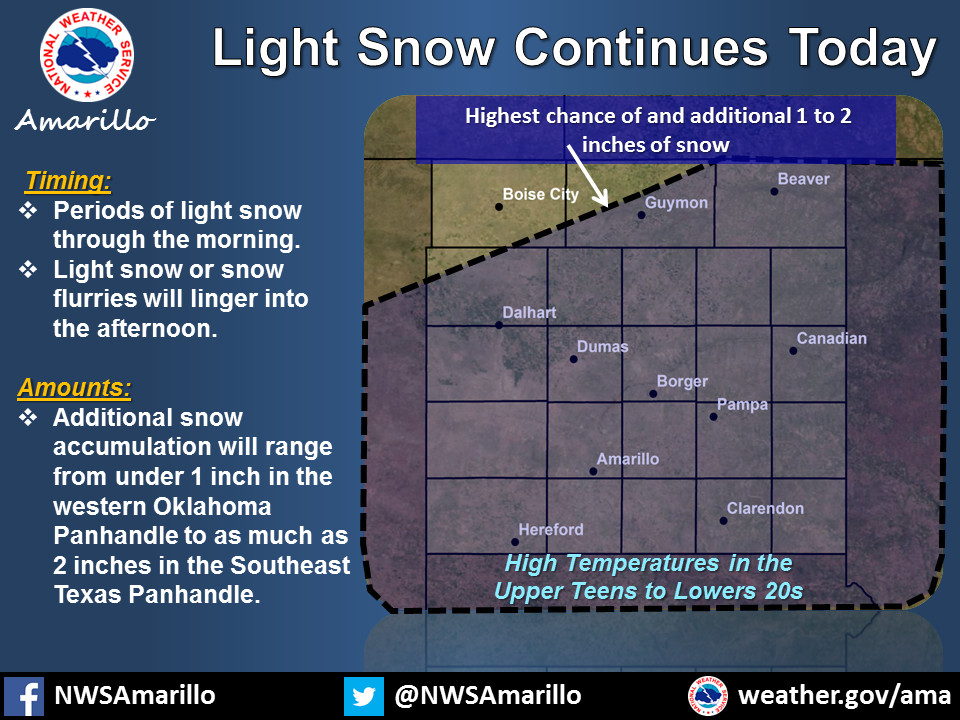
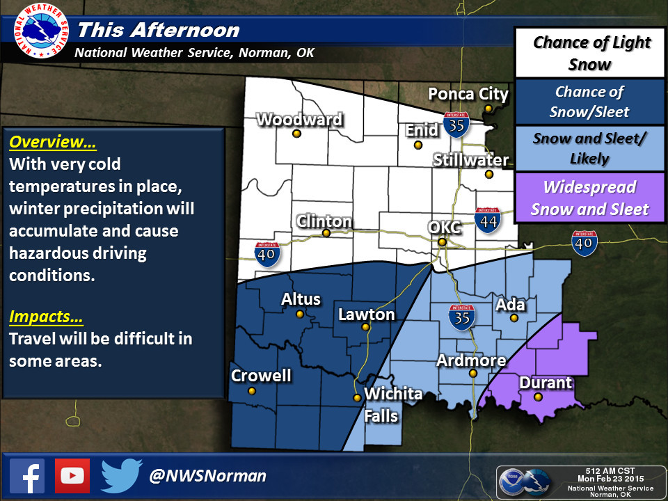
The chance of frozen precipitation continues throughout the day, although from
looking at the radar images I think we can assume that the heaviest stuff will
continue to shift off to the east and eventually exit the state later today.
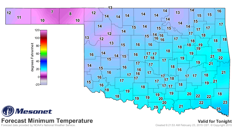
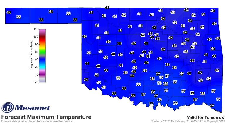
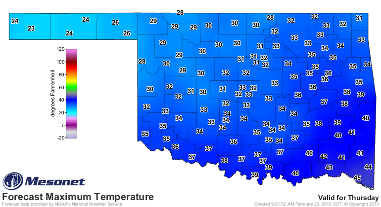
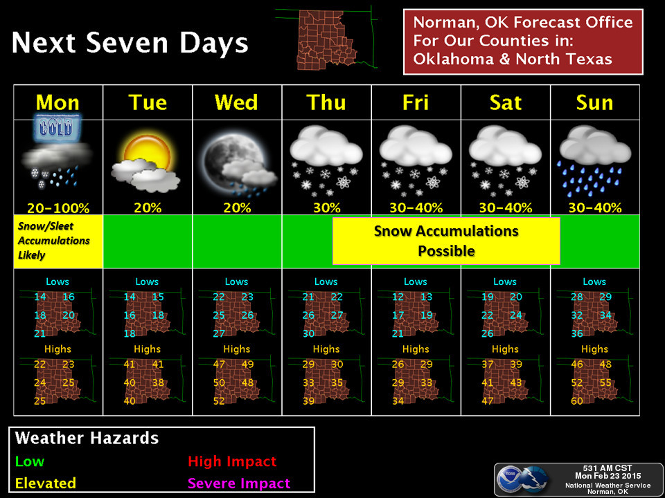
We can only go up from here, so after another frigid night, watch for a bit
of a warm up over the next couple of days before our next visit from winter
later this week (still a lot of uncertainty in the late-week forecast, from
what I can gather through the NWS forecast discussions).
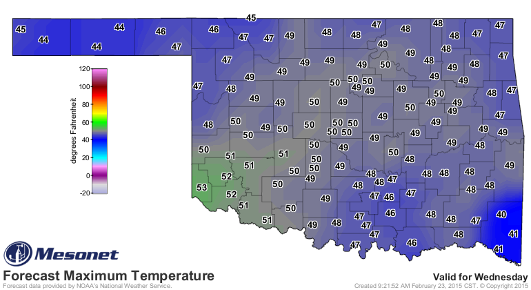
The good news is at least it will warm up during next weekend, so we'll probably
make a transition to liquid precip should the opportunity for moisture remain.
So the advice is to obviously stay inside if you can, don't travel if you don't
have to, and if you are in southern Oklahoma and you're out of milk...well,
probably a bit too late to head to Braum's!
Gary McManus
State Climatologist
Oklahoma Mesonet
Oklahoma Climatological Survey
(405) 325-2253
gmcmanus@mesonet.org
February 23 in Mesonet History
| Record | Value | Station | Year |
|---|---|---|---|
| Maximum Temperature | 91°F | WAUR | 2017 |
| Minimum Temperature | -2°F | BOIS | 2022 |
| Maximum Rainfall | 3.61″ | EUFA | 2018 |
Mesonet records begin in 1994.
Search by Date
If you're a bit off, don't worry, because just like horseshoes, “almost” counts on the Ticker website!