Ticker for February 19, 2015
MESONET TICKER ... MESONET TICKER ... MESONET TICKER ... MESONET TICKER ...
February 19, 2015 February 19, 2015 February 19, 2015 February 19, 2015
Good news on the drought front?
First off, there's no change for this week's U.S. Drought Monitor. We're still at
65% of the state in drought (D1-D4), but 99% of the state is at least Abnormally
Dry (D0). And 46% of the state remains in at least severe (D2 or above) drought.
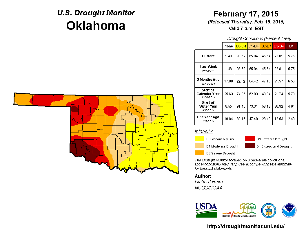
Here's where the good news comes in...the latest U.S. Drought Outlook released
this morning depicts the future of much of the drought in Oklahoma as either
"Drought removal likely" (along the eastern edge of the drought) to "Drought
remains but improves" (farther out west).
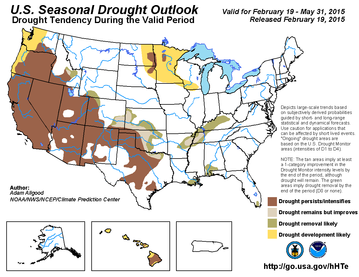
Here's the reasoning provided by the CPC forecaster who produced this product:
"Although the winter season is mostly dry across the Plains,
climatological precipitation increases substantially during
the spring months, particularly across Kansas and Oklahoma
as Gulf moisture penetrates further north and west. The CPC
1-month and 3-month outlooks maintain equal chances for below,
near, or above-median precipitation. Therefore, the primary
question for this outlook is whether climatological precipitation
through May would be sufficient to ameliorate extant drought
conditions. NCDC-based drought amelioration probabilities are
generally favorable for drought reduction; however, drought
conditions, particularly in western Oklahoma and northern Texas
have been entrenched for several years. Therefore, without a clear
signal for above-median precipitation, significant drought
improvements are less certain. Therefore, drought persistence is
maintained for the longer term drought areas of northern Texas,
eastern New Mexico, and western Oklahoma, while drought improvement
is indicated for northeastern Texas, central and eastern Oklahoma,
and southeastern Colorado."
Translation from your friendly neighborhood Spiderman...I mean State
Climatologist: We're counting on an at least normal springtime rainy season to
relieve the drought across the eastern two-thirds of the state, but the drought
is so entrenched across the far west that improvements will be tough to come by.
Let me also add that the forecast confidence for the south-central Plains is
listed as "low to moderate" for the supposed reliance upon a "normal" spring
rainy season.
Why is that risky? Well, we haven't had a lot of good springs lately. Here are
the rainfall stats for the last five climatological spring seasons (March-May).
2014: 4.16 inches below normal, 11th driest on record
2013: 0.60 inches below normal, 55th driest (66th wettest)
2012: 0.57 inches below normal, 57th driest (64th wettest)
2011: 2.03 inches below normal, 26th driest
2010: 1.27 inches below normal, 41st driest
You might be thinking that 2012 and 2013 don't look too bad, but remember that
that is a statewide average and other parts of the state didn't fare as well as
others. For instance in 2013, the SW corner of the state was 2.48 inches below
normal for their 30th driest spring on record. But again, after the damage done
by the 2010-11 exceptional drought period, a near normal spring would not be
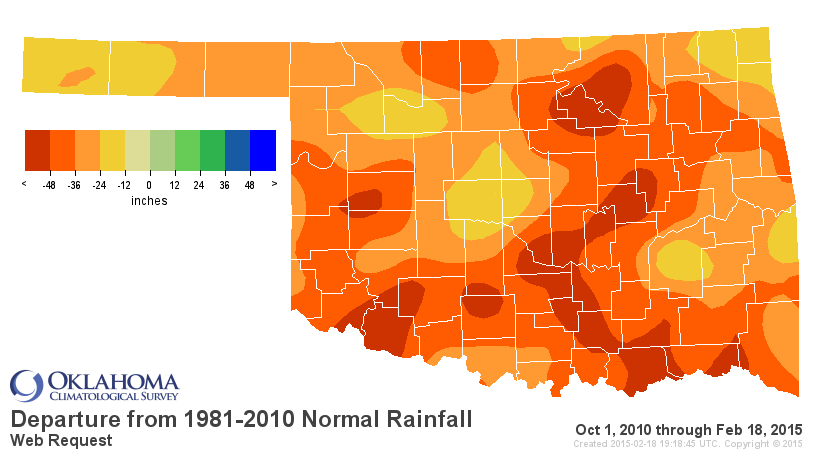
enough to end a drought. And now that we've built up deficits of 20-50+ inches
across the state, another near normal spring ain't gonna cut it either.
Some types of drought could be relieved, of course. The agricultural drought
would be helped tremendously by a normal spring, especially that thirsty wheat
crop, and it would also set up for a nice cotton planting if some of that
soil moisture would be restored.
The hydrologic drought is another story, as evidenced by the lake levels across
the state. Some areas are doing great, like the northeast (save for Skiatook,
which is 17 feet down, a record low), but again, most lakes across western and
southern Oklahoma are in the "bad color" territory.
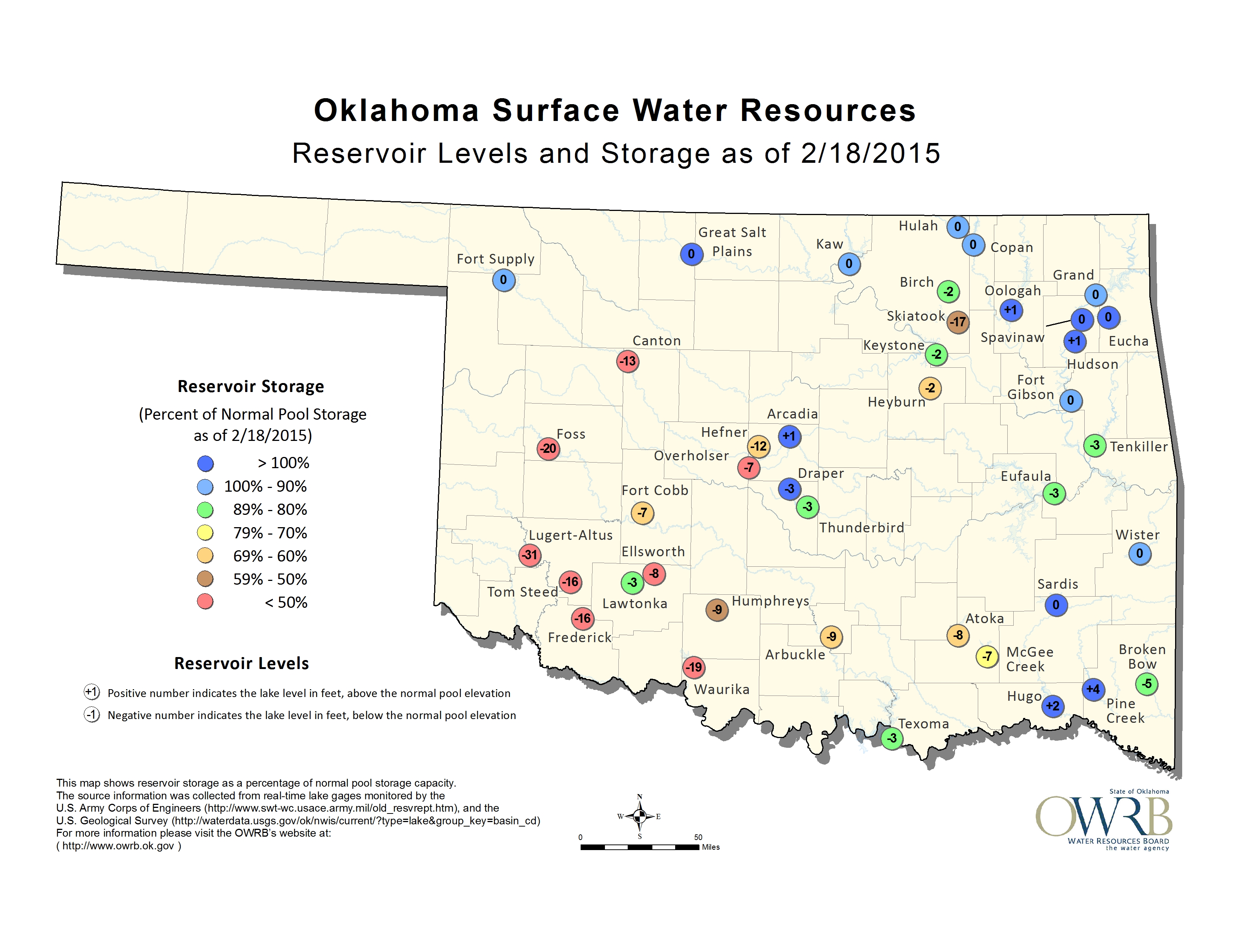
Being ____ feet down doesn't tell the whole story since it's not compared to
capacity. Everything out there is less than 50% of normal capacity, but dig
deeper and you'll find places like Canton, Foss, Altus-Lugert and Tom Steed
to be in woeful shape.
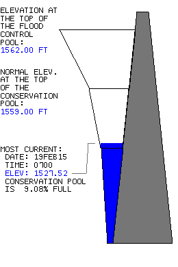
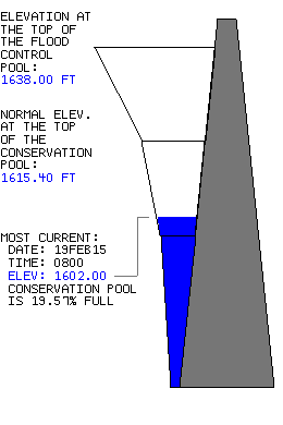
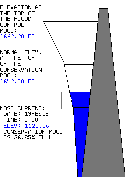

You're reading that correctly...Altus' water supply lake Tom Steed is down to
18% of capacity and still dropping.
For the near future, we have a storm coming in this weekend that will provide
some light precipitation...maybe a bit of snow Saturday night into Sunday, but
no significant accumulations expected.
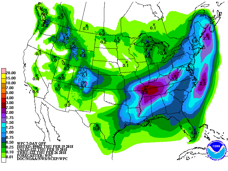
It will be cold from this weekend through much of next week, however, as we
come under control of that large upper-level trough and arctic air intrusion
across the East. There is a hint (A *HINT*) of another winter storm sometime
late next week near the end of the month, but that's a fantasy-cast right now
(although NWS forecasters call it "interesting").
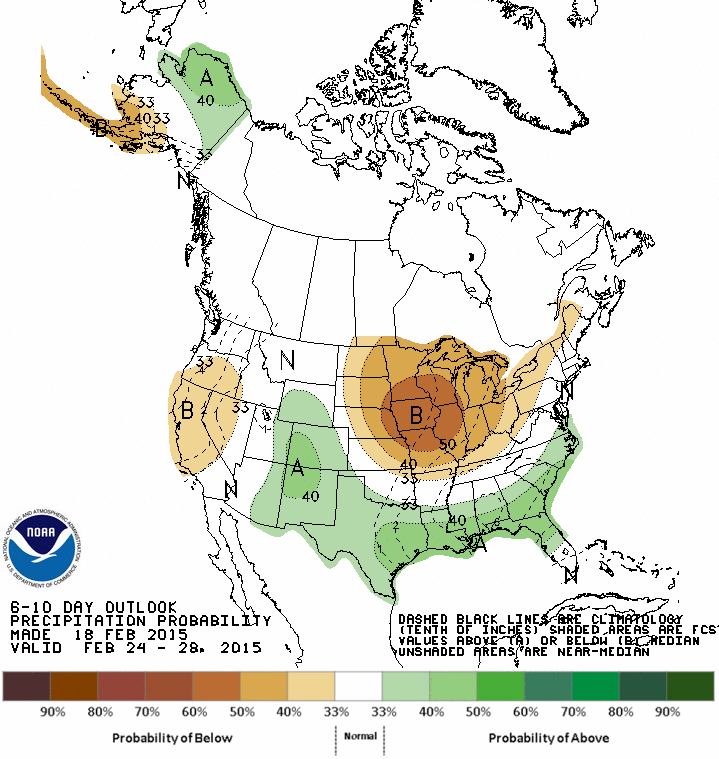
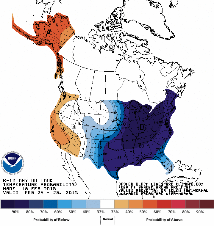
Finally, here are the March and March-May outlooks to go along with that
drought forecast. Notice that we mostly get the dreaded "EC" Equal Chances tag,
meaning no clear signal for us (equal odds of below-, above- or near-normal
precipitation and temperatures).
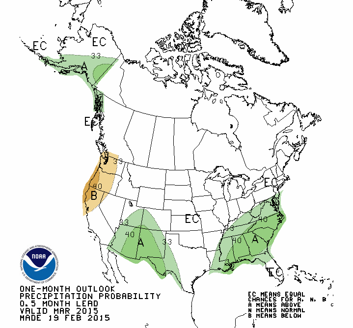
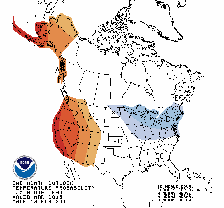
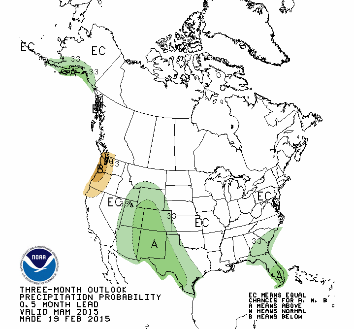
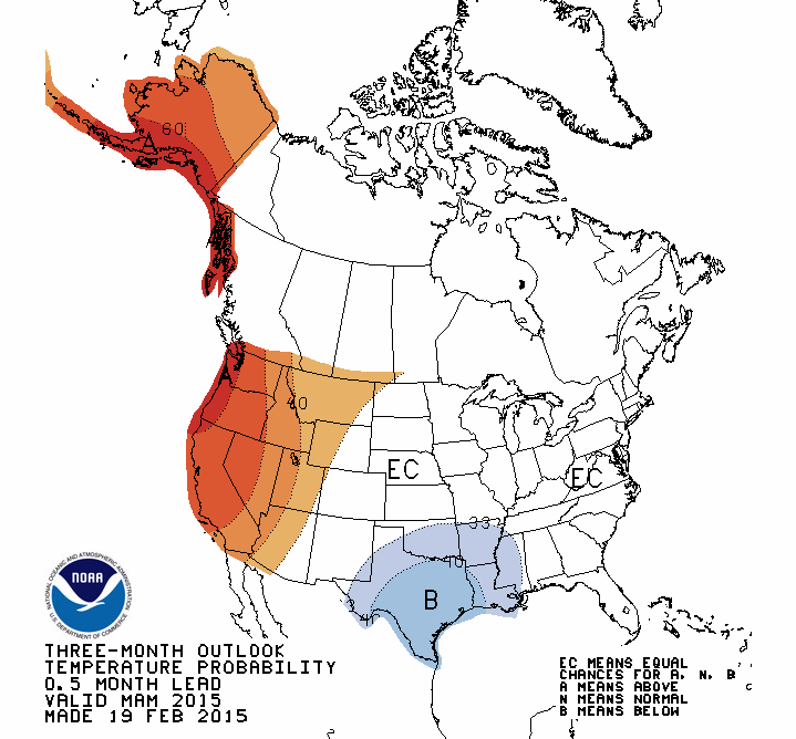
That's it for now. All bets hinge on spring.
Gary McManus
State Climatologist
Oklahoma Mesonet
Oklahoma Climatological Survey
(405) 325-2253
gmcmanus@mesonet.org
February 19 in Mesonet History
| Record | Value | Station | Year |
|---|---|---|---|
| Maximum Temperature | 81°F | ALTU | 2004 |
| Minimum Temperature | -8°F | CHIC | 2021 |
| Maximum Rainfall | 2.94 inches | BURN | 1997 |
Mesonet records begin in 1994.
Search by Date
If you're a bit off, don't worry, because just like horseshoes, “almost” counts on the Ticker website!