Ticker for February 17, 2015
MESONET TICKER ... MESONET TICKER ... MESONET TICKER ... MESONET TICKER ...
February 17, 2015 February 17, 2015 February 17, 2015 February 17, 2015
How much rain-sleet-snow did you get yesterday...SURVEY SAYS!
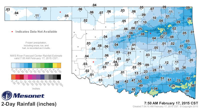
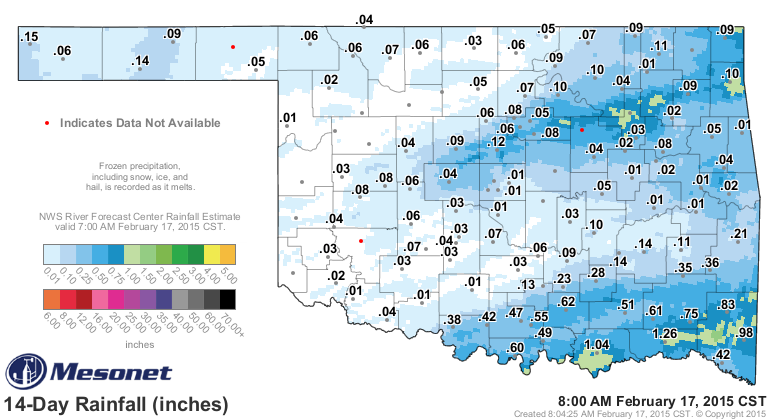
We're still waiting for some of the frozen stuff to melt in the Mesonet rain
gauges, but the radar estimates can give us a decent idea. Those convective bands
that brought the thunder-sleet and or -snow show up pretty well from around El
Reno up through Tulsa and beyond. The SE corner also did fairly well for a
February system.
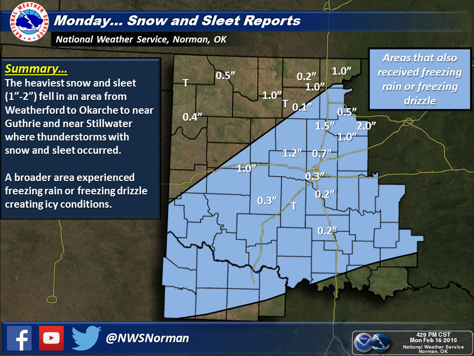
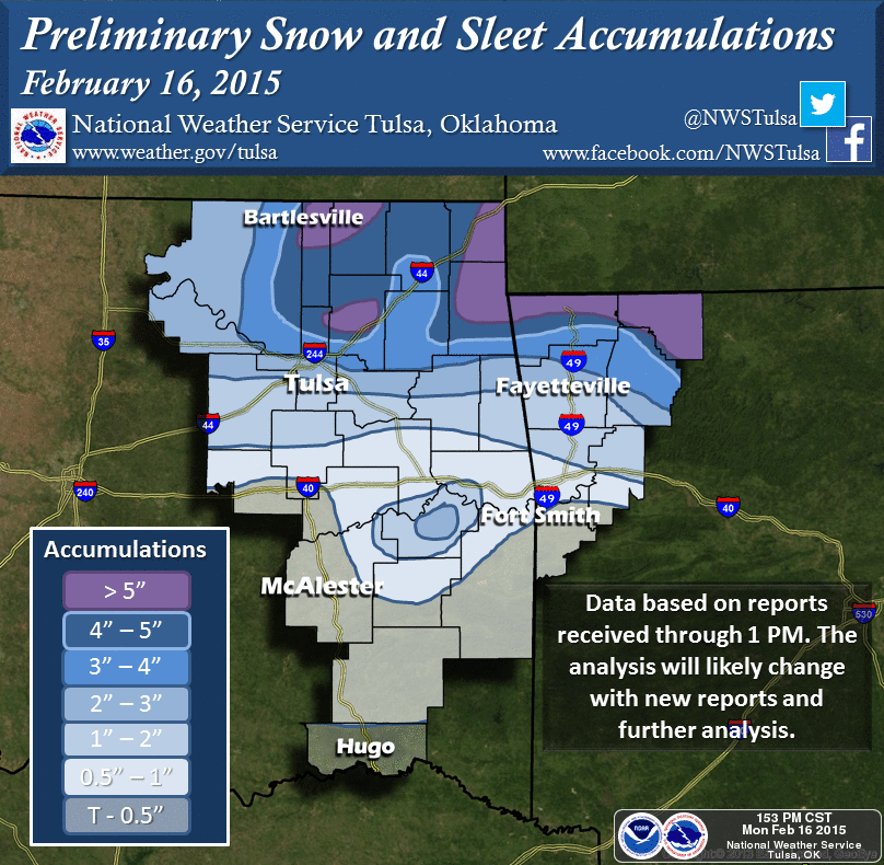
As far as actual frozen precip on the ground, we do have the estimates from the
Tulsa and Norman NWS offices. Looks like NE OK came in the winner for the snow
totals with more than 5 inches in some places. Things were pretty sparse up to
the NW, of course.
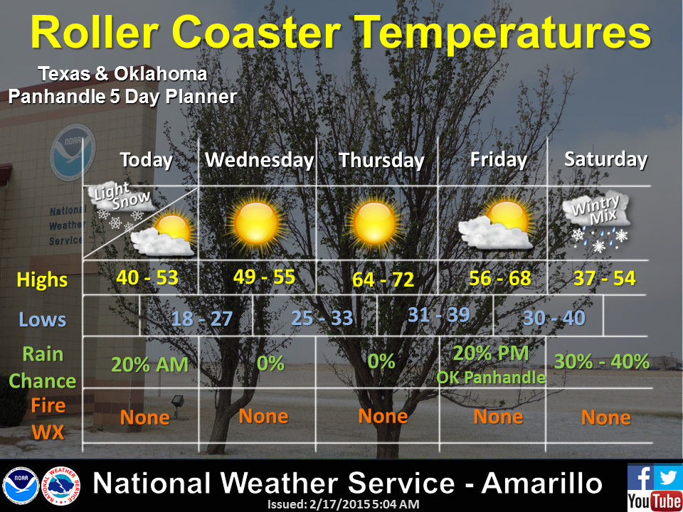
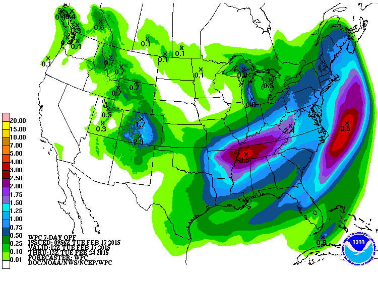
We now await another system this weekend, although there will be a chance for some
light rain and snow later today today.
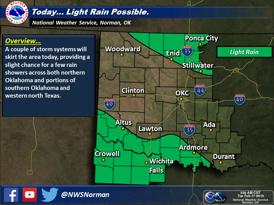
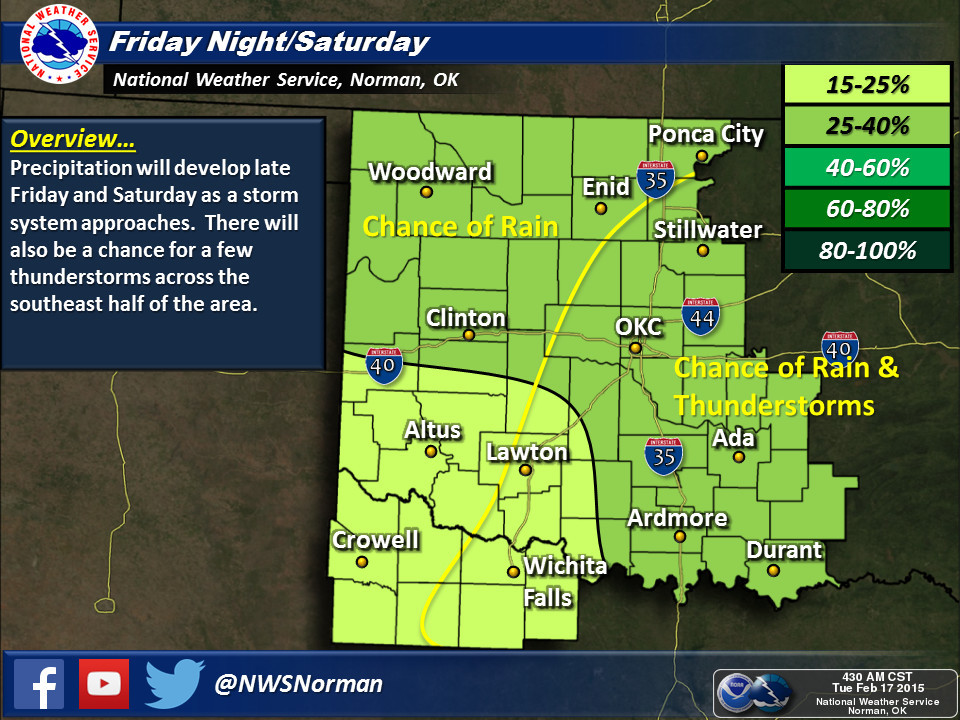
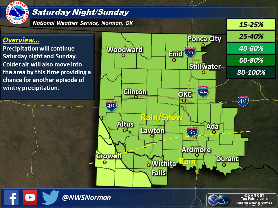
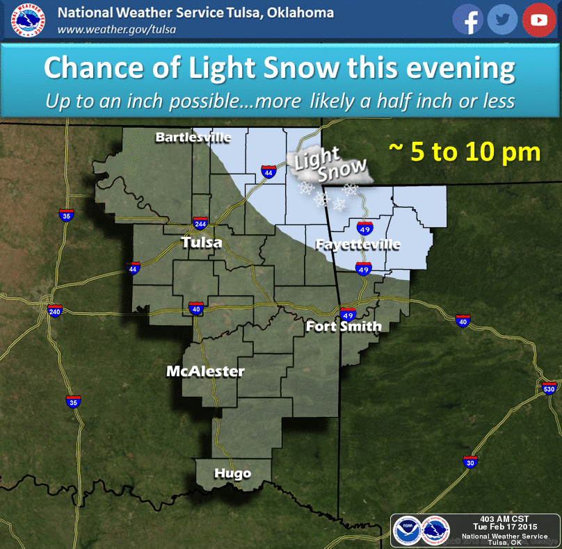
Again, not a drought buster, but possibly a drought-delayer for eastern Oklahoma.
Western Oklahoma remains under the gun with light amounts being forecast at
this time.
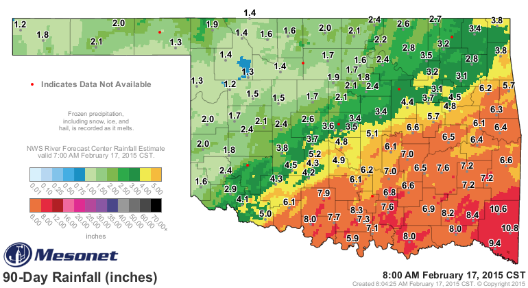
We'll get a better handle on February's totals thus far after we get some
melting, but the last 30 days according to the radar estimates still show a
dismal last couple of weeks, but an even more depressing last 90 days for the
NW half of the state.
Hope is always around the corner. In February, it's known as "spring."
Gary McManus
State Climatologist
Oklahoma Mesonet
Oklahoma Climatological Survey
(405) 325-2253
gmcmanus@mesonet.org
February 17 in Mesonet History
| Record | Value | Station | Year |
|---|---|---|---|
| Maximum Temperature | 85°F | ALTU | 2011 |
| Minimum Temperature | -2°F | HOLL | 2021 |
| Maximum Rainfall | 1.56″ | TULN | 2022 |
Mesonet records begin in 1994.
Search by Date
If you're a bit off, don't worry, because just like horseshoes, “almost” counts on the Ticker website!