Ticker for February 3, 2015
MESONET TICKER ... MESONET TICKER ... MESONET TICKER ... MESONET TICKER ...
February 3, 2015 February 3, 2015 February 3, 2015 February 3, 2015
The Two Faces Of January
What's more boring than January weather? A summary of January weather 3 days after
it's over. Well, February weather is nothing to write home about either, and it
looks like February will resemble January with lots of roller coaster type
swings. Let's hope some of the moisture shows up as well. It's looking more like
a merry-go-round as of now.
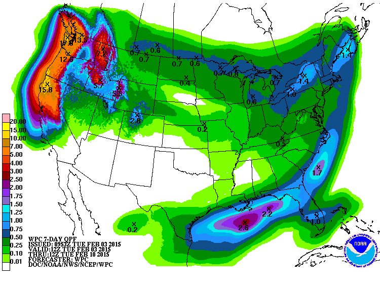
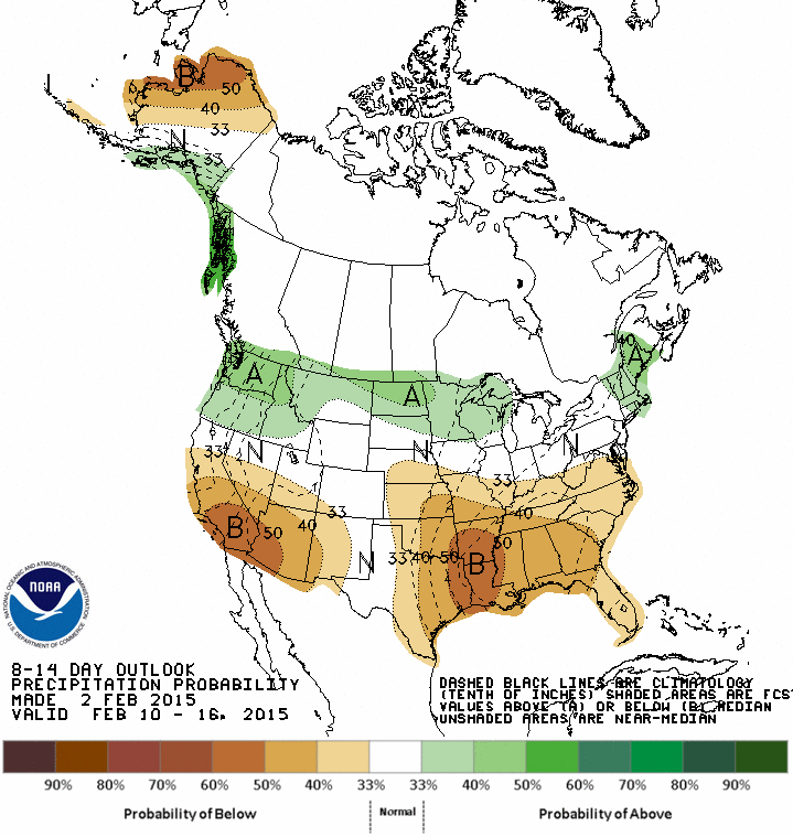
Ugh. Then let's take a look back at January and gaze fondly on some of those
precipitation totals. Northeastern Oklahoma, avert your eyes!
----------------------------------------------------------------------------------
The old adage "numbers never lie" is a good principle in theory, but often
dangerous if used within the context of Oklahoma's eccentric weather patterns.
For example, the statewide average temperature and precipitation values for
January ended very close to normal, but the journey to those numbers was
anything but. The first half of the month was frigid and mostly dry, somewhat
typical of a cold Oklahoma January. Around the 15th, however, the weather
decided it was time for spring a couple of months early. The second half of the
month brought a string of record-breaking temperatures, high fire danger and
bursts of moisture. According to preliminary data from the Oklahoma Mesonet,
the statewide average temperature was 37.9 degrees, just a couple of tenths of
a degree above normal and the 51st warmest January since records began in 1895.
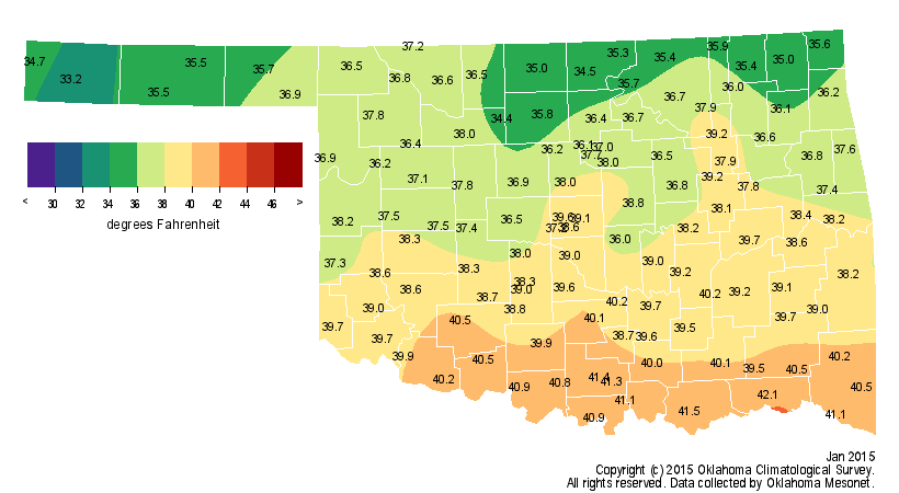
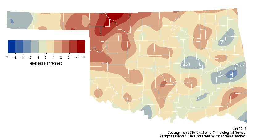
But again, the journey to those numbers was the remarkable story. For example,
the statewide average high temperature for the Jan. 1-14 period was 37.4
degrees, 11.1 degrees below normal while the second half enjoyed a statewide
average high of 60 degrees, 10.1 degrees above normal. Oklahoma City broke
daily maximum temperature records on four separate days, including three in a
row from Jan. 26-28. During those periods of record warmth, wildfire danger
rose to extreme levels with strong gusty winds and low humidity accompanying
the warm weather. The highest January temperature recorded by the Mesonet was
84 degrees at Alva on January 27 and the lowest was minus 6 degrees at Boise
City on the fourth.
The January statewide average precipitation total of 1.53 inches was equally
unremarkable, just three-hundredths below normal to rank as the 48th wettest
on record. One would be hard pressed to find a northeastern Oklahoman satisfied
with their moisture totals for the month, however, since most of that region
ended with a deficit of 1-2 inches. On the other hand, much of southern and
western Oklahoma had a surplus.
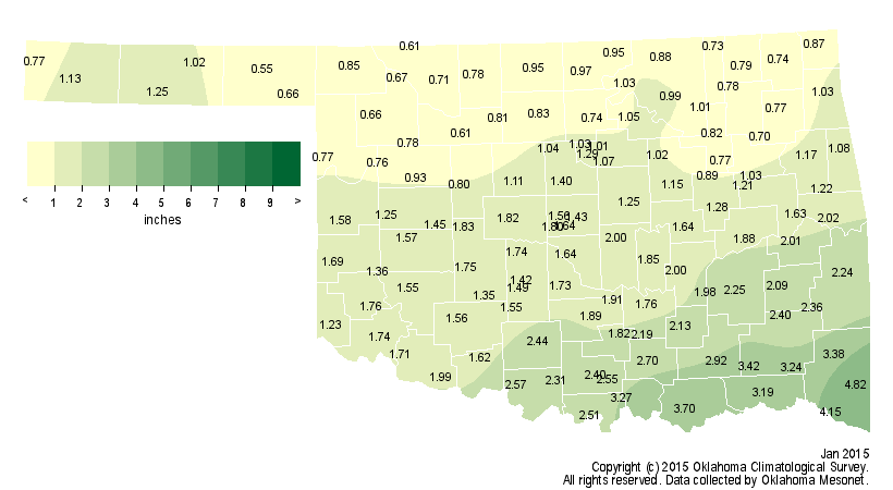

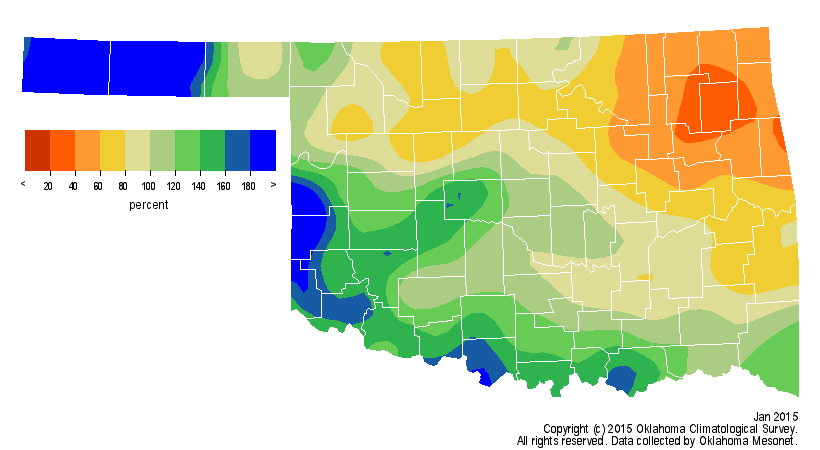
And while that moisture was much needed, it must be remembered that January is
normally Oklahoma's driest month, so a surplus is not necessarily the bounty it
appears to be at first glance. The Mesonet site at Broken Bow in far
southeastern Oklahoma led the state with 4.82 inches. Hooker had the lowest
January total at 0.55 inches. Some of January's moisture fell as snow and ice.
Boise City reported 14 inches of snow for January, about twice the next highest
total of 7.5 inches at Sayre. Boise City has recorded a total of 20.7 inches
for the season thus far. Guymon and Erick are the only other locations in
double digits with 11.8 inches and 10.8 inches, respectively.
The surplus moisture across western and southern Oklahoma was not enough to
make a big dent in the drought, now well into its fifth year. Some areas report
a shortfall of more than 50 inches since the drought began back in the fall of
2010.
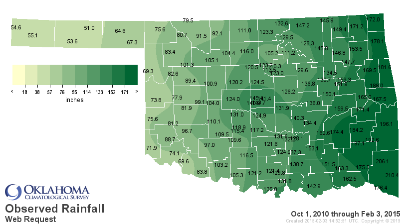
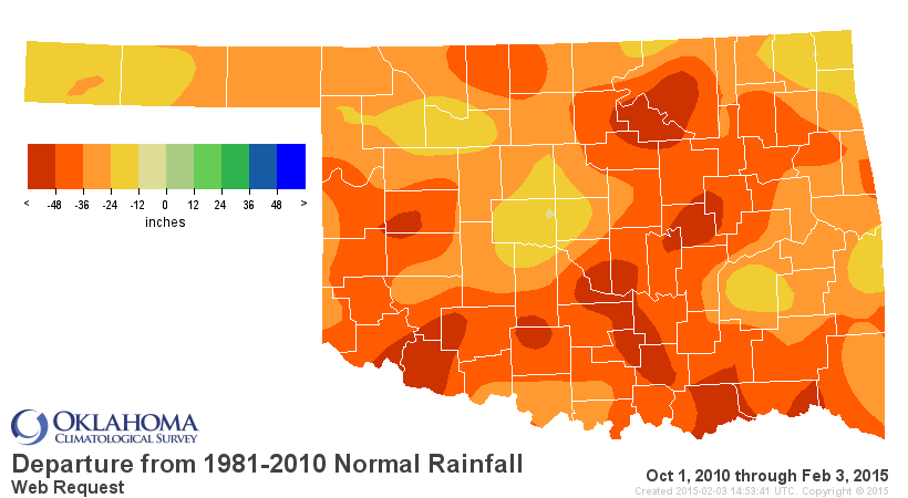

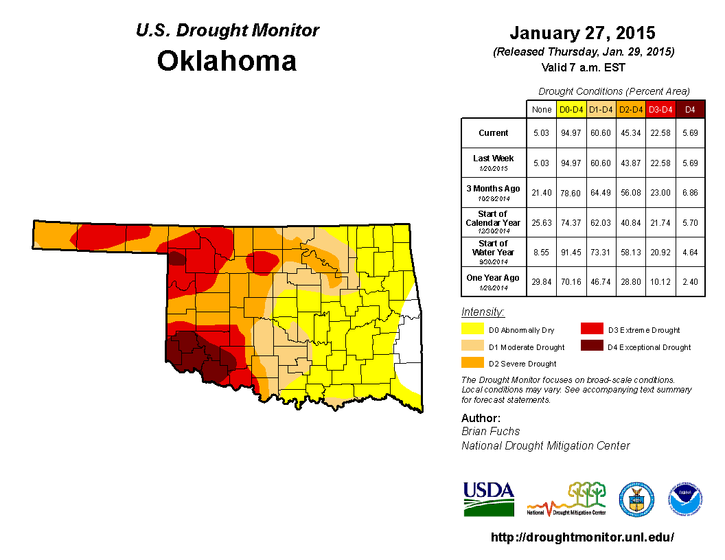
At month's end, more than 60 percent of the state was considered to be in
drought by the U.S. Drought Monitor, with at least 45 percent in the severe
category. The amount in extreme-exceptional drought held steady at about 23
percent. The Drought Monitor?s intensity scale slides from moderate-severe-
extreme-exceptional, with exceptional being the worst classification.
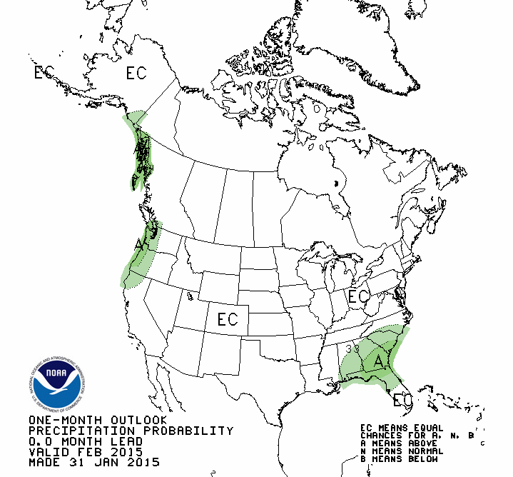
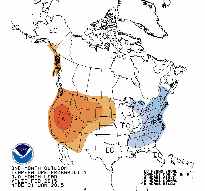
The February temperature and precipitation outlooks from the National Weather
Service's Climate Prediction Center (CPC) contain no information for the
Oklahoma area, other than to indicate "Equal Chances" for above-, near- and
below-normal values for the month.
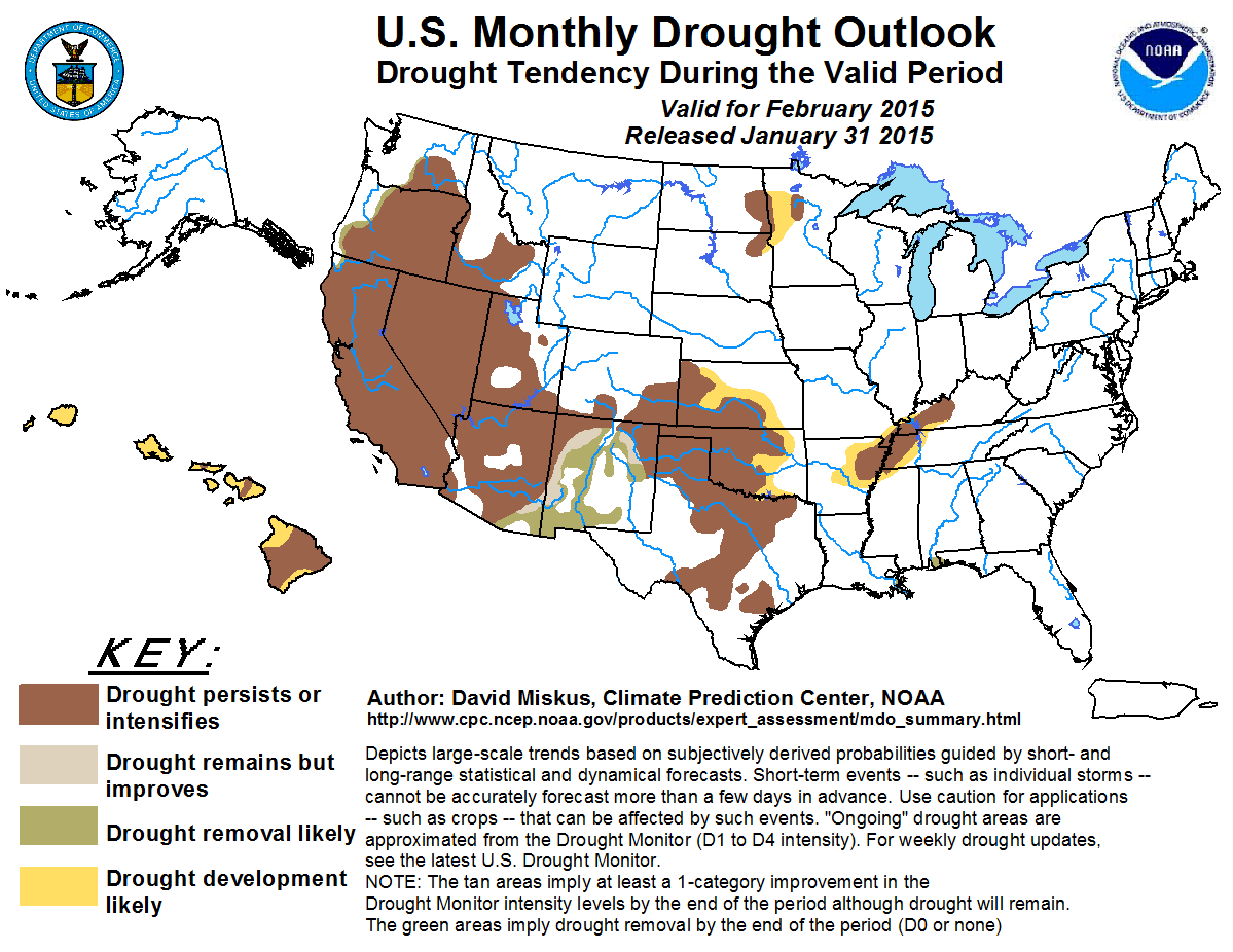
Given that February is Oklahoma's second driest month on average, CPC's U.S.
Monthly Drought Outlook for February calls for drought, at least where it
exists at the end of January, to either persist or intensify through the month.
Additional drought development is thought likely across the eastern edge of the
drought area where rainfall deficits continue to mount.
Gary McManus
State Climatologist
Oklahoma Mesonet
Oklahoma Climatological Survey
(405) 325-2253
gmcmanus@mesonet.org
February 3 in Mesonet History
| Record | Value | Station | Year |
|---|---|---|---|
| Maximum Temperature | 89°F | SEIL | 2025 |
| Minimum Temperature | -18°F | NOWA | 2011 |
| Maximum Rainfall | 2.76 inches | SEIL | 2012 |
Mesonet records begin in 1994.
Search by Date
If you're a bit off, don't worry, because just like horseshoes, “almost” counts on the Ticker website!