Ticker for February 2, 2015
MESONET TICKER ... MESONET TICKER ... MESONET TICKER ... MESONET TICKER ...
February 2, 2015 February 2, 2015 February 2, 2015 February 2, 2015
BLUE is good
No Gordon Gecko statements here...we're talking rain instead of money (or
temperatures). The current temperature and windchill maps might be blue (or even
worse...pink)
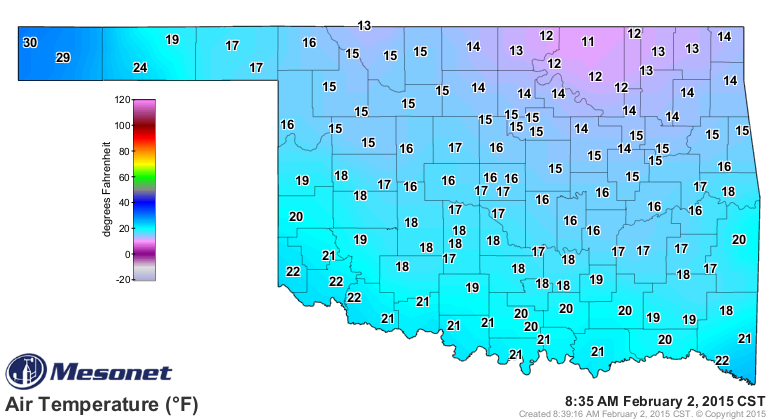
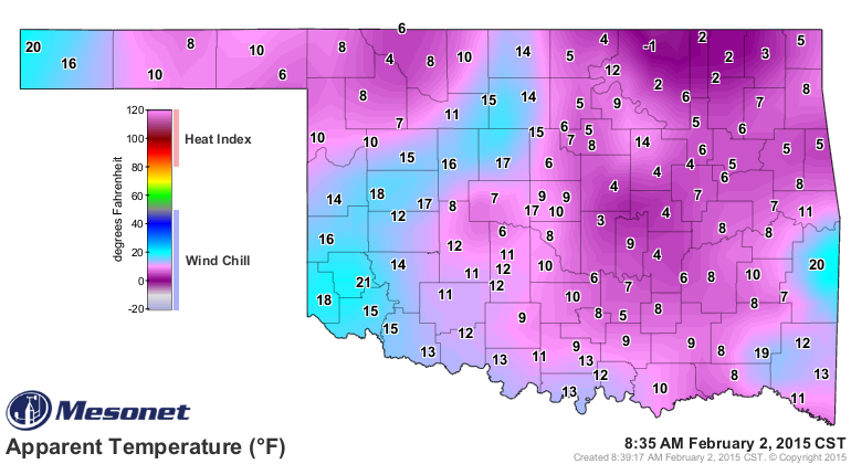
but so are the rainfall maps, with this weekend's state-soaking moisture coming
on the heels of the previous rains of a week ago.
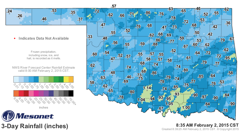
Nearly the entire state received at least a half-inch of rain, with some areas
eclipsing the one inch mark. Add that to the previous rain of about a week ago
and southern Oklahoma is looking especially pretty.
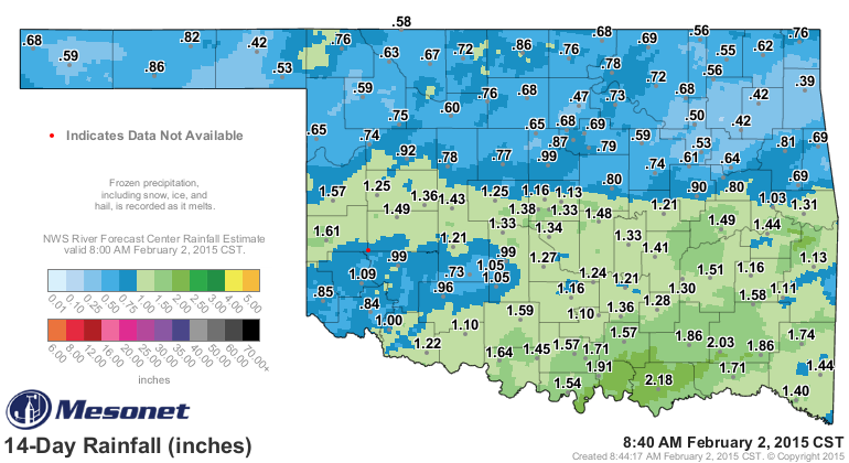
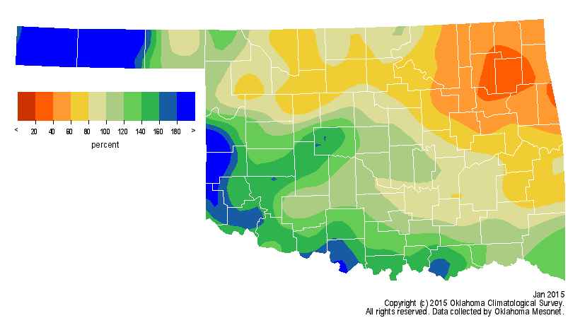
However, that still leaves NE OK in the bullseye for drought development,
unfortunately. If you look at the percent of normal rainfall map for January,
that's the area that remains well below normal for the month, while the fringe
out west and down south garnered the best soakers.
Now we appear to be headed back to our old pattern from the first half of
January, with above normal temperatures (with a cool down here and there) and
little moisture on the 7-day forecast.
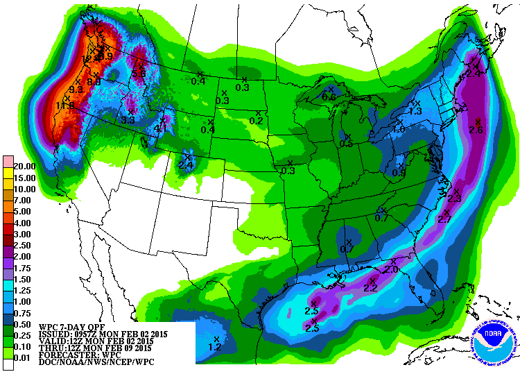
Fire danger will be back on the rise with gusty winds and low humidity for
awhile, it appears. Hopefully we can get some more substantial moisture for
next week. Until then, enjoy the blue rainfall maps.
Gary McManus
State Climatologist
Oklahoma Mesonet
Oklahoma Climatological Survey
(405) 325-2253
gmcmanus@mesonet.org
February 2 in Mesonet History
| Record | Value | Station | Year |
|---|---|---|---|
| Maximum Temperature | 87°F | ALTU | 2003 |
| Minimum Temperature | -19°F | KENT | 2011 |
| Maximum Rainfall | 2.35 inches | FREE | 2012 |
Mesonet records begin in 1994.
Search by Date
If you're a bit off, don't worry, because just like horseshoes, “almost” counts on the Ticker website!