Ticker for February 5, 2015
MESONET TICKER ... MESONET TICKER ... MESONET TICKER ... MESONET TICKER ...
February 5, 2015 February 5, 2015 February 5, 2015 February 5, 2015
Yah? Yah!
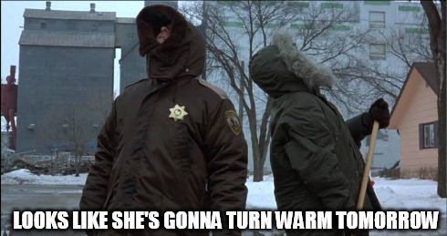
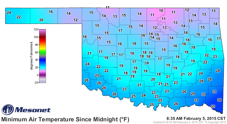
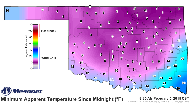
It was stupid-cold this morning. Just stupid-cold. I don't know how to get more
technical than that. I really shouldn't be that upset with early February, but
the last half of January teased us too much. These types of temperatures and
wind chills just won't cut it anymore, I'm afraid.
Mother Nature is just going to have to get with the program and bring some heat.
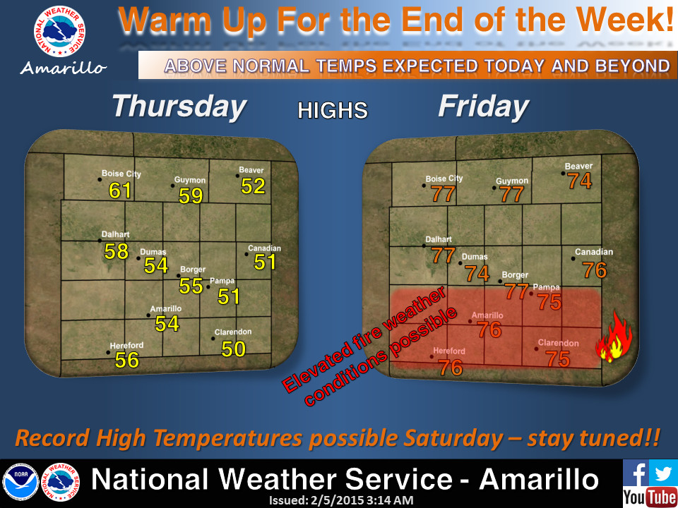
Looks like that might just happen (nay, WILL happen) starting today in the
Panhandle and then across the rest of the state through the weekend. Saturday
looks to be the warmest day with some 70s and I'll bet some 80s scattered about.
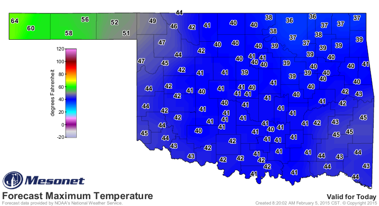
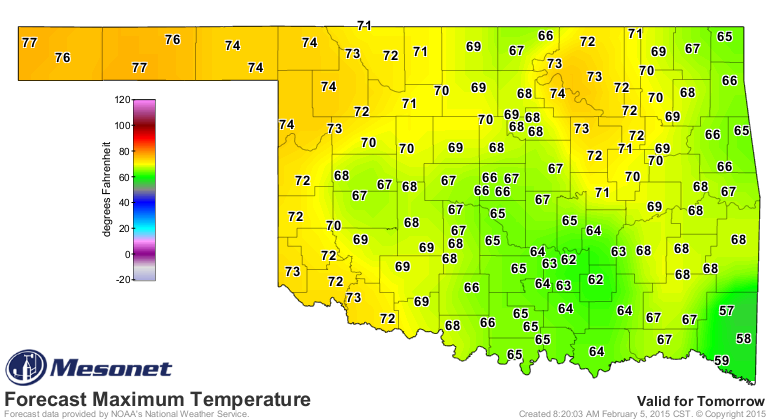
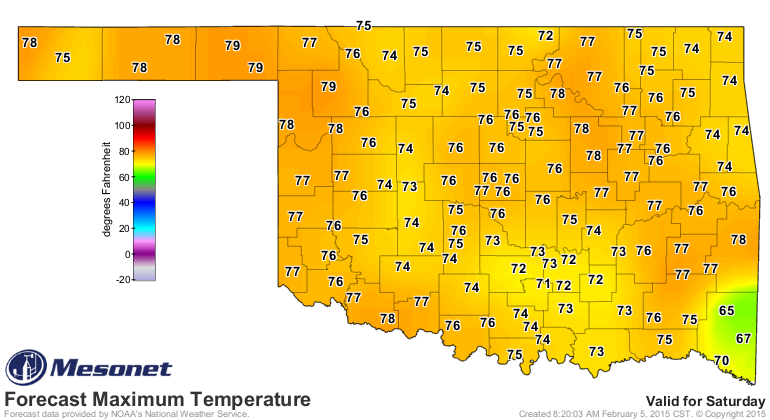
Not too weird to start in the Panhandle as that shallow layer of cold air starts
pulling off to the east. They get the premiere, I reckon. Unfortunately, the heat
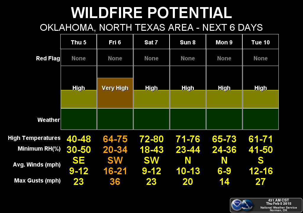
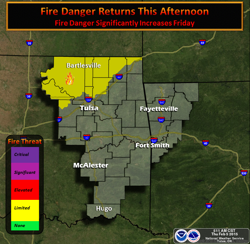
will come with some unwanted guests, like low humidity and strong winds at times.
When that occurs, and the low humidity is the key, we'll see high fire danger
at those times.
And let's not forget that we still have our old friend the drought hanging
around. Now you might think we'd have seen some pretty good relief with the
last two storm systems, at least enough in some areas for drought improvement.
In actuality, we have decided to hold off on improvements for a couple of
different reasons. We feel that the DM depiction is just now starting to show
a good balance between short-term improvements vs. long-term impacts. In other
words, that rain helped the short-term impacts improve somewhat, so topsoil
moisture and wheat crop impacts are improved, but we still have to remember
those deficits of 30-50+ inches hanging on from all the way back to 2010. That
gives us a picture that looks like this.

Now you may be saying to yourself "But Gary..." which is an odd thing to say
to yourself unless your name is Gary... "But Gary, why did the amount of
drought (D1 or above) go up from 60.6 percent to 63.11 percent?" Because while
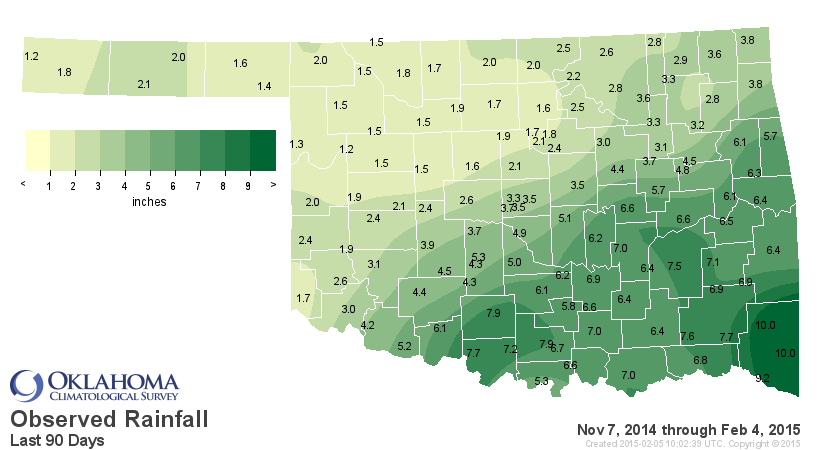
this moisture from the last 30 days might have caught us up around much of
western and southern Oklahoma, northeastern Oklahoma continues with mounting
deficits from that point and beyond.
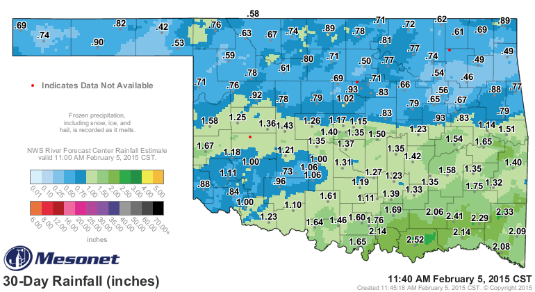
That looks good for the southern half of the state. Check out the pct of normal
maps for the same period, however.
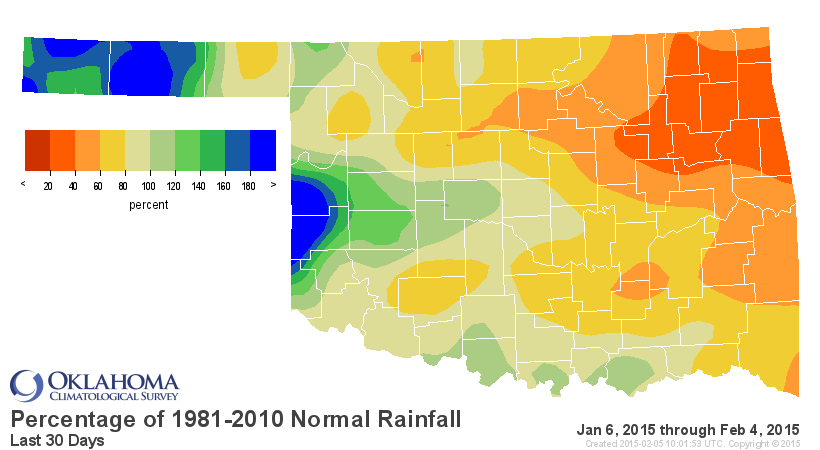
That's not good over most of the state, but especially across the NE where we're
running from 20-40 percent of normal over that period. And as I said, it's
been mounting for a few months now.

That's the reason why we haven't seen more improvements with the last couple
of rainfalls. We're just catching up.
Hope for the future? Well, not in the next week or so, other than some light
stuff.
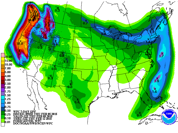
CPC is showing some type of system for this area with a blob of increased odds
of above normal precip for the Feb. 12-18 period.
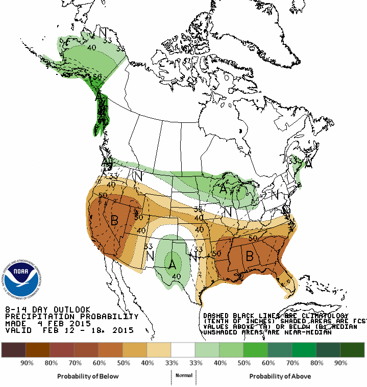
Grain of salt time...looks like that moisture might also come with some warmth
and a reminder that above normal precipitation during February is welcome, of
course, but not necessarily a drought-buster.
Gary McManus
State Climatologist
Oklahoma Mesonet
Oklahoma Climatological Survey
(405) 325-2253
gmcmanus@mesonet.org
February 5 in Mesonet History
| Record | Value | Station | Year |
|---|---|---|---|
| Maximum Temperature | 84°F | GOOD | 2025 |
| Minimum Temperature | -2°F | BEAV | 2014 |
| Maximum Rainfall | 1.40 inches | MTHE | 2008 |
Mesonet records begin in 1994.
Search by Date
If you're a bit off, don't worry, because just like horseshoes, “almost” counts on the Ticker website!