Ticker for January 20, 2015
MESONET TICKER ... MESONET TICKER ... MESONET TICKER ... MESONET TICKER ...
January 20, 2015 January 20, 2015 January 20, 2015 January 20, 2015
Silver linings?
You know that feeling when you wake up in the middle of the night and you think
you feel a spider crawling in your hair? Pretty creepy right? Well, glass-half
full guys like me would say "at least you have hair!" And, even though we had a
lot of wildfires to go along with our near-record temps and strong winds (and
a desiccating lack of humidity)...hmmmm, well, having trouble here. I guess I'll
just say "at least it was warm," but the warmth was part of the problem. I'll
admit I love 70s in January at times, but not when it comes with high winds
and wildfires. Check out the high temperature map from the Mesonet yesterday.
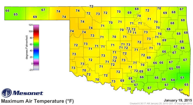
Notice that Buffalo led the state with 74 yesterday (along with some other, less-
famous-and-awesome locations...apologies to folks from those other less-famous-
and-awesome locations). I won't mention that Mangum, Fairview and Camargo all
reached 77 on Sunday, lest it sap some of Buffalo's notoriety.
The weather conditions were not the only part of that wildfire equation. I've
mentioned many times that the 2014 rainy season was short, succinct, and perfectly
timed for growing lots of lush, green vegetation. In other words, during the
summer. And it never did get too hot this summer, so there was plenty of
vegetation by the time we made it to fall. Here are those May 21-July 31 rainfall
maps as a reminder.
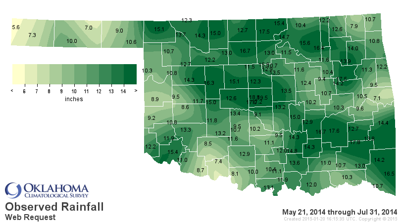
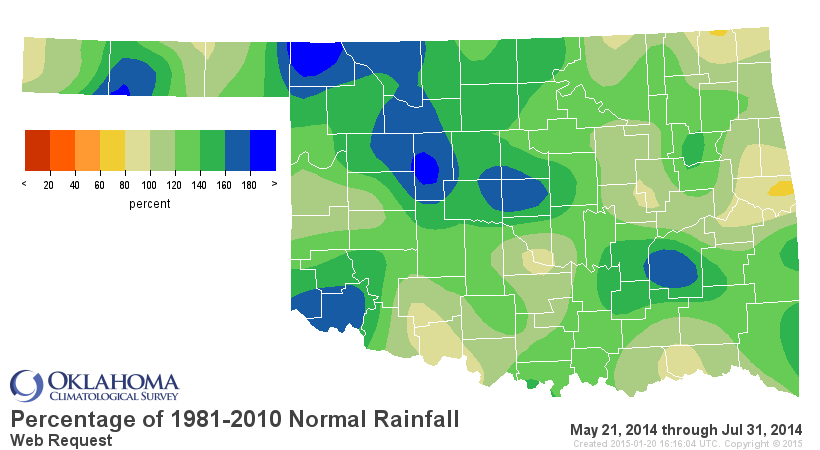
Lots of dead/dormant vegetation from that period just waiting for a spark, and
that's what we saw this weekend. The winds and dry air can really take their
toll on the soils and also that wheat crop thirsting for moisture out there.
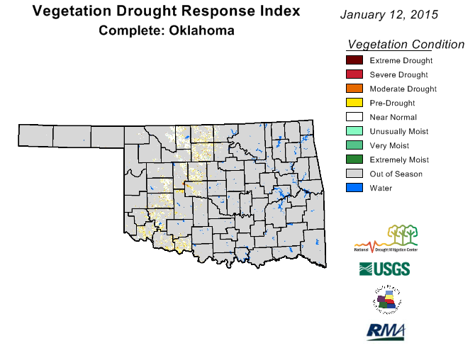
In this satellite image that measures the "health" of the in-season vegetation
(and wheat is the major plant that's "in season" right now), you can see that
some of the wheat crop across Oklahoma's wheat belt from the SW up through NC
Oklahoma is looking okay/good, and a lot of it is starting to look like it's
being impacted by drought.
The wheat farmers and the wheat itself don't really care what a satellite
looking down sees, of course, so still lots of time for that wheat to recover,
IF it is really ailing. One thing we do now is, that wheat will need moisture.
Looks like there's a chance for some parts of the state to get a bit at least,
maybe in the form of snow and a bit of rain later this week.
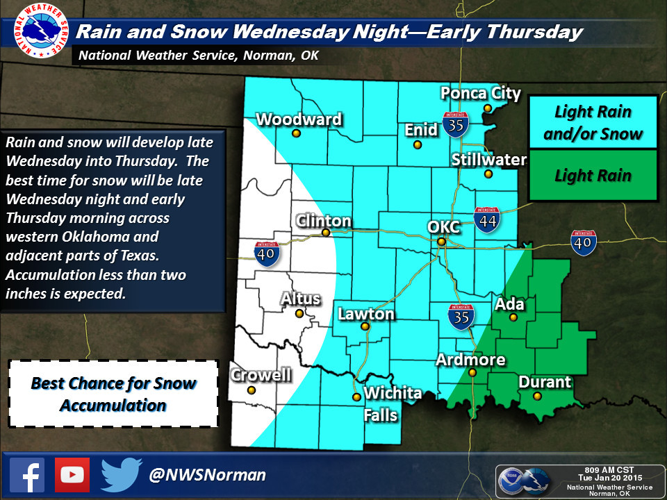
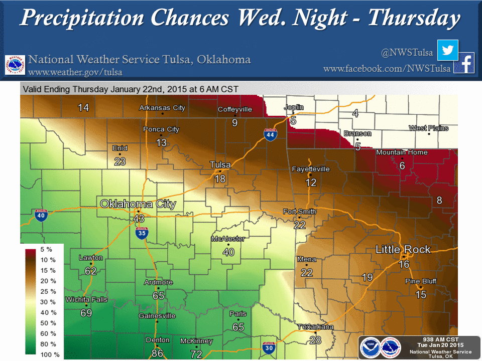
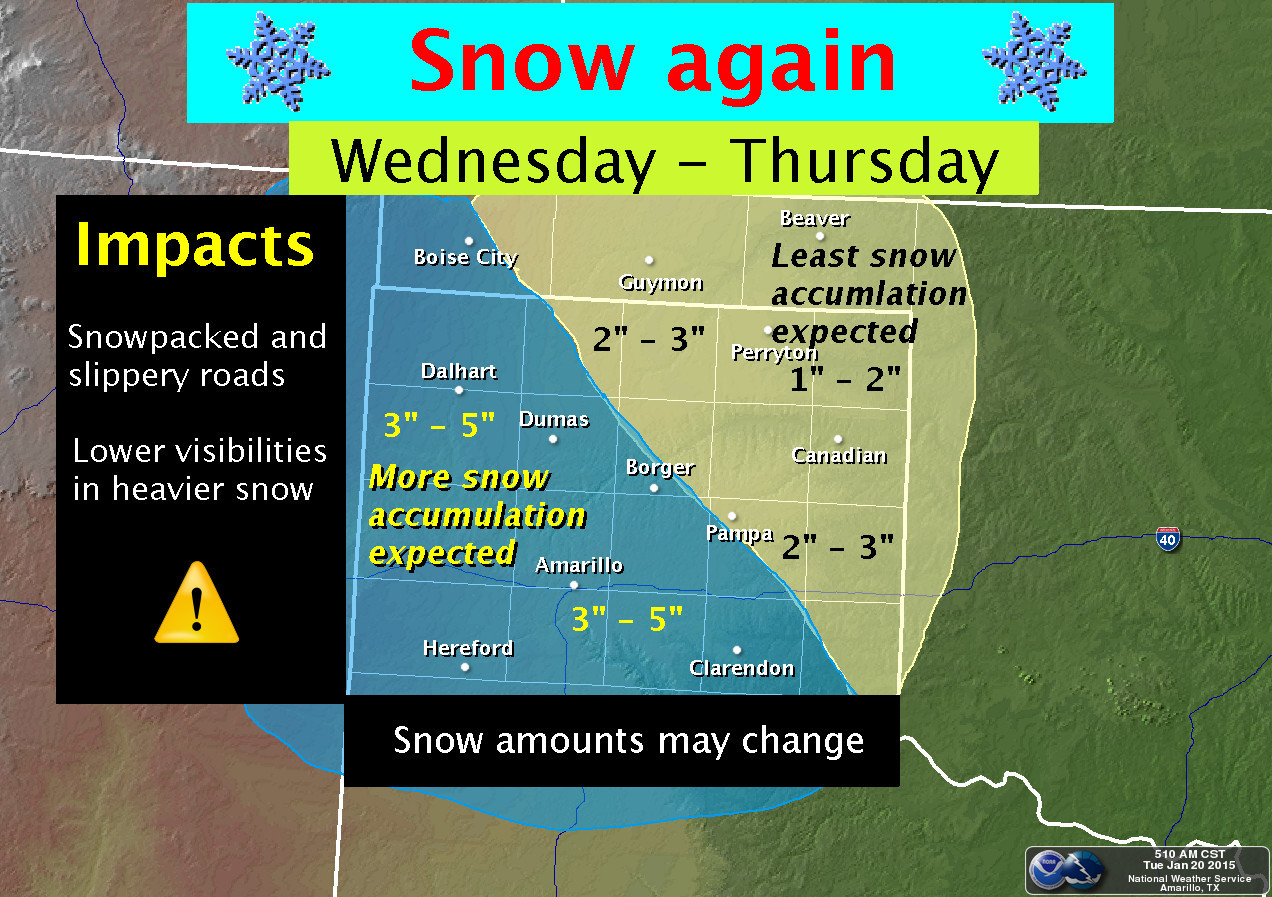
But we're not talking a drought-buster here, but maybe a bit of moisture for
some of that wheat.
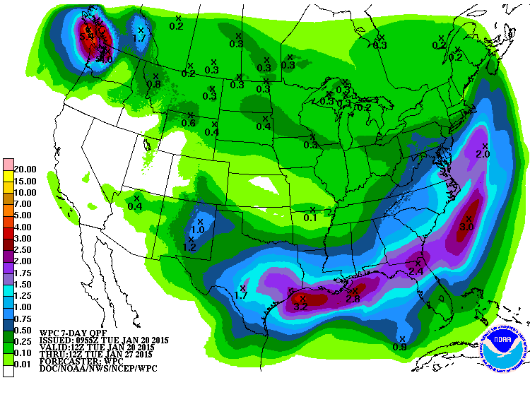
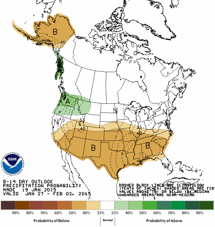
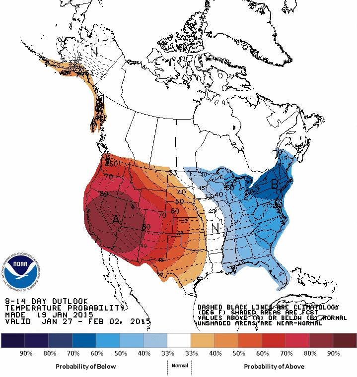
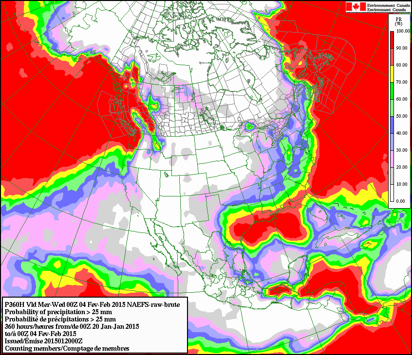
Things don't look too great after that, both from the CPC outlooks AND the
forecast models from our neighbors to the north in Canada. CPC says increased
odds of above normal temps and below normal precip for the Jan. 27-Feb. 2
period, while the Canadian forecast model gives most of the state very little
chance to see at least an inch of accumulated liquid precip through Feb. 4.
This is not a shocker. Remember, it is still the driest time of the year.
Silver lining? It's all uphill from here. Well, after a plateau through mid-March.
Then it's all uphill. Well, until mid-June.
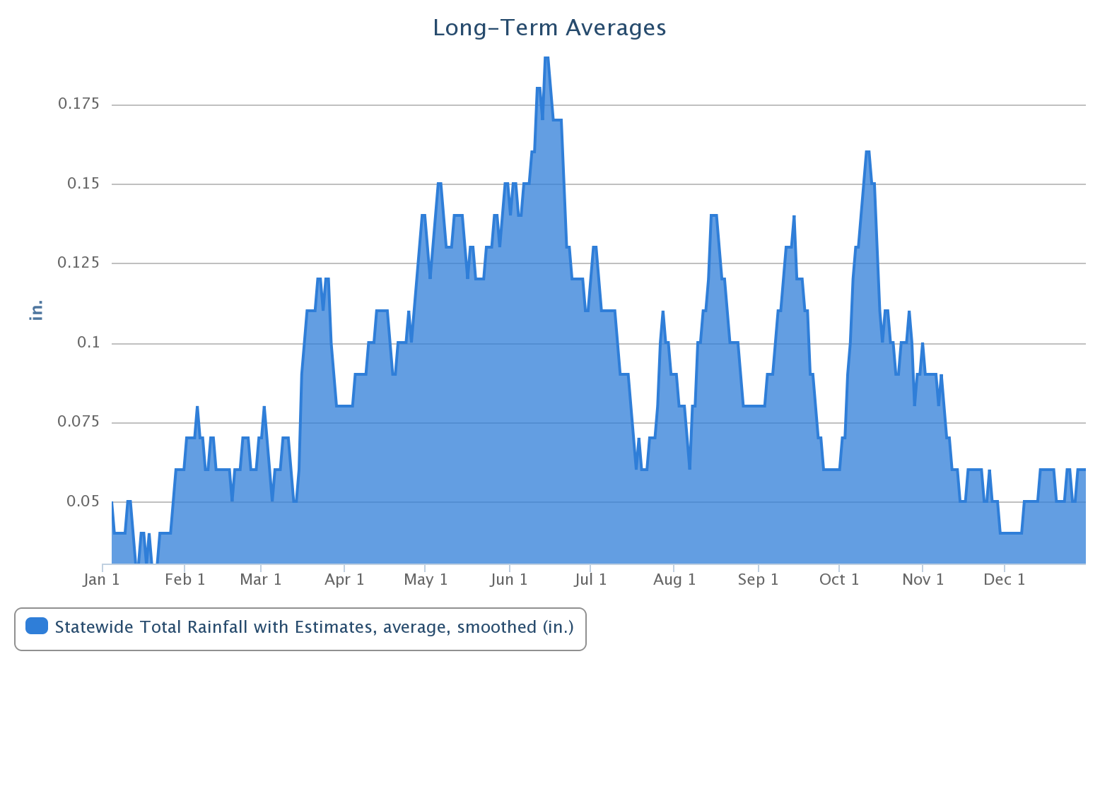
Okay, we'll go with a bronze lining. Still beats a spider crawling around in your
hair when your asleep though.
Gary McManus
State Climatologist
Oklahoma Mesonet
Oklahoma Climatological Survey
(405) 325-2253
gmcmanus@mesonet.org
January 20 in Mesonet History
| Record | Value | Station | Year |
|---|---|---|---|
| Maximum Temperature | 80°F | ALTU | 1999 |
| Minimum Temperature | -15°F | KENT | 2025 |
| Maximum Rainfall | 2.05 inches | CLOU | 2010 |
Mesonet records begin in 1994.
Search by Date
If you're a bit off, don't worry, because just like horseshoes, “almost” counts on the Ticker website!