Ticker for January 15, 2015
MESONET TICKER ... MESONET TICKER ... MESONET TICKER ... MESONET TICKER ...
January 15, 2015 January 15, 2015 January 15, 2015 January 15, 2015
BEGONE, WINTER...and drought.
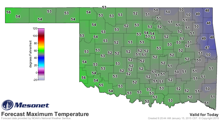
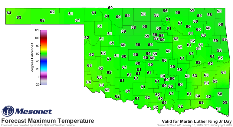
It won't last for long, I'm sure, but I sure do like to see the high temperature
maps over the next few days...50s and 60s, anyone? They don't change much, so I'll
just show the today's and Monday's maps.
And this is generally what the lows will look like.
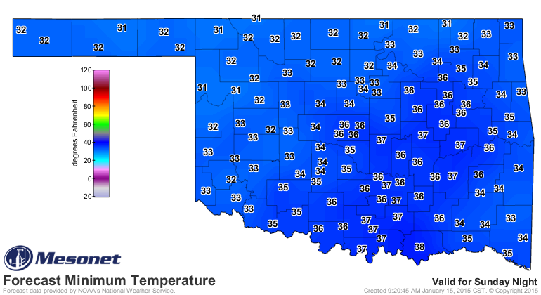
So we'll be about 10 degrees above our normal highs and lows for the next week or
so. I think we deserve a bit of warmth, seeing how we've been in the arctic
deep freeze since December 27. Check out the statewide average highs and lows
as measured by the Mesonet, and the departures from normal, from Dec. 27-Jan. 14.
BRRRRRR!!!
-***-
Avg. Tmax Avg. Tmin Avg. Mean
Mesonet Avg. 37.6 20.2 28.8
Normal 48.5 25.2 36.8
Dep. from Normal -10.9 -5.0 -8.0
-****-
Now the one bad thing about the coming "heat wave" is that it won't help the
drought situation at all. If it gets windy, it will have a desiccating effect
on the already flagging soil moisture. All the other things that come with a
warm, windy period during the winter will follow...impacts on the winter wheat
crop, possible wildfire danger, etc. Let's take a look at the Drought Monitor
map from this morning and see where we are...I'm betting yesterday's snow didn't
eradicate the drought up in NW OK.
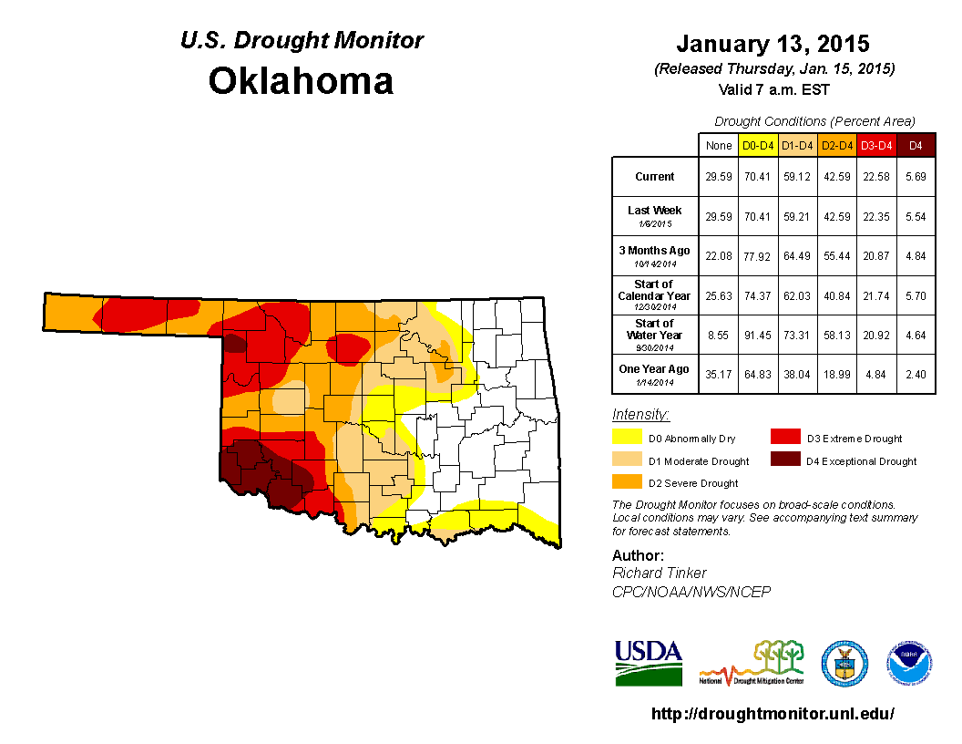
The numbers:
* 6% of the state in D4-Exceptional drought
* 17% in D3-Extreme drought
* 20% in D2-Severe drought
* 17% in D1-Moderate drought
* 11% in D0-Abnormally Dry conditions
* 30% of the state drought free
* More than 1.4 million people affected by drought in Oklahoma
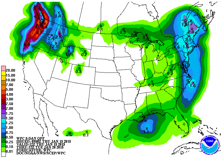
There is hope for some more moisture coming our way later into next week. should
cool down a bit too. For the next 5 days, however...let them eat dust.
Indeed, NWS Norman indicates elevated fire danger for the next several days,
especially on Saturday.
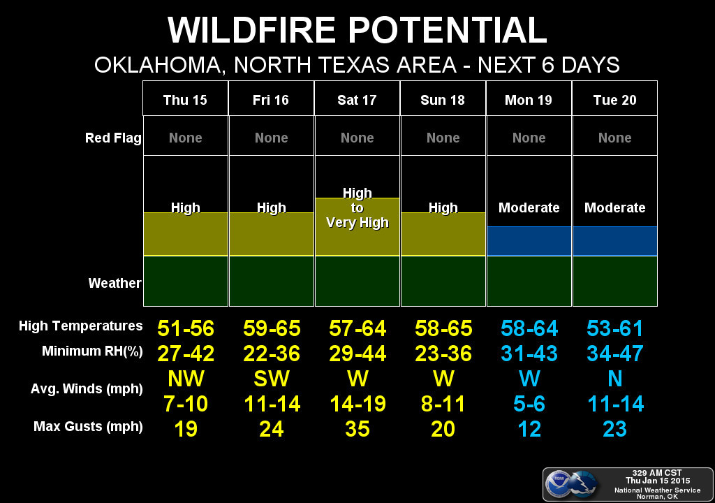
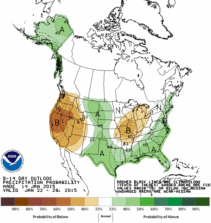
The winds don't look especially bad for the most part, but gusts to 35 on
Saturday is getting up there. At least we are seeing some increased odds of
above normal precipitation for later next week on the CPC medium-range outlook,
but remember, this is the driest time of the year. It's like me buying a comb...
don't go out and print up celebration stickers just yet. However, every little
bit helps (hair, rain...lots of things qualify).
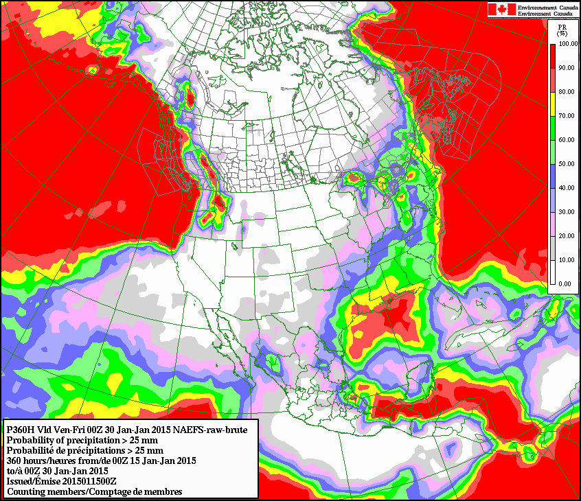
The Canadian model is still bullish on us remaining dry through the rest of the
month. They have the chances of us accumulating at least an inch of rain through
the rest of January as slim-to-none (unless you're in far SE OK).
Again, driest time of the year. However, I'm going to just go ahead and say it
... we don't get good moisture and soon, some of those wheat farmers are going
to be in very bad moods. Especially after the coming warm, dry and windy
weather. How many years in a row have we said that now? But again, it is the
driest time of the year. The problem is the "driest time of the year" for
Oklahoma over the last 4+ years has become (insert any date range you want).
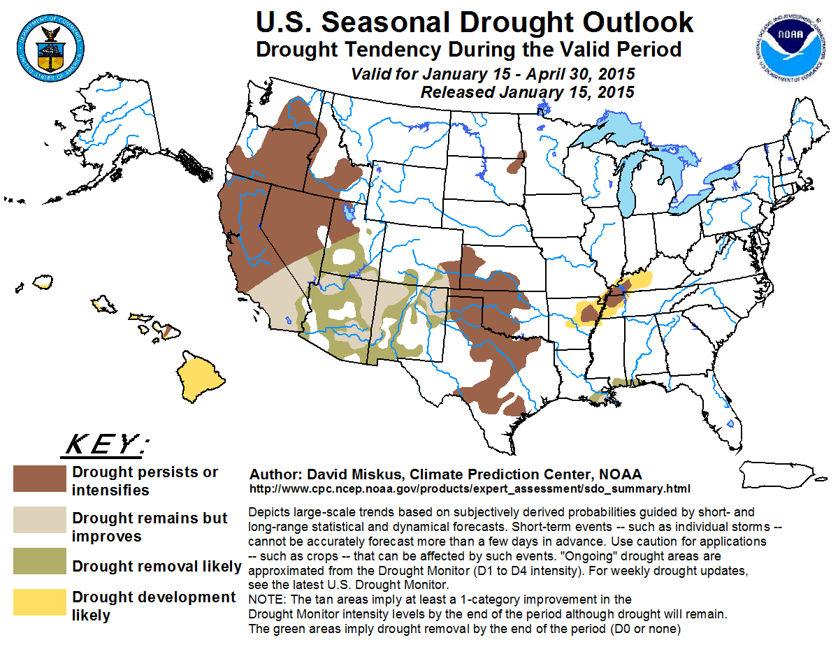
For the "Hey, here's some more pessimistic news" department, the latest U.S.
Seasonal Drought Outlook for the January 15-April 30 period shows drought, at
least where it exists now in the state, either persisting or intensifying. Only
across far far FAR western Cimarron County do we see a bit of "improves but
remains."
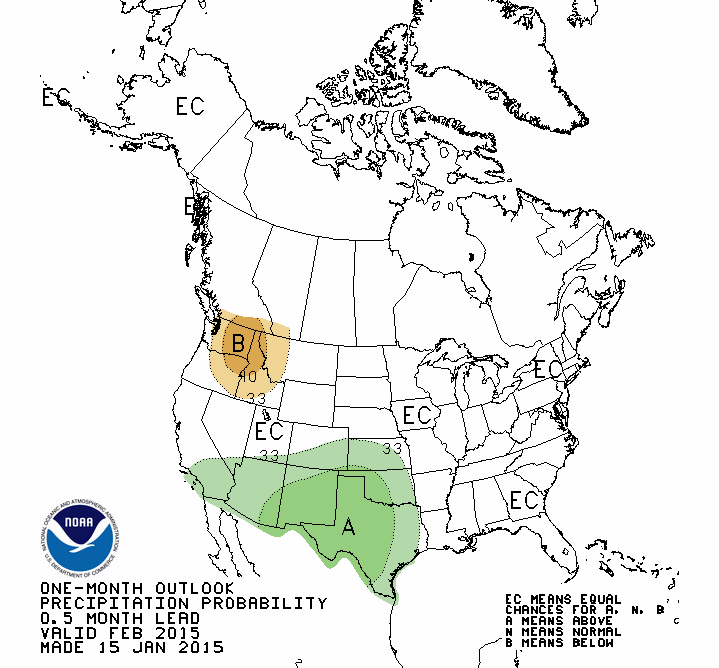
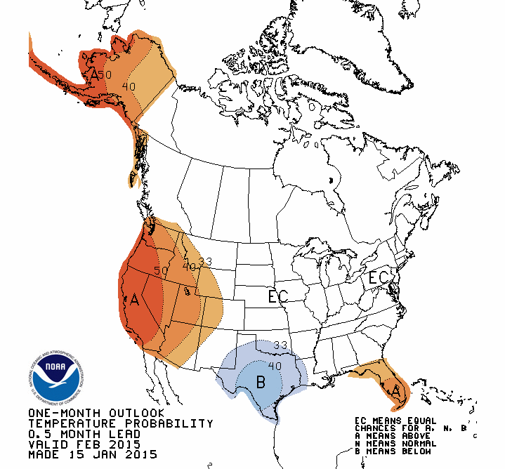
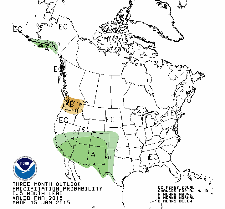
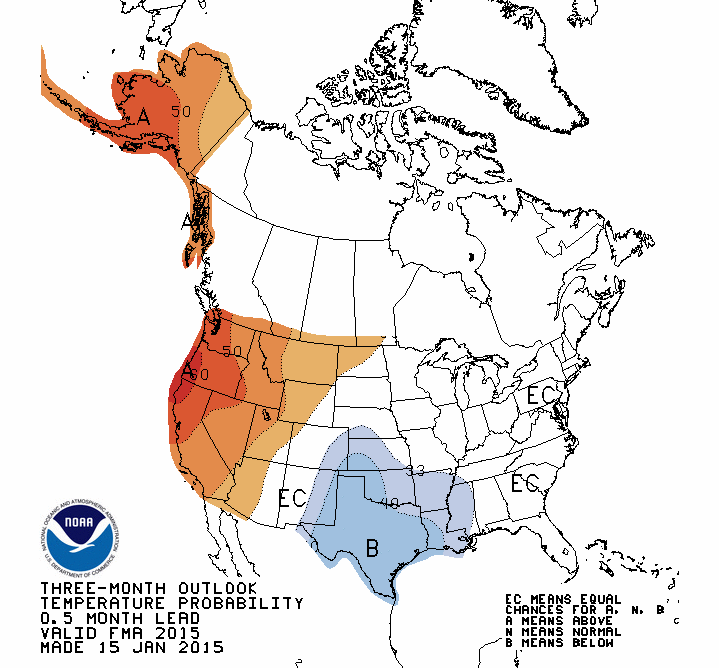
That comes from the latest CPC outlooks for February and also the Feb-April
time frame. Forget February's increased odds of above normal precip...that still
falls into the "driest time of the year" frame so not as much of an impact as
we'd like to see. And we DON'T see that on the Feb-April map, where above normal
moisture would really start to mean something.
IMPORTANT REMINDER: The white "EC" area on the Feb-Apr precip outlook DOES NOT
MEAN THEY EXPECT NORMAL AMOUNTS! It means "Equal Chances" of above-, below- or
near-normal precip amounts over that 3-month period. In other words, they don't
have a clue what it's going to do. But again, that's not an expectation of
normal.
So we want the warm weather, but we don't want the warm weather. We need the
rain but it's not gonna rain enough. I'm not gonna pay a lot for this muffler,
but I probably will anyway.
What can you do??
Gary McManus
State Climatologist
Oklahoma Mesonet
Oklahoma Climatological Survey
(405) 325-2253
gmcmanus@mesonet.org
January 15 in Mesonet History
| Record | Value | Station | Year |
|---|---|---|---|
| Maximum Temperature | 78°F | CAMA | 2006 |
| Minimum Temperature | -11°F | NOWA | 2024 |
| Maximum Rainfall | 2.95 inches | FAIR | 2017 |
Mesonet records begin in 1994.
Search by Date
If you're a bit off, don't worry, because just like horseshoes, “almost” counts on the Ticker website!