Ticker for December 8, 2014
MESONET TICKER ... MESONET TICKER ... MESONET TICKER ... MESONET TICKER ...
December 8, 2014 December 8, 2014 December 8, 2014 December 8, 2014
Warmth and rain...a warm rain?
We've touted it for at least a week, and maybe, just maybe, we'll finally see
what all the hubbub was about. I'm talking the heat (no, not 90 degrees, but an
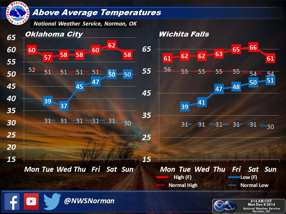
un-December'ish lack of 30s. NWS-Norman gives a pretty good illustration for
OKC (and Wichita Falls, TX) describing what we've been waiting for. Notice how
the lows expected later this week are in tune with the NORMAL HIGHS for this time
of year!
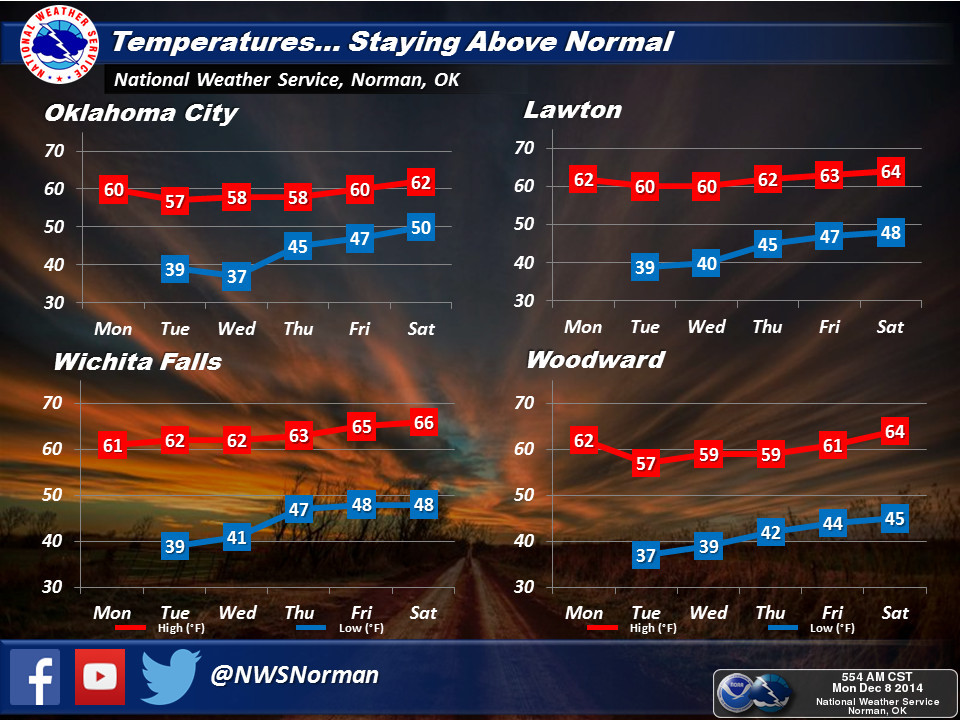
And then they give something of an indication from other parts of the state, again
tracking the highs and lows.
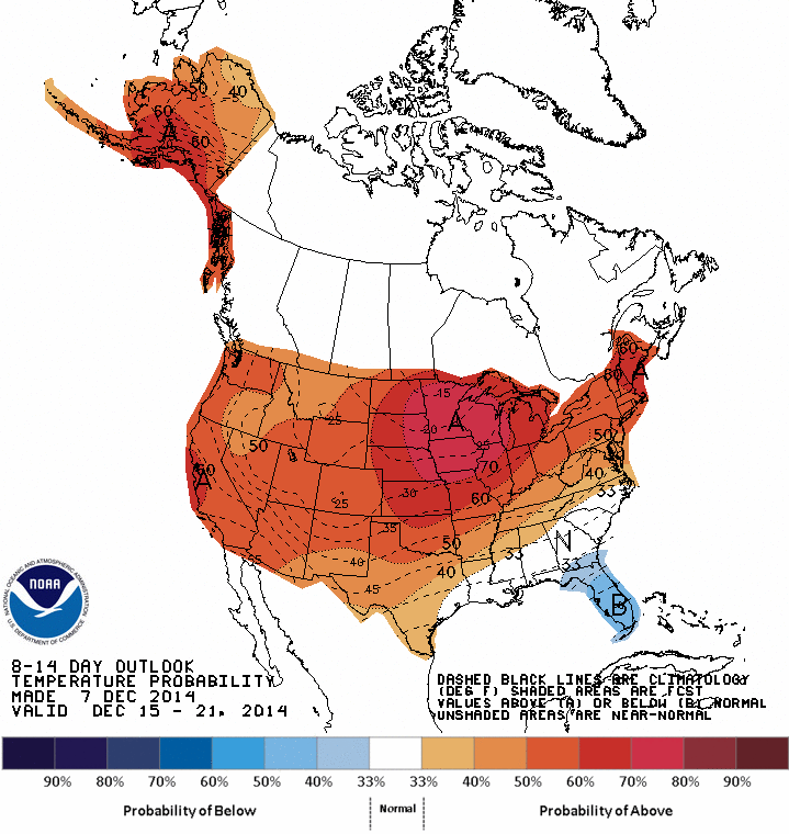
Remember last week I said it wasn't necessarily that we were going to be in the
70s, but some sort of combination of highs and lows would keep us above normal,
just as the outlooks from CPC were showing (and still are).
So whereas we'd "normally" be expecting low 30s for minimums and low 50s for highs,
looks like we're going to be seeing high 40s and low 50s for minimums and
upper 50s to mid-60s for highs (depending where you are in the state). And you
never know, a 70 or two might work its way in there sometime.
There is a storm system that appears to be taking shape for this weekend, but
it is very much a warm-type system, given the air mass already in place, and
so expect some rain later this week if that continues to show up in the
forecast models. It looks like the possibility of a nice 1-inch rain event for
some parts of the state.
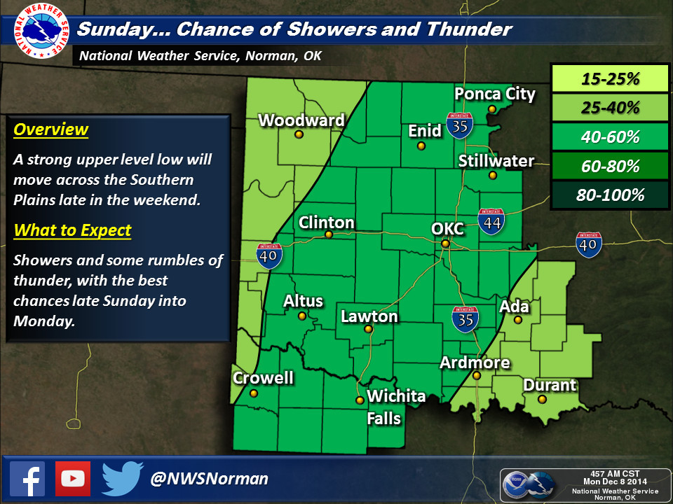
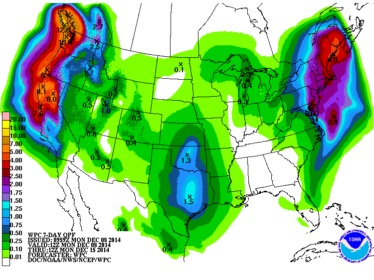
We'll have to keep watching and see how that system evolves. There might be a
chance of some severe weather this weekend. Still no big arctic air masses
showing up yet, but give it time. That jet stream will kink eventually.
Gary McManus
State Climatologist
Oklahoma Mesonet
Oklahoma Climatological Survey
(405) 325-2253
gmcmanus@mesonet.org
December 8 in Mesonet History
| Record | Value | Station | Year |
|---|---|---|---|
| Maximum Temperature | 80°F | BURN | 2023 |
| Minimum Temperature | -15°F | KENT | 2005 |
| Maximum Rainfall | 2.35″ | MTHE | 1994 |
Mesonet records begin in 1994.
Search by Date
If you're a bit off, don't worry, because just like horseshoes, “almost” counts on the Ticker website!