Ticker for November 18, 2014
MESONET TICKER ... MESONET TICKER ... MESONET TICKER ... MESONET TICKER ...
November 18, 2014 November 18, 2014 November 18, 2014 November 18, 2014
The un-common cold, part deux
Kind of fitting for me, since I'm at home taking care of a sick kid with a very
common cold. But, the deep November Chill of 2014 continues unabated, treating
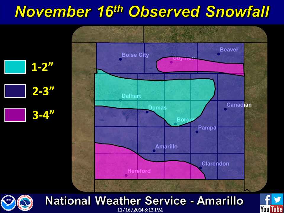
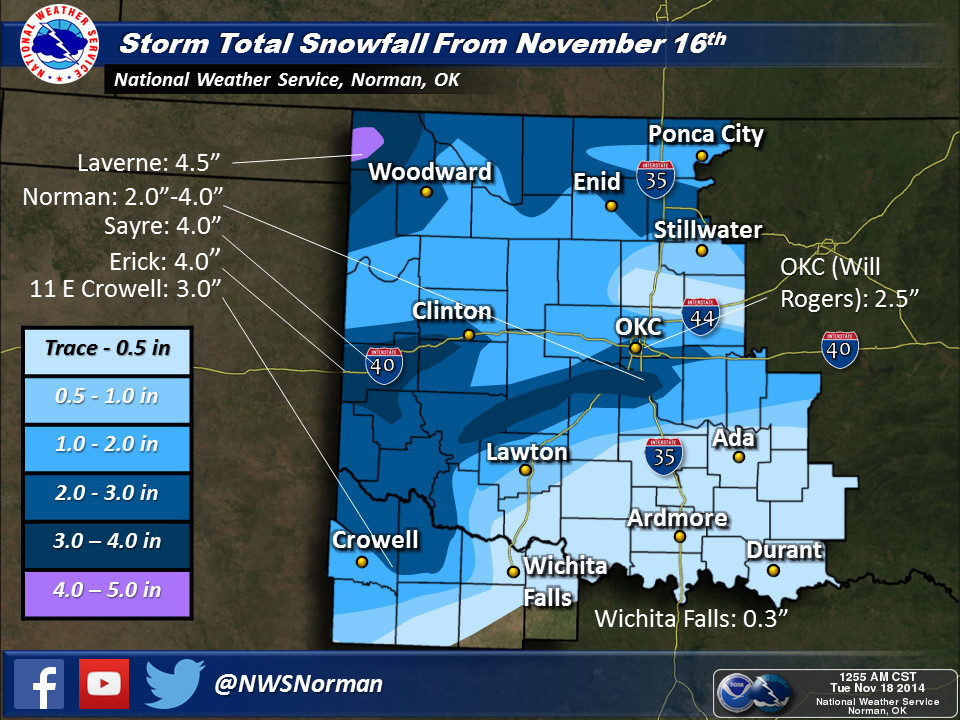
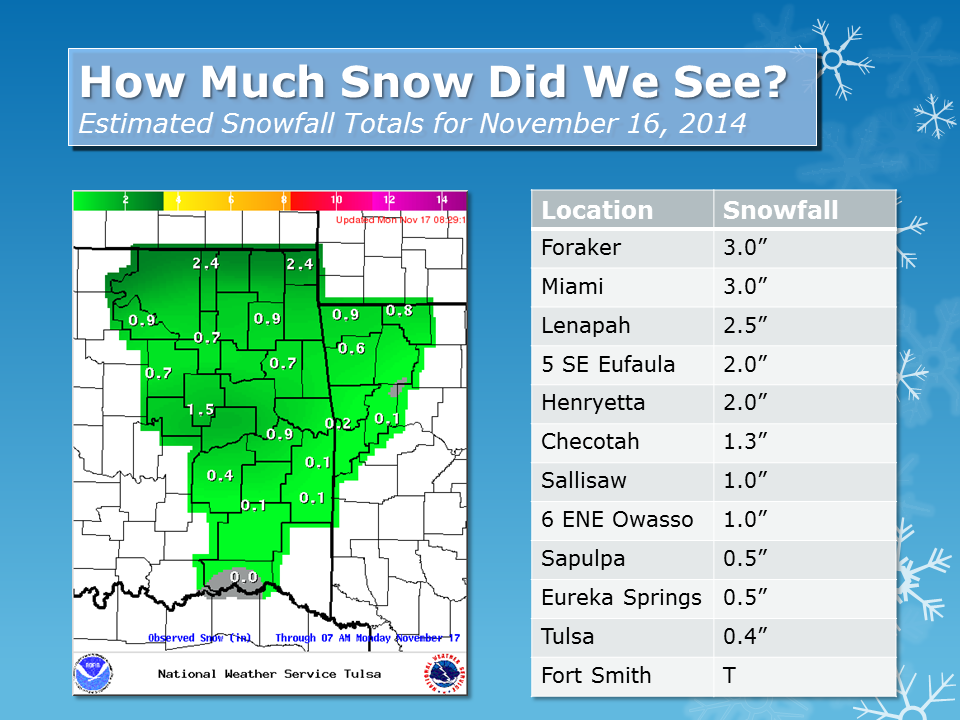
a large part of the state to a nice coat of frozen water Sunday and Monday. Snow
totals were a bit heftier than expected in some places, at least in the earlier
forecasts. Looks like 4-5 inches would be the max for areas across far NW OK.
The snow cover, light winds and clear skies made for some chilly starts the last
couple of days (heck, not sure yesterday ever made it past "start" if that's
the case). Wayyy too many single digits around.

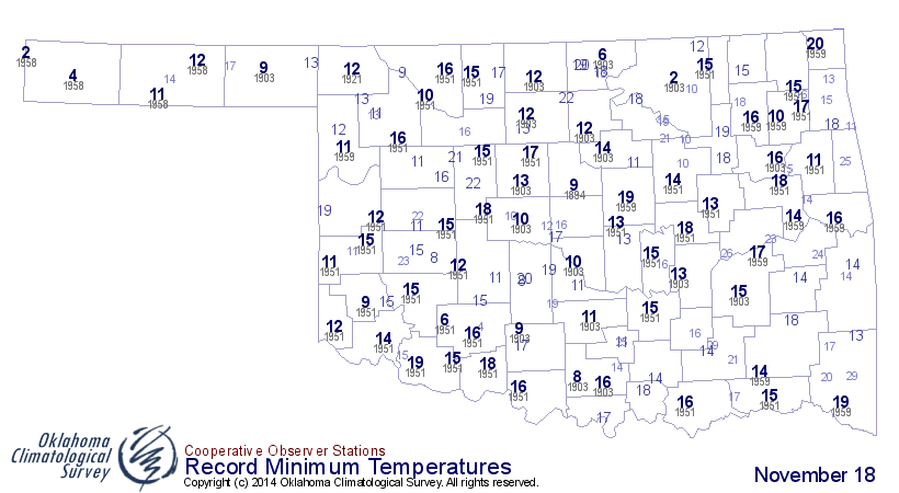
As you can see from the historical record lows for just Nov. 18, lots of records
have no doubt been threatened or broken outright over the last several days.
We've spent a TON of hours (not sure how that works, but we'll go with it)
below freezing since this whole thing hit back on the 11th or so.
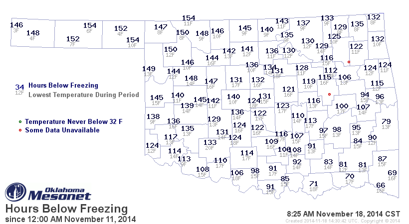
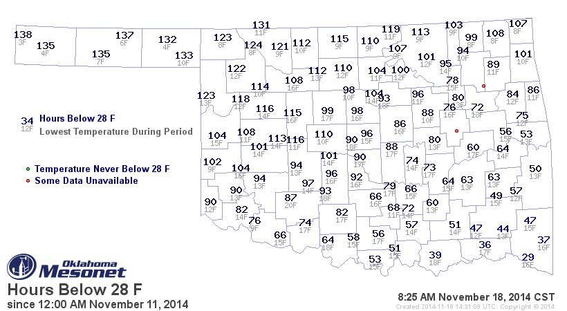
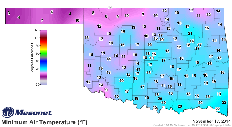
More than 150 hours at-or-below 32 degrees in some areas, and nearly that long
below 28 degrees in the Panhandle. Heck, we'll even throw in number of hours
below 10 degrees. Very bad sign that there actual numbers on the map!
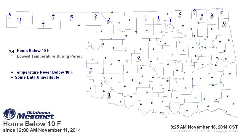
Looks to me like the 3 degrees at Kenton yesterday is the lowest temperature
we've measured on the Mesonet through this whole mess.
BRRRR indeed!
Historically, this is obviously one of the longest (and coldest) cold snaps
we've seen this early in the season. Historically, looking at all the November
deep chills in state history, the previous 7-day period (Nov. 11-17) is the
coldest for ANY 7-day period in November, regardless of whether we look late
in the month or early.
The statewide average temperature (averaging all the highs and lows across
the state together) for Nov. 11-17 is 29.6 degrees, besting the previous record
cold 7-day temperature of 30.2 degrees from Nov. 16-23, 1937.
Before we forget, however, we did have an even earlier cold snap that is up
there in the record books. The sixth coldest November 7-day statewide average
temperature of 32.3 degrees occurred on Nov. 5, 1991. So that one even extended
back into October. A lot of folks my age will remember that Halloween as the
one where there were scarier things about than ghouls and goblins...snow! We
have a story about that in one of our past Seasonal Summaries. You can read
about that frightfully cold Halloween (and the days thereafter into November)
here:
http://climate.ok.gov/summaries/seasonal/Oklahoma_Climate_Fall_2005.pdf
The Mesonet wasn't around then, but check out this map of max-min temperatures
from Nov. 3, 1991.
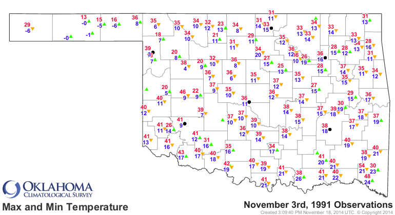
Yes, those are -6 degrees readings you see out in the Panhandle, to go along
with a -5 at Turpin and -1 at Optima Lake (the lake that isn't a lake).
So yes, this has been one of, if not THE cold snap of November, at least based
on 7-day statewide average temperatures. But let's not forget that doozy back
in 1991!
Gary McManus
State Climatologist
Oklahoma Mesonet
Oklahoma Climatological Survey
(405) 325-2253
gmcmanus@mesonet.org
November 18 in Mesonet History
| Record | Value | Station | Year |
|---|---|---|---|
| Maximum Temperature | 89°F | ANT2 | 2025 |
| Minimum Temperature | 8°F | NOWA | 2014 |
| Maximum Rainfall | 2.95 inches | ARNE | 2024 |
Mesonet records begin in 1994.
Search by Date
If you're a bit off, don't worry, because just like horseshoes, “almost” counts on the Ticker website!