Ticker for November 5, 2014
MESONET TICKER ... MESONET TICKER ... MESONET TICKER ... MESONET TICKER ...
November 5, 2014 November 5, 2014 November 5, 2014 November 5, 2014
The November 2014 rain Hall of Fame
We decided to let the last bit of rain trickle in last night to get a clearer
picture of who got what, and where. All in all, a pretty sweet picture for the
state (again, sorry Panhandle and far NW...and SE). Most folks saw at least an
inch, and there were even a few 2-inch+ amounts in there. The radar-derived
color overlay shows that this was a widespread rain as well.

Here are the top-20 totals from the Mesonet over the last few days.
-***-
KETC 2.32 CHIC 1.82
PAWN 2.32 ARD2 1.80
WATO 2.24 MARE 1.79
WYNO 2.05 TALA 1.79
VINI 2.02 MADI 1.78
ERIC 1.90 NEWP 1.78
MIAM 1.88 SKIA 1.76
STIL 1.88 BESS 1.74
MINC 1.85 MRSH 1.74
WAUR 1.83 CARL 1.73
-****-
92 of the 120 Mesonet sites saw at least an inch of rain, which is fantastic!
Not so fantastic, Most places in the far NW and the Panhandle saw diddly,
including Beaver, Goodwell, Hooker and Slapout who all came in with NO rain.
The statewide average for November thus far is 1.2 inches, which would place
the month as a whole (if it ended today...RATS! No Thanksgiving??) somewhere in
the 35th driest range. Meaning, we're already moving up the charts and we still
have 25 days to go!
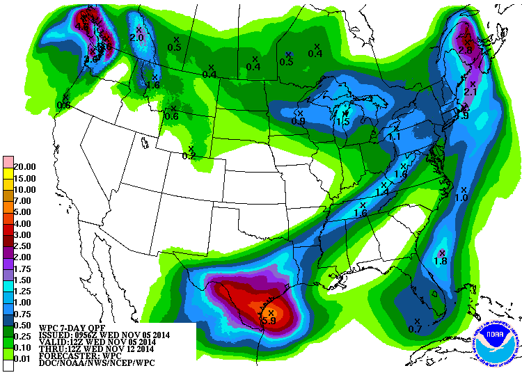
Don't look for any help anytime soon, at least based on the latest forecasts.
The 7-day rainfall forecast looks pretty bare for Oklahoma.
The 6-10 and 8-14 day outlooks from CPC don't look too promising either, unless
you like cooler than normal weather.
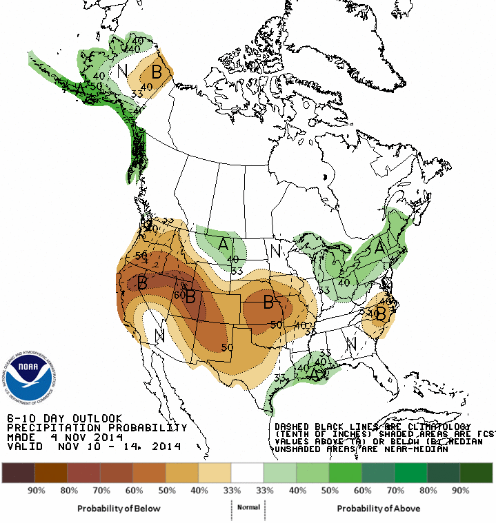
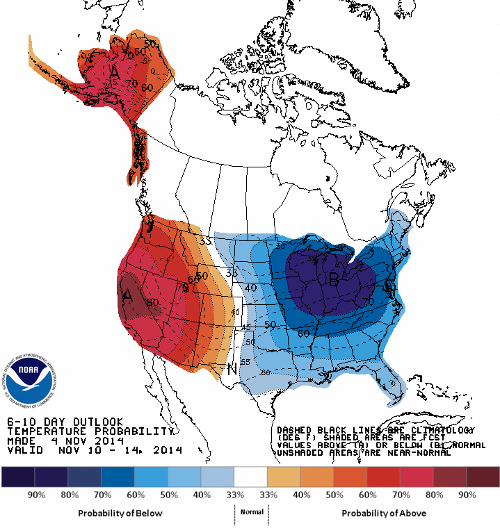
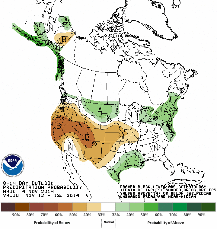
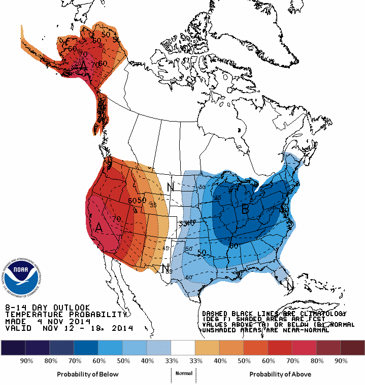
That pattern (warm in the western U.S., cold in the eastern U.S.) looks a lot
like the pattern we were in for most of last winter into spring. Let's hope we
have a little more variety this go-round. The last thing we want is a month
between precipitation events.
Gary McManus
State Climatologist
Oklahoma Mesonet
Oklahoma Climatological Survey
(405) 325-2253
gmcmanus@mesonet.org
November 5 in Mesonet History
| Record | Value | Station | Year |
|---|---|---|---|
| Maximum Temperature | 91°F | BURN | 2017 |
| Minimum Temperature | 20°F | BEAV | 2010 |
| Maximum Rainfall | 4.60 inches | IDAB | 2000 |
Mesonet records begin in 1994.
Search by Date
If you're a bit off, don't worry, because just like horseshoes, “almost” counts on the Ticker website!