Ticker for November 10, 2014
MESONET TICKER ... MESONET TICKER ... MESONET TICKER ... MESONET TICKER ...
November 10, 2014 November 10, 2014 November 10, 2014 November 10, 2014
Something Wicked This Way Comes

By now, you all know we have just a few hours to live, soon to be entombed within
our own houses by weather so cold geese have been seen flying all the way to the
equator. Okay, not really, but the proverbial "other shoe" is about to drop. The
scenario is well publicized by now, former SUPER-TYPHOON Nuri, birthed in the
western pacific, combined with a powerful jet stream over the Bering Sea to
transform from a tropical cyclone to an incredibly powerful extra-tropical
cyclone. This rapid deepening or intensification has been labeled many colorful
terms, such as "bomb-ifcication" or "bomb-o-genesis". In a nutshell, we now
have a large upper-level low pressure system in the Bering Sea which in turn is
creating a kinked-up pattern in the jet stream with a strong upper-level ridge
across the West Coast and a rapidly dipping trough of low pressure over the
eastern two-thirds of the country.
This somewhat dated explanation from the NWS Office in Chicago should give you
an idea of how some crazy typhoon half a world away eventually leads us to being
mired in the deep freeze.
http://www.crh.noaa.gov/news/display_cmsstory.php?wfo=lot&storyid=105107&source=0
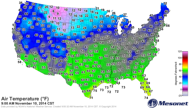
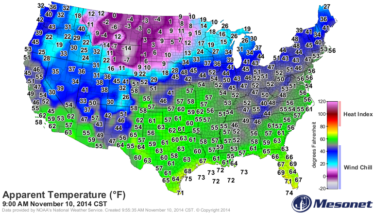
What's it mean for us? Well, it means a strong cold front is going to pass through
the state throughout the day, and as the name implies, it's gonna get cold. And
the problem is it's gonna stay cold as reinforcing shots of cold air and
funneled down from the north into the eastern two-thirds of the U.S.
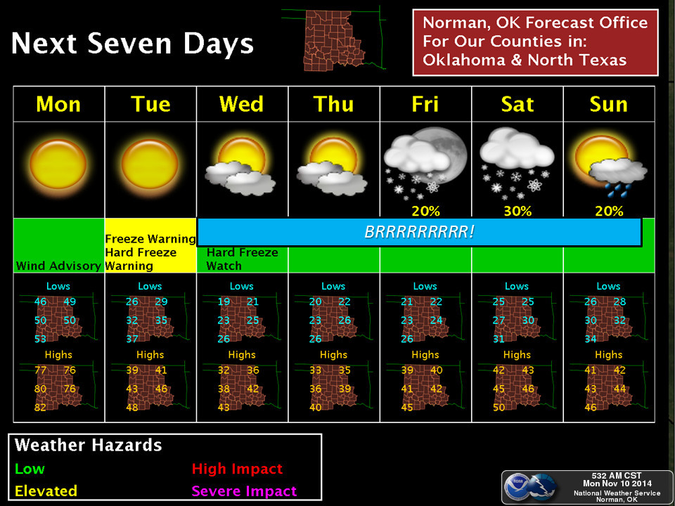
Here's a bit on what we can expect this week, courtesy of our local NWS offices.
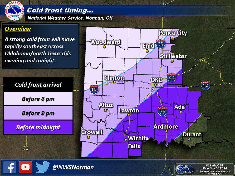

So prepare for strong southerly winds ahead of the front, and strong northerly
winds after the front.
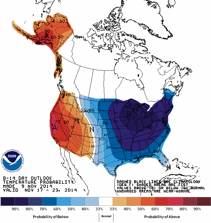
One of the problems here is that it looks like this pattern might be entrenched
for awhile, as indicated by the 6-10 and 8-14 day outlooks from CPC.

Now you probably noticed on that 7-day planner figure from Norman...a chance of
some sort of wintry precipitation coming up this weekend. Not a great chance
as of right now, and it will be fairly dry as another upper-level system comes
across the state possibly generating said wintry precipitation. There is also
a chance it will be warm enough any moisture could just be of the cold rain
variety. And frankly, as I said, there ain't a lot to work with right now.
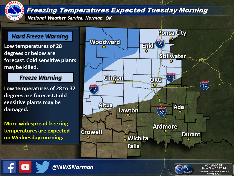
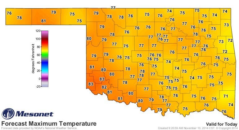
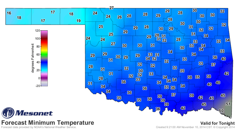
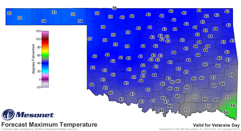
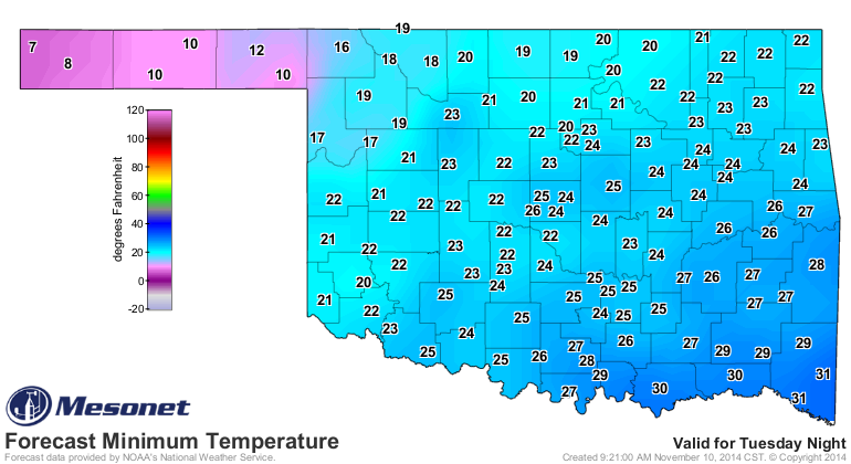
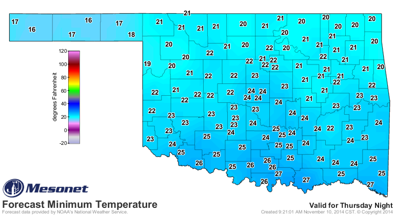
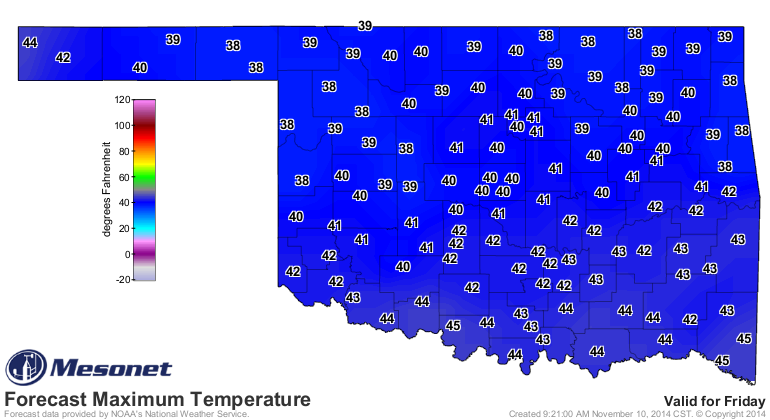
You can see from the upcoming temperature forecasts, however, that a hard freeze
is now a certainty for the entire state this week. WITH ONE WARM DAY LEFT!
...
With several requests, relying heavily on our friends from the local NWS offices,
the first official BRAUMS DEF-CON LEVEL will be set at "4" for this weekend.
You know, stop by after work for a bit of bread and milk.
Just in case.
Gary McManus
State Climatologist
Oklahoma Mesonet
Oklahoma Climatological Survey
(405) 325-2253
gmcmanus@mesonet.org
November 10 in Mesonet History
| Record | Value | Station | Year |
|---|---|---|---|
| Maximum Temperature | 88°F | MANG | 2014 |
| Minimum Temperature | 13°F | VINI | 2018 |
| Maximum Rainfall | 2.98 inches | WIST | 2008 |
Mesonet records begin in 1994.
Search by Date
If you're a bit off, don't worry, because just like horseshoes, “almost” counts on the Ticker website!