Ticker for November 3, 2014
MESONET TICKER ... MESONET TICKER ... MESONET TICKER ... MESONET TICKER ...
November 3, 2014 November 3, 2014 November 3, 2014 November 3, 2014
And now for something completely different...
I have the October climate summary ready, and you can read that below. I won't
bury the lead, however...I'm sure we're all (im)patiently waiting for Mother
Nature to turn on the spigot and bring us some rain. Especially for those down
across southwestern OK who missed out on the big rainstorm in October. Here's
what we can expect (CAUTION: expectations breed disappointment!) from the
system coming in over the next couple of days.
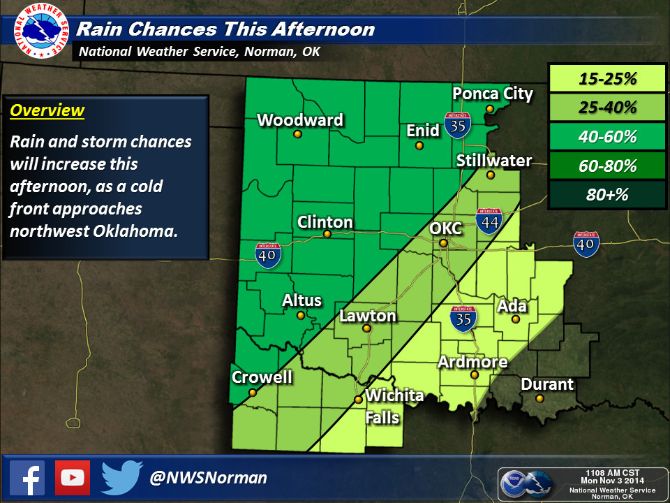
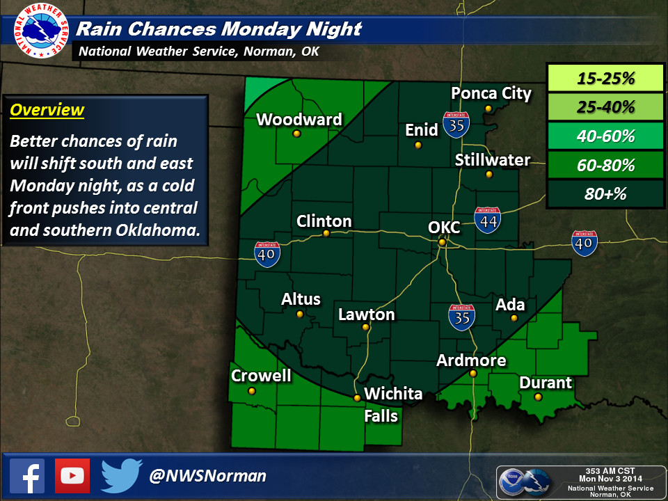
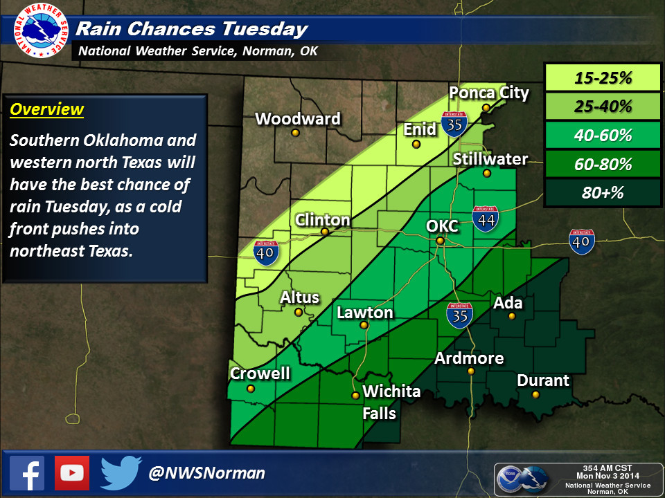
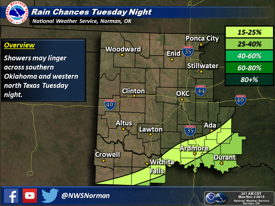
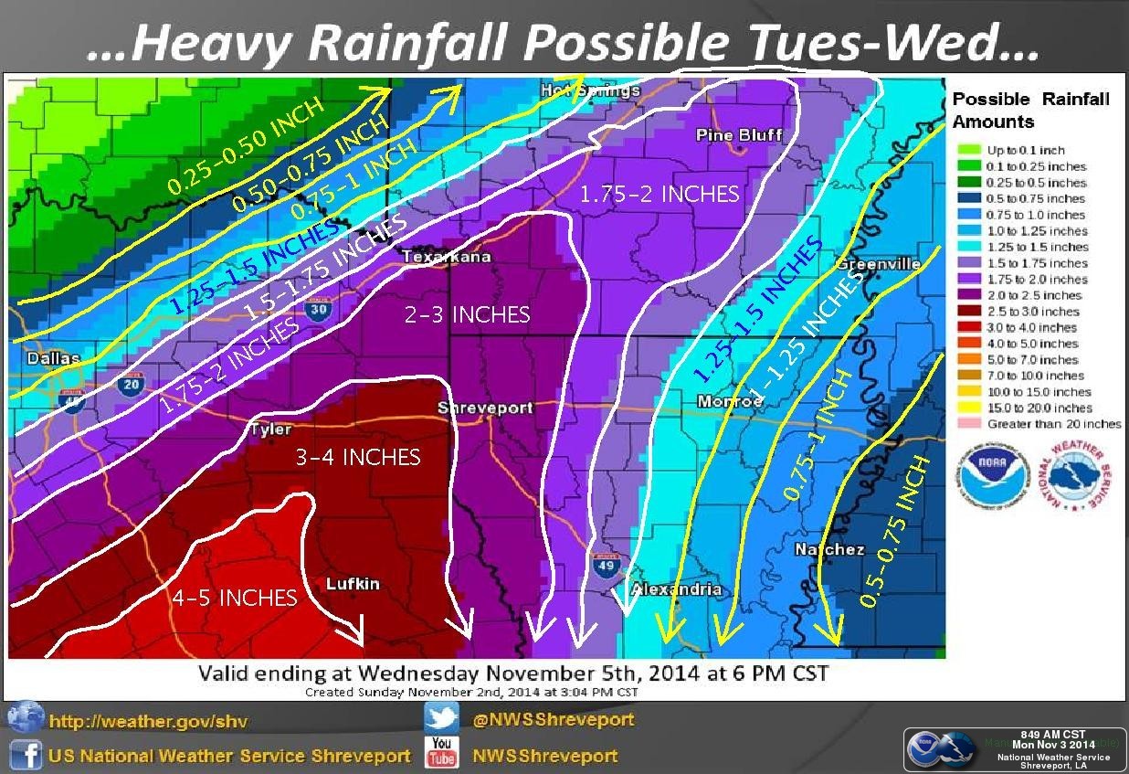
It's pretty obvious that some sort of squall line is expected to form along the
cold front headed this way, creating a swath of heavy rains from SW to NE. At
this point, SW needs it much more than NE, so let's hope it's "south-heavy."
Here are how the local NWS offices see the coming system.

Following that, just enjoy a nice, sunny fall week with seasonable temps.
-------------------------------------------------------------------------------
October Rains Plentiful For Some, Scarce For Others
One weekend of heavy rain brightened the fortunes of some Oklahomans during
October while others continued on in the embrace of significant drought.
Eastern Oklahoma, especially the far northeast corner, came out the big winner
in the moisture sweepstakes. Those across the western half of the state,
particularly southwest Oklahoma, were not so lucky. According to preliminary
data from the Oklahoma Mesonet, the statewide average rainfall total for the
month was 3.42 inches, just a tad above normal and the 41st wettest October
since records began in 1895.


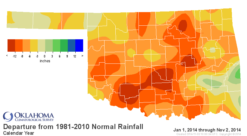
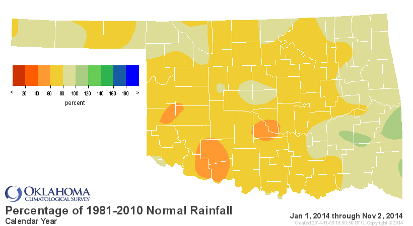
Punctuating the stark difference in fortunes along the southwest-to-northeast
diagonal of the state, northeastern Oklahoma saw widespread totals of 5-9
inches, but much of southwestern Oklahoma received less than an inch. Northeast
Oklahoma recorded an average of 5.99 inches, nearly 2.5 inches above normal and
the 16th wettest October on record for that area. Meanwhile, southwest Oklahoma
garnered a measly 1.34 inches, more than 1.5 inches below normal and the 39th
driest on record. The Mesonet site at Oilton led the state with 9.04 inches
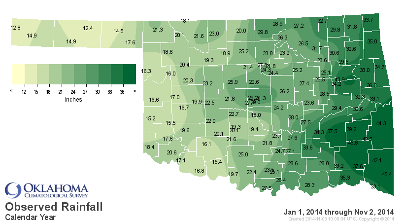
while Mangum recorded a paltry 0.57 inches. The near normal totals of October
kept the year-to-date statewide average in firm deficit mode at 25.07 inches,
6.78 inches below normal to rank as the 26th driest January-October on record.
Southwest Oklahoma stands out in that time frame with an average of 18.32
inches, 9.37 inches below normal to rank as the 17th driest.
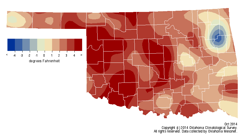
Unlike precipitation, temperature had no intention of finishing near normal
during October. The statewide average temperature, as determined by the
Mesonet, was 64.1 degrees, 2.8 degrees above normal to rank as the 20th warmest
on record.
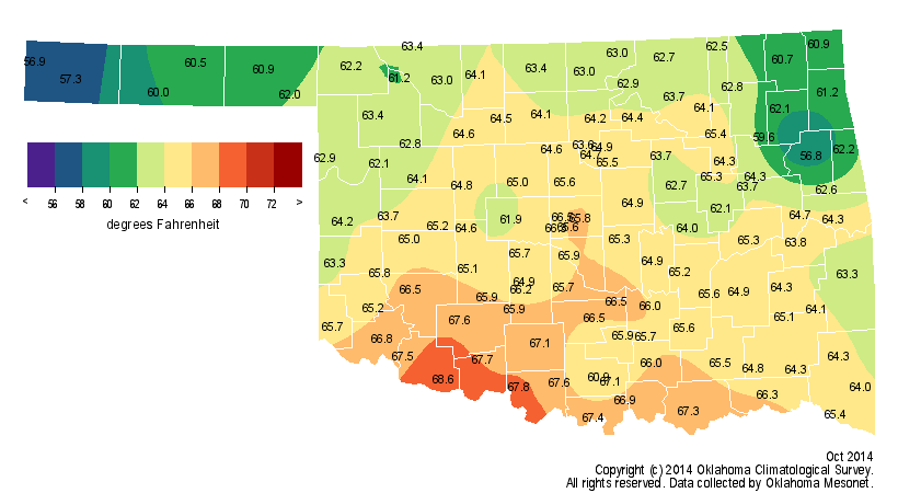
The month's highest reading from the Mesonet was 99 degrees from several sites
on October 7, although 90s were recorded as late as the 27th. The lowest
reading of 23 degrees was reported at Oilton on the month's final day. Combined
with a somewhat warm September, the average for the first two months of
climatological fall was 68.6 degrees, good for the 27th warmest such period on
record. The year-to-date average of 62.1 degrees remained 0.7 degrees below
normal and ranked as the 28th coolest January-October since 1895.
The warm weather was a disappointment to those hoping drought would begin to
taper during what is considered the beginning of Oklahoma's cool season and
secondary rainy season. Daytime highs in the 80s and even 90s at times kept
pressure on the soils and reservoirs in the areas impacted by significant
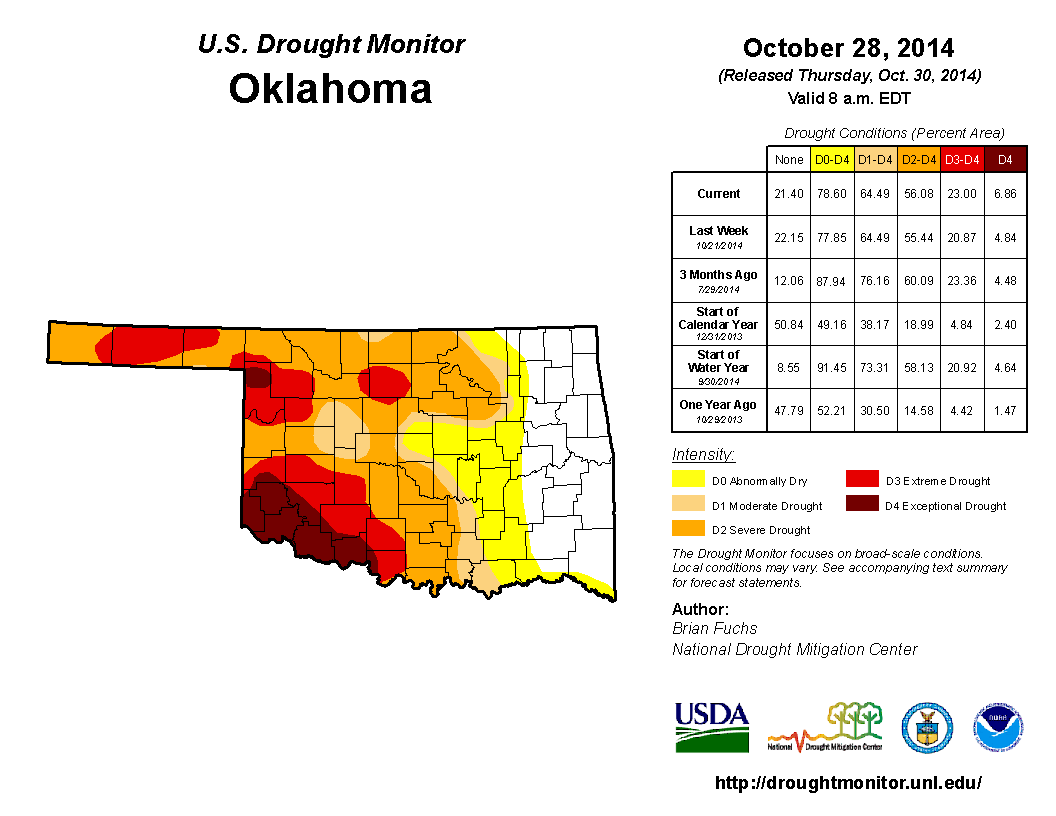
drought. Owing to the uneven precipitation pattern of October, the U.S. Drought
Monitor showed an overall decrease in drought from 73 percent to 64 percent,
but an increase in extreme-exceptional drought ? the two worst categories ? from
21 percent to 23 percent. Nearly the entire eastern half of the state was
drought free, although some moderate drought was noted to the east of I-35 in
northern and southern Oklahoma. The majority of southwestern Oklahoma remained
in extreme or exceptional drought. One year ago, only 27 percent of the state
was considered to be in drought according to the Drought Monitor.
The November precipitation outlook from the National Weather Service's Climate
Prediction Center (CPC) showed increased odds for above normal precipitation
across the state. There was not a clear signal for the November temperature
outlook.
The precipitation outlook for the November-January period portrayed the
southwestern half of the state with increased odds for above normal
precipitation. That same area also had increased odds of below normal
temperatures. No clear signal exists for either precipitation or temperature in
the northeastern half of the state.
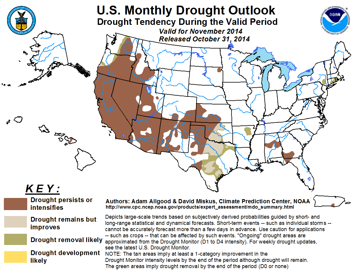
CPC's U.S. Monthly Drought Outlook for November calls for drought to either
persist or intensify across the western third of Oklahoma, but some improvement
or even removal is likely to the east of that area.
Gary McManus
State Climatologist
Oklahoma Mesonet
Oklahoma Climatological Survey
(405) 325-2253
gmcmanus@mesonet.org
November 3 in Mesonet History
| Record | Value | Station | Year |
|---|---|---|---|
| Maximum Temperature | 93°F | MANG | 2005 |
| Minimum Temperature | 10°F | KENT | 2004 |
| Maximum Rainfall | 6.69 inches | TISH | 2024 |
Mesonet records begin in 1994.
Search by Date
If you're a bit off, don't worry, because just like horseshoes, “almost” counts on the Ticker website!