Ticker for October 23, 2014
MESONET TICKER ... MESONET TICKER ... MESONET TICKER ... MESONET TICKER ...
October 23, 2014 October 23, 2014 October 23, 2014 October 23, 2014
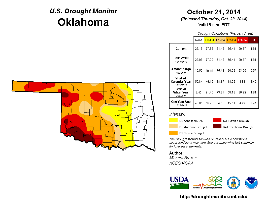
Drought holding steady...for now
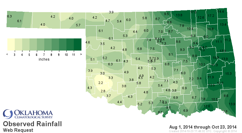
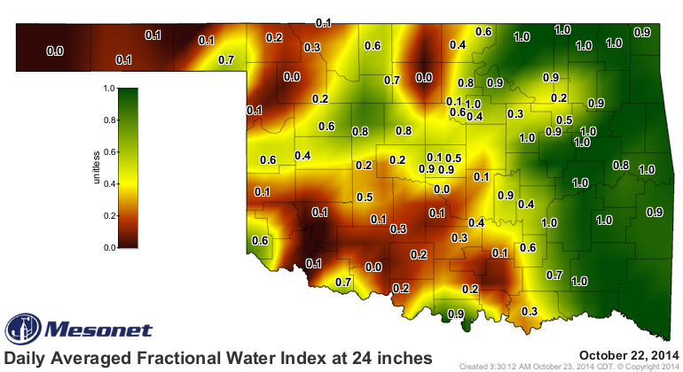
Hey, there was rain! Not much, but enough to turn some of the state blue on the
Mesonet rainfall maps. Trouble is they were already feeling blue from lack of
rainfall, but that 0.59 inches in Hollis is much appreciated, I'm sure.

It's been a sad situation since our big rains of a couple of weeks ago, however.
Drought eased back across eastern Oklahoma due to that rain, but the lack of
any appreciable rains across western Oklahoma keeps our eyes glued to that area
for possible intensification. We're still looking at fairly significant deficits
since the end of July for a large part of western and southern Oklahoma.
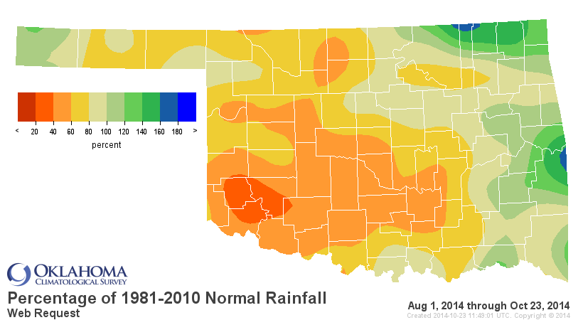
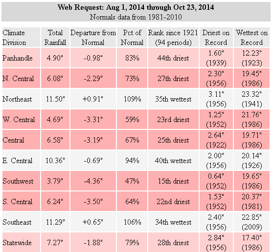
The other parts of the state aren't much better, save for patches across eastern
Oklahoma, but that SW corner of the state is really hurting with their 15th driest
Aug. 1-Oct. 23 since at least 1921, down over 4 inches. Those folks haven't been
able to catch a break since 2010, if even then.
Impacts from long-term deficits are still dominating the state, from the
diminished soil moisture at lower depths
to some "ghosts of their former selves" reservoirs across western Oklahoma.

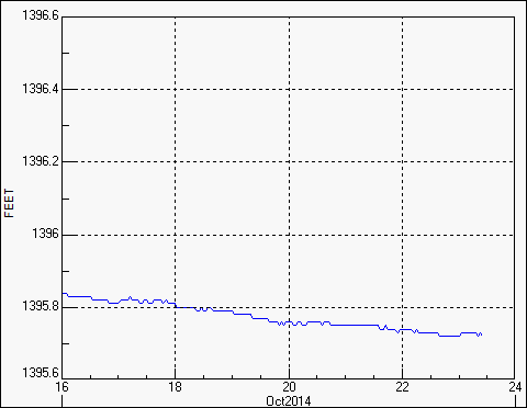
If something doesn't happen soon, Lake Tom Steed, Altus' main drinking supply,
will once again approach that 20% of normal capacity that triggers some pretty
harsh water restrictions...21% now and still sinking.
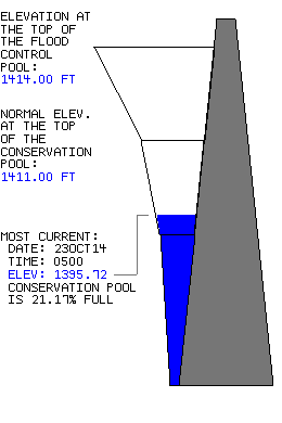
The warm weather is not helping matters as that level drops a bit more each day.
Canton has continued to drop and now sits at about 20% of normal (and dropping).

A pretty simple cure for all of this would be some cooler weather and some rain!
Well, not much rain showing up just yet, at least that could be confidently
forecast.

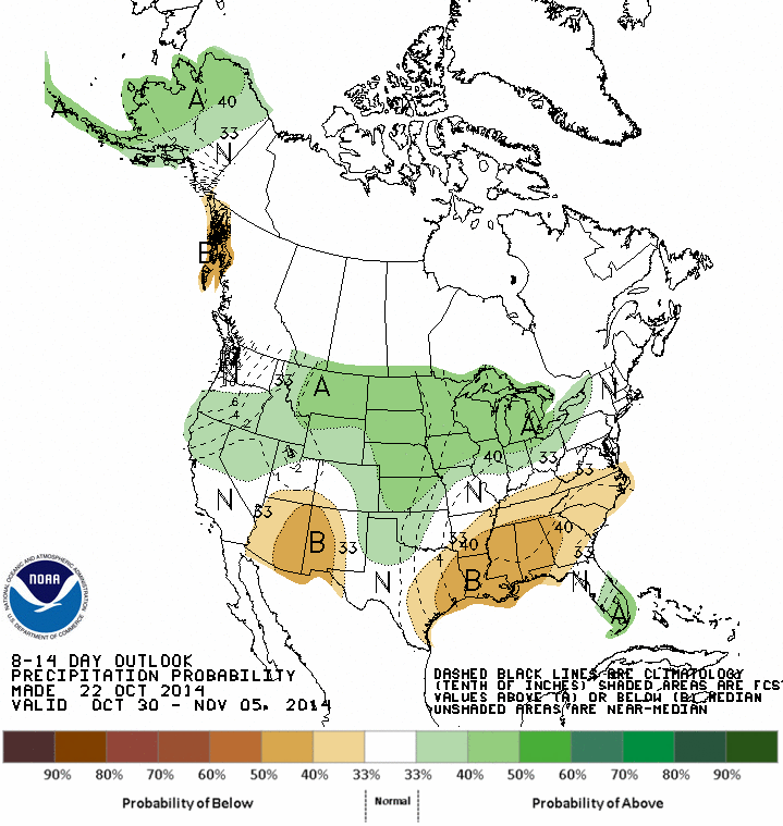
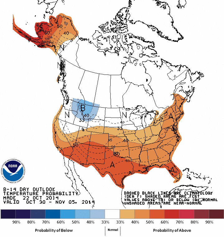
There's a hint of another wet system more than a week down the road, as we can
see on the 8-14 day precip outlook from CPC, but the cooler weather (other than
a few bumps here and there) doesn't appear to be looming just yet (again, at
least not that can be confidently forecast at this time).
We once again look at the chances for at least an inch of rain to accumulate
through the next 15 days or so, courtesy of the Canadian forecast models. This
runs from today through November 7.
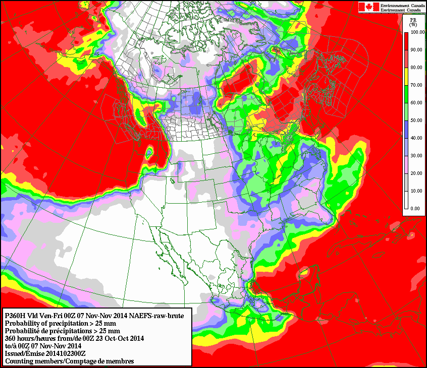
A bit better across eastern Oklahoma at 40-50%, and not quite so good across
the west. What a shocker!
It's a tired old pattern by now as we're over halfway into climatological
fall (September-November). Maybe the next big pattern change will show up right
around the corner.
It can do that, you know!
(patiently looking at Mother Nature)
Gary McManus
State Climatologist
Oklahoma Mesonet
Oklahoma Climatological Survey
(405) 325-2253
gmcmanus@mesonet.org
October 23 in Mesonet History
| Record | Value | Station | Year |
|---|---|---|---|
| Maximum Temperature | 96°F | WAUR | 2024 |
| Minimum Temperature | 21°F | EVAX | 2020 |
| Maximum Rainfall | 4.31 inches | BROK | 2015 |
Mesonet records begin in 1994.
Search by Date
If you're a bit off, don't worry, because just like horseshoes, “almost” counts on the Ticker website!