Ticker for October 27, 2014
MESONET TICKER ... MESONET TICKER ... MESONET TICKER ... MESONET TICKER ...
October 27, 2014 October 27, 2014 October 27, 2014 October 27, 2014
The next end of summer...COME ON DOWN!!
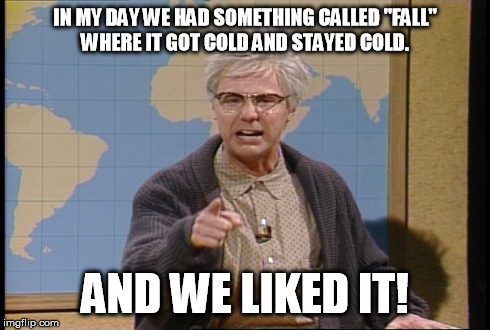
Soon, we shall be back in glorious fall again for some undetermined period of
time...a brief window to enjoy apple cider whilst father reads tales to the
family in front of a roaring fireplace. The leaves, turning shades of glorious
reds and oranges, skim across the ground outside, borne on the northerly winds
of the coming winter.
Really? I'll believe it when I see it, especially after what we've seen over the
last week. Take yesterday, for instance...please!
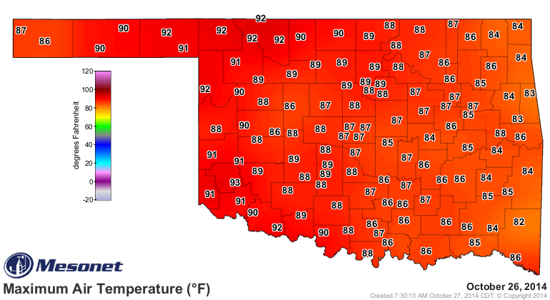
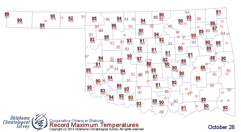
And THAT was a continuation of Saturday, and Friday...and so on and so forth. With
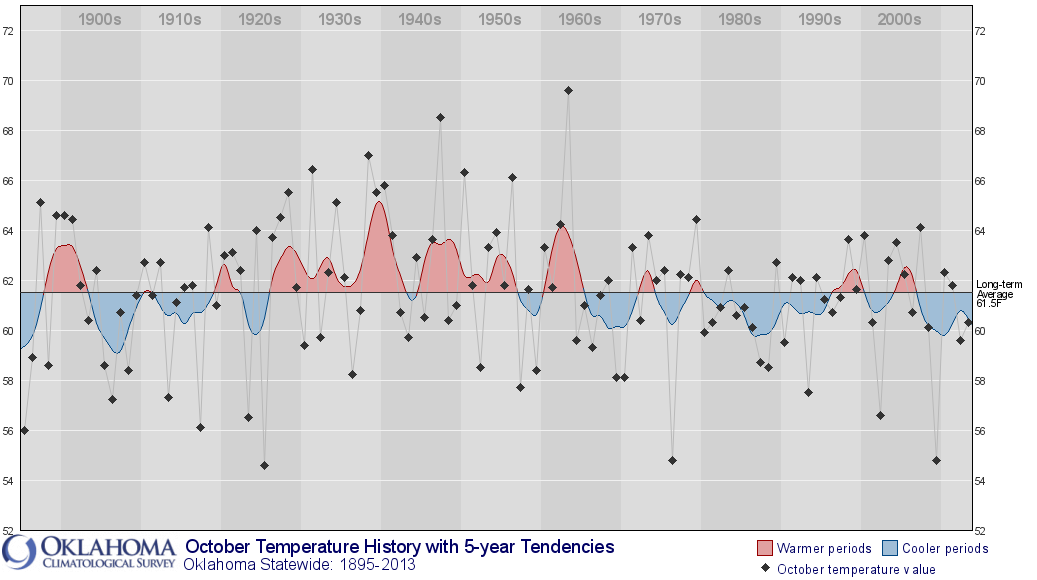
a statewide average temperature of 64.7 degrees since October 1, we are without
a doubt going to end up with one of our warmest October's in recent memory. Maybe
all the way back to 1963, which is also the warmest October on record for the
state.
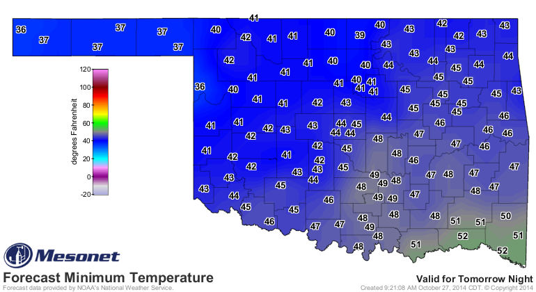
Back to our sojourn into fall, however. The front that is going to drop us back
down to more seasonable levels is currently moving into NW OK. In fact, the
Panhandle is already enjoying fall once again with strong northerly winds
ushering in those temperatures in the 50s.

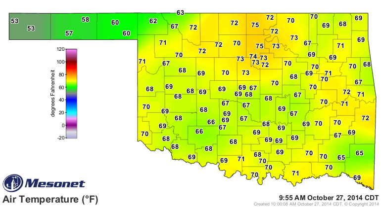
Make no mistake about it, there is some cool air poised to the north.
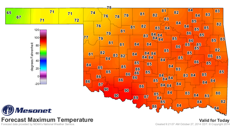
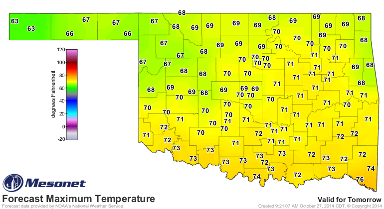
We will, however, see temperatures ONLY rise into the 60s and low 70s for the
next few days (after one really hot day south of the front today). So southern
OK should prepare for some 90s before they get the 70s tomorrow.
And we could even see some 30s up in the north during the week. Frost is
possible in the low-lying areas.
Lots of mixed messages about a possible big storm system next week sometime
(which is always a possibility that far out), but otherwise, expect more of the
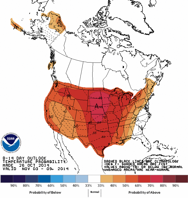
same...warm, dry, where the heck is fall type weather. The CPC outlook for
Nov. 3-9 is showing WARM. Keep in mind that this is a product from yesterday,
and that it was probably not adjusted by a forecaster since they are usually
automated on the weekends. Still, greatly increased odds of above normal
temperatures for next week. Maybe that will change with today's run.
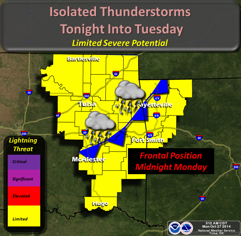
Now there is the obligatory small chance of rain today with the front's passage.
Don't expect much or you'll probably be disappointed.
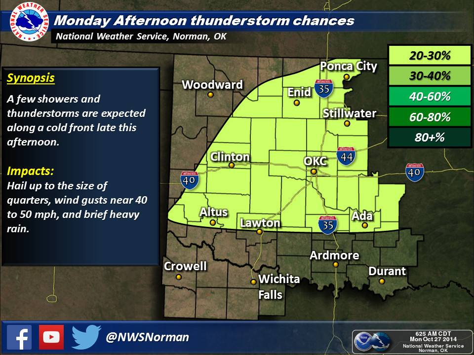
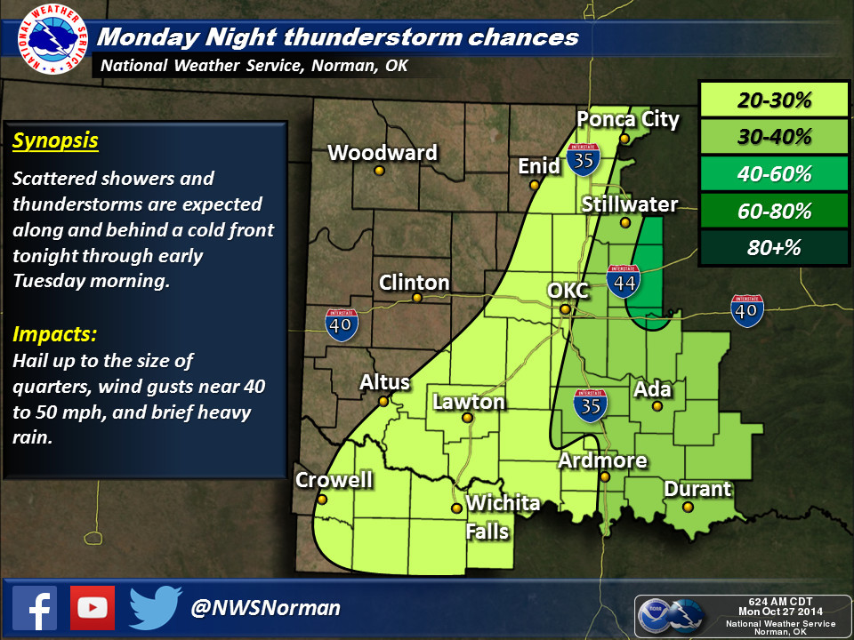
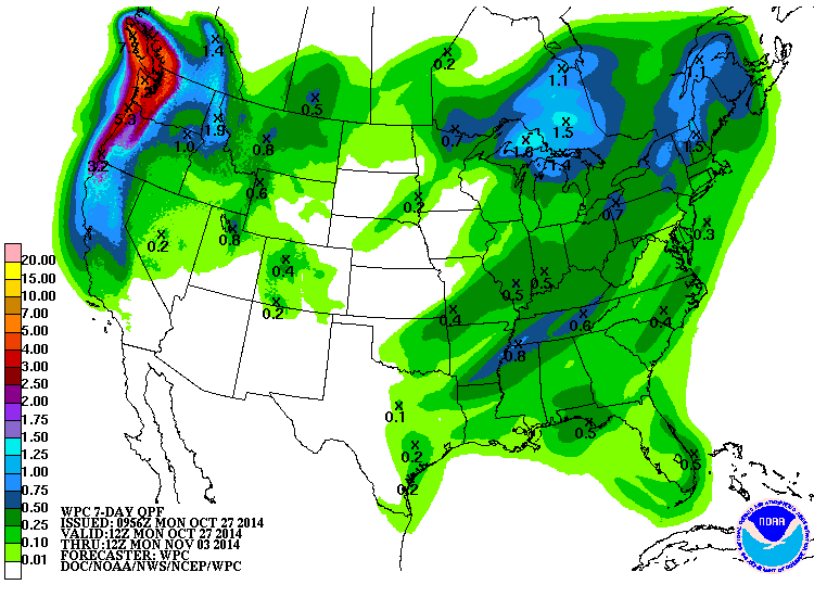
The 7-day moisture forecast is less than hopeful.
Enjoy fall while it's here. Winter will show up one day. No, literally, in one
day we'll go from 80s to 30s and we'll wonder why we never had a fall. Twas
ever thus in Oklahoma.
Gary McManus
State Climatologist
Oklahoma Mesonet
Oklahoma Climatological Survey
(405) 325-2253
gmcmanus@mesonet.org
October 27 in Mesonet History
| Record | Value | Station | Year |
|---|---|---|---|
| Maximum Temperature | 91°F | MANG | 2014 |
| Minimum Temperature | 15°F | BOIS | 2020 |
| Maximum Rainfall | 4.03 inches | EUFA | 2004 |
Mesonet records begin in 1994.
Search by Date
If you're a bit off, don't worry, because just like horseshoes, “almost” counts on the Ticker website!