Ticker for October 15, 2014
MESONET TICKER ... MESONET TICKER ... MESONET TICKER ... MESONET TICKER ...
October 15, 2014 October 15, 2014 October 15, 2014 October 15, 2014
A frighteningly dry second half of October??
The scariest part of this Ticker is that we couldn't even remember if
"frighteningly" is a word. But hey, it didn't turn red, so we're going with it.
In Microsoft we trust! With the weather, that's even more iffy. The rains we
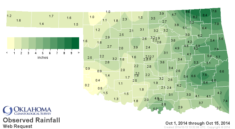
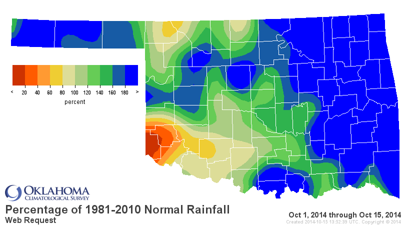
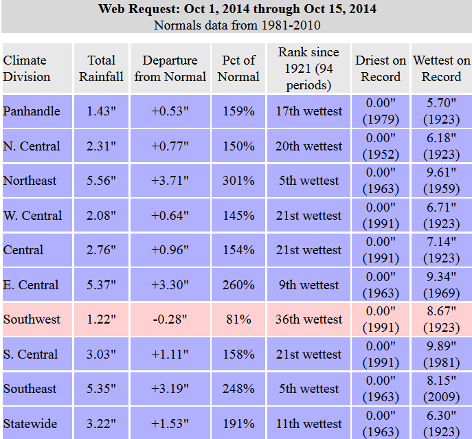
got over the weekend were awesome (again, sorry Hollis) for most. In fact, with a
statewide average of 3.22" for the first half of the month, that makes that period
the 11th wettest Oct. 1-15 on record at least back to 1921. Quite a bit of that
surplus was provided by the eastern portions of the state (look at the NE, EC and
SE climate divisions on the stats figure). Only SW OK came in below normal for
the period.
If October ended today, it would be tragic since I would lose the chance to eat
all my kids' Halloween candy. But we would be pretty close to normal on moisture
for the month. The normal statewide total for the entire month of October is
3.1".
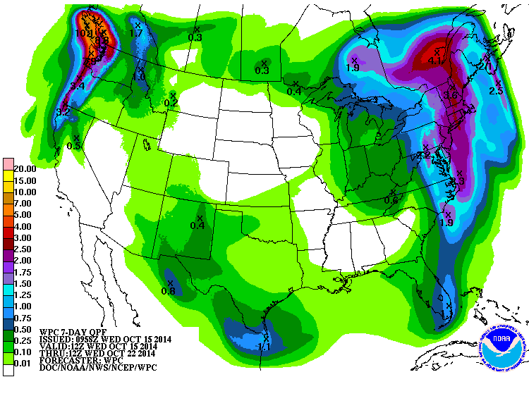
What about prospects moving forward? Well, there is another chance for rain
early next week it appears. It does not look like a major rainer right now. Heck,
not even a Corporal Rainer as far as we can see on the 7-day moisture forecast.
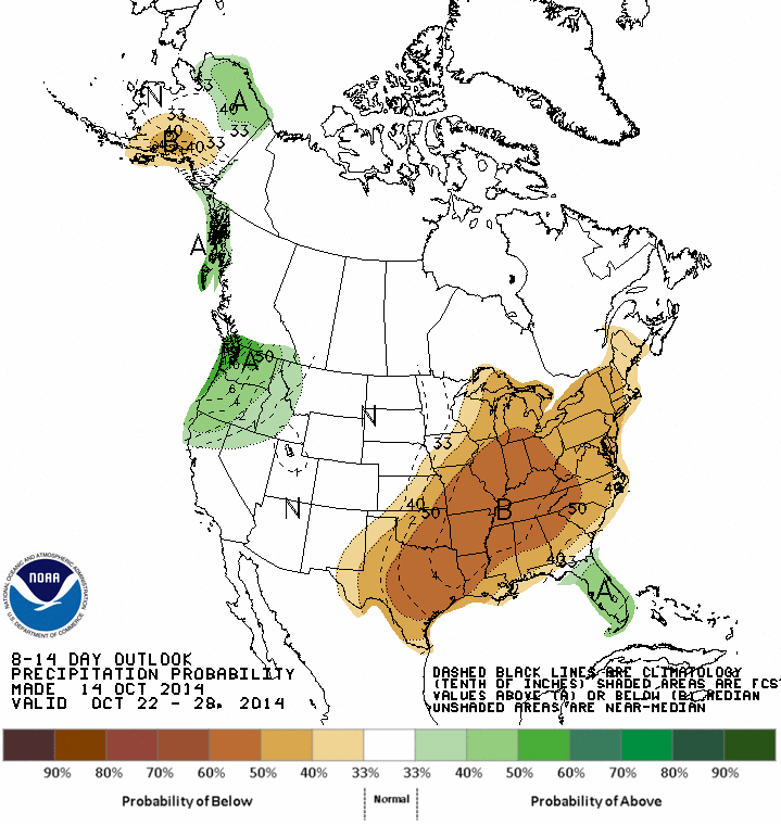
We can go even farther out with the CPC's 8-14 day outlooks. It would appear
that this warm and dry pattern we've been in (save for last weekend) for awhile
is going to continue.

Our friends to the north (no, not Kansas...farther north!) show very little
chance for even another inch of rain right up until Halloween. Here's the view
from the Canadian forecast model on chances for an accumulation of at least an
inch of rain through Oct. 30th.
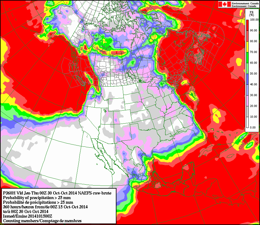
From 10-20% it would appear...that's not good. Of course, that can change in a
hurry. But, it does appear that a large ridge of high pressure is about to
dominate the western half of the U.S. for awhile, including Oklahoma. Another
reason to be thankful for the rains last weekend. And HALLOWEEN CANDY in another
couple of weeks.
Gary McManus
State Climatologist
Oklahoma Mesonet
Oklahoma Climatological Survey
(405)325-2253
gmcmanus@mesonet.org
October 15 in Mesonet History
| Record | Value | Station | Year |
|---|---|---|---|
| Maximum Temperature | 97°F | TIPT | 2015 |
| Minimum Temperature | 26°F | EVAX | 2018 |
| Maximum Rainfall | 5.41 inches | WALT | 2006 |
Mesonet records begin in 1994.
Search by Date
If you're a bit off, don't worry, because just like horseshoes, “almost” counts on the Ticker website!