Ticker for October 9, 2014
MESONET TICKER ... MESONET TICKER ... MESONET TICKER ... MESONET TICKER ...
October 9, 2014 October 9, 2014 October 9, 2014 October 9, 2014
Simon Says...oh, forget it! Just bring us some rain.
I'm going over Simon's head straight to the person in charge...Mother Nature, this
one is up to you. The sense I'm getting from the forecast types around the region
is that, yes, the remnants of Hurricane Simon will impact our area to some degree,
and yes, there will also be another chance for rain early next week, and yes,
there will be a nice cold front with this first system that will drop us back
into fall, and yes, WOW, are you still reading this sentence; it's a long one for
sure.
I hope I lulled you into complacency just in case things don't pan out, nobody
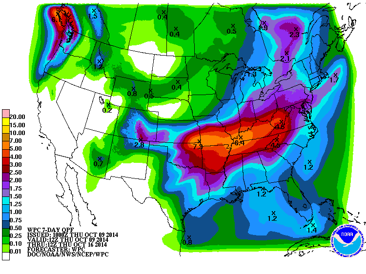
will remember to quote me. Here is how WPC sees the overall rain for the two
systems, from today through next Thursday (rain should be well over by then).
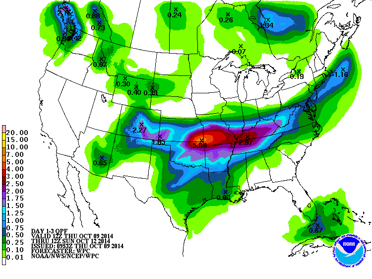
We can try to break that up into separate systems. Here are the projected totals
for the next three days.
And here are the totals for Sunday morning through Tuesday morning.
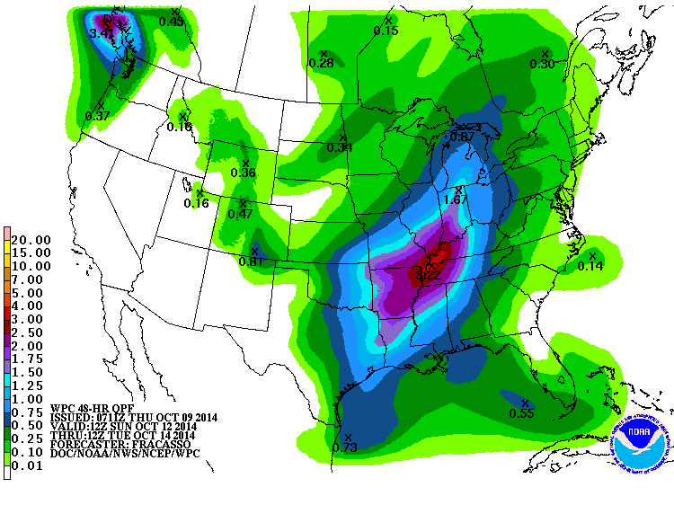
So it does appear that the bulk of the projected rains for the next five days
or so are expected with the Simon remnants/cold front system, and then another
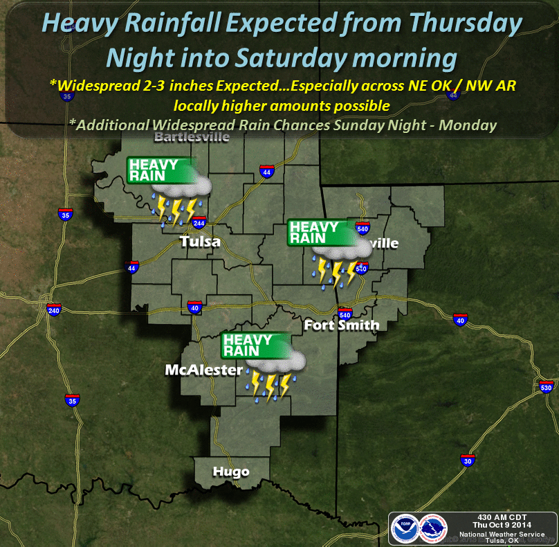
good rain for eastern Oklahoma early next week. The area for heaviest totals
still appears to be along the OK/KS border, especially in far NE OK. Flooding
could be a concern in areas that see multiple rounds of storms.
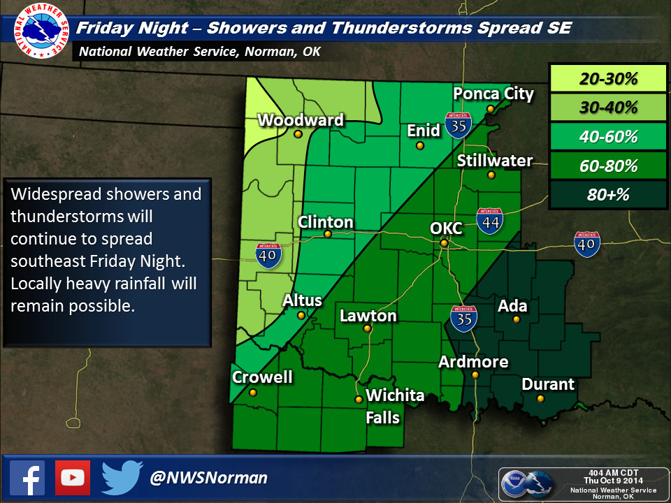
Here are the graphics from our friendly neighborhood NWS offices detailing
what they expect from the first system.


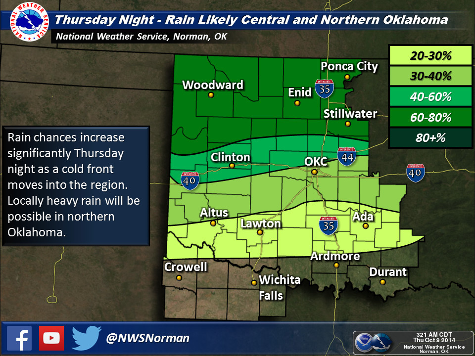
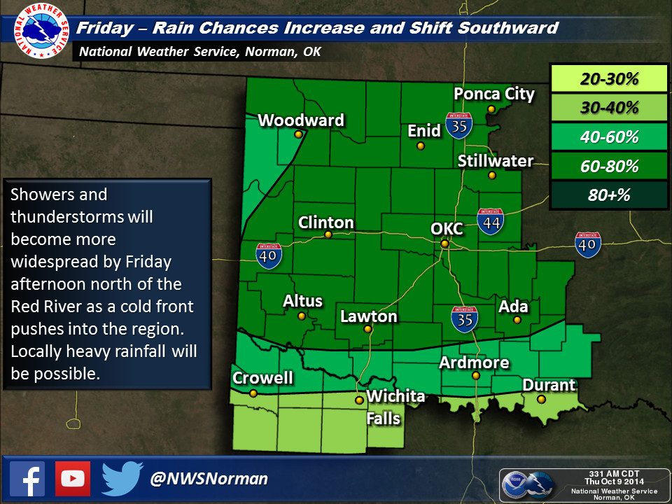
It's already raining in the Panhandle, and the storms located in KS could drop
south as part of the first wave.
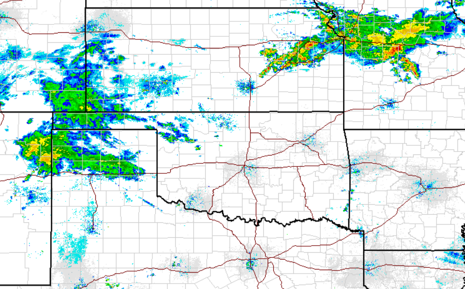
You can see the cool air poised to the north, ready to flow into the Southern
Plains behind that front.

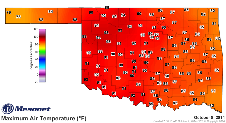
Would you rather see this??
Or this??
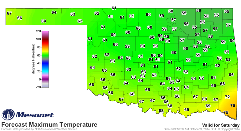
I thought so. Don't get to needy, though. Looks like our summer-like weather
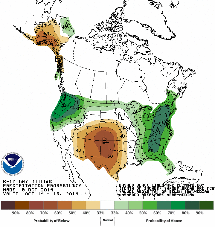
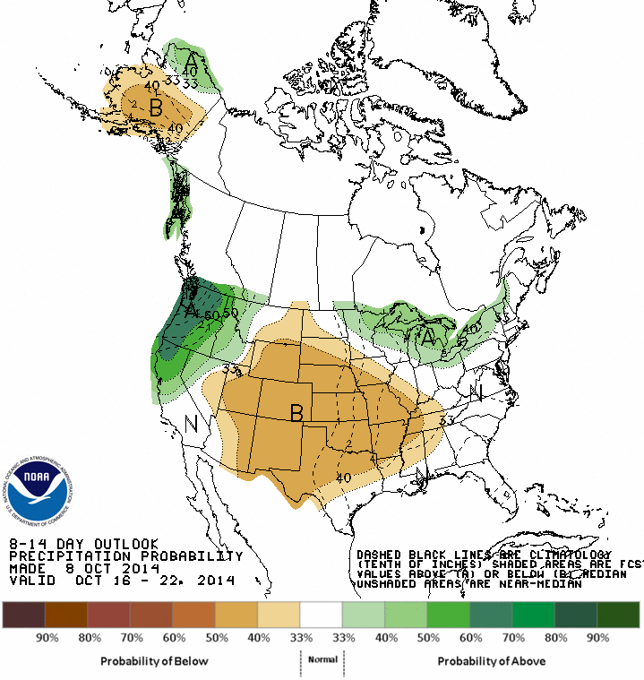
could return after that, at least according to CPC's 6-10 and 8-14 day outlooks.
Dry too.
6-10 day outlooks

8-14 day outlooks

That puts all the more pressure on having some good rains this weekend, because
it might be all we get for awhile. These two systems are even more important
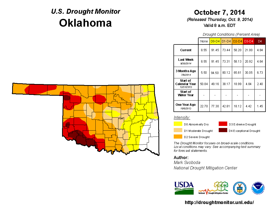
given the current drought situation, as indicated by the new U.S. Drought
Monitor map. There were no big changes this week, which is why I buried the map
until the last.
We'll take some rain. We'll take some fall. Then we'll take some summer. All
par for the course in Oklahoma.
Gary McManus
State Climatologist
Oklahoma Mesonet
Oklahoma Climatological Survey
(405) 325-2253
gmcmanus@mesonet.org
October 9 in Mesonet History
| Record | Value | Station | Year |
|---|---|---|---|
| Maximum Temperature | 102°F | FREE | 2021 |
| Minimum Temperature | 16°F | ELRE | 2000 |
| Maximum Rainfall | 4.15 inches | WAUR | 1997 |
Mesonet records begin in 1994.
Search by Date
If you're a bit off, don't worry, because just like horseshoes, “almost” counts on the Ticker website!