Ticker for October 7, 2014
MESONET TICKER ... MESONET TICKER ... MESONET TICKER ... MESONET TICKER ...
October 7, 2014 October 7, 2014 October 7, 2014 October 7, 2014
Those hot, sultry days of...October??
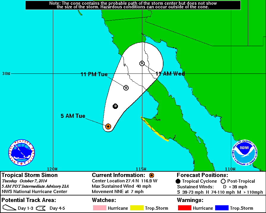
Yes yes, we're all still excited about the rain that probably won't happen over
the next week or so with the remnants of hurricane Simon (downgraded by NOAA's
National Hurricane Center to a tropical storm) headed this way and then another
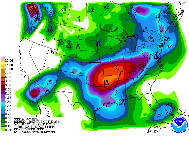
very-iffy chance for rain next week. Here's the latest 7-day rainfall forecast
from WPC. Some very generous totals, especially for a wheat crop that has been
dusted in, waiting for moisture.
A word of caution...Simon is still out over open water, so just remember, Odile
me once, shame on you. Odile me twice, shame on those danged forecast models! But,
looking good for now.
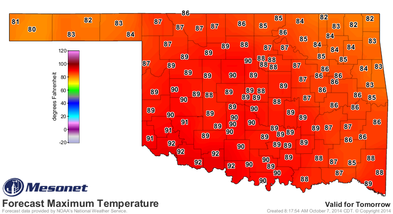
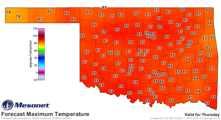
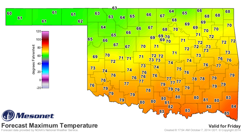
Before we get to the rain and the cooler weather, it's gonna be hot. In fact, it's
probably gonna be close to record hot in some areas. Check out the forecast
highs for today and then the historical high temperatures for this calendar day.
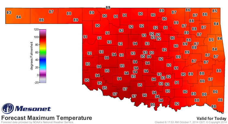
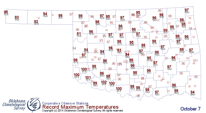
I doubt we see any triple-digits, but it could be close in some areas. Oct. 7,
1979 was apparently a warm day since six locations across the state hit 100
that day.
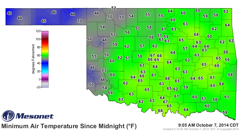
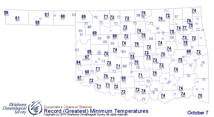
The low temperatures were ridiculously warm for this time of year as well, as
shown by the Mesonet versus the historical record high minimum temperatures
for this date.
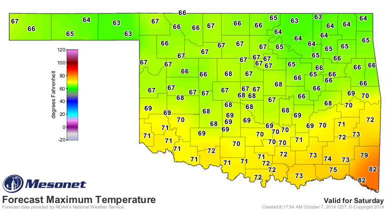
The heat will continue through Thursday until that frontal system finally
arrives in time for the weekend. The exact timing will become more clear as
we get closer, but look for a Friday-ish passage. Then we'll have a lovely,
rainy fall weekend (hopefully).
I'd say that's enough excitement for one week. Again, at least we HOPE it's
exciting. How about some flooding rains over Lake(s) Skiatook, Lugert, Canton,
Tom Steed and Waurika?
That's not asking much.
Gary McManus
State Climatologist
Oklahoma Mesonet
Oklahoma Climatological Survey
(405) 325-2253
gmcmanus@mesonet.org
October 7 in Mesonet History
| Record | Value | Station | Year |
|---|---|---|---|
| Maximum Temperature | 99°F | WAUR | 2014 |
| Minimum Temperature | 26°F | SEIL | 2012 |
| Maximum Rainfall | 5.79 inches | HOBA | 2018 |
Mesonet records begin in 1994.
Search by Date
If you're a bit off, don't worry, because just like horseshoes, “almost” counts on the Ticker website!