Ticker for October 6, 2014
MESONET TICKER ... MESONET TICKER ... MESONET TICKER ... MESONET TICKER ...
October 6, 2014 October 6, 2014 October 6, 2014 October 6, 2014
(Hurricane) Simon Says...LOTS OF RAIN!
Yeah yeah, I know we're still smarting from Hurricane Odile's treachery. Remember
this?
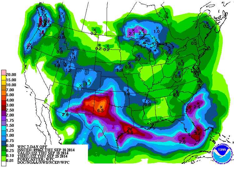
Or this?
Me either! I mean, I would have to be crazy to bring that up again. But...here we
go again. Hurricane Simon, now tropical storm Simon, is still spinning off of
Baja California and headed to the northeast. SUPPOSEDLY, the remnants are
supposed to head up over Oklahoma and meet up with a cold front that is supposed
to plunge into the state from the north, where the two are then supposed to
interact and dump lots of rain across the state.
Supposedly.
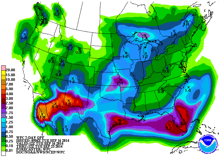
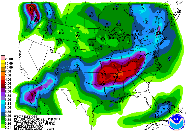
Check out the latest 7-day rainfall forecast from WPC.
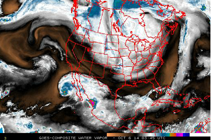
This is a Particularly Dangerous Forecast, what with Simon still over open water
and still some forecast model disagreement. Here's a look at the culprit in
question...shift your gaze to the SW of the Gulf of Cali.
But hey, why deal with all this conjecture and uncertainty when it actually
rained across the eastern half (or so) of OK last night? Check out the rainfall
map from last night's storms.

So there were just a few areas that received some pretty good rainfall, but at
this point I think we'll call ANY rainfall "pretty good." Personally, I heard
the loudest thunderclap in my life last night. There was no separation between
the lightning and the thunder, so I'm scared to go outside and see what got
blasted. As Large Marge said, it made the sound of a trash truck falling off
the Empire State Building. Of course, I ask my 9-year-old twins this morning if
the thunder woke them up..."what thunder?" Next time I'll go wake them up
myself and tell them they're supposed to be scared!
Okay, the die is cast. Now we'll see what happens later this week with the
complicated weather setup.
Simon says: "Read the forecasts."
Done.
Simon says: "Get excited about the chance for rain."
Done.
"Now hype the forecast."
WE COULD SEE 10 INCHES OF RAIN IN LOCALIZED AREAS, EASY!
"Ahhhh, I didn't say Simon Says."
Rats.
Gary McManus
State Climatologist
Oklahoma Mesonet
Oklahoma Climatological Survey
(405) 323-2253
gmcmanus@mesonet.org
October 6 in Mesonet History
| Record | Value | Station | Year |
|---|---|---|---|
| Maximum Temperature | 95°F | FREE | 2016 |
| Minimum Temperature | 27°F | KENT | 2013 |
| Maximum Rainfall | 7.75 inches | JAYX | 2019 |
Mesonet records begin in 1994.
Search by Date
If you're a bit off, don't worry, because just like horseshoes, “almost” counts on the Ticker website!