Ticker for October 2, 2014
MESONET TICKER ... MESONET TICKER ... MESONET TICKER ... MESONET TICKER ...
October 2, 2014 October 2, 2014 October 2, 2014 October 2, 2014
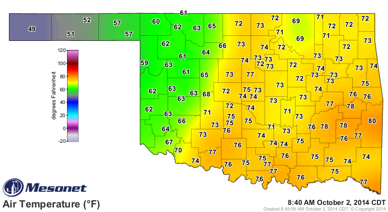
IT'S 49 IN BOISE CITY!
Well, it was when I typed that. See, here's proof.
Plus, IT'S RAINING IN EASTERN OKLAHOMA!
Well, it was when I typed that. See, here's proof.
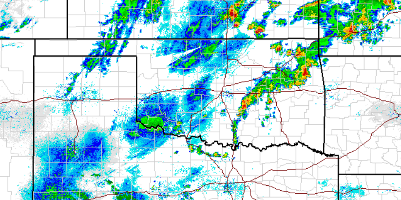
I'm gonna call all those other green blips drizzle, because I'm the one writing
this and so I can. All of the above come courtesy of our first cold front and some
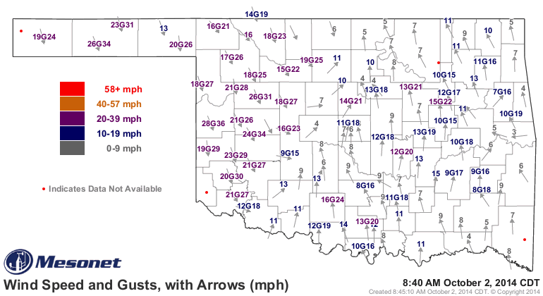
accompanying boundaries. You can see the front to the northwest (or southeast if
you are in the northwest) on the Mesonet wind map.
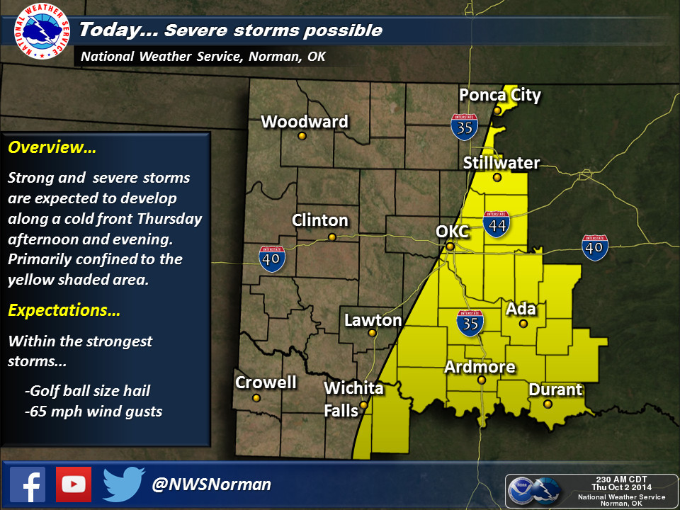
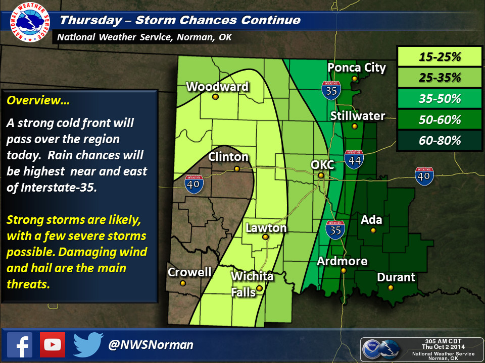
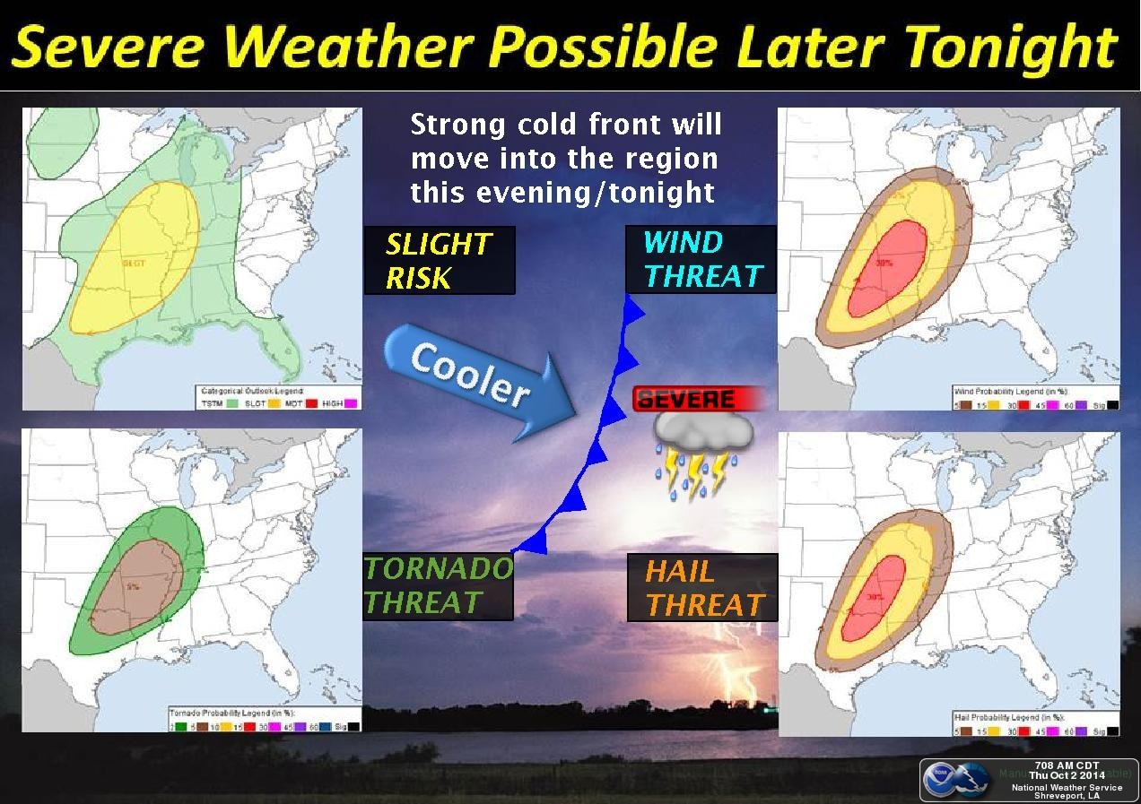
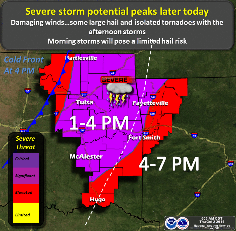
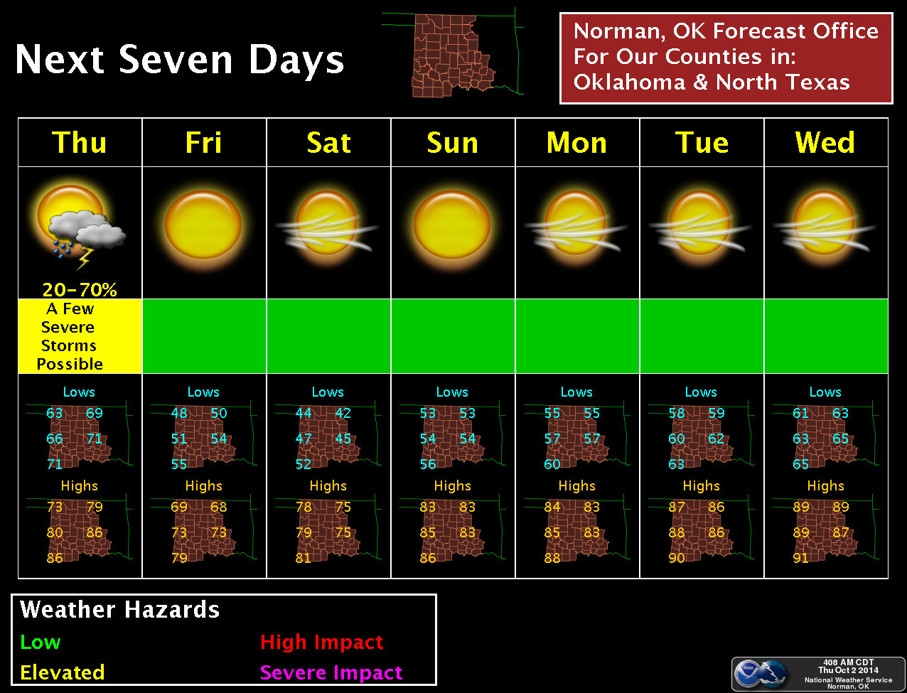
Now the good news is we should expect another round of showers/storms/rain as the
cold front moves through. Here's proof.
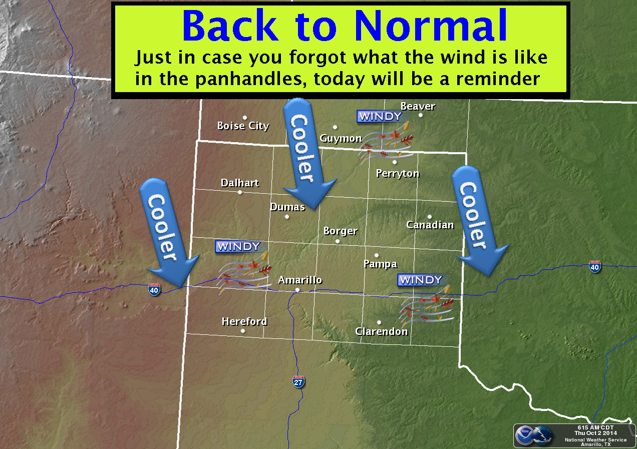
Unfortunately, for those up to the northwest that need the rain pretty
desperately, they're just in for cool weather and wind...may be a few drizzles
here and there. Sort of like what Amarillo is talking about here for the OK
Panhandle.
Why do they need rain? Well, there's a drought going on, and it's now 1463 days
old (stupid leap year gave us an extra day of drought!). And, it's intensifying.
Here's the latest drought map that shows the damage.
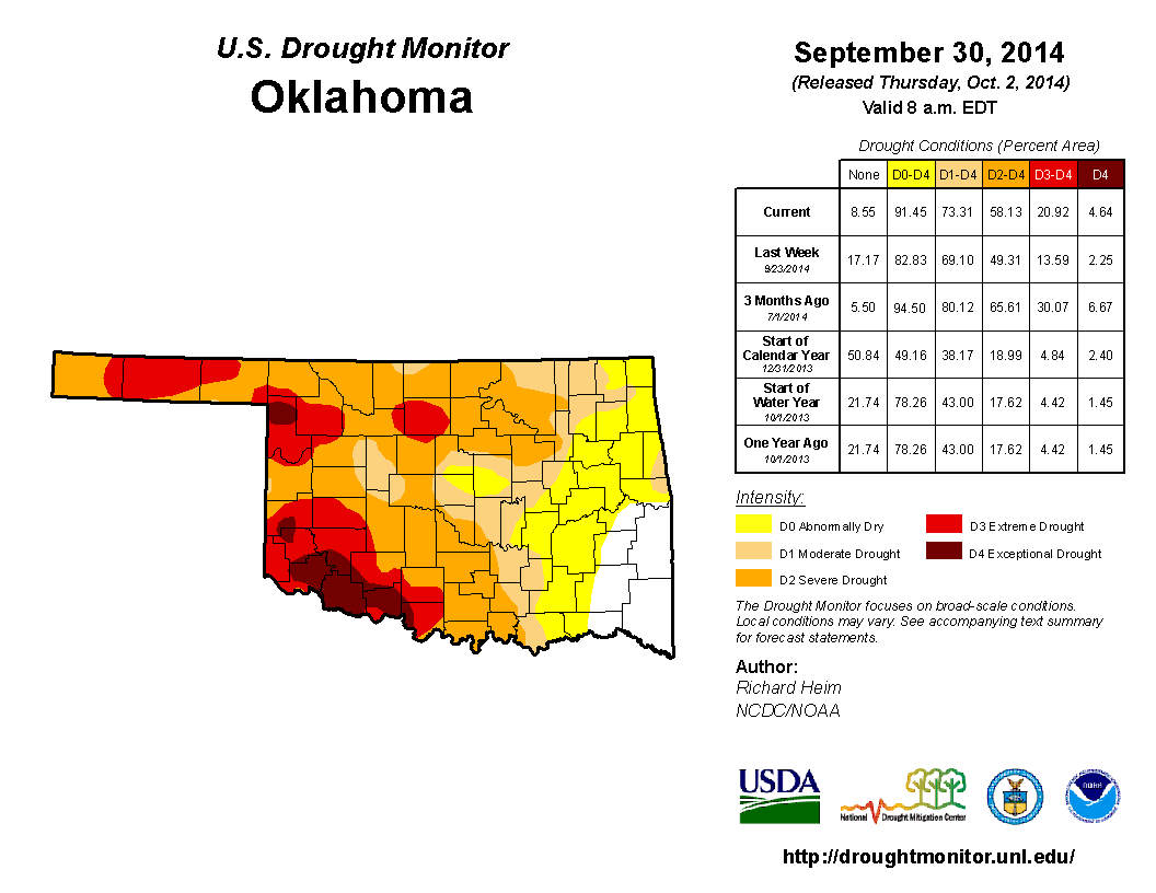
In just one week, the U.S. Drought Monitor went from 14% of the state in at
least D3 (extreme) drought to 21%. And the amount of at least D2 (severe)
drought jumped up to 58% from 49%. Obviously the drought impacts didn't increase
that much in one week, but the word slowly trickles in and all of a sudden you
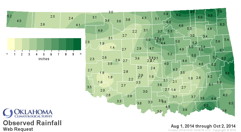
will get a jump like that. I'll show the rainfall maps since August 1st one
more time so you can get a feeling for just how dry things have been for the
last two months. And these include the current rains.
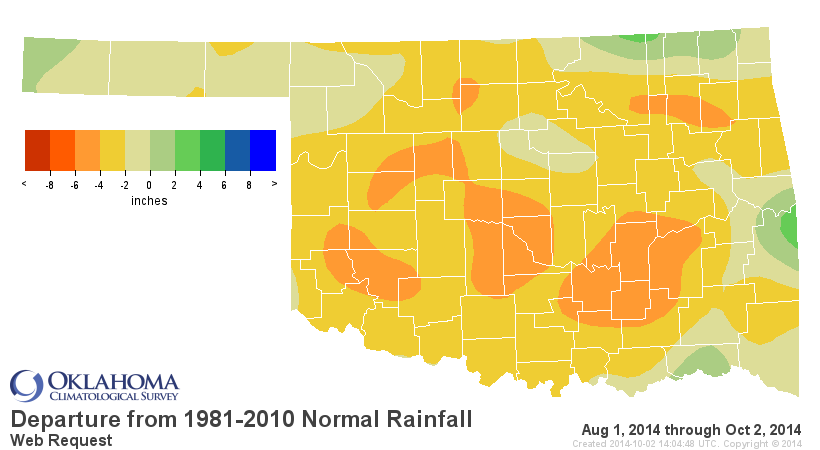
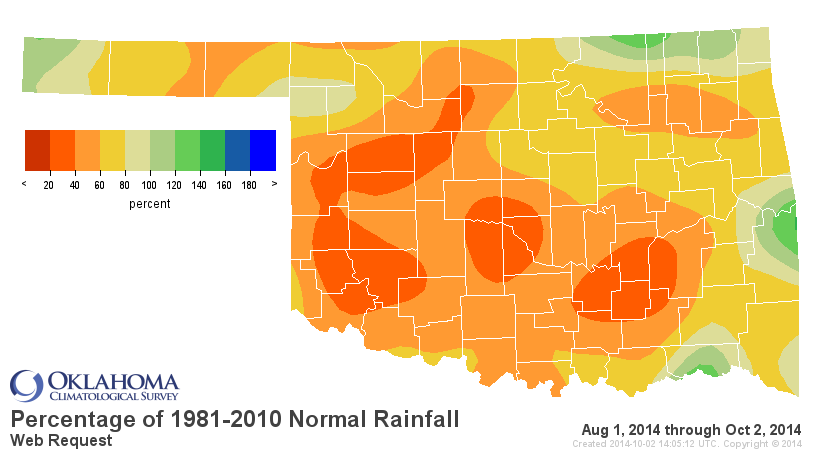
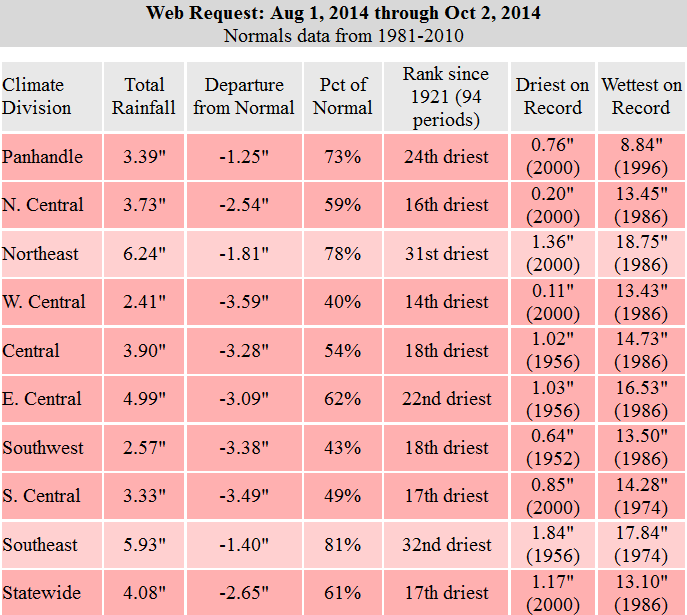
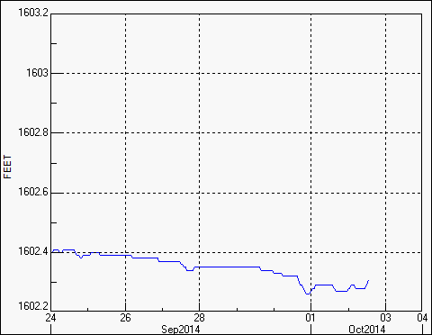
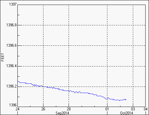
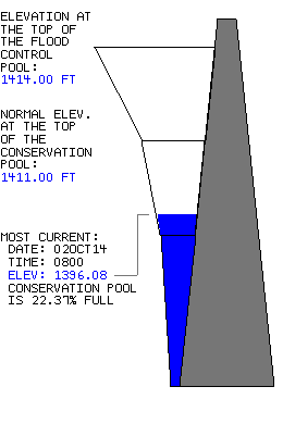
So all sorts of bad things are showing up again across western and northern
Oklahoma. The lakes are still in really bad shape for the most part.
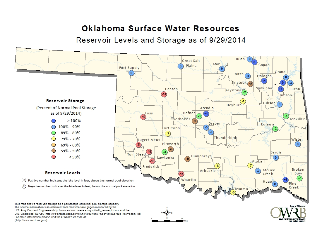
Lakes Altus-Lugert, Tom Steed and Canton are in particularly bad shape, and
they continue to drop. That's a consequence of the lack of rainfall AND the
above normal temperatures (which increase evaporation). So the rain from the
cold front will be a plus, but so will the cooler weather.

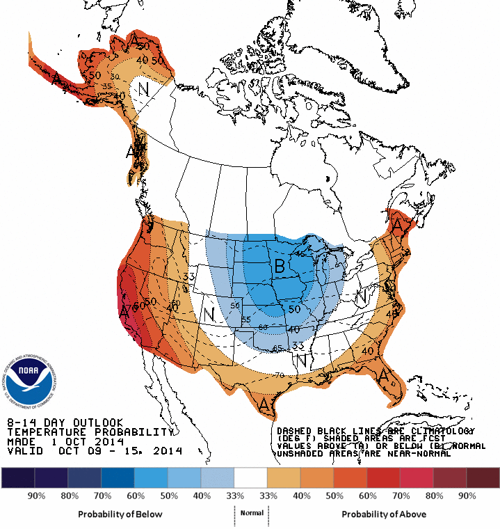
There is a possibility of more rain early next week, and then maybe a bit more
later next week. You can see indications of that on the 8-14 day outlooks from
CPC.

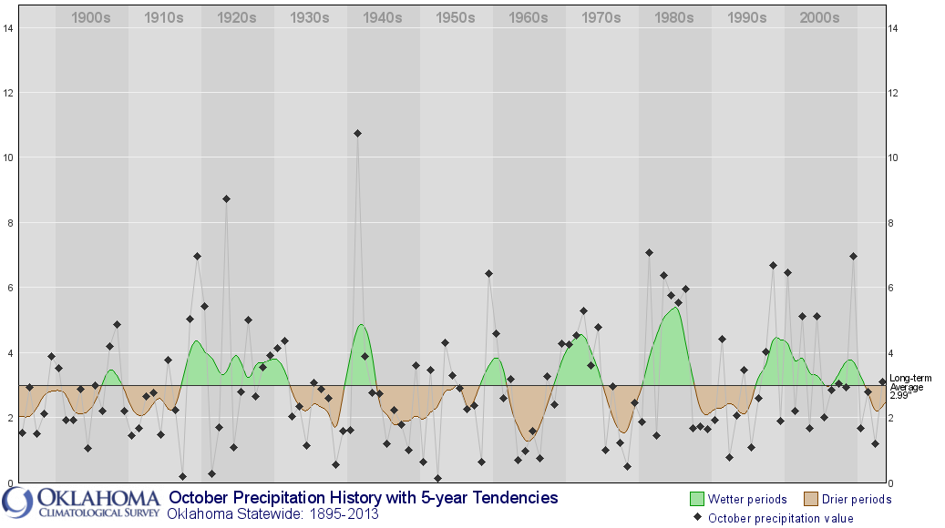
At any rate, drought appears to be here to stay unless we have an October like
1941, which is still the wettest month on record for Oklahoma (based on the
statewide average of 10.75 inches). Pretty easy to pick out on the historical
Oklahoma October rainfall time series.
Somebody wake me when it's spring again. Next Monday should suffice.
Gary McManus
State Climatologist
Oklahoma Mesonet
Oklahoma Climatological Survey
(405) 325-2253
gmcmanus@mesonet.org
October 2 in Mesonet History
| Record | Value | Station | Year |
|---|---|---|---|
| Maximum Temperature | 103°F | TIPT | 2000 |
| Minimum Temperature | 28°F | BOIS | 2009 |
| Maximum Rainfall | 4.76 inches | CHER | 2002 |
Mesonet records begin in 1994.
Search by Date
If you're a bit off, don't worry, because just like horseshoes, “almost” counts on the Ticker website!