Ticker for October 1, 2014
MESONET TICKER ... MESONET TICKER ... MESONET TICKER ... MESONET TICKER ...
October 1, 2014 October 1, 2014 October 1, 2014 October 1, 2014
Un-happy 4th Birthday, 2010-14 drought!
We have the September summary ready, just in time to celebrate the drought's
4th birthday. Now it's almost impossible to track down the exact starting date of
a drought. What day did it start to get dry? Really dry? Droughty? See what I
mean? But most of us climate types do track it to the beginning of October, so we
hope the drought takes our offer of a cake with explosive candles in the spirit
it was intended.
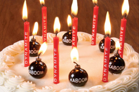
Don't go away mad, drought. Just...just go away.
---------------------------------------------------------------------------------
Dry September Diminishes Drought Recovery
Hopes were high for much-needed rainfall across Oklahoma after August's
disappointing totals. June and July were exceedingly wet, lending optimism that
August's step back would be but a brief interruption. Unfortunately, that
script did not play out as written and September became yet another dry month
in the now four-year-old drought. According to preliminary data from the
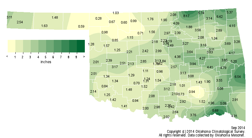
Oklahoma Mesonet, the statewide average rainfall total was 2.6 inches, 1.3
inches below normal and the 46th driest September since records began in 1895.
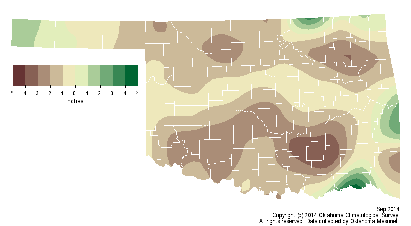
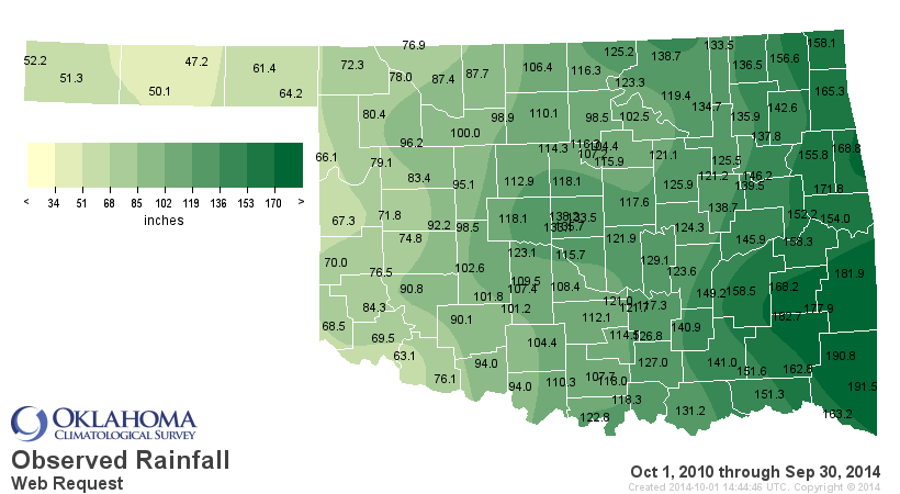
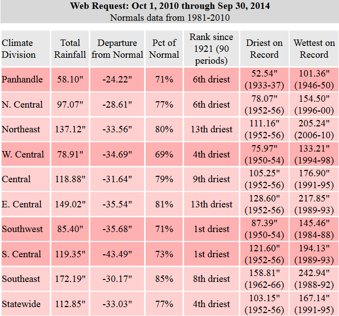
Of the 48 months since the drought began back in October 2010, 34 have been
drier than normal, amounting to a deficit of over 30 inches during that span.


Hugo led all Mesonet sites with 8.7 inches of rain during September while
Buffalo received a scant 0.3 inches. August and September combined for a
statewide average of 3.9 inches, 2.6 inches below normal and the 22nd driest
August-September on record in the state.
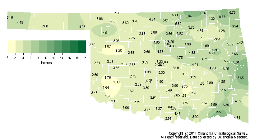
Much of the state had less than 4 inches of rain throughout the two months,
with many of the stations across western Oklahoma receiving less than 2 inches.
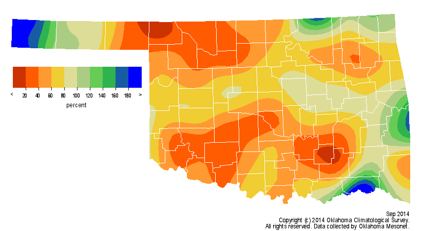
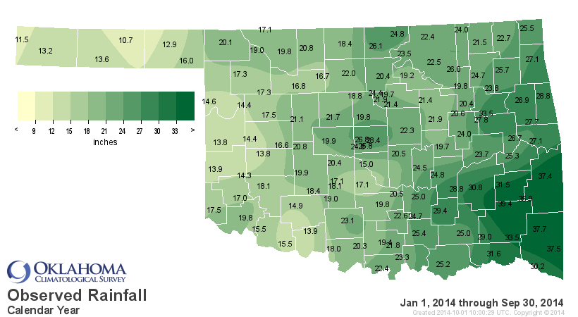
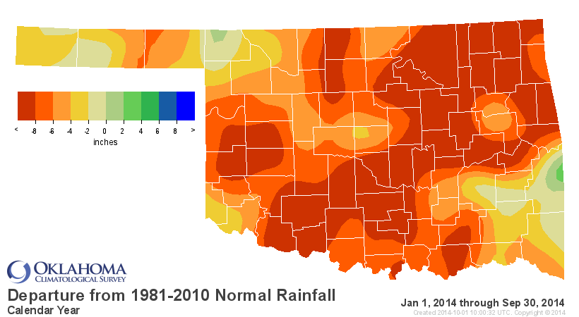
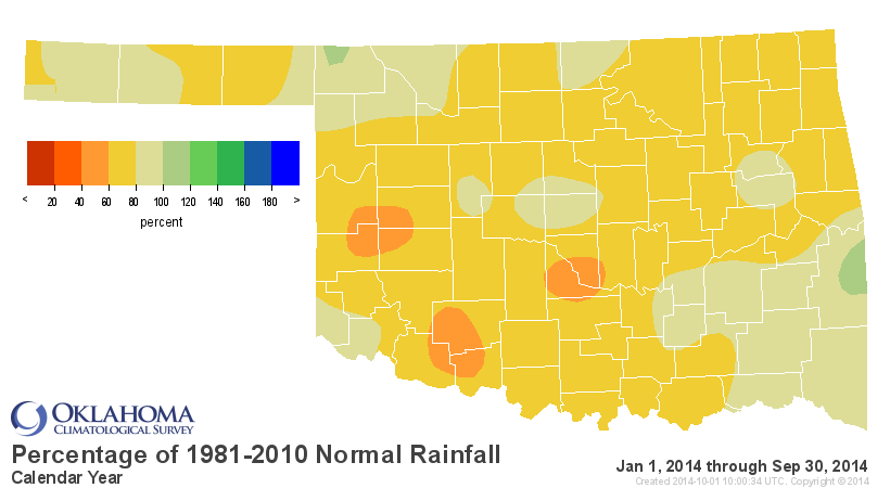
The January-September statewide average reflected the dry start to the year,
coming in at 21.7 inches, 6.7 inches below normal and the 18th driest such
period on record.
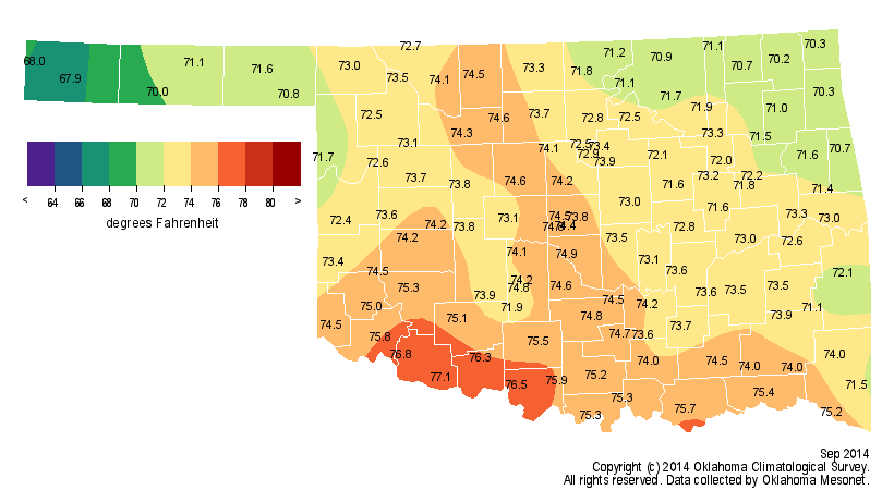
Not surprisingly, temperatures across the state were a bit above normal with
the lack of rainfall and accompanying storm systems. The statewide average as
measured by the Mesonet was 73.1 degrees, 0.7 degrees above normal and the 63rd
warmest September on record.
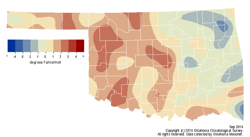
Grandfield led all Mesonet sites with 102 degrees on Sept. 1. The lowest
temperature of the month was 40 degrees from several locations on the 12th and
13th. The August-September temperature was also 76.9 degrees and 0.5 degrees
above normal. The first nine months of the year were substantially cooler,
again a reflection of the chilly winter through early spring as well as the
below normal temperatures of June and July. The January-September statewide
average temperature was 61.9 degrees, 1.1 degrees below normal and ranked as
the 21st coolest such period on record.
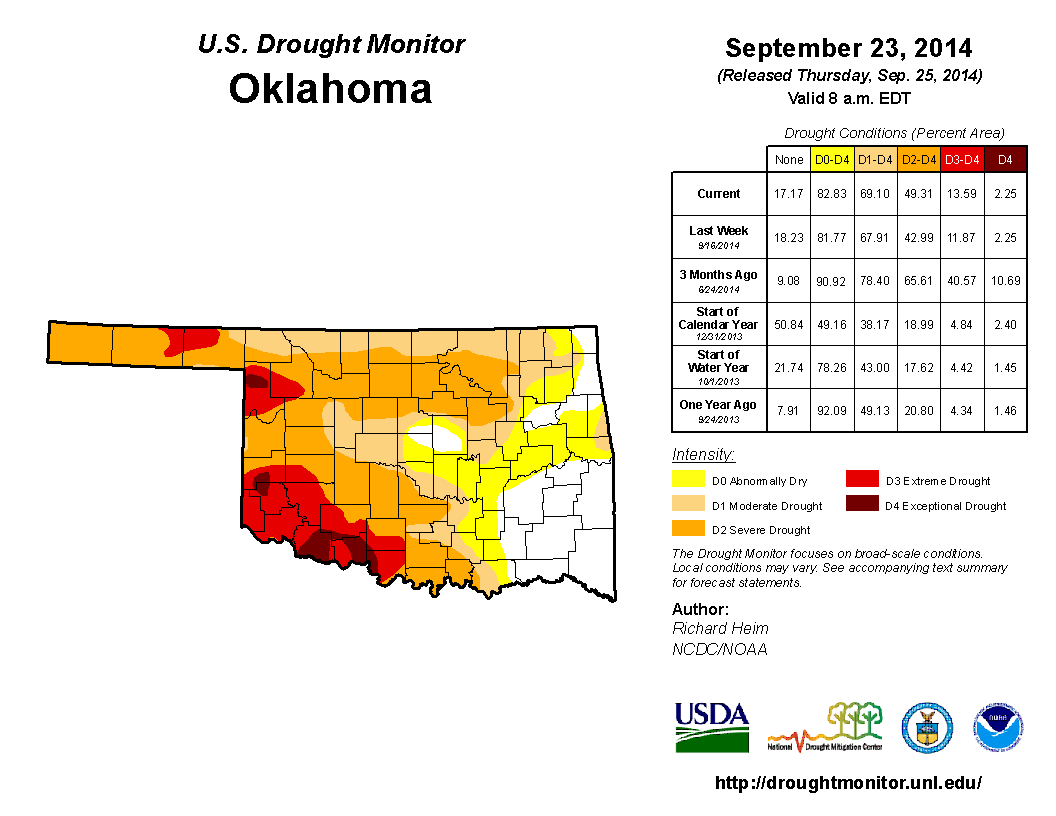
The last U.S. Drought Monitor report of the month, released on Sept. 25, gave a
clear indication that drought was once again gaining strength. Drought impacts
began to worsen across most of western and northern Oklahoma where farm ponds,
vegetation and soils showed increasing signs of water stress. By the end of
September, more than 49 percent of the state was considered in at least "severe"
drought, and 14 percent of that area was in the more significant "extreme" and
"exceptional" drought categories. The Drought Monitor?s intensity scale slides
from moderate-severe-extreme-exceptional, with exceptional being the worst
classification.
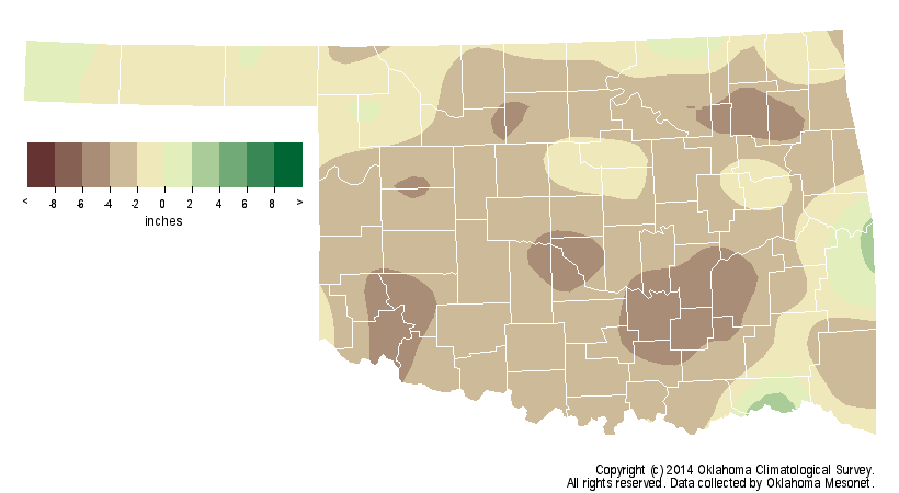
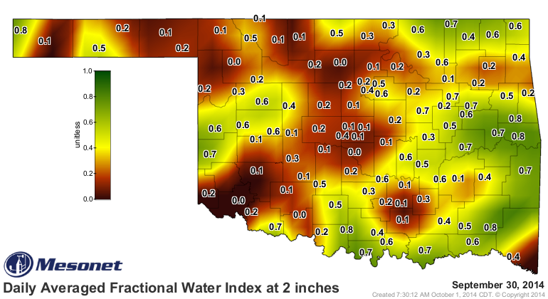
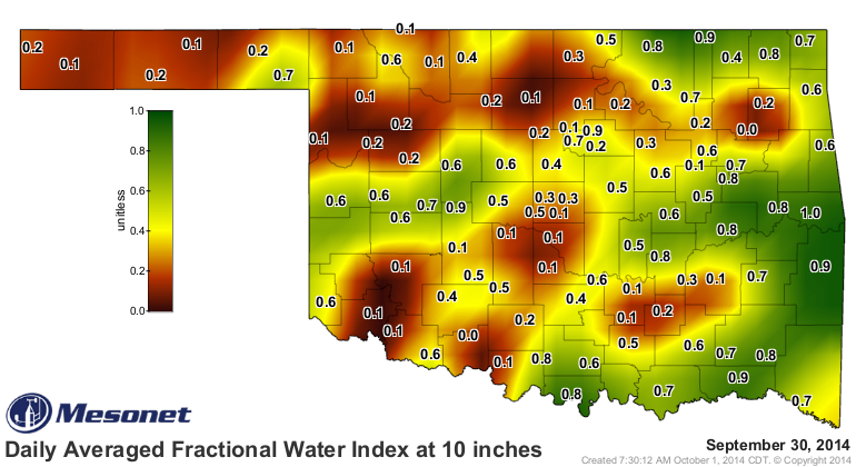
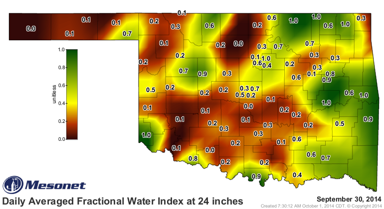
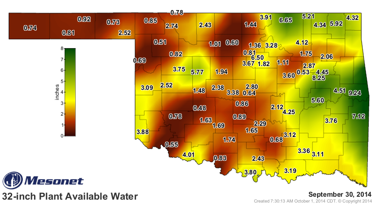
Soil moisture appeared to be critically low across much of the western half of
the state according to data from the Oklahoma Mesonet, including the important
wheat-producing north central region.
The Oklahoma Field Office of the USDA's National Agricultural Statistics
Service (NASS) reported 54 percent of the state's topsoil and 77 percent of the
subsoil to be in "short" or "very short" condition. Eighty percent of the
state's pastures and rangeland were rated from "fair" to "excellent," a benefit
of the rains that occurred from late May through July.
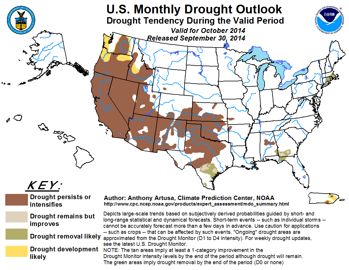
Widespread improvement in the drought conditions might be at least a month
away. The National Weather Service's Climate Prediction Center (CPC) expected
drought to either persist or intensify through October, at least in those areas
where drought is already in place, according to the latest U.S. Monthly
Drought Outlook. Development of drought across eastern Oklahoma was not
expected.
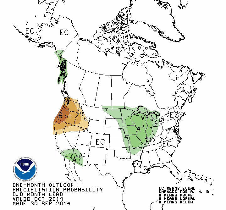
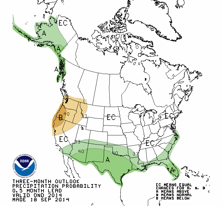
The October precipitation and temperature outlooks from CPC lacked a definitive
direction other than increased odds for above normal precipitation across far
northeastern Oklahoma.
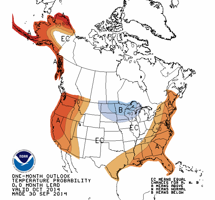
The first half of October looked to be on the warm and dry side according to
CPC's medium-term outlooks, although their October-December outlooks released
in mid-September gave increased odds of above normal precipitation for most of
the state. The October-December temperature outlook provided no clear
direction, with equal odds of above-, below- and near-normal conditions.

Gary McManus
State Climatologist
Oklahoma Mesonet
Oklahoma Climatological Survey
(405) 325-2253
gmcmanus@mesonet.org
October 1 in Mesonet History
| Record | Value | Station | Year |
|---|---|---|---|
| Maximum Temperature | 99°F | SLAP | 2000 |
| Minimum Temperature | 34°F | KENT | 2009 |
| Maximum Rainfall | 3.52 inches | ERIC | 1998 |
Mesonet records begin in 1994.
Search by Date
If you're a bit off, don't worry, because just like horseshoes, “almost” counts on the Ticker website!