Ticker for September 30, 2014
MESONET TICKER ... MESONET TICKER ... MESONET TICKER ... MESONET TICKER ...
September 30, 2014 September 30, 2014 September 30, 2014 September 30, 2014
Will Oklahoma set a tornado record this year??
Finally, a climate/weather extreme we can all be happy about...a possible record
low number of tornadoes this year. I've done all the searching/perusing/data
mining allowed on a browser for OK tornado counts this year (i.e., I looked it
up on the NWS-Norman website) and found the total number of tornadoes this year
to still be sitting at 13. The count is only through June, but I can't find any
other reports of possible tornadoes after June either, so let's assume that count,
albeit preliminary, is good through September.
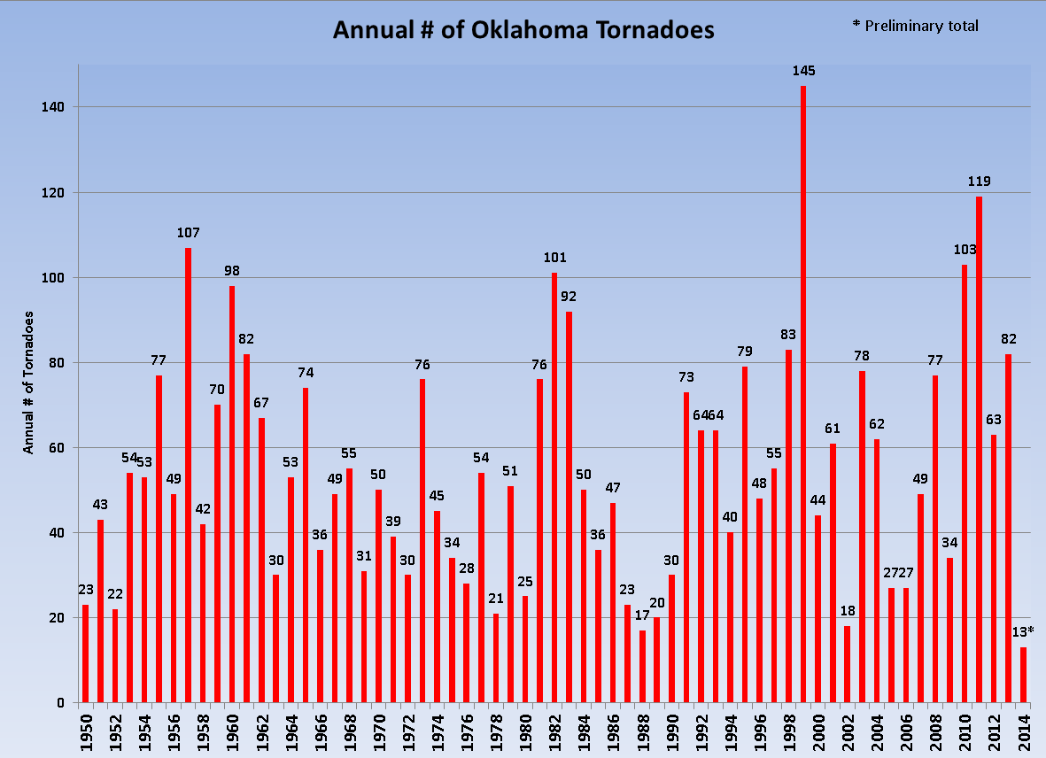
First off, that would be the second lowest total through September dating back to
the beginning of official statistics in 1950. Only 1988 had a lower Jan-Sept
total with 12.
Second, 1988 is the current record holder for lowest annual total of tornadoes
with 17. But, 1988 is also a cautionary tale for those thinking no more tornadoes
are likely to occur. After the 12 touched down in the first nine months of the
year, five more touched down in November, of all months. That's tied for the
sixth greatest total for November. So even during a record benign twister year,
an uncommon month like November can jump up and bite you. It doesn't look like
any of those tornadoes were serious, at least no injuries or deaths were
reported, but that is all dependent on where they strike and the strength.
C. Even if we see the average number of tornadoes for Oct-Dec, which based on
1950-2013 data stands at 3.9 tornadoes, we will still see a tie with 1988 for
the record lowest number of tornadoes at 17.
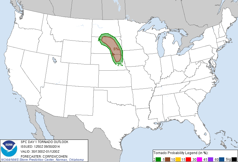
Fourth, there is a chance of severe weather in the state today and tomorrow.
It ain't great, and frankly we need these storms because we need the rain, but
the tornado threat looks very low. We're talking a small risk of hail and
wind with these storms. Only a 5% chance for both in the NW corner of the
state.


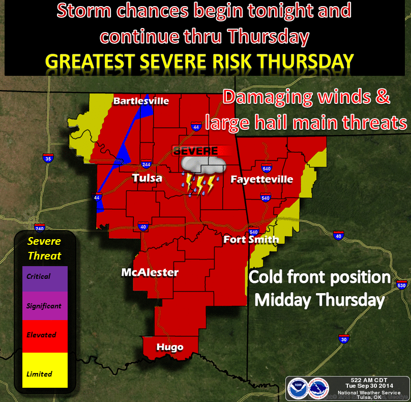
Following that, there might severe wx in the offering plate for Wednesday and
Thursday as that strong cold front travels through the state.
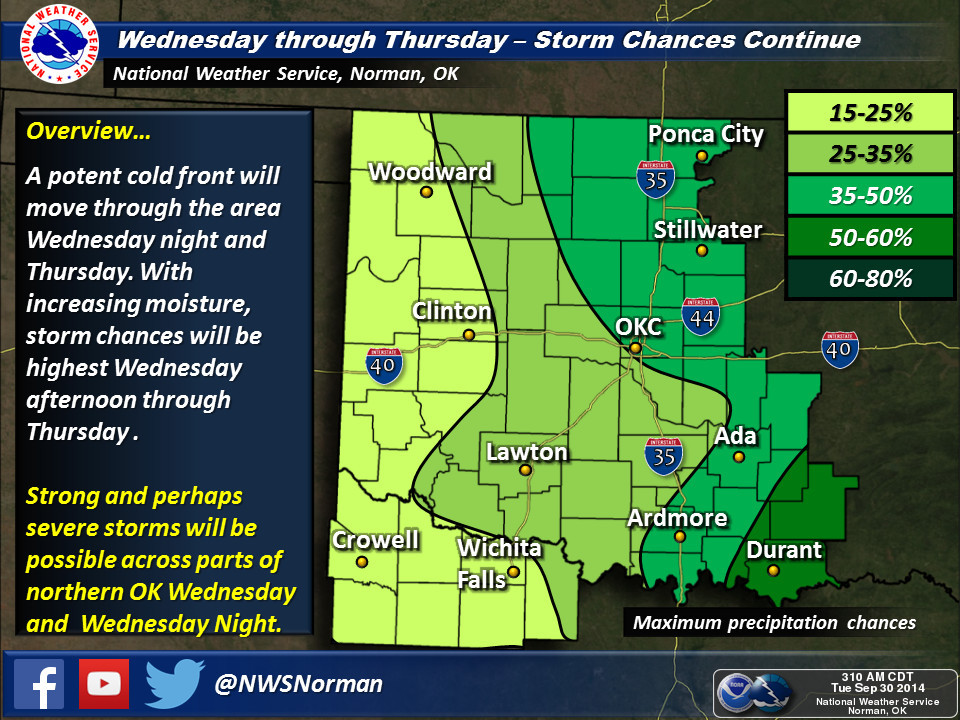
BTW, if you think this cold front will be the one to finally usher us fully
into fall, BZZZZZZZZZZTTTTTTTTTT, think again. It will cool us down to Autumnal
territory for a couple of days, but the same type of weather we have seen for a
the last two weeks will arrive again - dry with a touch of late summer.
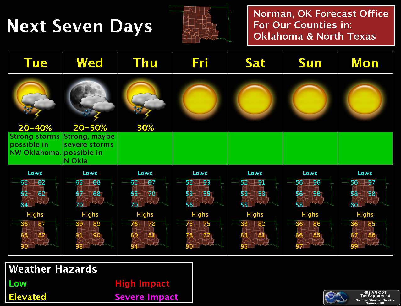
This boost of cool air and the drier air that will move in and replace it will
at least bump out low temperatures back down to normal-ish in the 50s. Those
temps are still 5-10 degrees above normal, but at least there will be a touch
of fall for those early risers.
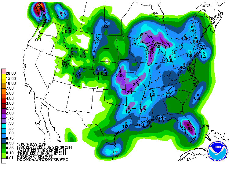
Still, not a lot of rain in the offing for western Oklahoma where drought is
really starting to gain a foothold once again. We'll see where the totals really
start to grow as we go through the next couple of days, however.
I hope I haven't jinxed this record. Of all the records set over the last 10-15
years, this would be one of the most welcome.
Gary McManus
State Climatologist
Oklahoma Mesonet
Oklahoma Climatological Survey
(405) 325-2253
gmcmanus@mesonet.org
September 30 in Mesonet History
| Record | Value | Station | Year |
|---|---|---|---|
| Maximum Temperature | 101°F | RING | 1998 |
| Minimum Temperature | 33°F | ANTL | 1999 |
| Maximum Rainfall | 3.96 inches | LAHO | 2021 |
Mesonet records begin in 1994.
Search by Date
If you're a bit off, don't worry, because just like horseshoes, “almost” counts on the Ticker website!