Ticker for September 9, 2014
MESONET TICKER ... MESONET TICKER ... MESONET TICKER ... MESONET TICKER ...
September 9, 2014 September 9, 2014 September 9, 2014 September 9, 2014
Apparently, it's gonna get cold
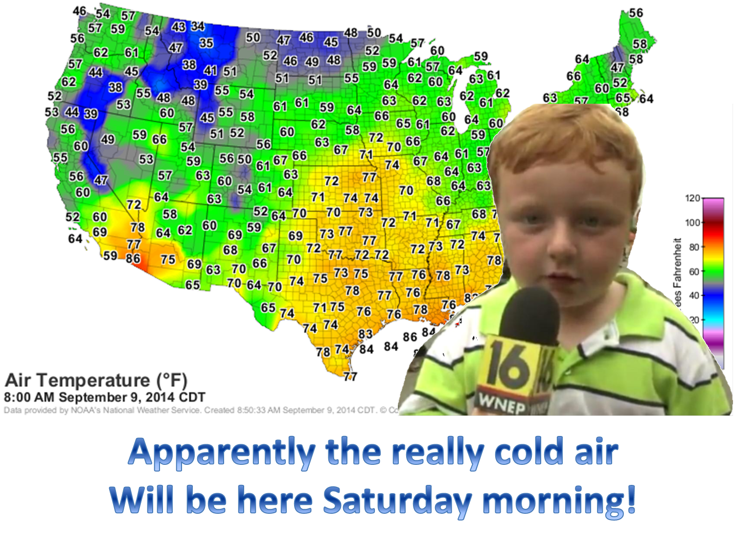
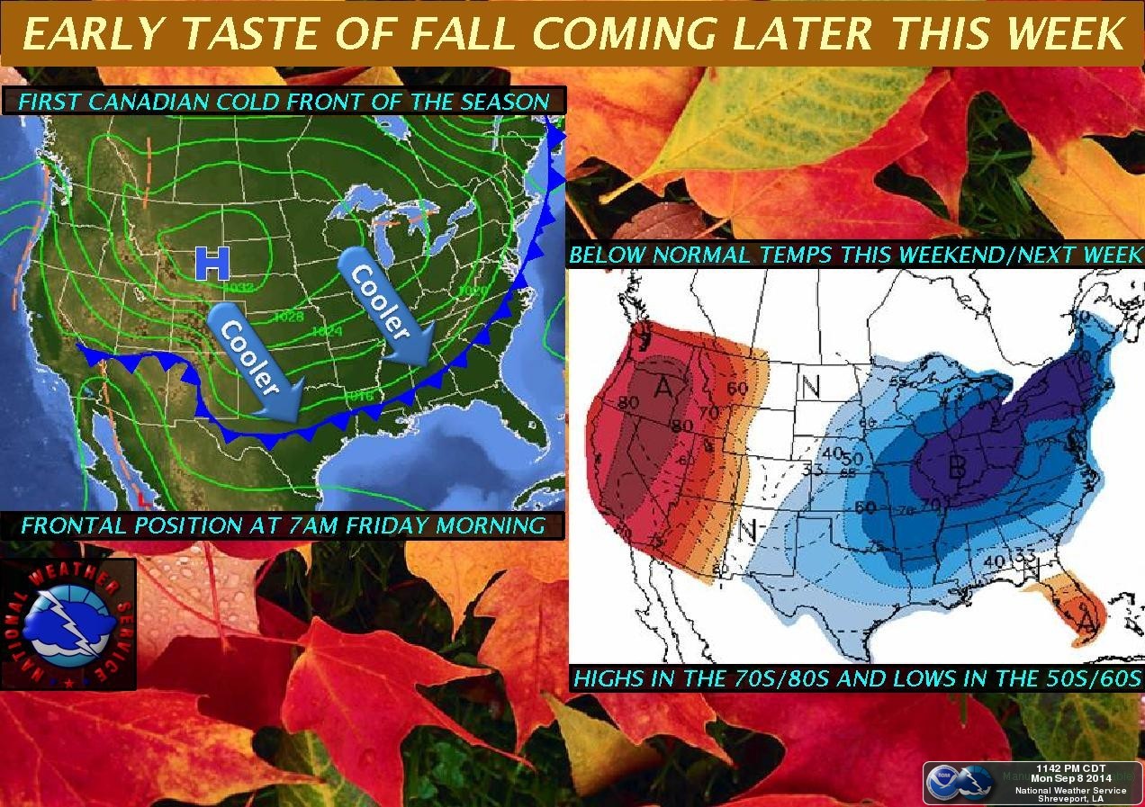
Right about now, North Dakota is getting theirs. Serves them right for being so
far north. But that cold air you see plunging across the Canadian border has
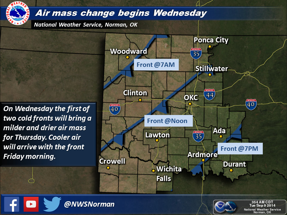
blown right through the Mounties and is headed our way. Apparently, we'll see our
first sign of the front sometime on Wednesday, we'll get a reinforcing shot of
cold air on Friday (or thereabouts) and bottom out with 40s and 50s Saturday
morning.
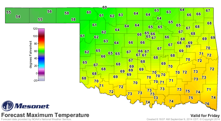
Here are Friday's and Saturday's forecast highs from the NWS. Or as I like to call
them, Fri-BRRRRR-day and Satur-BRRRRR-day.
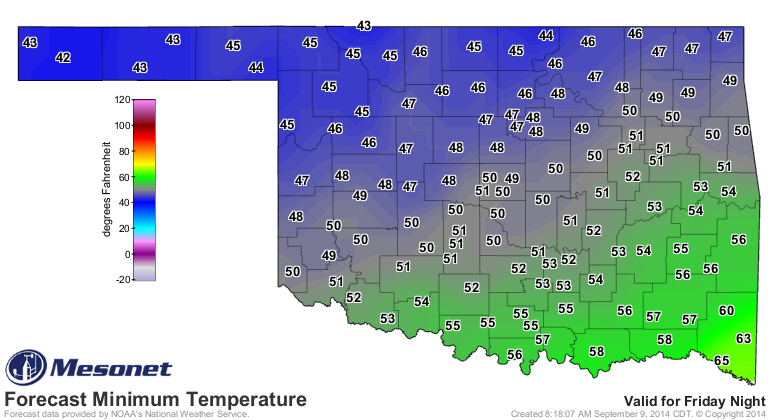
Low 40s in the Panhandle? Are you kidding me? That will be the coldest air we've
seen in the state since May 16, when we had a bunch of 30s infest the state.
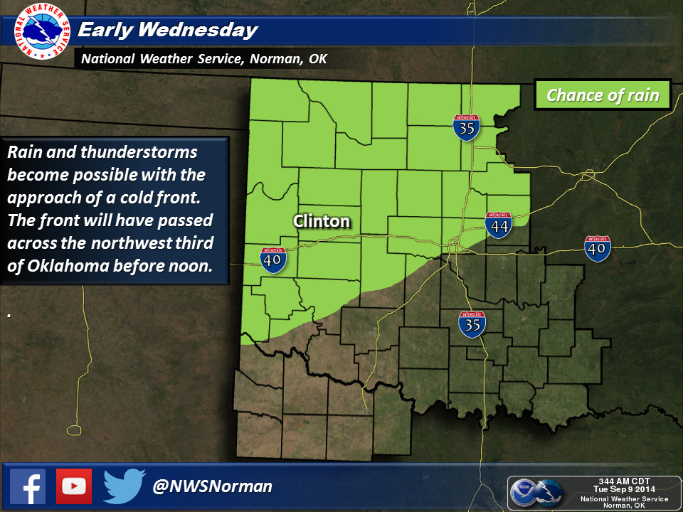
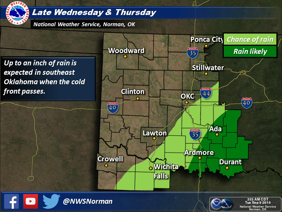
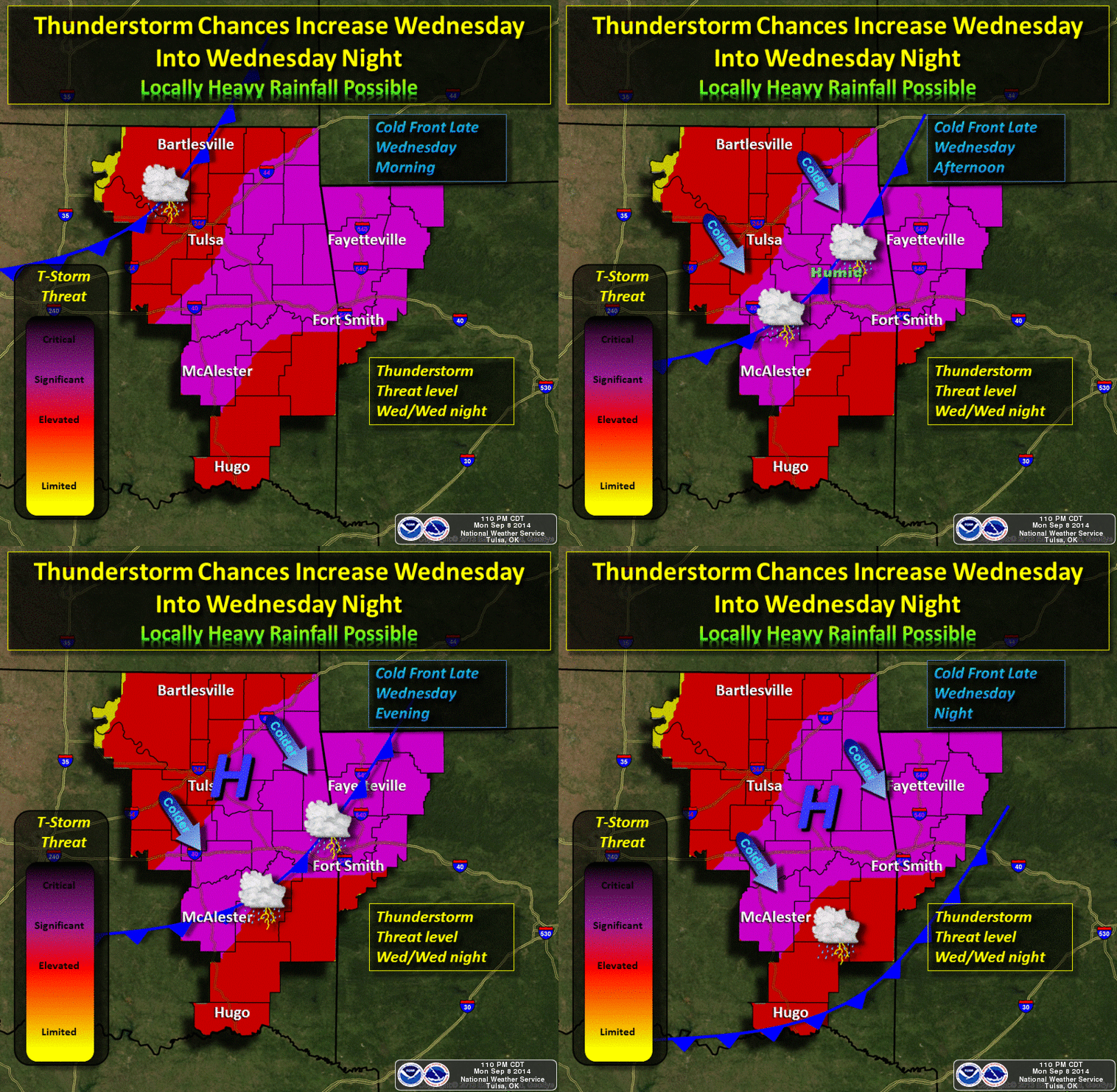
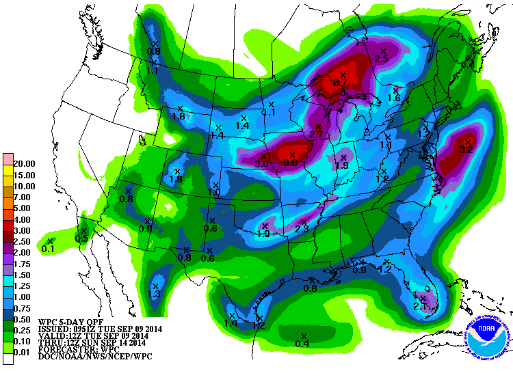
And we're still tracking the rains on our Ticker-Rain-Detector-4000 (quite a
step up from the Ticker-Rain-Detector-3999) with the front and it's secondary
push. SE OK looks to get the bulk of this moisture. That's okay, they're due.
So sit back and allow yourself to get Autumn'd. Looks like we'll be back to
September next week. But for now, apparently you'll need a good sturdy jacket
(light winter coat??) Saturday morning.
Gary McManus
State Climatologist
Oklahoma Mesonet
Oklahoma Climatological Survey
(405) 325-2253
gmcmanus@mesonet.org
September 9 in Mesonet History
| Record | Value | Station | Year |
|---|---|---|---|
| Maximum Temperature | 100°F | TIPT | 2016 |
| Minimum Temperature | 33°F | KENT | 2020 |
| Maximum Rainfall | 8.09″ | SALL | 2010 |
Mesonet records begin in 1994.
Search by Date
If you're a bit off, don't worry, because just like horseshoes, “almost” counts on the Ticker website!