Ticker for September 8, 2014
MESONET TICKER ... MESONET TICKER ... MESONET TICKER ... MESONET TICKER ...
September 8, 2014 September 8, 2014 September 8, 2014 September 8, 2014
September hath more than August
Twas a lovely little weekend storm, no? Combine a cold front with lots some
tropical moisture and you produce a rainfall map with plenty of green in places
that needed it the most.
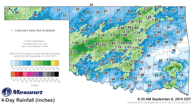
We told you last week that west central Oklahoma, having seen only 0.3 inches of
rain on average during August, was in dire need of a drenching. The 2-3 inches in
Beckham, Roger Mills, Custer and Washita counties (and to points east) were
therefore well timed. And let's not forget the 1-2 inches in Cimarron County,
another hard hit area. Not so much for south central Oklahoma, unfortunately.
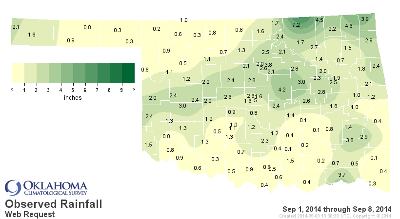
The real winner appears to be Osage County once again, and they finally have
enough of a tally to see real improvements in that area. If you look at all of
September, all 8 days!!, you'll see the Mesonet site in Foraker in Osage County
has recorded an impressive 7.2 inches of rain. Chandler has seen 4.2 inches as
well. The far southern border counties are still lagging behind with less than a
half-inch in many cases.
So the statewide average for Sept. 1-8 is already 1.51 inches (0.59 inches
above normal for that period). Believe it or not, that's already bested the
statewide average for all of August (1.37 inches).
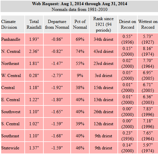
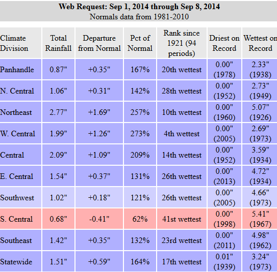
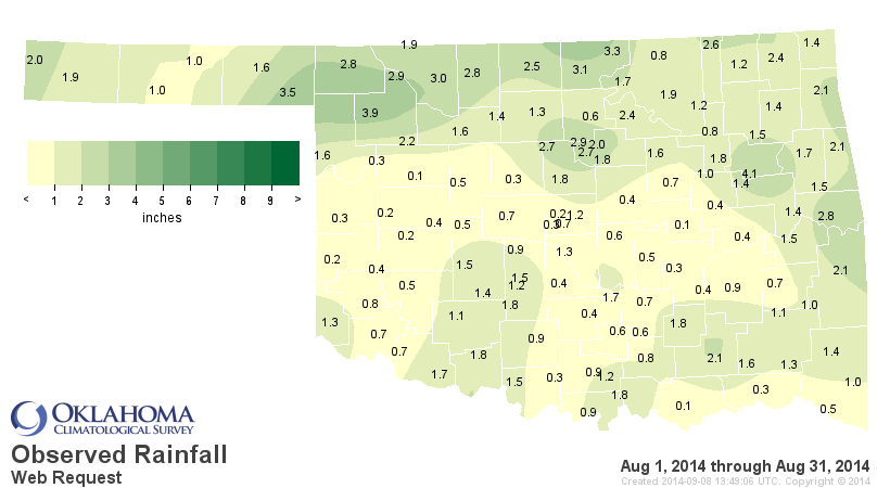
You can see some pretty major differences there, like the major change in west
central Oklahoma. Erick had 0.2 inches in all of August but a whopping 2.4 inches
in September thus far. Again, for south central Oklahoma, they're still under
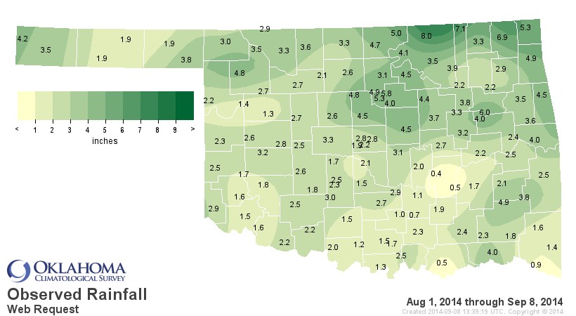
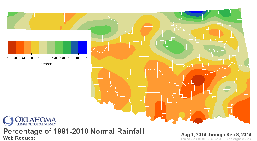
the gun. That shows up on the maps for the Aug. 1-Sept. 8 time frame. Still way
too much orange and red on these maps. Much of the state is still well below
60% of normal since August 1 and it is the 31st driest Aug. 1-Sept. 8 period
on record with a statewide average of 2.88 inches, an inch below normal.

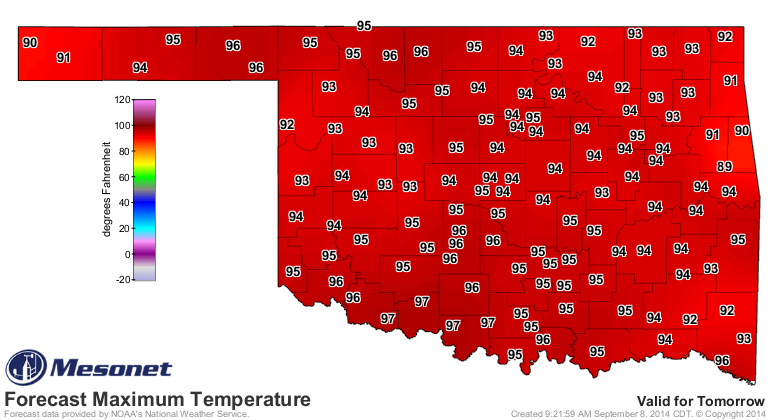
We have a couple more hot day ahead before we become Grand Central Station for
cold fronts later this week. So today and tomorrow look hot, and then we'll
have a gradually cooling day on Wednesday with the first frontal passage. Then
the stronger cold front arrives on Thursday.

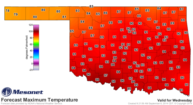
Note the gradients from NW to the S in highs for Wednesday as that front makes
its way through the state. Don't be shocked if we reach 100 degrees in the far
south as the front kicks up those southerly winds.
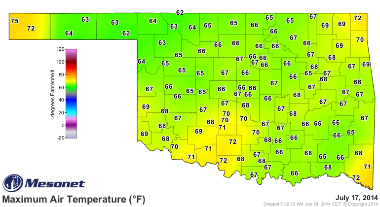
And then Thursday will be cooler in the 70s and 80s, with Friday being downright
autumnal!


Wow, Friday might even be as cold as July 17th!
Yeah, you heard me correctly. July 17th.
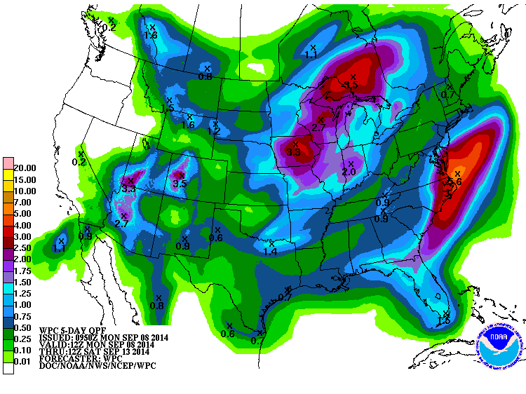
The successive cold fronts will come with a chance of rain, of course, although
probably not like what we saw last week. No help from Dolly and Norbert this
week. Saturday will be a glorious fall day with lows in the 50s and highs
in the 70s, and then we'll get a bit more warmth on Sunday with highs in the
80s. Here are the forecast rainfall totals for the next 5 days. Remember, each
drop is another feather in the cap of September over August.
Gary McManus
State Climatologist
Oklahoma Mesonet
Oklahoma Climatological Survey
(405) 325-2253
gmcmanus@mesonet.org
September 8 in Mesonet History
| Record | Value | Station | Year |
|---|---|---|---|
| Maximum Temperature | 111°F | GRA2 | 2023 |
| Minimum Temperature | 34°F | KENT | 2020 |
| Maximum Rainfall | 5.37 inches | WILB | 2001 |
Mesonet records begin in 1994.
Search by Date
If you're a bit off, don't worry, because just like horseshoes, “almost” counts on the Ticker website!