Ticker for September 10, 2014
MESONET TICKER ... MESONET TICKER ... MESONET TICKER ... MESONET TICKER ...
September 10, 2014 September 10, 2014 September 10, 2014 September 10, 2014
When Fronts Attack!
The much ballyhooed (hey, I think I spelled that correctly the first time!) cold
front we've been waiting on has finally entered the state and it is showing up
on the Mesonet quite nicely. Check out the current winds and temperatures and
see if you can locate the front. Okay, I added a very crudely drawn cold front
on the wind map as a hint.
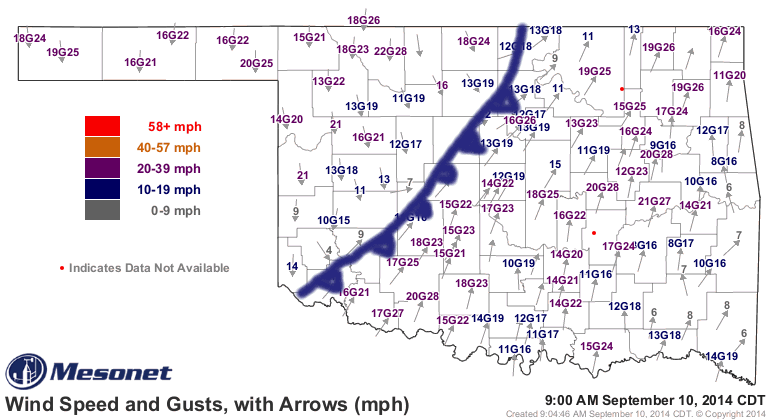
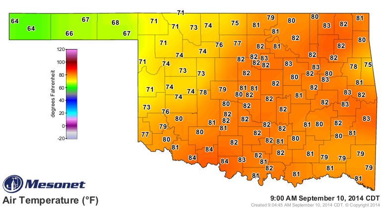
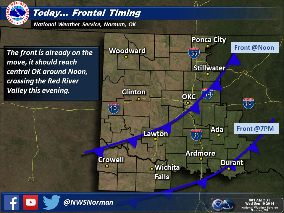
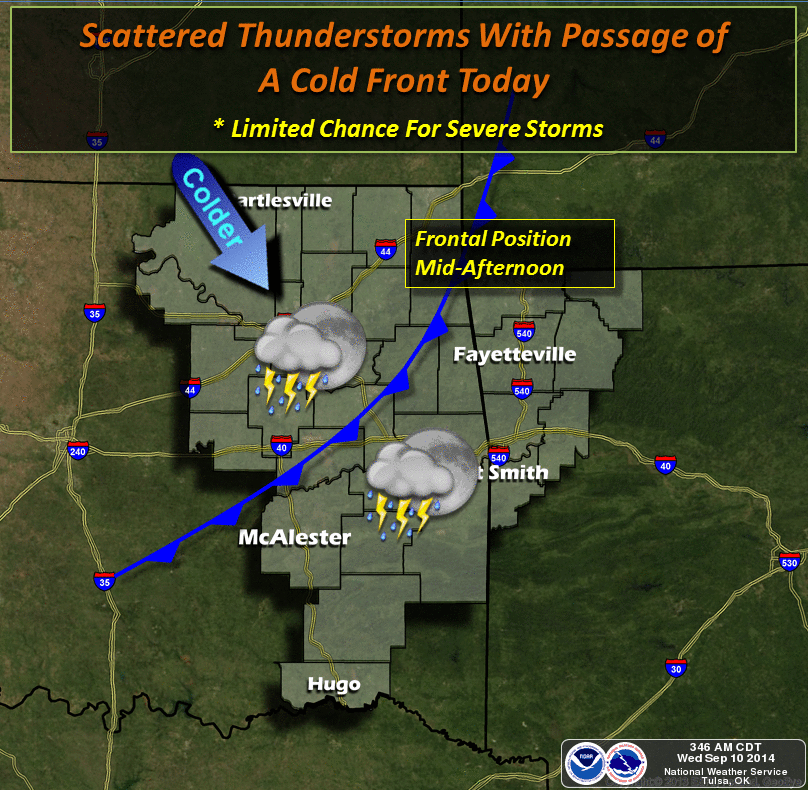
Temperatures have dropped (or not risen above) the 60s and 70s behind the front
as it plunges to the southeast, so expect a bit of a cooldown as we go throughout
the day. Here are a couple of graphs showing the timing of the front, made
available by our friends at the local NWS offices.
You can always follow along with the front's progress through the state on the
Mesonet wind and temperature maps.
http://www.mesonet.org/index.php/weather/map/air_temperature/air_temperature
http://www.mesonet.org/index.php/weather/map/wind_speed_gusts_with_arrows/wind
If you get desperate, you can just go look outside, but where's the fun in
that? Maybe we'll even get a wind chill going later tonight.
http://www.mesonet.org/index.php/weather/map/wind_chill_heat_index/air_temperature
No difference yet since wind chill doesn't really start to matter until the
actual air temperature reaches about 50 degrees, I believe.
Looks like any rain associated with this first front will be across southeastern
Oklahoma.
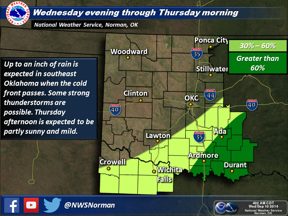
Here are the totals expected with the front.
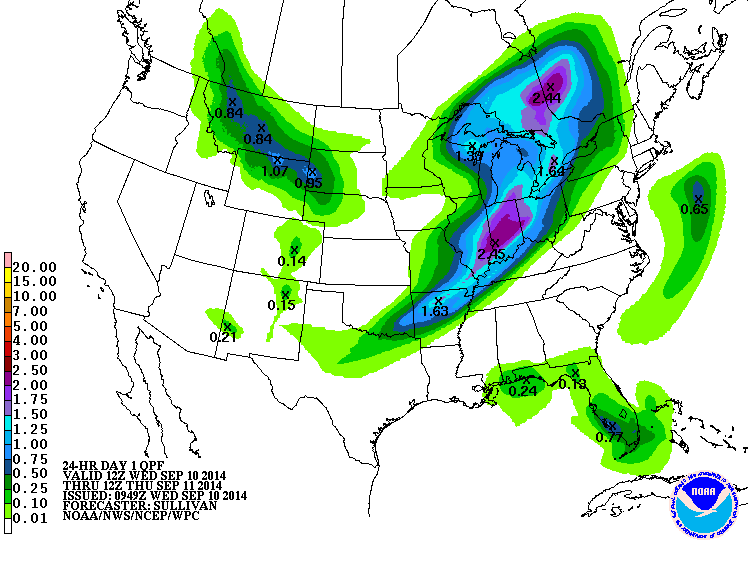
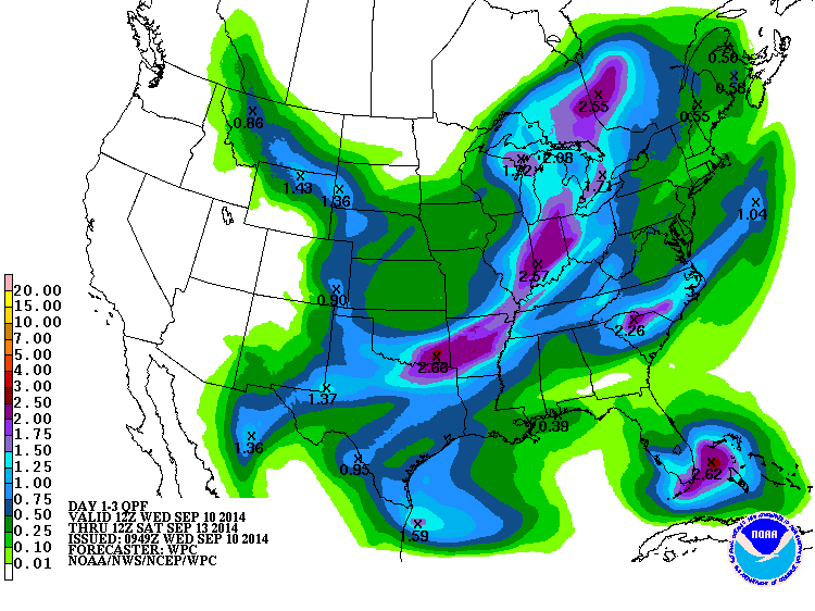
Then we'll see another chance with the secondary (and colder) frontal surge
on Friday. It still doesn't appear to be much of a deluge, except maybe across
the southeast. Remember, some of these totals across the SE are expected today.

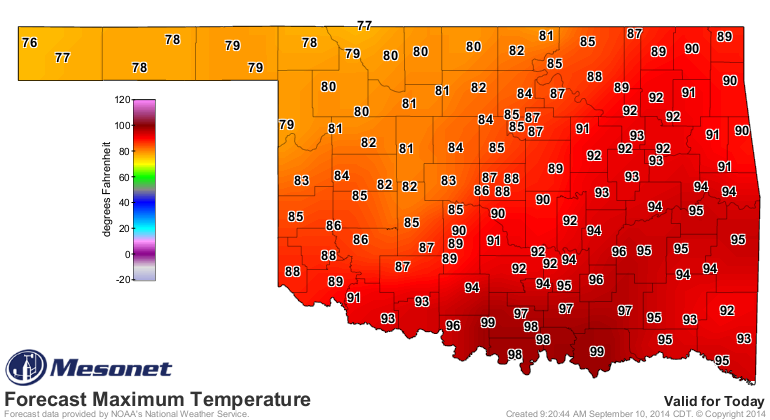
For you folks across southern Oklahoma, one more hot day for awhile. The
northwest should stay in the 70s.
Then we get a cool Thursday with 50s and 60s for lows and highs in the 70s.
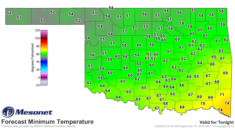
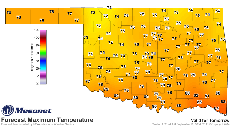
And finally the Coup de gr?ce of the 70s arrives sometime on Friday and we go
down from there, culminating in temps nearing the 30s for NW OK on Saturday
morning.


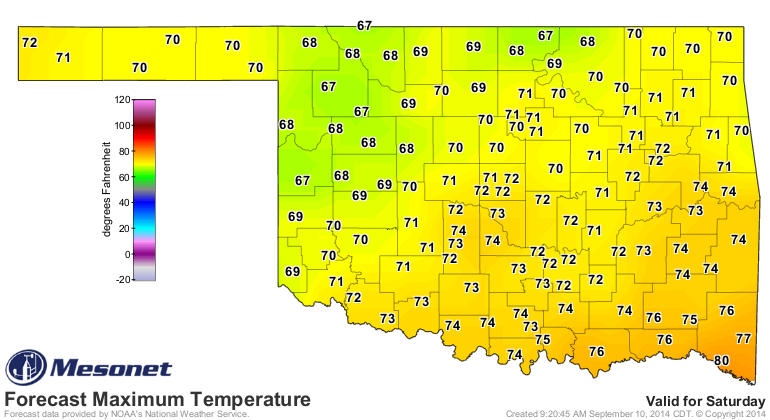
Friday could be quite a lovely gray fall day, just perfect for the second day
of the Oklahoma State Fair. By the way, the front has probably advanced half
a county or so in the time I've taken to write this, so better go back and
check those Mesonet maps again...just in case.
Gary McManus
State Climatologist
Oklahoma Mesonet
Oklahoma Climatological Survey
(405) 325-2253
gmcmanus@mesonet.org
September 10 in Mesonet History
| Record | Value | Station | Year |
|---|---|---|---|
| Maximum Temperature | 106°F | HOLL | 2000 |
| Minimum Temperature | 37°F | KENT | 2020 |
| Maximum Rainfall | 5.70 inches | ERIC | 2003 |
Mesonet records begin in 1994.
Search by Date
If you're a bit off, don't worry, because just like horseshoes, “almost” counts on the Ticker website!