Ticker for September 3, 2014
MESONET TICKER ... MESONET TICKER ... MESONET TICKER ... MESONET TICKER ...
September 3, 2014 September 3, 2014 September 3, 2014 September 3, 2014
Wait for it...
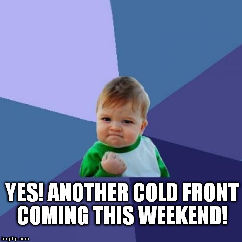
Yes, the last half of August was mostly lousy with summer during a summer when
we didn't really have a summer. What? I don't get it either, except even a
cold-blooded fella like myself likes to see those temperatures start to drop as
we get into September. That's what is "supposed to" (the two most dangerous
words in weather) happen, at least. Don't believe me, well check out the
statewide average maximum temperature graph from the Mesonet for 1999-2013.
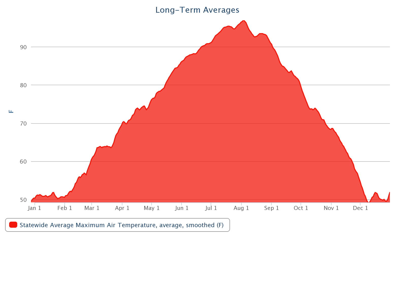
The statewide average maximum temperature drops from 91 degrees on Sept. 1 all
the way down to 81 degrees on Sept. 30. By Halloween, we're down to a ghoulishly
COLD 68.4 degrees.
If you were in the rain-drenched northeast yesterday, you got your wish. Not so
much anywhere south of that first northern tier of counties (especially if you
are looking at the heat index).
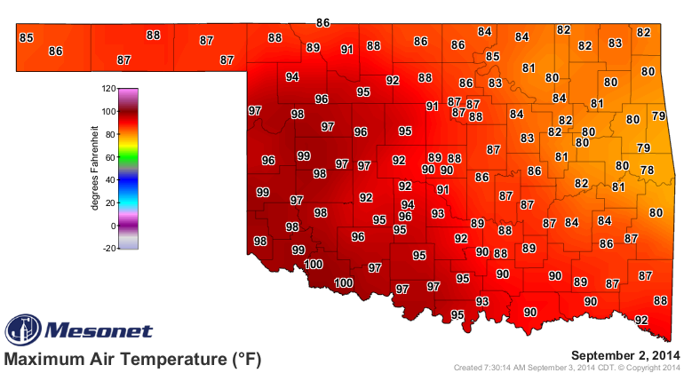
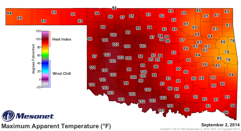
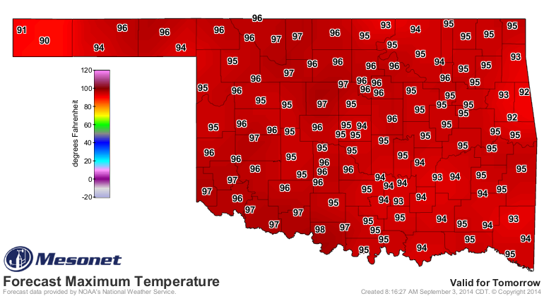
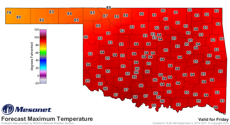
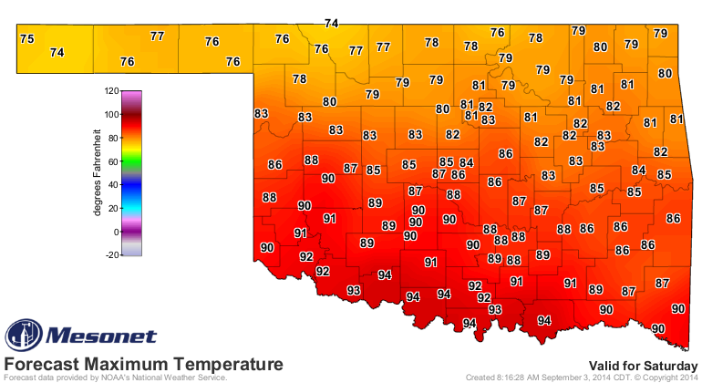
We have a couple of brutal days to go under the dreaded heat dome before it
starts to slide to the east and a pretty decent cold front (and rain chances)
enters the state on Friday.

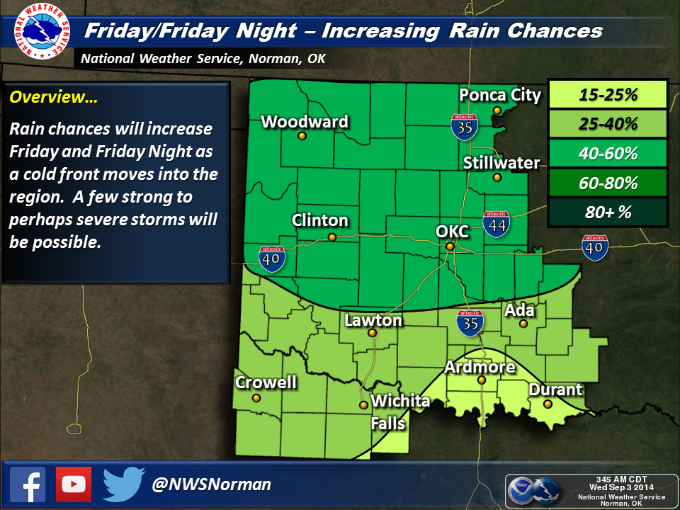
Front enters state on Friday...look to the northwest:
Our NWS friends have some graphics depicting Friday's weather situation (RAIN!).
Click the links for embigenation.

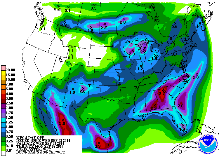
The rainfall amounts aren't too bad for this time of year, although still not
too much happening across southern Oklahoma.
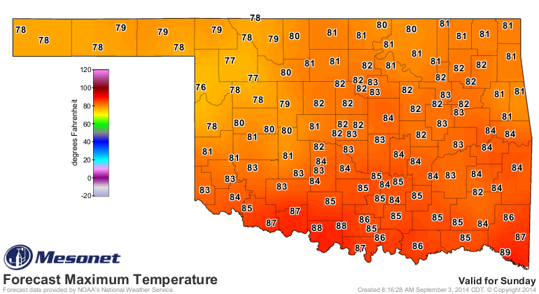
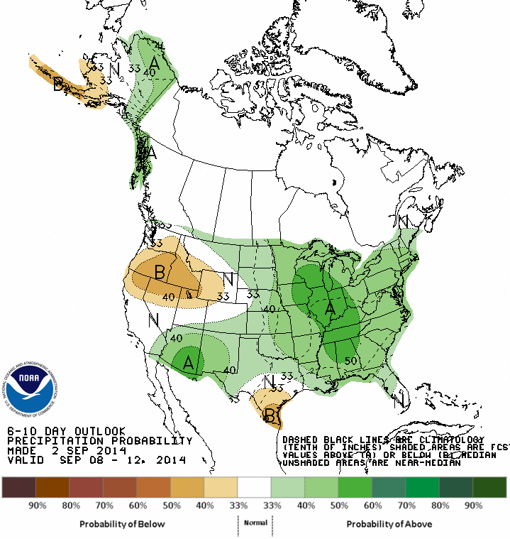
We will probably see highs back into the hot category as we get into early next
week then more cold fronts approacheth (maybe)! The first half of September
still looks like it might be on the wet side, or at least CPC thinks so with
increased odds of above normal rainfall over the next couple of weeks.
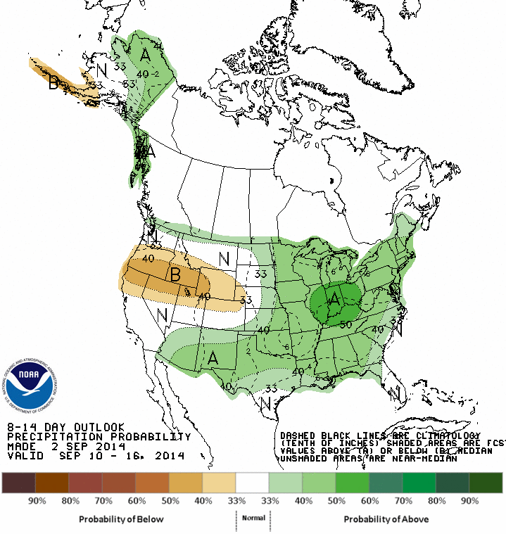
The farther into September we get, the more significant "above normal"
precipitation becomes as we approach out secondary fall rainy season. Remember,
we get about 25-30% of our annual normal precipitation from August through
October.
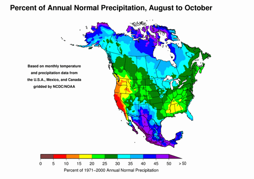
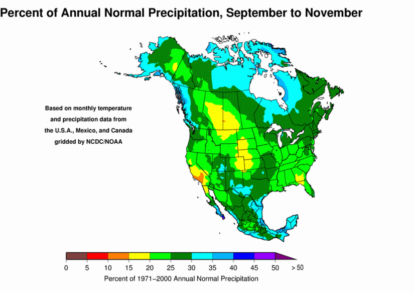
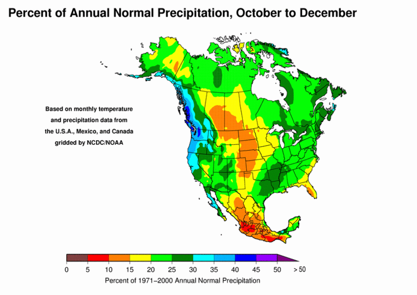
And it starts going down from there as we get into the drier winter months
until we reach our driest three months of the year...December-February, when
we receive only about 5-15% of our normal annual total.

Gary McManus
State Climatologist
Oklahoma Mesonet
Oklahoma Climatological Survey
(405) 325-2253
gmcmanus@mesonet.org
September 3 in Mesonet History
| Record | Value | Station | Year |
|---|---|---|---|
| Maximum Temperature | 111°F | ARDM | 2000 |
| Minimum Temperature | 44°F | KENT | 2010 |
| Maximum Rainfall | 3.51 inches | COOK | 2008 |
Mesonet records begin in 1994.
Search by Date
If you're a bit off, don't worry, because just like horseshoes, “almost” counts on the Ticker website!