Ticker for August 28, 2014
MESONET TICKER ... MESONET TICKER ... MESONET TICKER ... MESONET TICKER ...
August 28, 2014 August 28, 2014 August 28, 2014 August 28, 2014
Southwest Oklahoma needs rain
And Mars needs Moms, but that's a different story. If you have kids, you probably
knew this already. The newest drought monitor was mostly bad news, but it
obviously isn't going to stay that way with this upper-level system approaching
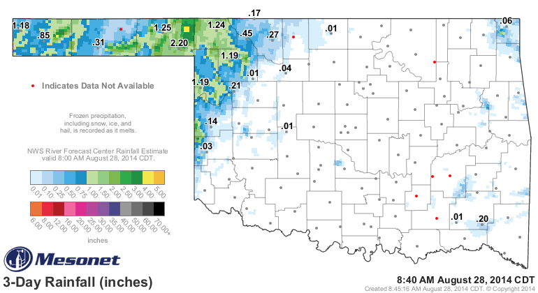
the state (and already paying dividends across parts of western OK). The Mesonet
totals map over the last three days shows a good 1-2 inches across parts of the
Panhandle, with a few localized areas of 3-4 inches (NE Beaver County came out
in really great shape).
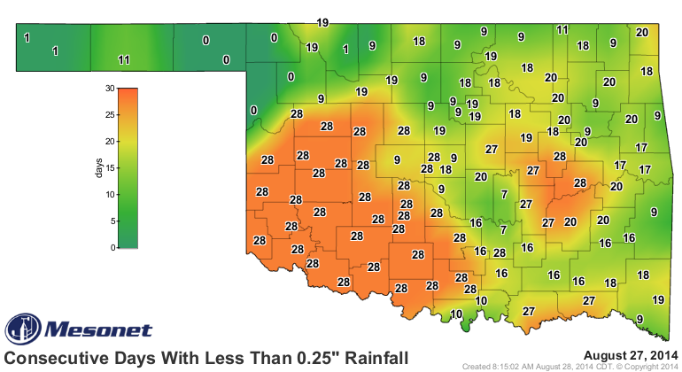
However, it's not tough to see where the rest of the state REALLY needs some
rain. It has now been 28 days since the SW quarter of the state has seen at
least a tenth of an inch of rain in a single day, and that area expands for
the quarter-inch criteria.

And as I've told you until you're tired of it, August has really picked a fight
with SW OK (and much of the rest of the state as well).
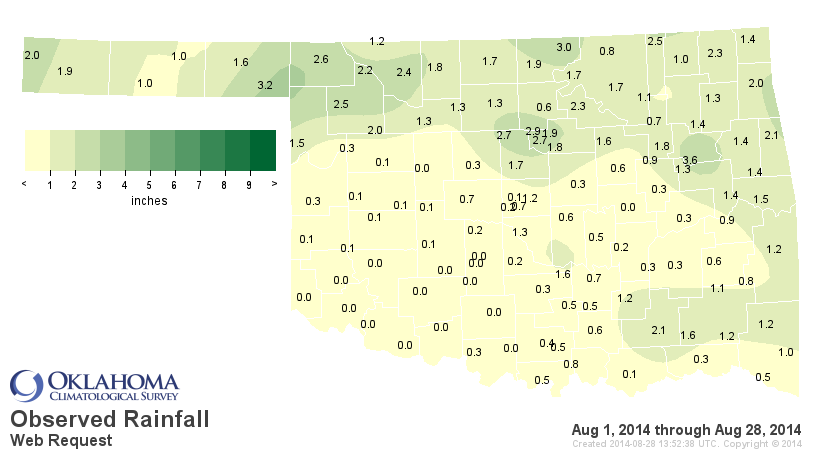
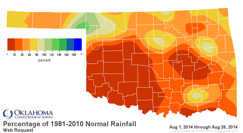
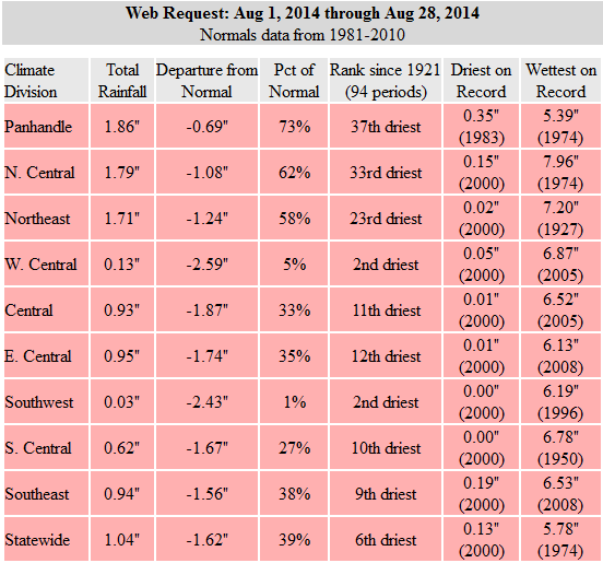
In southwestern Oklahoma, at least through the 28th, no August has been drier
save for August of 2000. That August was the driest on record with a statewide
average of 0.12 inches, so at least we're in no danger of breaking that record.
We've seen 1.04 inches so far this August across the state, mostly thanks to
rain across the northern half of the state.
Given the deficits that have mounted (at least through Tuesday morning, so the
generous Panhandle rains and (hopefully) those across the rest of the state
won't show up until next weeks map, if at all), this week's Drought Monitor
map saw an overall increase in drought for the first time in awhile.
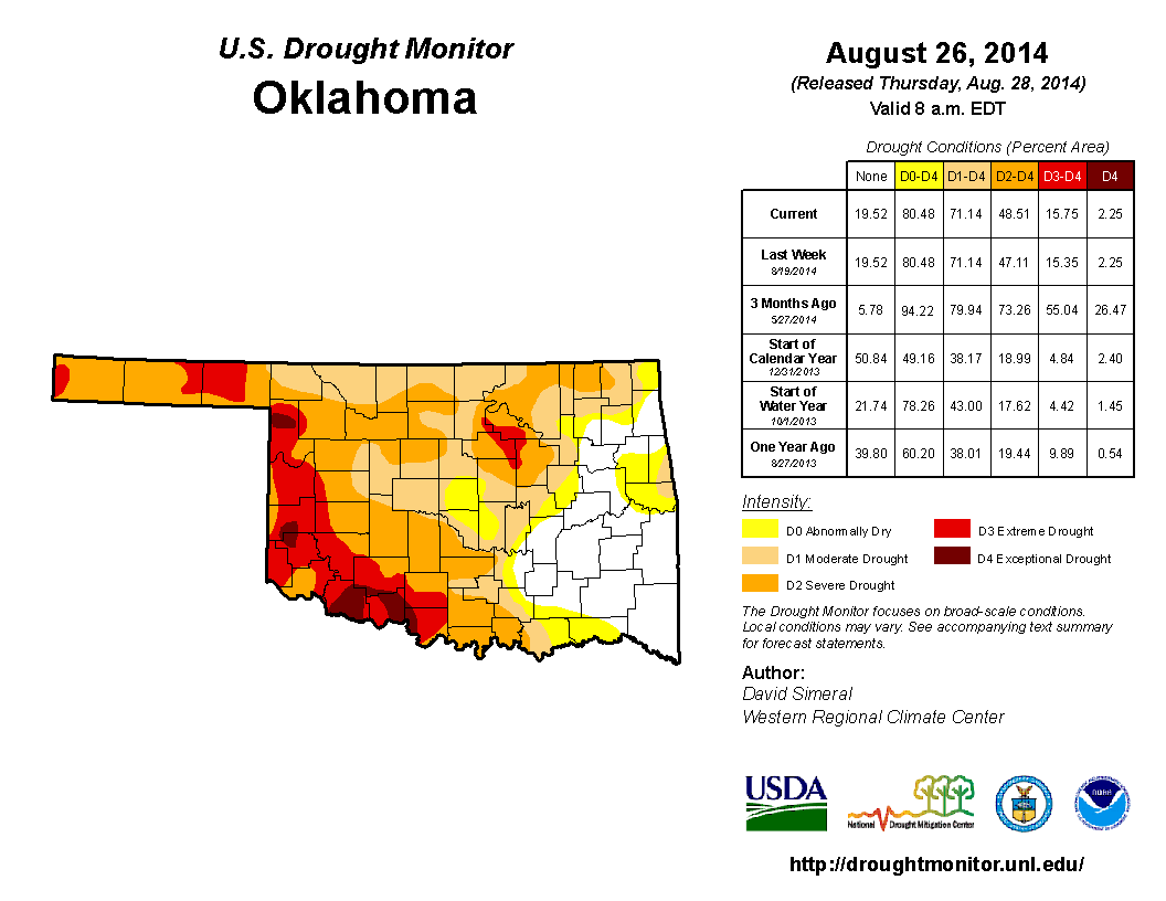
The increase was subtle with D3 expanding south into Jackson County and also a
a bit more D2 in northeastern Osage County. We now have 49% of the state in at
least Severe (D2 or higher) drought, and 16% in at least Extreme (D3-D4). Still
much better than three months ago when more than half of the state was portrayed
in at least Extreme drought. You can see the tremendous improvements across
Oklahoma and other parts of the Central and Southern Plains in this 3-month
change map.
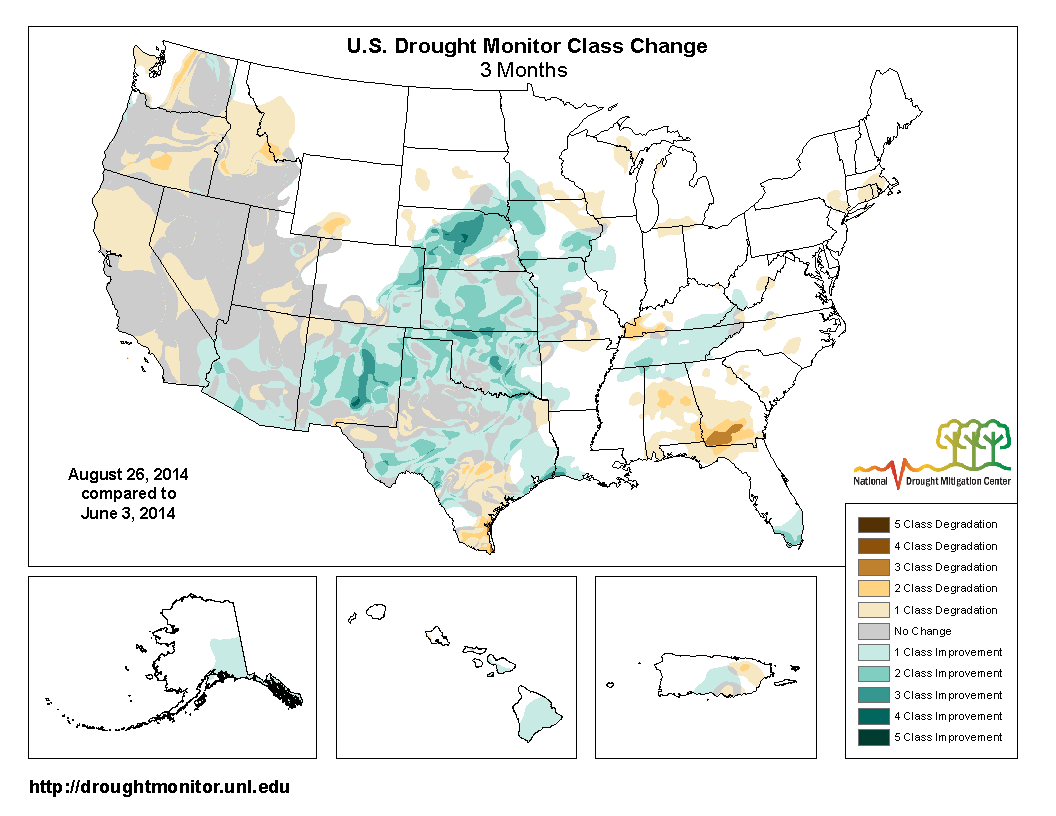
Northern Oklahoma has been particularly blessed with a 3-class improvement in
some areas after one of their driest January-May periods on record. Speaking
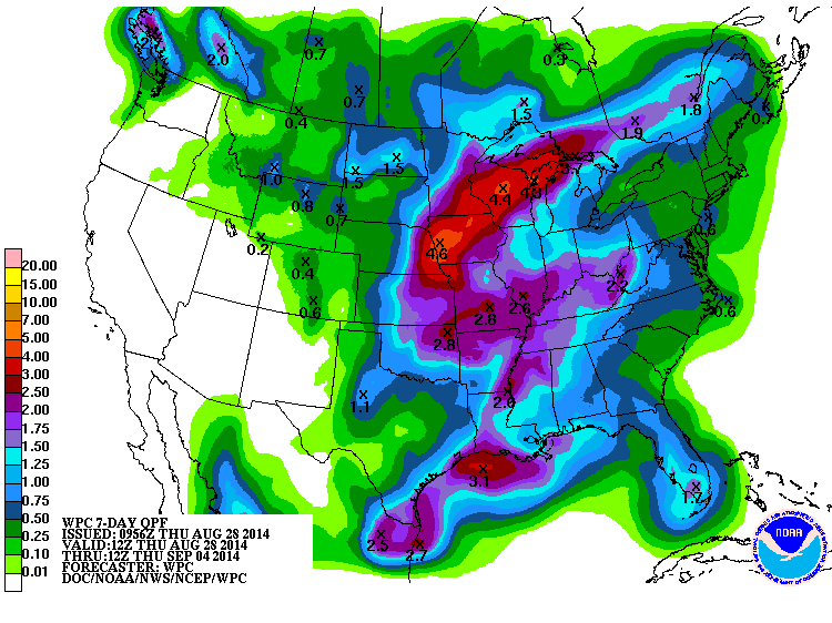
of improvements, we mentioned those possible bountiful rains over the next few
days earlier in the Ticker. Here is the 7-day rainfall forecast generated from
the current upper-level system approaching AND a possible storm for next week
(that one's a bit tenuous, so we'll throw in the 3-day rainfall map as well to
reflect the current storm system).

The potential is definitely there to return to the dreaded heat dome next week
with temperature back up into the mid-to-upper 90s, so be aware. Until then,
however, we look to have a really nice Friday and Saturday (depending on where
you are, and whether it's raining or not).
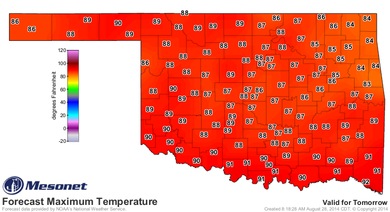
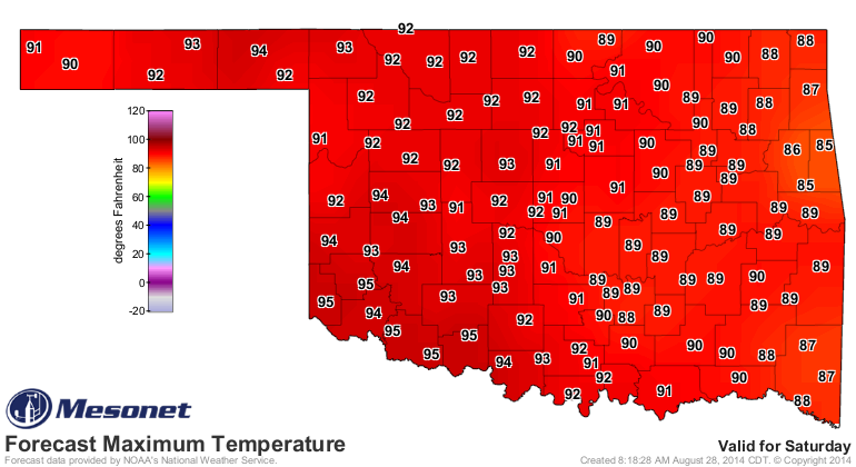
After that, prepare to sizzle!
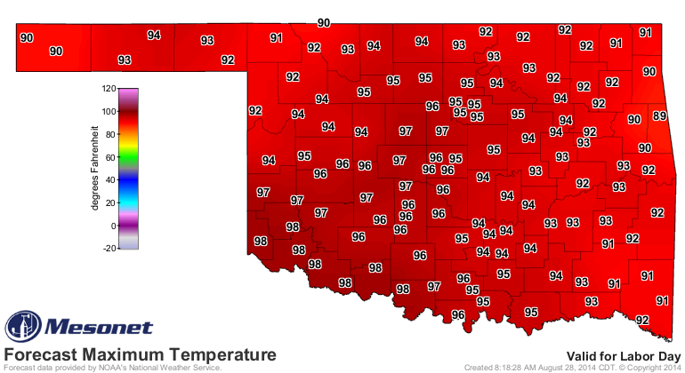
Gary McManus
State Climatologist
Oklahoma Mesonet
Oklahoma Climatological Survey
(405) 325-2253
gmcmanus@mesonet.org
August 28 in Mesonet History
| Record | Value | Station | Year |
|---|---|---|---|
| Maximum Temperature | 111°F | ALTU | 2011 |
| Minimum Temperature | 50°F | BOIS | 2004 |
| Maximum Rainfall | 4.73 inches | VINI | 2025 |
Mesonet records begin in 1994.
Search by Date
If you're a bit off, don't worry, because just like horseshoes, “almost” counts on the Ticker website!