Ticker for August 27, 2014
MESONET TICKER ... MESONET TICKER ... MESONET TICKER ... MESONET TICKER ...
August 27, 2014 August 27, 2014 August 27, 2014 August 27, 2014
Flash flooding...in the Panhandle?
It is indeed true. Now some of you might think that's pretty rare, but not really.
Rain can be rare in that area, of course, but us High Plains'ers know that when
it does really come down out that way, a LOT of it is going to run off into the
creeks and long,winding channels of grass (known as rivers elsewhere)and cause
quite a kerfuffle! The rain has fallen by the bucketfull out that way overnight
with the Beaver Mesonet site adding 1.96 inches to its tally. But you can see
widespread rains of 1-2 inches across much of the NW corner of the state (and
even more if you throw in the 48-hour totals).
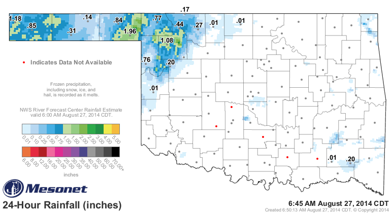
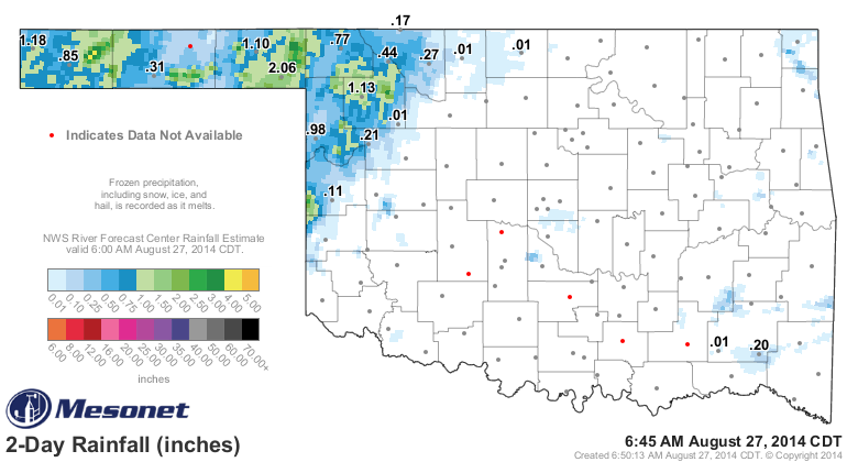
And here you can see the flash flood warning in red for eastern Beaver County,
extending down into the Texas Panhandle. To the east, a flood advisory has been
issued.
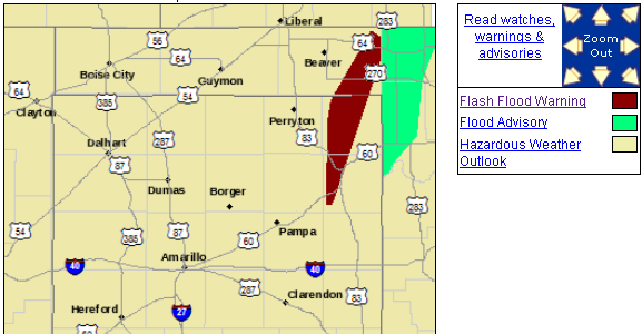
Here's the NWS screaming the warning at ya.
"AT 525 AM CDT...NATIONAL WEATHER SERVICE DOPPLER RADAR INDICATED A
THUNDERSTORM WITH VERY HEAVY RAINFALL 6 MILES NORTH OF LIPSCOMB.
DOPPLER RADAR ESTIMATES 1 TO 3 INCHES OF RAIN HAVE ALREADY FALLEN
OVER PARTS OF THE WARNED AREA IN THE PAST 3 HOURS WITH ADDITIONAL
HEAVY RAIN EXPECTED. FLOODING IS LIKELY TO OCCUR."
And for the flood advisory area:
"AT 445 AM CDT...NATIONAL WEATHER SERVICE RADAR INDICATED HEAVY RAIN
THAT WILL CAUSE SMALL STREAM FLOODING IN THE ADVISORY AREA. UP TO
AN INCH OF RAIN HAS FALLEN IN THE PAST HOUR IN FAR NORTHWESTERN
HARPER COUNTY. ADDITIONAL RAINFALL OF 1 TO 2 INCHES IS EXPECTED OVER
THE AREA THROUGH 745 AM CDT FROM AN APPROACHING LINE OF SHOWERS AND
THUNDERSTORMS."
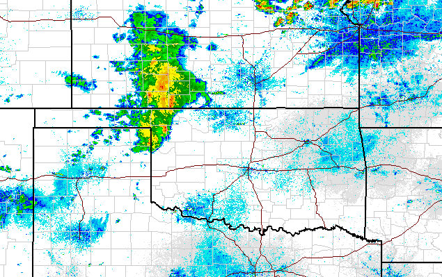
And here's a lovely picture of actual RAIN in the state of Oklahoma. Well,
pictures of electromagnetic energy flung outwards and collected after bouncing
off of actual rain in the state of Oklahoma, and turned into pretty colors.
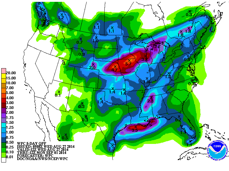
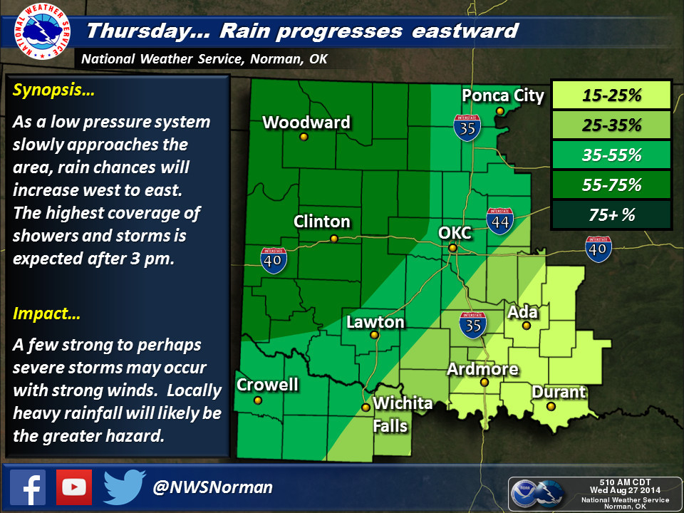
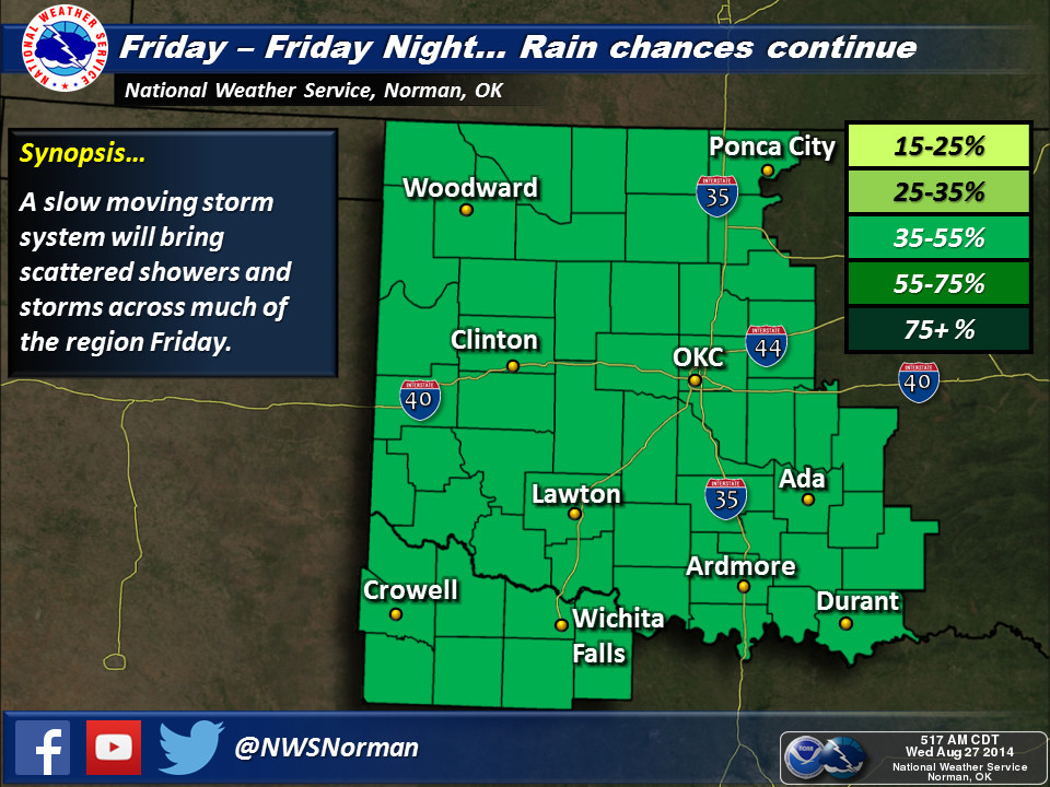
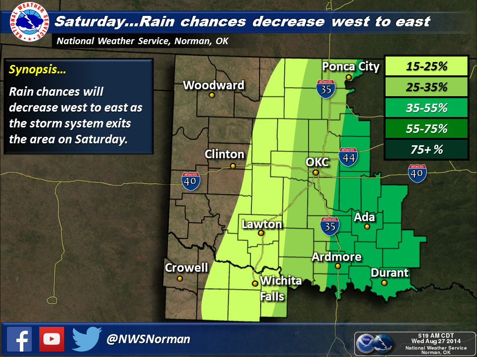
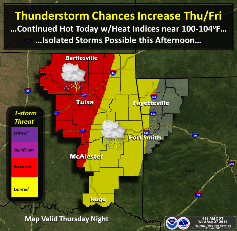
So as this storm system slides to the east over the next 2-3 days, expect to see
some of that rain shift as well. Here is the latest 5-day rainfall forecast where
we can see 1-2 inches are expected to fall as the system slowly moved through.
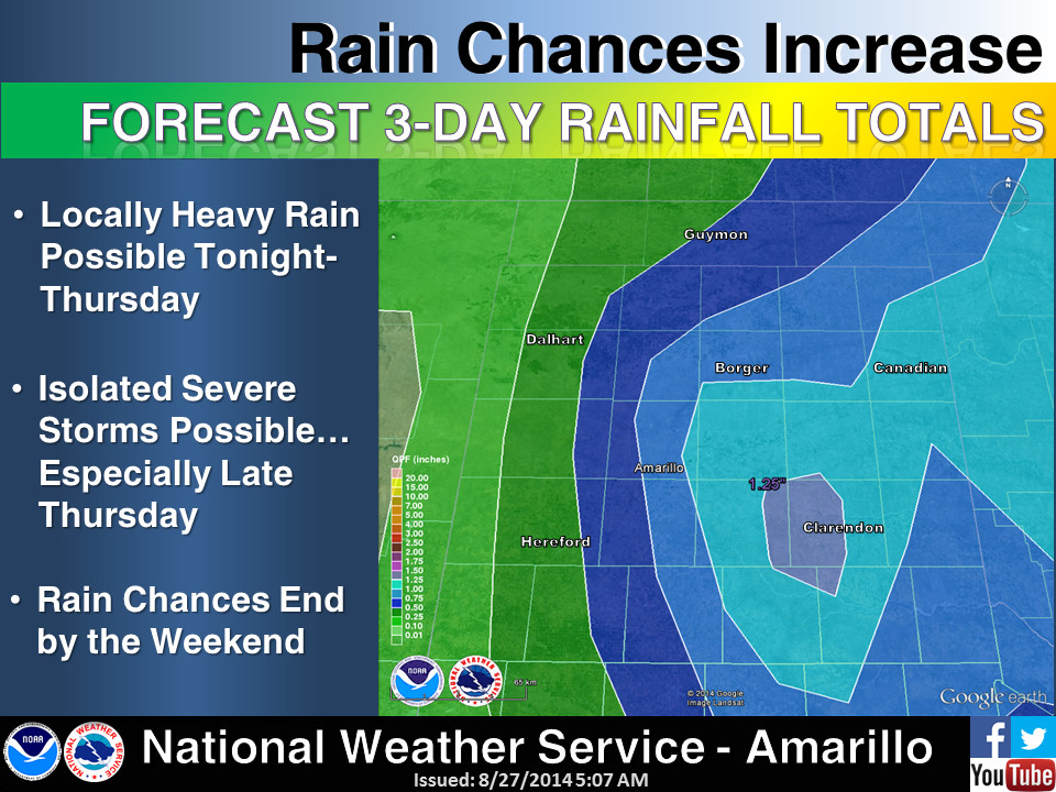
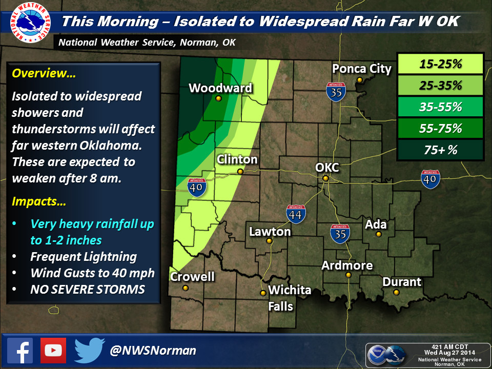
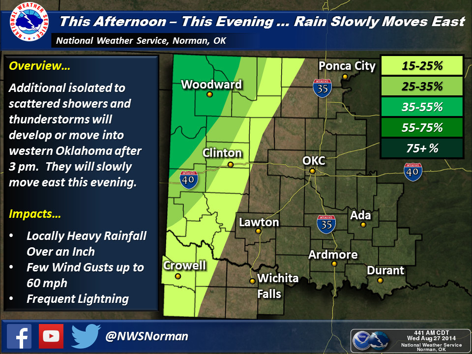
As for timing and all that, I'll turn you over to our friends at the local
NWS offices, both for their expertise and also somebody else to blame if it
doesn't occur to your liking.
The rain this morning and the last couple of days has already put some green
on our much-too-orange/red percent of normal rainfall map for August thus far.
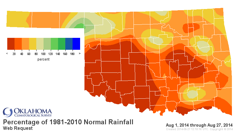
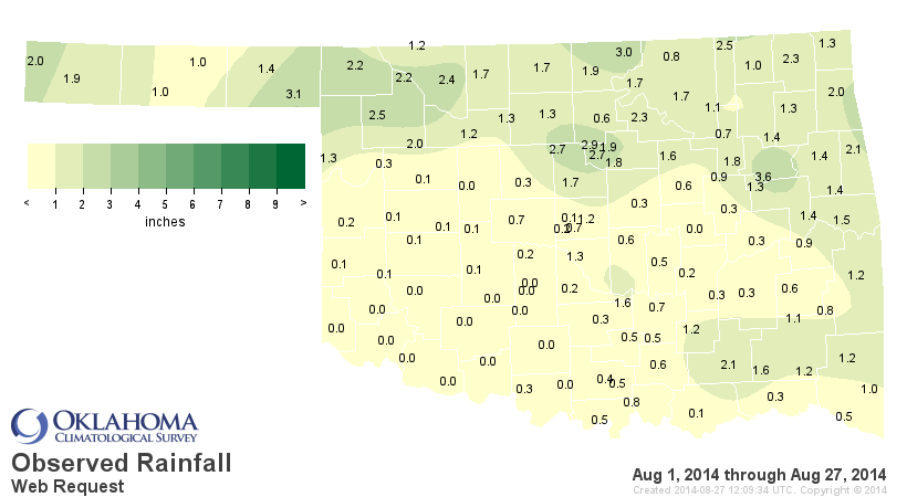
Still the 7th driest August thus far dating back to at least 1921, so we hope
to move up the ranking over the next few days, especially in SW OK where they
are seeing they're 2nd driest August on record.

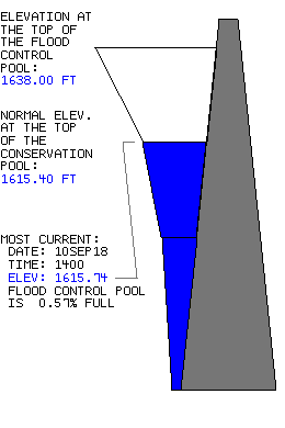
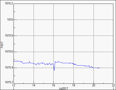
How about the lakes? Those across western Oklahoma are really suffering despite
the summer rains, and they have been worsening thanks to the recent hot, dry
weather. Check out those levels, courtesy of the OK Water Resources Board.

Lake Lugert-Altus is still 30 feet below normal (about 11% of normal capacity)
and continues to drop each day.
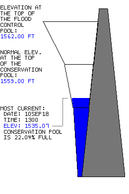
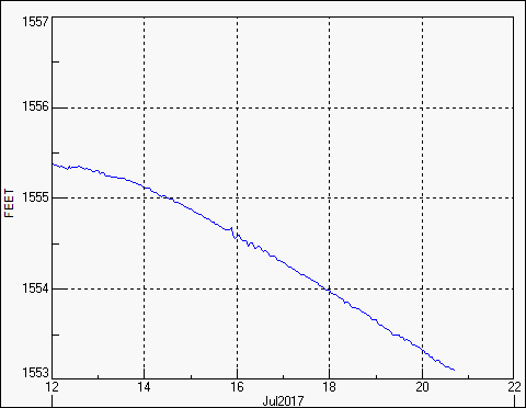
That's a major cotton irrigation lake, so no irrigation for the fourth year in
a row for that lake. Altus' water supply lake, Tom Steed, has dropped back down
to 25% of capacity after going up to about 30% after some nice rains in the
area.
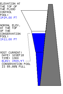
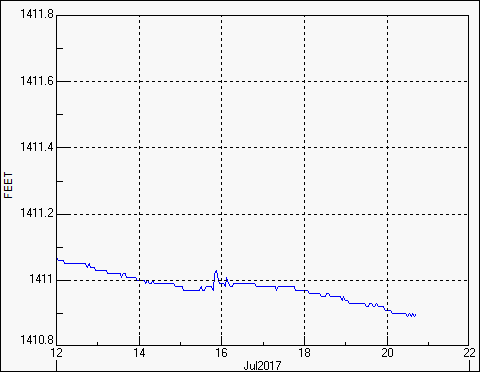
Even some of those eastern area lakes are suffering, such as Skiatook Lake up
in Osage County, Lake Texoma and Atoka. Canton remains 13 feet low (about 23%
of normal capacity) and continues to drop.
Those are long-term impacts that will need a long-term solution. We've heard
reports that vegetation out across the state has started to wither and turn
brown, becoming fuel for wildfires, so hopefully a good 1-2 inches of rain will
give us a burst of green and clamp down on that short-term drought impact.
Gary McManus
State Climatologist
Oklahoma Mesonet
Oklahoma Climatological Survey
(405) 325-2253
gmcmanus@mesonet.org
August 27 in Mesonet History
| Record | Value | Station | Year |
|---|---|---|---|
| Maximum Temperature | 109°F | GRA2 | 2011 |
| Minimum Temperature | 48°F | SEIL | 2010 |
| Maximum Rainfall | 3.95″ | CLOU | 1996 |
Mesonet records begin in 1994.
Search by Date
If you're a bit off, don't worry, because just like horseshoes, “almost” counts on the Ticker website!