Ticker for August 21, 2014
MESONET TICKER ... MESONET TICKER ... MESONET TICKER ... MESONET TICKER ...
August 21, 2014 August 21, 2014 August 21, 2014 August 21, 2014
A little more hope for the fall?
There really wasn't much change in this week's U.S. Drought Monitor map, mainly
because there wasn't really much widespread rainfall (although we had a heckuva
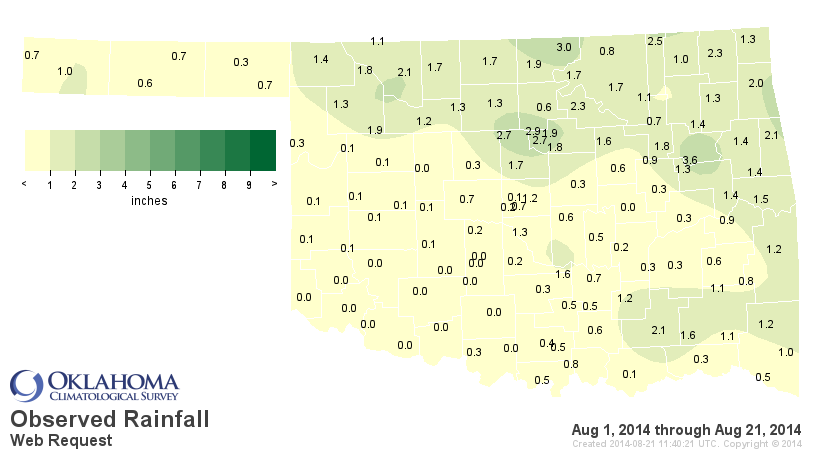
storm here in central Oklahoma Monday night). Here you can see the rainfall we
could consider for the DM map.
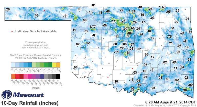
So there was just enough to make a few changes across north central Oklahoma,
and a bit out in the Panhandle. Here is the new map.
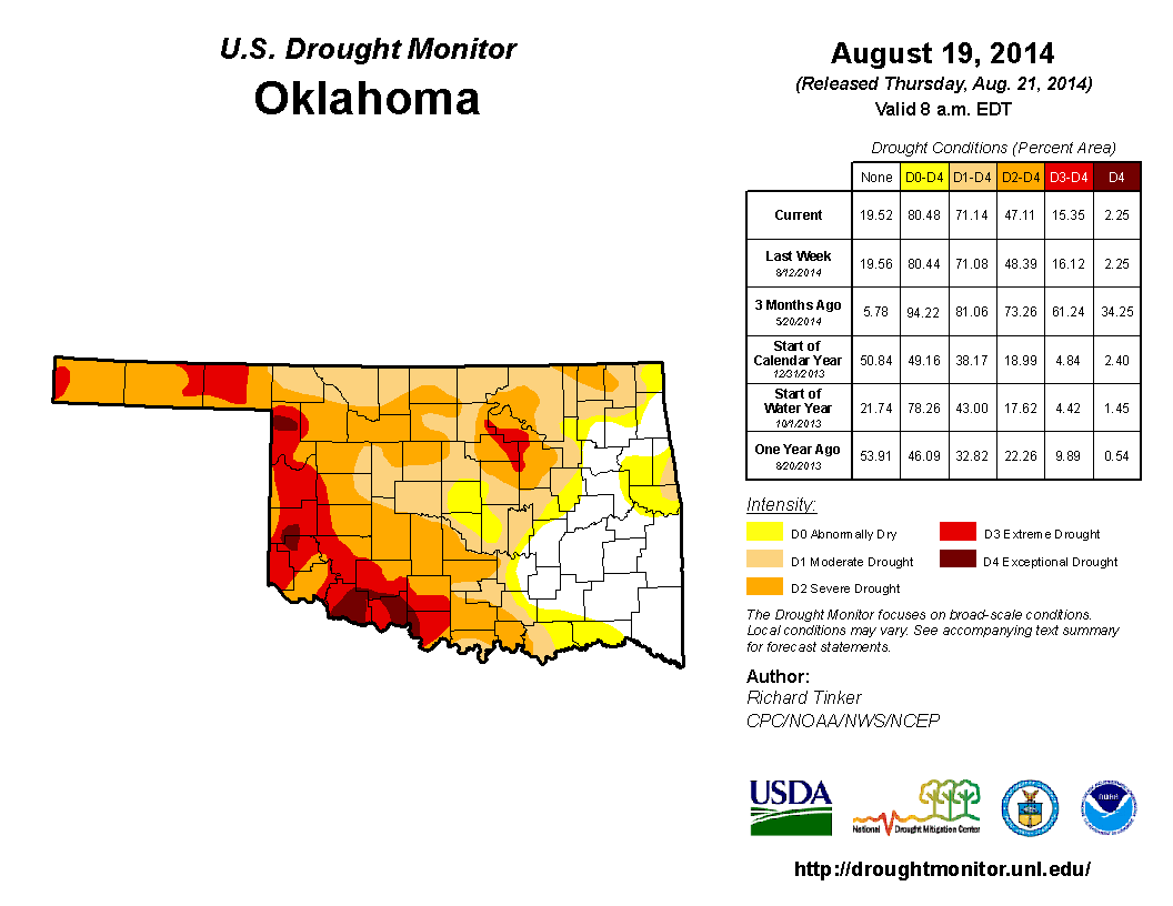
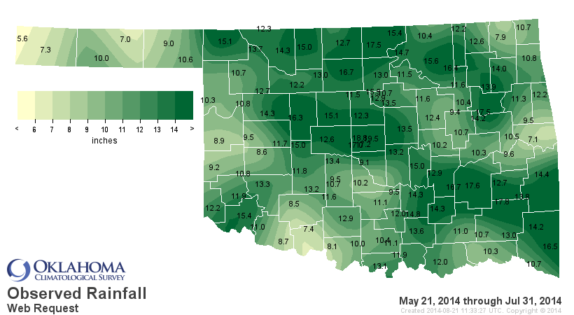
Most of the changes on that map have occurred in the past 2.5 months thanks to
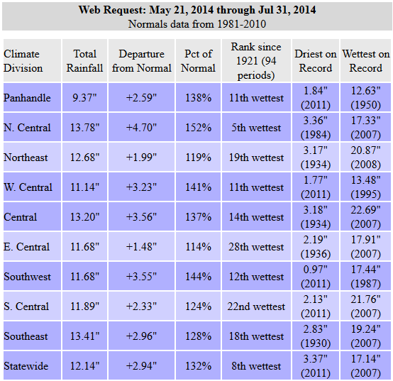
the oft-discussed May 21-July 31 rains across the state. I've shown you these
maps a million times, so here's a million and one!

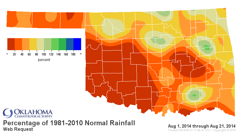
Unfortunately, other than for a select few, August has been less than
cooperative. There have been a few good rains scattered about, but for much of
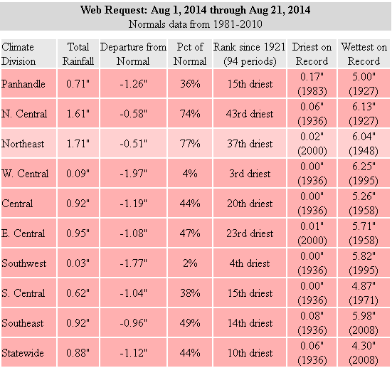
the southern half of the state. zilch. For SW OK, that super-duper scientific
measurement of "zilch" is reality. In fact, this August 1-21 is the 4th driest
such period on record since at least 1921 with an average of 0.03 inches. That
ain't helping!
Add all the heat we've been seeing the last week or so, and the lack of
rainfall, it all adds up to August simply being August. So we are going to have
to keep a close eye on parts of the state to make sure a flash drought situation
doesn't develop (although in this case, if would be more like a "flash
intensification" since drought already exists in those areas.
It would appear that we are going to hold in this hot, dry pattern for another
week or so, with the possibility of a few storms here and there. Widespread
rain...not so much.
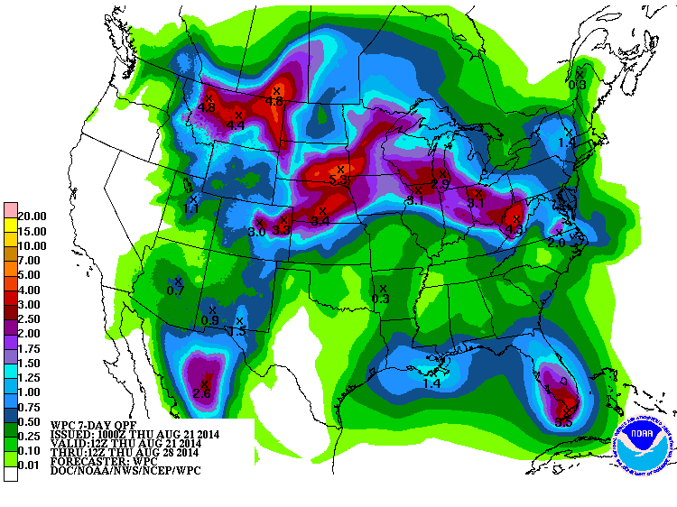
You can still see the overall shape of that rainfall pattern from the west of
Oklahoma, over us to the north, and then back down to the south as you get east
of us...in other words, the shape of that ridge of high pressure that is
baking us. There is SOME HOPE that a cold front sometime in the middle or
later next week will drop us back down to a bit cooler weather with better
chances of rainfall. Keep your fingers crossed on that one. There's nothing
August hates more than to give up its persistently hot/dry pattern.
Okay, now for the good news! The September-November temperature and precipitation
outlooks released today by the National Weather Service's Climate Prediction
Center hint and cooler- and wetter-than-normal weather for Oklahoma over that
three-month span. Check them out here where you see increased odds of above
normal rainfall and below normal temperatures (at least for the NW half of the
state or so).
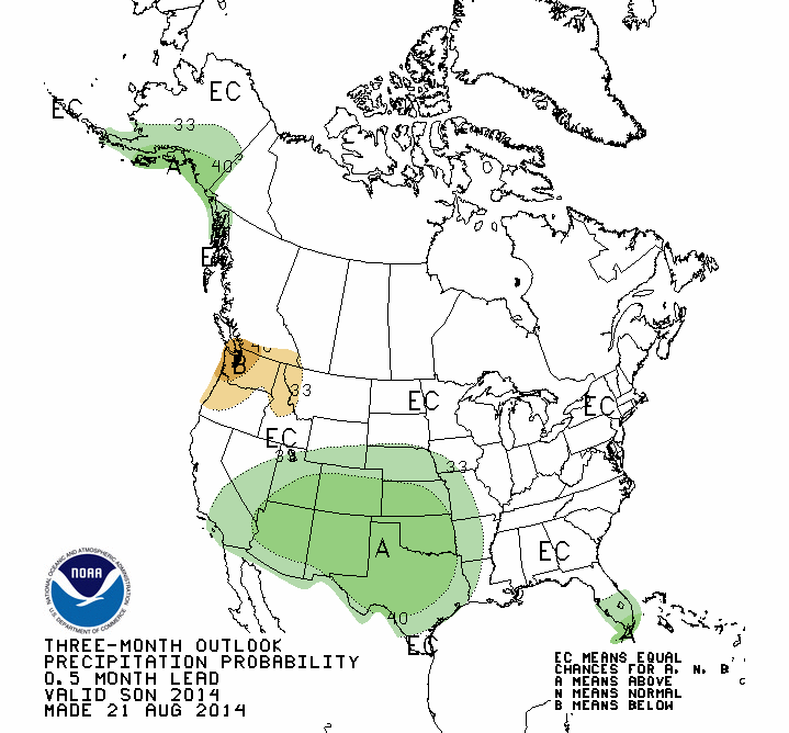

With those expectations, CPC also expects for the drought relief we've seen
through the late-spring into summer to continue into fall, as depicted on the
latest U.S. Seasonal Drought Outlook for now through November 30.

So maybe not enough for a total drought eradication plan, but at least more
improvements. That DOES NOT preclude the possibility of complete drought
removal with some great rains, however, and we are quickly approaching our
secondary fall rainy season. So "above normal" precipitation during that time
frame certainly means more than it would in the summer (or even winter).
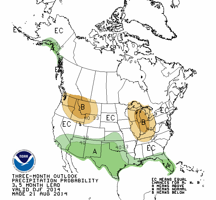
I'll leave ya with a sneak peak at the latest outlook for winter (Dec-Feb)...
again we see increased odds of above normal precip. Snow, rain, ice? Whatever
comes, it's better than nothing (e.g., 2010-11, 2013-14).
Gary McManus
State Climatologist
Oklahoma Mesonet
Oklahoma Climatological Survey
(405) 325-2253
gmcmanus@mesonet.org
August 21 in Mesonet History
| Record | Value | Station | Year |
|---|---|---|---|
| Maximum Temperature | 109°F | GRA2 | 2023 |
| Minimum Temperature | 48°F | EVAX | 2018 |
| Maximum Rainfall | 4.25″ | RING | 2022 |
Mesonet records begin in 1994.
Search by Date
If you're a bit off, don't worry, because just like horseshoes, “almost” counts on the Ticker website!