Ticker for August 20, 2014
MESONET TICKER ... MESONET TICKER ... MESONET TICKER ... MESONET TICKER ...
August 20, 2014 August 20, 2014 August 20, 2014 August 20, 2014
August acting the fool
What happened to summer that felt like fall (Sall or Fummer, remember)? What
happened to our highs in the 80s and lows in the 50s and 60s, like we showed
you in the August 12 Ticker?
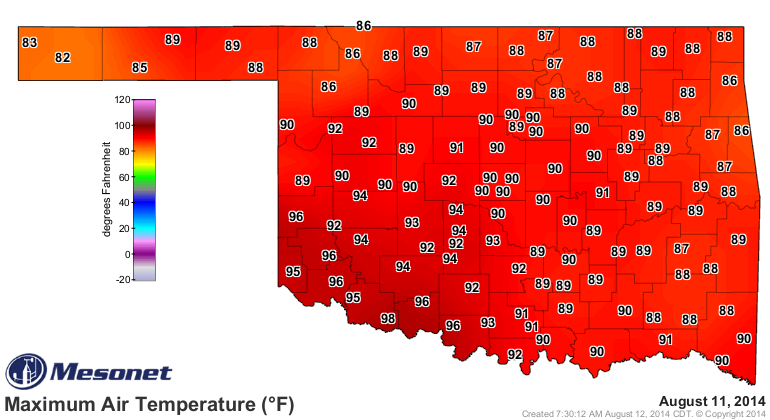
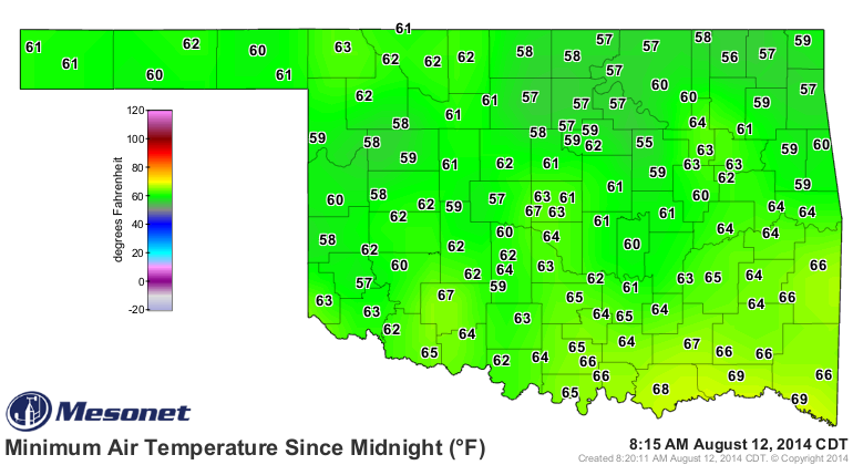
Shortly after that, August began acting the fool and decided it had seen enough
of the mamby-pamby (work with me here) non-summer'ish weather. Now it's not like
we've started to see unusual August weather, but compared to the mild summer we
had seen from June through mid-August, it sure seems like a blast furnace now.
Only one triple-digit yesterday, which isn't too bad.
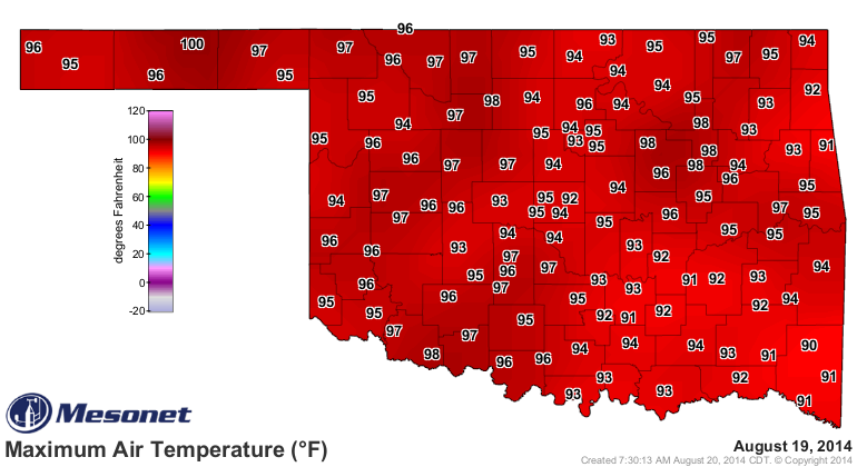
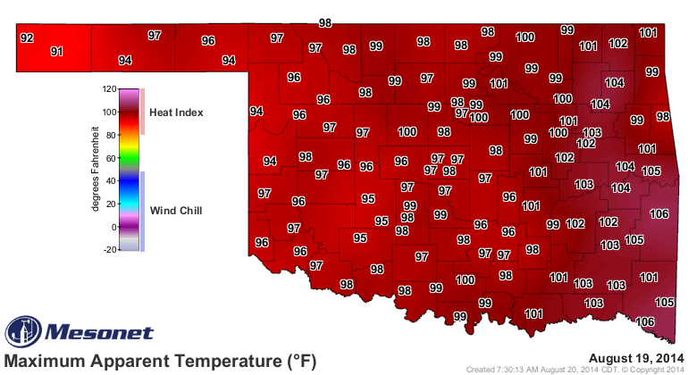
Although the heat indices across the state were a bit tougher across the eastern
two-thirds.
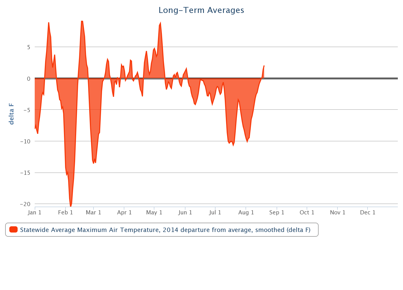
We can show this once again with the departure from average (1999-2013) Mesonet
maximum temperature graph for 2014. Only in the last few days has the statewide
average maximum temperature risen above normal levels for the summer (since
mid-May, actually). Absolute proof that the state has been been unusually cool
for the season (heck, most of the year).
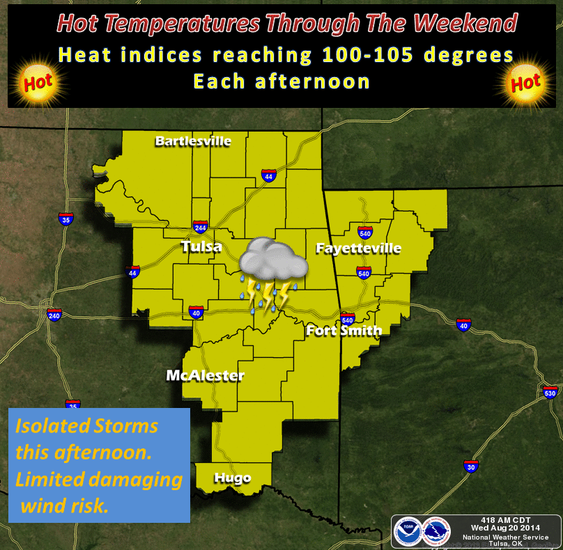
The problem is that it looks like our newly-empowered August is going to
continue with its foot on the heat pedal for awhile longer.

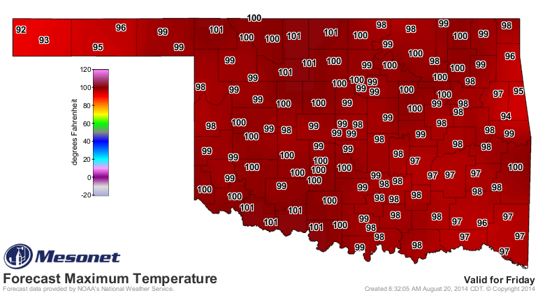
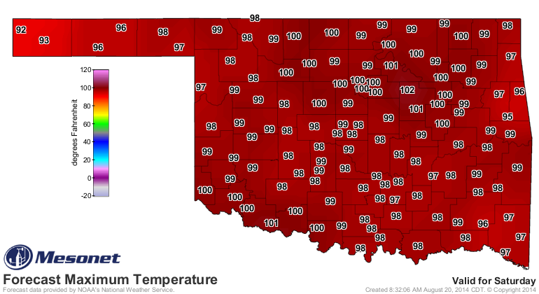
And Friday and Saturday appear to be the hottest of days this week. Remember,
these are just the "regular" air temperature maps. The heat index maps could
look a lot nastier.
At least that dome of high pressure that has began baking us is expected to
shift a bit to the east and allow something of a cool front to approach
the state later into the weekend. In other words, a bit of a rain chance (and
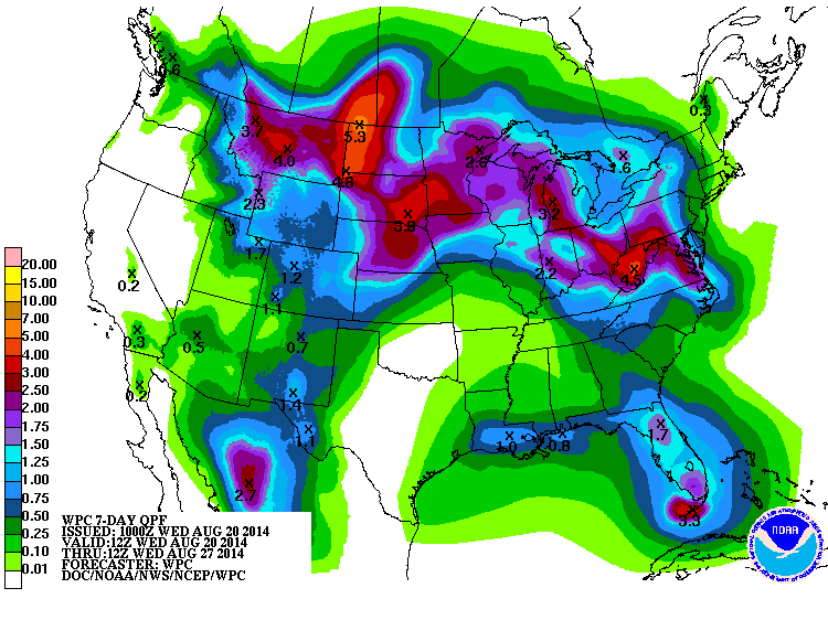
maybe temperatures a bit cooler). It's sure not showing up on the 7-day rain
forecast from the WPC, so don't expect the widespread rains of June and July.
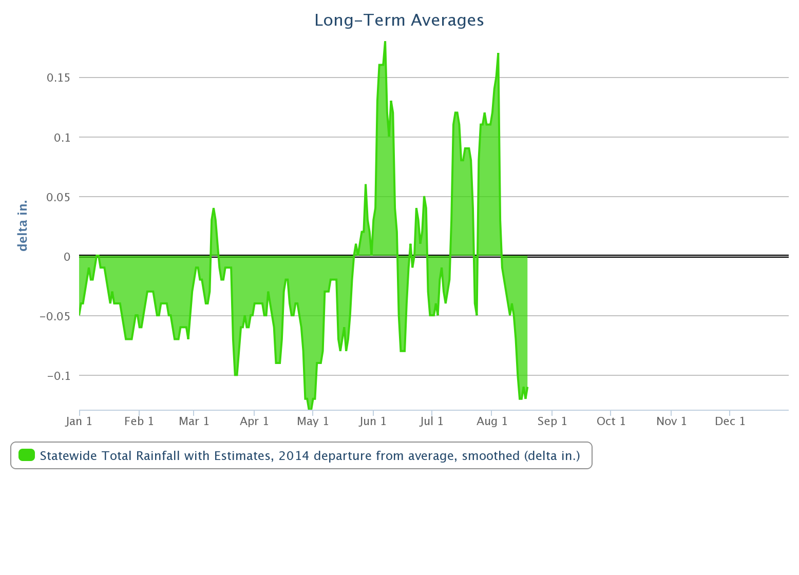
Speaking of those rains of June and July (and late-May), they sure look sweet
on the 2014 statewide departure from average rainfall graph. August has turned
into a real dud in that regard, however.
Have no fear! According to the Canadian National Weather Service (I'm giving
them that name, hope they like it) forecast models, the northern half of the
state has a 50-70% chance of seeing at least an inch of rain accumulate through
September 4. But less than a 30% chance of seeing 2 inches of rain.
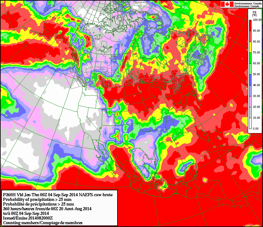

Rats! That's barely average for that time frame. Oh well, what do those hosers
know anyway, eh?
Gary McManus
State Climatologist
Oklahoma Mesonet
Oklahoma Climatological Survey
(405) 325-2253
gmcmanus@mesonet.org
August 20 in Mesonet History
| Record | Value | Station | Year |
|---|---|---|---|
| Maximum Temperature | 111°F | WAUR | 2023 |
| Minimum Temperature | 47°F | ELRE | 2015 |
| Maximum Rainfall | 3.45″ | MAYR | 1996 |
Mesonet records begin in 1994.
Search by Date
If you're a bit off, don't worry, because just like horseshoes, “almost” counts on the Ticker website!