Ticker for August 12, 2014
MESONET TICKER ... MESONET TICKER ... MESONET TICKER ... MESONET TICKER ...
August 12, 2014 August 12, 2014 August 12, 2014 August 12, 2014
A brief intermission...but of what?

The milder air that rushed in behind the weekend's cool front still lingers with
its effects, giving us a brief intermission from summer.
Alternate version!
Summer-like weather is on its way again later this week with highs in the 90s and
triple-digits giving us a brief intermission from this unusually cool summer.
I'll let you pick (although DO NOT sing the lyrics to that "Let's all go to the
lobby" song in your head or they will NOT go away!).
But yes, temperatures have been delightfully early-early autumnal with lows in
the 50s and 60s and highs mostly in the 80s for a couple of days (some 90s are
sneaking back in already).
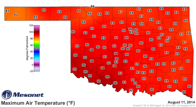
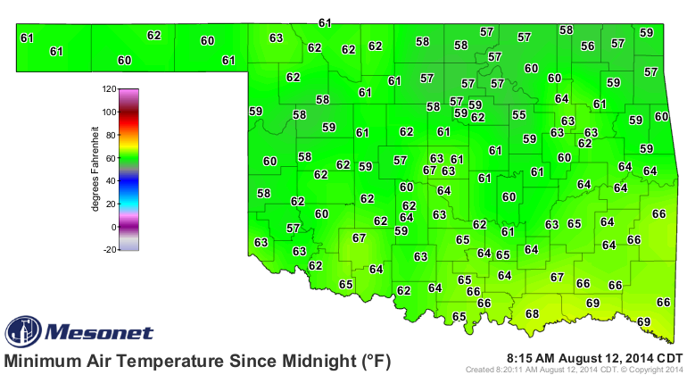
No record lows today, by the way. Those start to go farther and farther into the
50s and 40s as we go through August.

Because, believe it or not, we ARE on the downward slide toward fall now that
we've passed what I call the Heavenly point (the hottest part of the year from
late July through early August), but what a lot of you might call the Hell
point. I'll make no cold weather fans remarks if you refrain from the hot
weather jibes! Look at that slope we're on now, as evidenced by this 1999-2013
statewide average maximum temperature graph from the Oklahoma Mesonet.
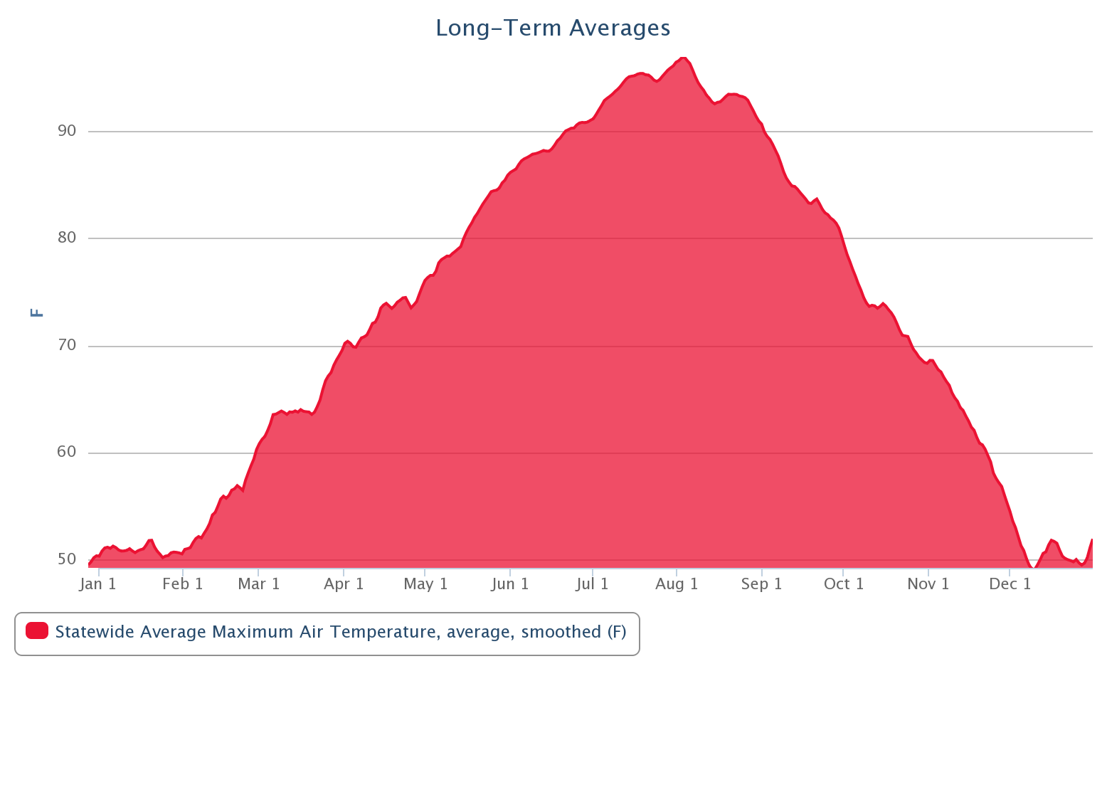
Now some of you weird cold weather people (it's my Ticker, I can break my
promises) might see a chance for a sled on some snow there. Personally, I see
a slip-n-slide on a hot summer day. A red slip-n-slide, but it ain't a cool
blue! There are a few bumps here and there, but regardless, climatologically
speaking, we're on the way towards fall, slowly but surely.
But that's the point I was making earlier. It hasn't really been summer, more
like a summer and fall hybrid. Fummer? Sall? Add 2014's statewide average high
temperatures onto that long-term average map and you can see for the most part,
we've dipped below normal ... significantly so at times.
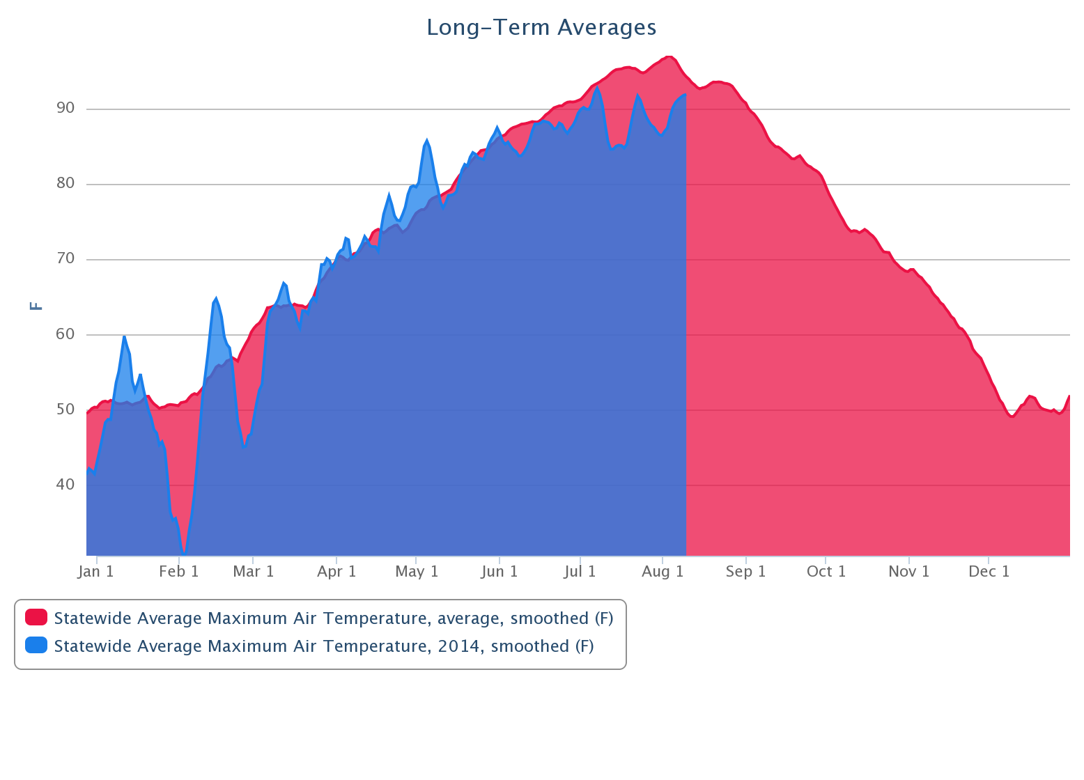
Some fascinating things show up in that graph (remember, we're just talking
maximum temperatures here). First, the brutal cold of late January-February
and then the wheat-damaging freezes of March. Then the heat of April and May
as the drought started to accelerate and the state began to burn. Finally, the
multitude of cool fronts that have brought us all this rain since late May. We
can see the same thing in the Mesonet statewide average minimum and mean
average (highs+lows averaged together) temperature graphs.
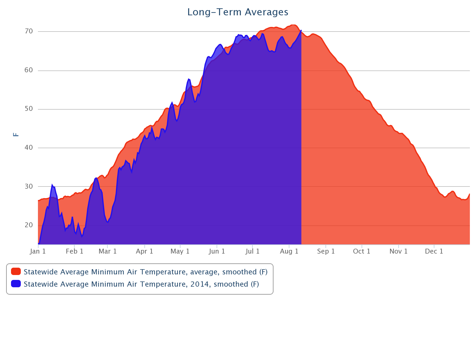

But all we really needed were the statistics so far this summer (climatological
summer, that is, beginning on June 1). Remember July was the 3rd coolest on
record for Oklahoma at more than 4 degrees below normal, and the June-July
period was the 16th coolest at nearly 2 degrees below normal. And August has
kept up the company line thus far through the first 11 days at nearly 4 degrees
below normal.
-***-
Aug. 1-11 MaxT MinT Avg.
Statewide Avg. 90.1 67.2 78.2
Normal 94.3 69.6 82.0
Departure -4.2 -2.4 -3.8
-****-
As stated previously, we are headed into an intermission(??) back into an
actual summer. Highs will once again reach into the upper 90s and low 100s as
we reach the end of the week and then into early next week.
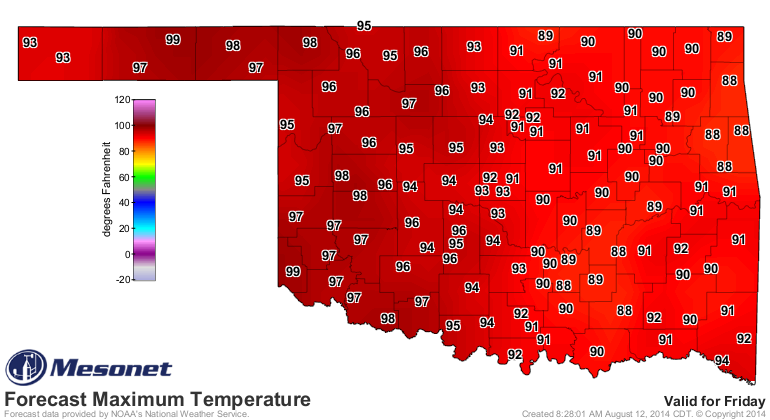
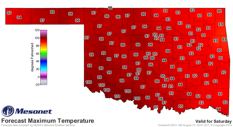
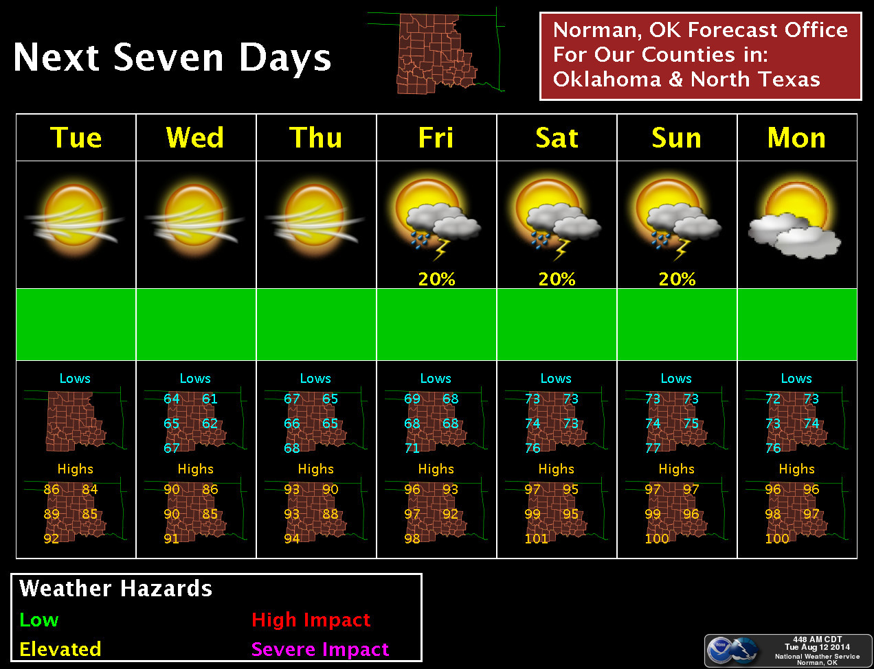
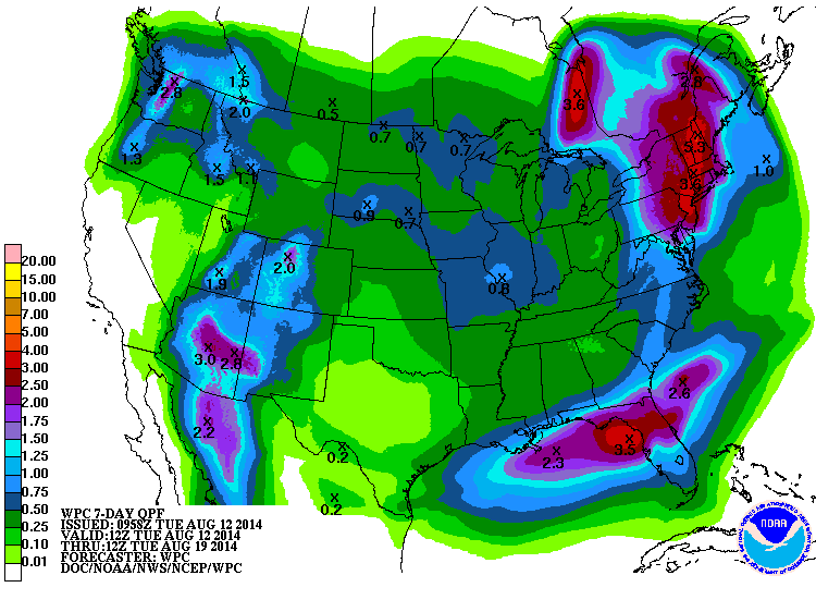
Strangely enough, that's also when our next chance of rain arrives as another
storm system travels up and over the upper-level ridge that will be in place
bringing us our heat. It shows up on the 7-day forecast. It ain't much, and you
can see the influence of that dome of high pressure over the High Plains, as
well as the monsoon flow over the Desert Southwest.
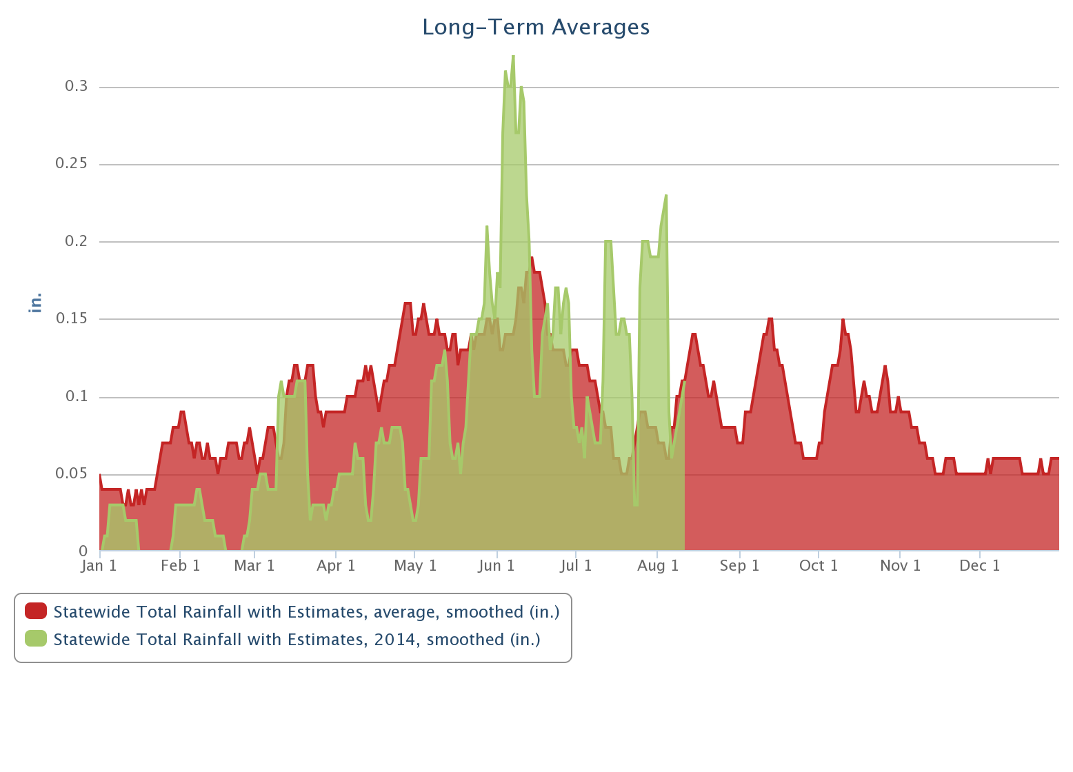
Okay, I can't get out of here without saying something about drought. As with
the long-term temperature graphs above, pretty easy to pick out the changing
point of our drought fortunes this year on the precipitation graph ... May 21,
a day that changed the direction of a state in misery.
And also on sunscreen sales!

Now enjoy the rest of your Fummer. Surely another cool front is on its way.
Gary McManus
State Climatologist
Oklahoma Mesonet
Oklahoma Climatological Survey
(405) 325-2253
gmcmanus@mesonet.org
August 12 in Mesonet History
| Record | Value | Station | Year |
|---|---|---|---|
| Maximum Temperature | 112°F | GRA2 | 2023 |
| Minimum Temperature | 48°F | MIAM | 2004 |
| Maximum Rainfall | 3.93″ | PRYO | 2011 |
Mesonet records begin in 1994.
Search by Date
If you're a bit off, don't worry, because just like horseshoes, “almost” counts on the Ticker website!