Ticker for August 6, 2014
MESONET TICKER ... MESONET TICKER ... MESONET TICKER ... MESONET TICKER ...
August 6, 2014     August 6, 2014     August 6, 2014     August 6, 2014


Woof woof

Did you know that the largest temperature gradient at any Oklahoma observing
station for any single day is 80 degrees? Just a simple high minus low
temperature calculation. The date was March 4, 1989. Although the Hammon NWS
cooperative observing station made their observations each day at 8 a.m., so
the high and low occurred sometime in the 24-hours previous to 8 a.m. on March
4. What happened? They reached a high of 75 degrees on March 3 and then a big
honking Blue Norther came through and sometime early on the morning of March 4
the temperature bottomed out at -5 degrees.

Many folks will probably remember that March 3 cold front that brought severe
storms and then heavy snows as it passed through the state. Here's how our
monthly climate summary described it back in the day:

"A strong cold front ... interacted with a mass of warm, moist air over
Oklahoma on the 3rd to produce violent, cold and snowy weather. Seven
weather-related deaths were reported. Central Oklahoma recorded brief
hail before temperatures quickly dropped below freezing. Snow fell
statewide on March 5. Stations within about 100 mile wide SW to NE swath
through central Oklahoma reported the greatest snow accumulations,
ranging from 8" at Stilwell, Tahlequah and Eufaula to 16" at Pauls
Valley. The heavy snowfall collapsed the roofs of some 150 northeastern
Oklahoma poultry houses, killing 3,000,000 chickens (about 15% of the
state's total). Damage was estimated at $20 million. Snow damage exceeded
$500,000 at some marinas on state lakes."

Somewhere that day, Chicken Little said "the sky is falling" and this time, he
really meant it, I guess. By the way, if you want to see how far we've come in
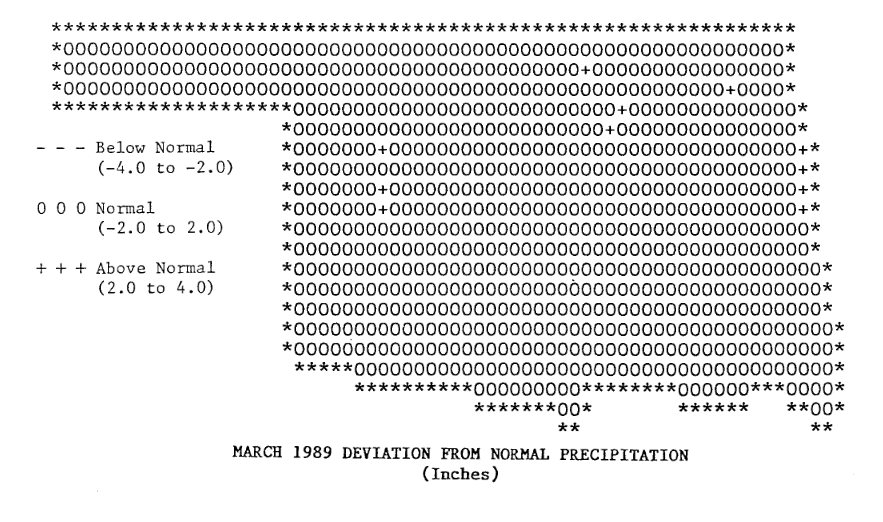
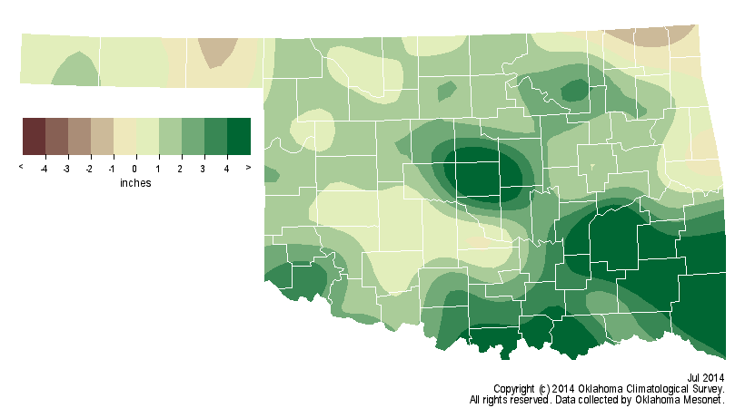
the graphics department, take a look at those precipitation maps from the
summary that month. You can read the whole thing here:

http://climate.ok.gov/summaries/monthly/1989/mcs_march_1989.pdf

Or look at any of our old summaries back to January 1985 here:

http://climate.ok.gov/index.php/climate/summary/reports_summaries

How would you like to be reading this to see if you had above-, below- or near-
normal rainfall for a month?


How times have changed.


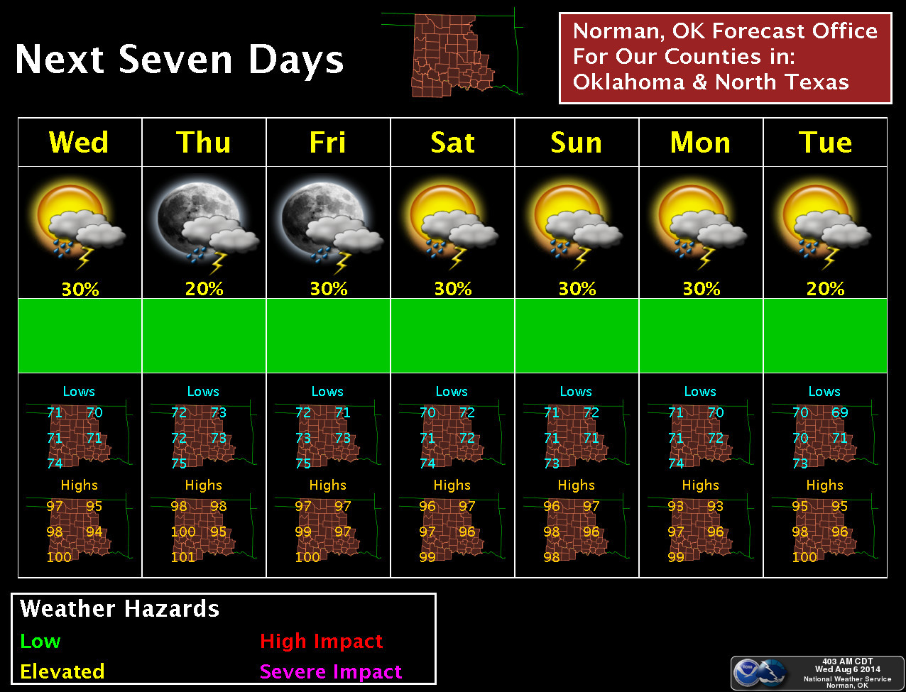
Still not much rain in the forecast. The dog days of summer are here. I'm
telling you, nothing beats August for taking the fun out of the weather.
January comes close sometimes.


Gary McManus
State Climatologist
Oklahoma Mesonet
Oklahoma Climatological Survey
(405) 325-2253
gmcmanus@mesonet.org
August 6 in Mesonet History
| Record | Value | Station | Year |
|---|---|---|---|
| Maximum Temperature | 112°F | OKMU | 2011 |
| Minimum Temperature | 54°F | BOIS | 1998 |
| Maximum Rainfall | 6.70 inches | HUGO | 2017 |
Mesonet records begin in 1994.
Search by Date
If you're a bit off, don't worry, because just like horseshoes, “almost” counts on the Ticker website!