Ticker for August 1, 2014
MESONET TICKER ... MESONET TICKER ... MESONET TICKER ... MESONET TICKER ...
August 1, 2014 August 1, 2014 August 1, 2014 August 1, 2014
A July To Remember
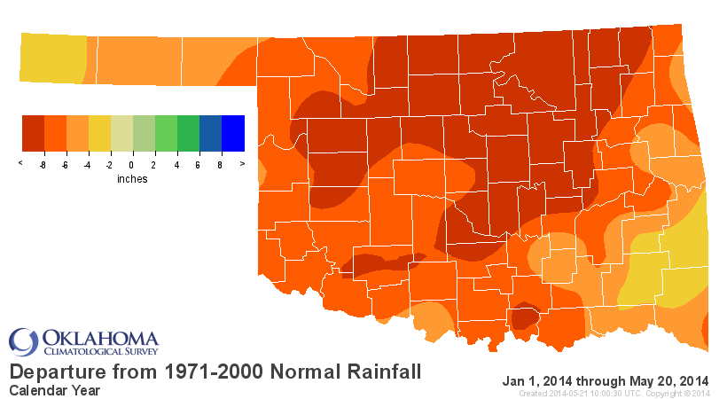
Sometime around the third week of May, with wildfires scorching the state and
drought continuing to intensify, Oklahomans were in search of a miracle. The
spring rainy season at that point seemed like a figment of Mother Nature's
imagination amongst one of the driest January-May periods in state history.
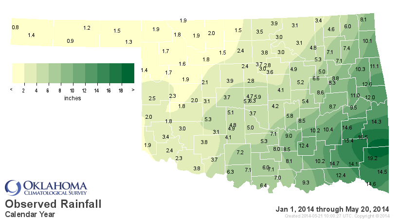

Finally, the miracle did arrive in the form of an upper-level low pressure
system that brought the state some of its most substantial moisture since the
previous fall. That system turned on the spigot and the moisture has continued
largely unabated since that point.
It is not unusual for Oklahoma to see big rains during May and June. That is
Oklahoma's rainiest part of the year, after all. It is a bit uncommon, however,
for those rains to continue deeper into the summer, but that is exactly what
has occurred. And for Oklahoma, a rainier summer generally means a milder
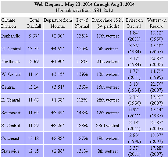
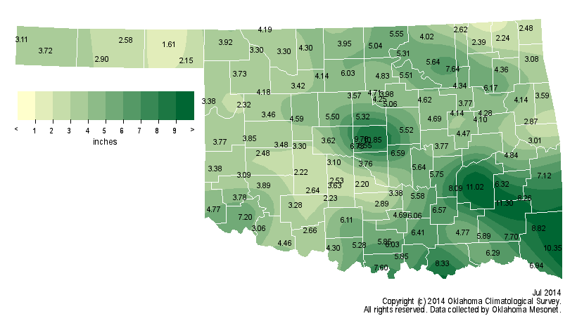
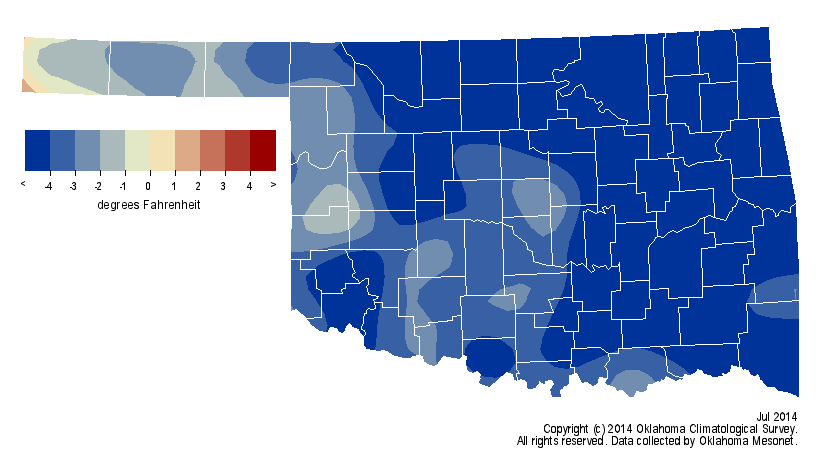
summer. According to preliminary data from the Oklahoma Mesonet, Oklahoma
experienced its third coolest and 15th wettest July on record.
The first two months of climatological summer (June and July) finished as the
16th coolest and 15th wettest on record.
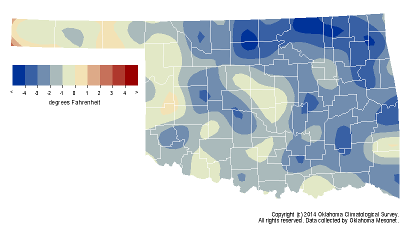
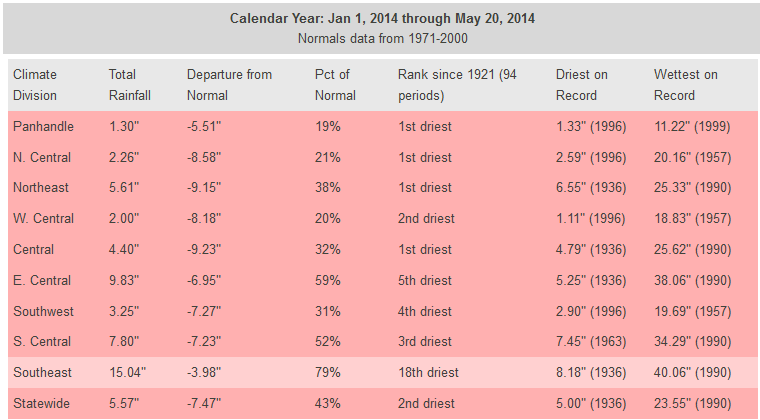
The January-July temperature was similar with a ranking of 15th coolest, but
long-term moisture deficits remained with a ranking of 38th driest, more than
4 inches below normal.

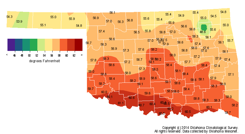
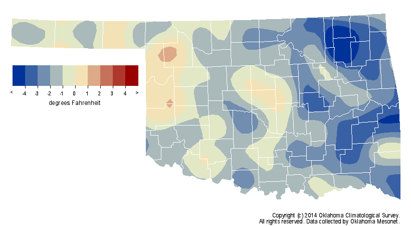
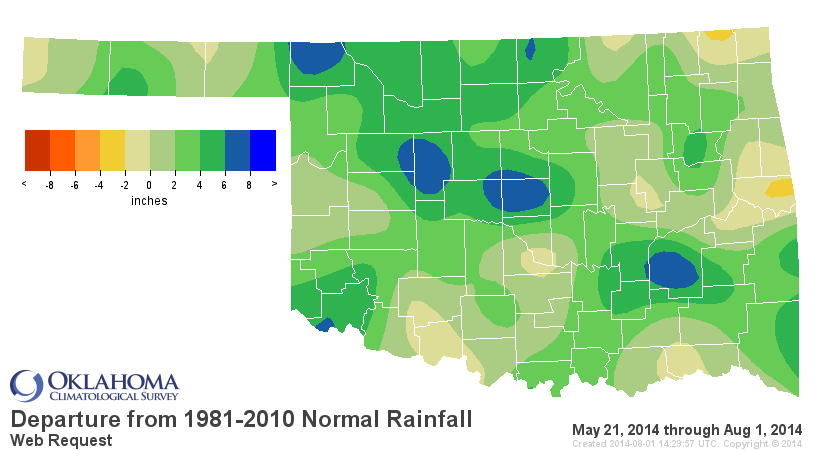
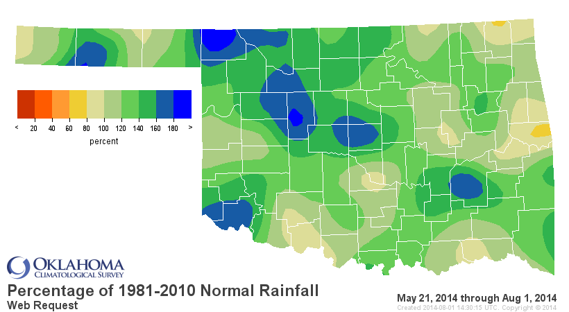
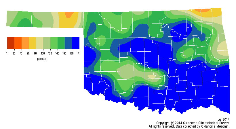
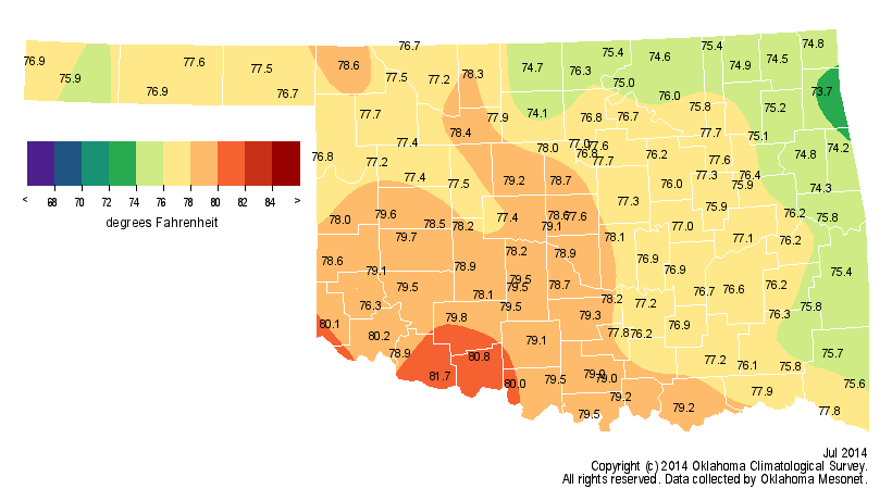
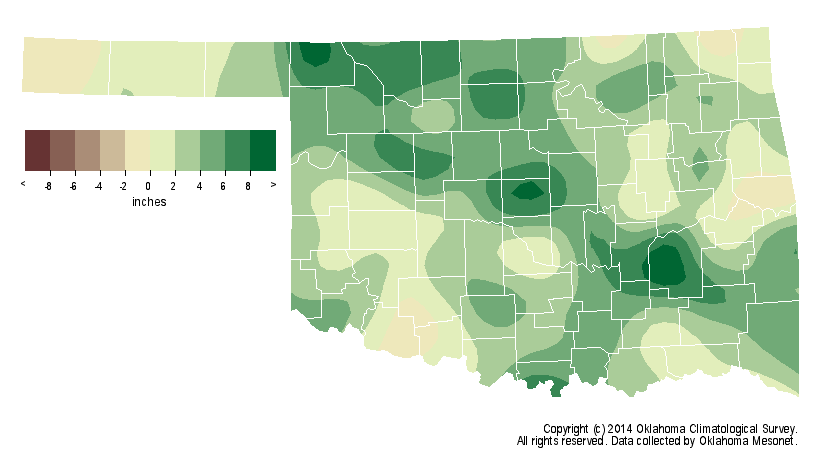
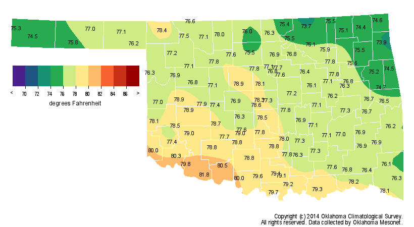
The statewide average temperature was 77.3 degrees, 4.3 degrees below normal
and the statewide average precipitation came in at 4.68 inches, 1.94 inches
above normal. Most Oklahomans will recall that just three years ago the state's
July 2011 statewide average of 89.2 degrees broke the record for the hottest
month ? of any calendar month ? ever recorded in any state. The coolest
Oklahoma July occurred in 1906 with a statewide average of 76.4 degrees. The
Mesonet site at Slapout recorded an October-like high of 62 degrees on July 17,
the 12th coolest high temperature ever recorded in Oklahoma during July. Vinita
reached a low temperature of 49 degrees on July 3, which is the normal low on
October 19 for that part of the state. The month's highest temperature of 107
degrees was recorded at three separate locations.
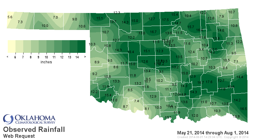
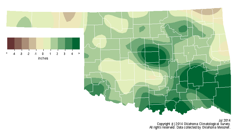
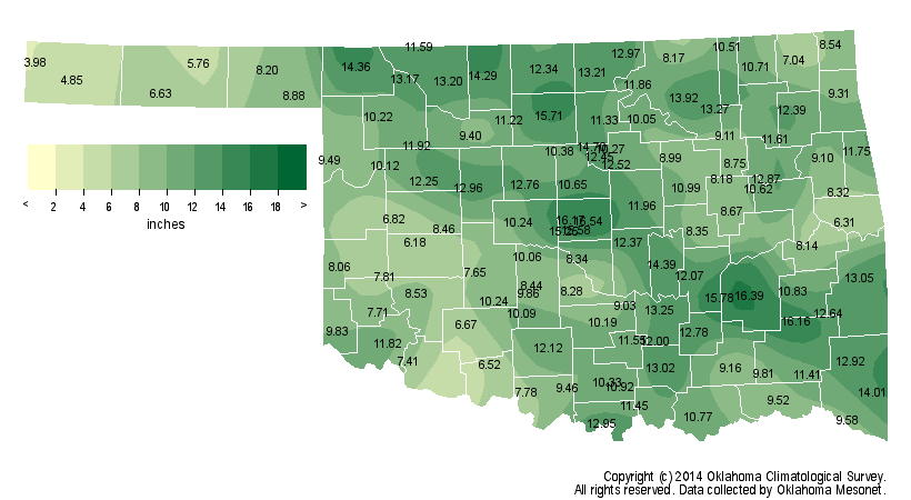
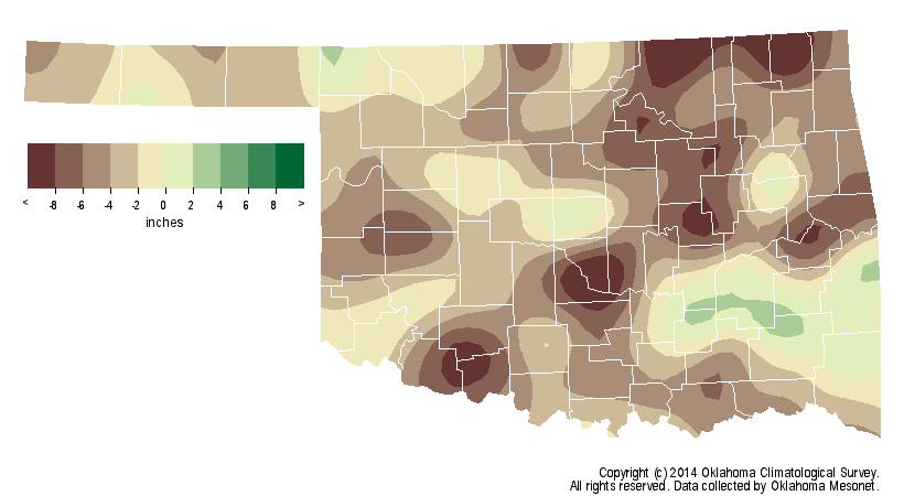
The abundant July moisture led to relief of both short- and long-term drought
impacts, and some of those July rainfall totals were quite impressive. The
Mesonet site at Clayton led the state with 11.3 inches. Three Oklahoma City
Mesonet stations recorded at least 9 inches of rainfall, although the official
observing site at Will Rogers Airport recorded only 4.18 inches. A total of 43
Mesonet sites recorded at least 5 inches of rain during July. Beaver brought up
the rear with only 1.6 inches, about an inch below normal. The final U.S.
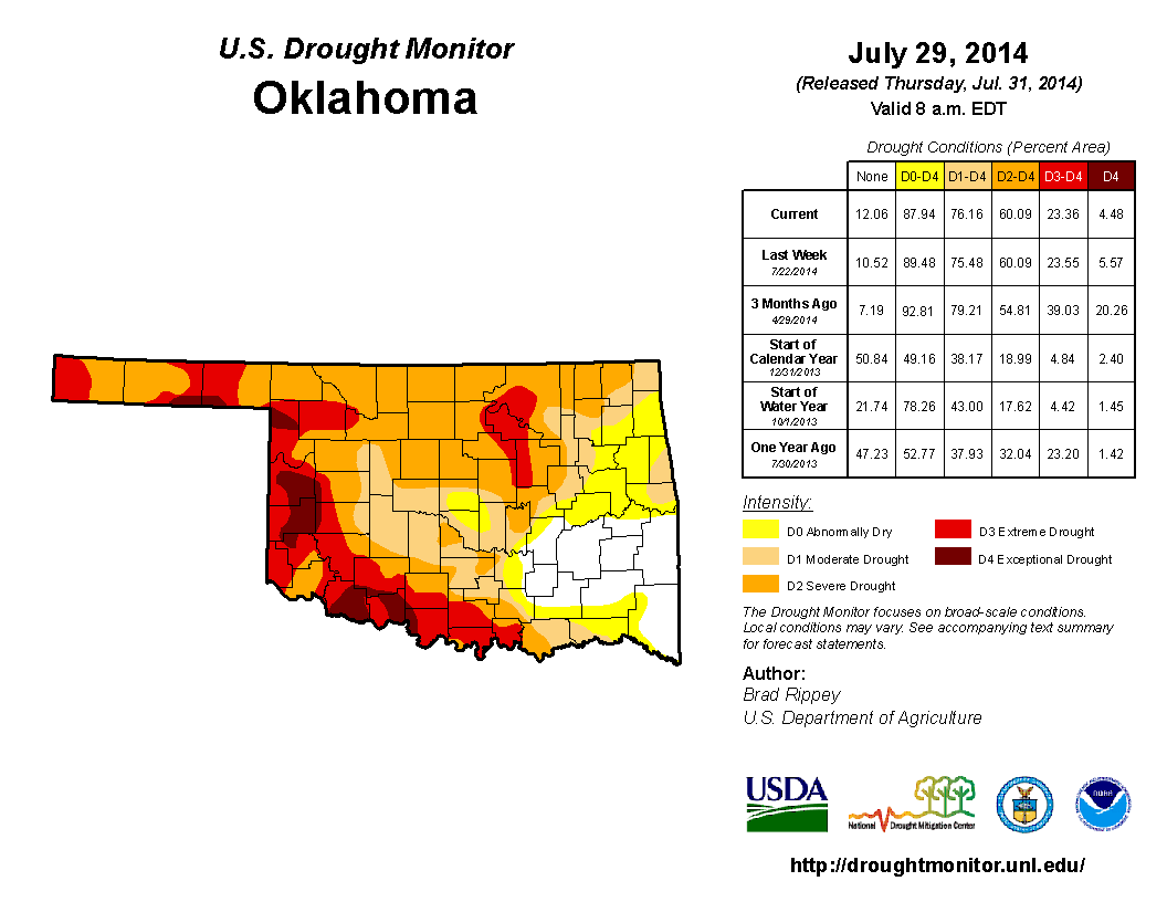
Drought Monitor map of the month portrayed 76 percent of the state in drought,
although only 23 percent was considered in extreme-to-exceptional drought, the
Monitor's worst two categories. Additionally, that final map did not consider
heavy rains that fell in July's final few days.
Severe weather was sporadic during July with various reports of wind or hail
damage and flash flooding. The most noteworthy event was the 106 mph wind gust
recorded by the Burneyville Mesonet site late in the evening of July 30. A
possible microburst was the culprit, and more than 3 inches of rain fell in
just a few hours following the 106 mph gust.
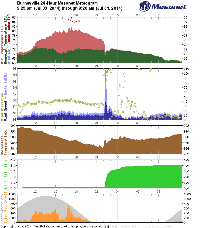

The reading tied a wind gust at Idabel on May 4, 2006, as the fourth highest
ever recorded since the Mesonet began in 1994. The top two gusts of 151 mph
and 131 mph were both associated with the May 24, 2011, EF5 tornado that
brushed the El Reno Mesonet site.
The Mesonet's 100 mph gusts:
May 24, 2011: 151 mph at El Reno
May 24, 2011: 131 mph at El Reno
August 17, 1994: 113 mph at Lahoma
July 30, 2014: 106 mph at Burneyville
May 4, 2006: 106 mph at Idabel
November 9, 1998: 102 mph at Bowlegs
Preliminary numbers from the National Weather Service show 13 tornadoes for
Oklahoma thus far in 2014. The 1950-2013 average for January-July is 48, and
the annual average is 56. Only 1988 saw fewer tornadoes through July with 10.
That year also ended with the lowest annual total of 17. The 2014 tornado
totals are subject to change with further investigation from NWS personnel.
According to the 6-10 day outlooks from the NWS' Climate Prediction Center
(CPC), another surge of cool air and moisture looked possible for early August.
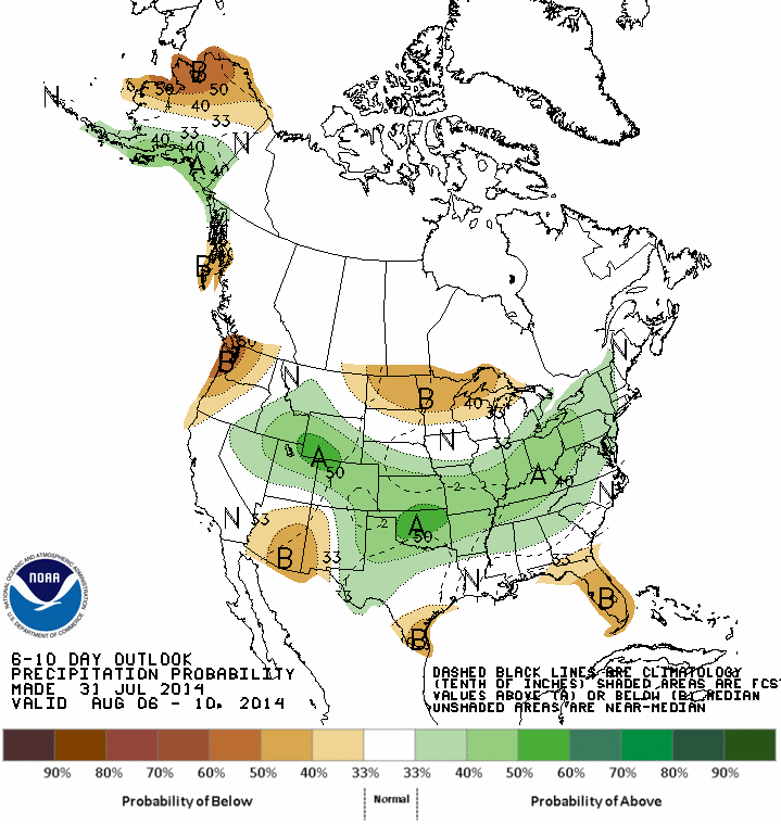
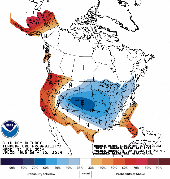
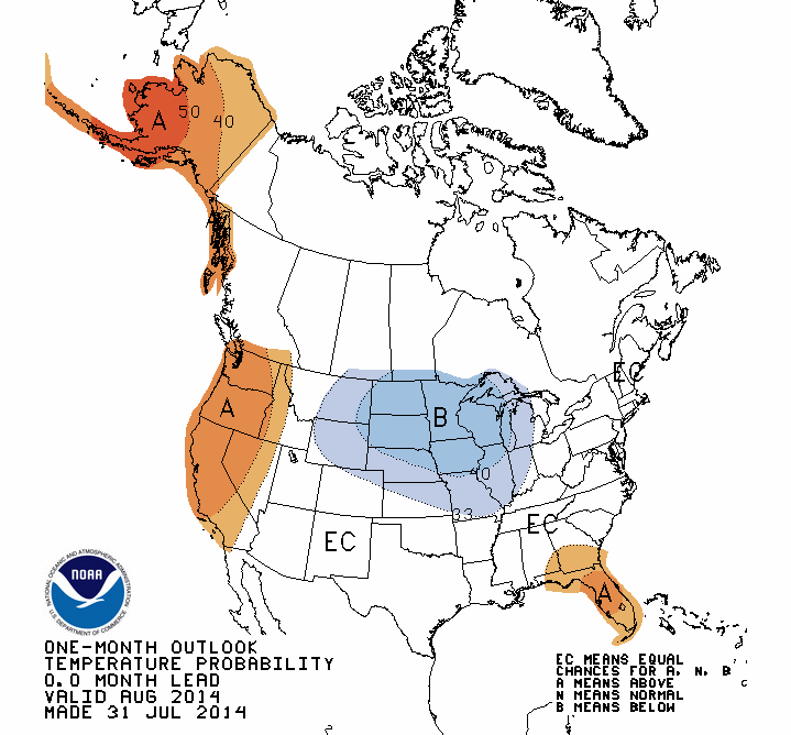
The CPC outlooks for the month of August saw increased odds of above normal
precipitation across Oklahoma, but equal chances of above-, below- and near-
normal temperatures.
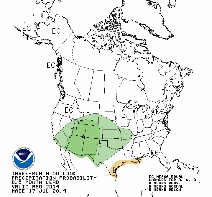
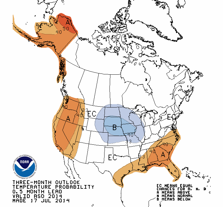
The August-October outlooks indicated similar forecasts.
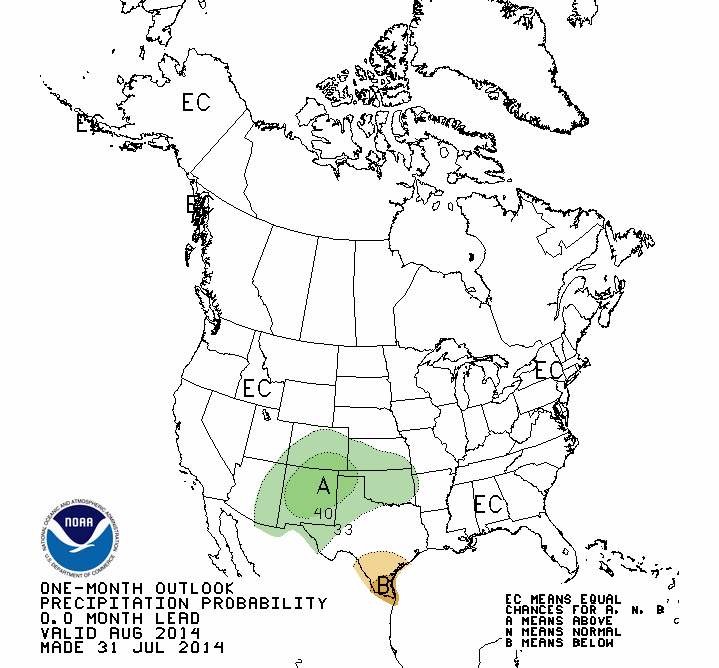
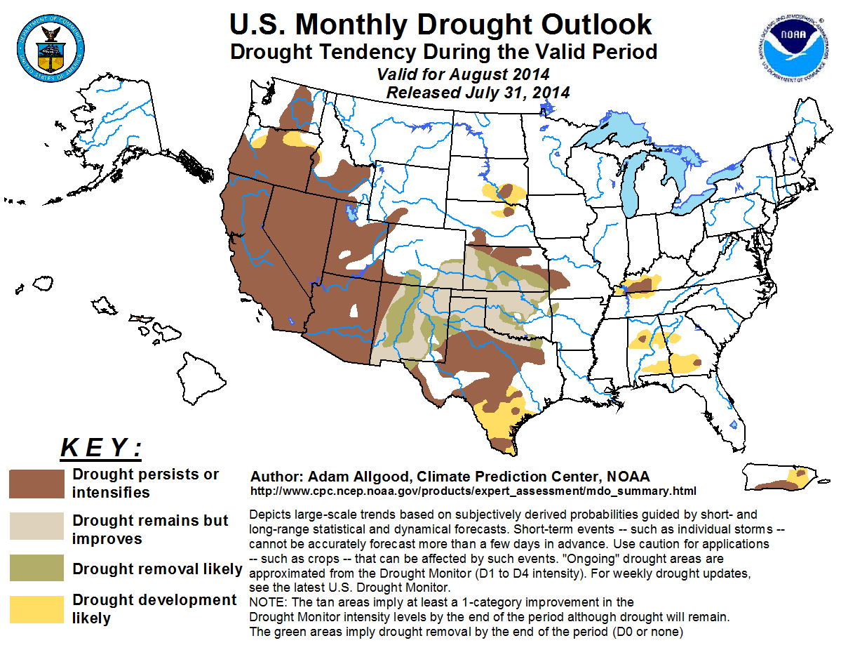
The U.S. Monthly Drought Outlook saw drought improvement or removal across all
of Oklahoma by the end of August.
Gary McManus
State Climatologist
Oklahoma Mesonet
Oklahoma Climatological Survey
(405) 823-9054
gmcmanus@mesonet.org
August 1 in Mesonet History
| Record | Value | Station | Year |
|---|---|---|---|
| Maximum Temperature | 115°F | KIN2 | 2012 |
| Minimum Temperature | 53°F | KENT | 2018 |
| Maximum Rainfall | 5.04 inches | NOWA | 1995 |
Mesonet records begin in 1994.
Search by Date
If you're a bit off, don't worry, because just like horseshoes, “almost” counts on the Ticker website!