Ticker for July 15, 2014
MESONET TICKER ... MESONET TICKER ... MESONET TICKER ... MESONET TICKER ...
July 15, 2014 July 15, 2014 July 15, 2014 July 15, 2014
Jultober?
Have you been outside this morning? BRRR! Where's my puffy coat? Hey, it's
Gore-Tex! Okay, maybe not QUITE that cold, but we've already seen temperatures
drop into the 50s behind last night's cold front that brought a few scattered
strong storms through the state. Maybe a possible tornado in Adair last night?
Lots of wind damage in some places, at least. The entire town of Newkirk was
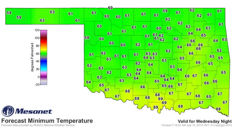
without power after a storm up that way. Still, my eyes are drawn to that low
temperature map. And keep in mind this map could change if somebody gets lower
than what you see there by midnight tonight. Then take a look at the record lows
for July 15th.
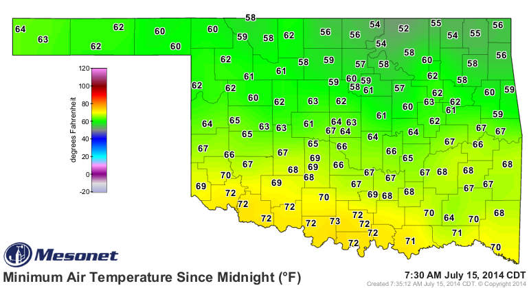
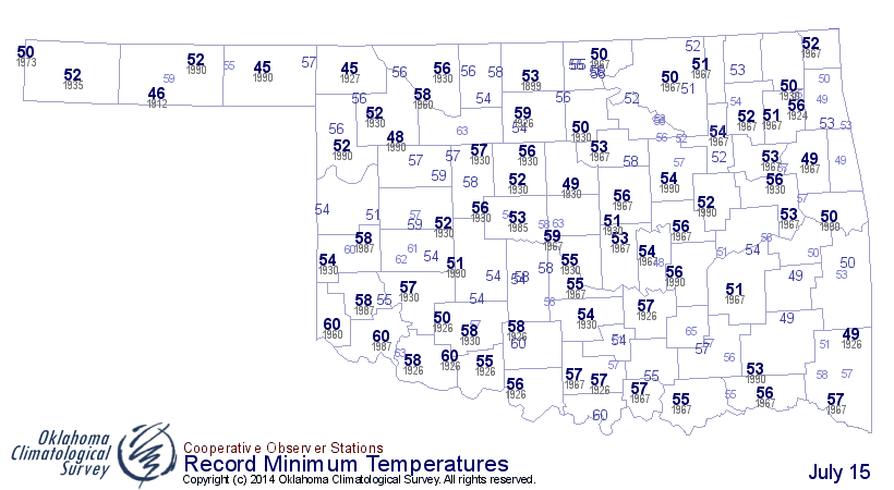
So very close to some record lows across N OK. The Mesonet's lowest recorded
temperature was 52 degrees at Foraker, although 50s were prevalent throughout
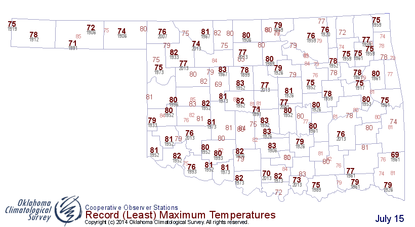
NC and NE OK. Now we turn our attention towards today's record LOW maximum
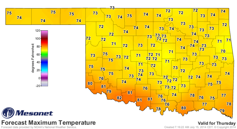
temperatures. The record low maximum temperatures for today are generally in
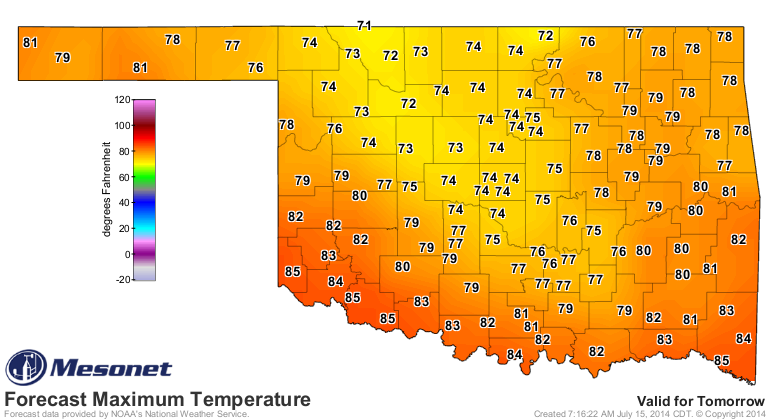
the upper 70s and low 80s, and the forecast we're seeing from the NWS shows
highs in that ballpark for the northern half of the state.

And that's not even the coolest weather for the next couple of days! Check out
these next few forecast maps. Surely some records will fall (or Autumn, since
that's what it feels like).
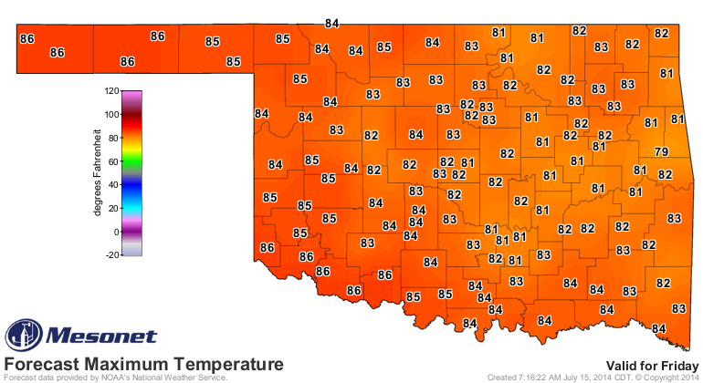
You can see summer starting to make a comeback there on Friday, and indeed, we
could see upper 90s by early next week again. But highs in the low 70s in the
middle of July? Not only is that October weather, it's mid-late'ish October
weather!
Jultober!!
Luckily, the lows aren't forecast to go into late October territory just yet.
I'll take the low-mid 60s over late October's 40s any day.
Here's the weather setup once again in pictures from the NWS offices that cover
the state.
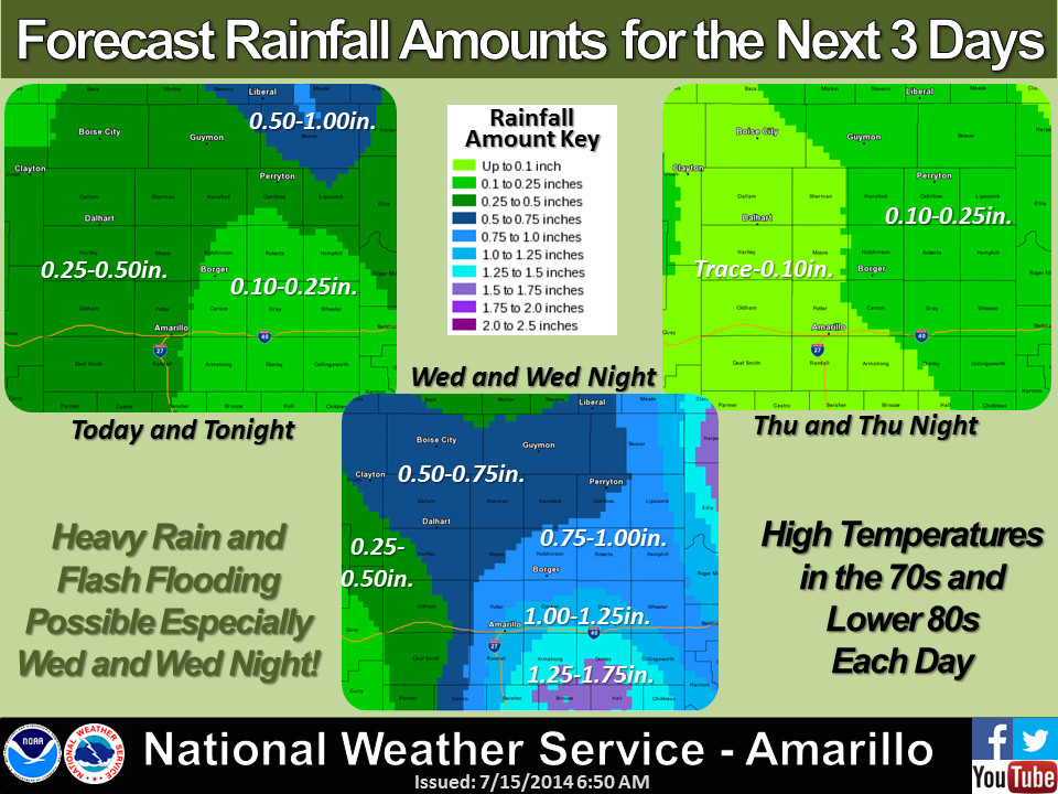

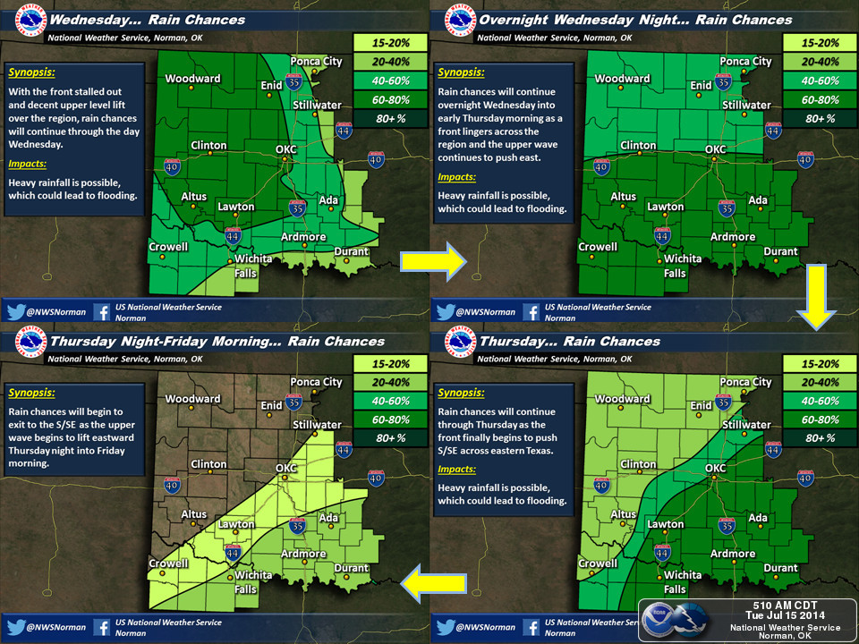
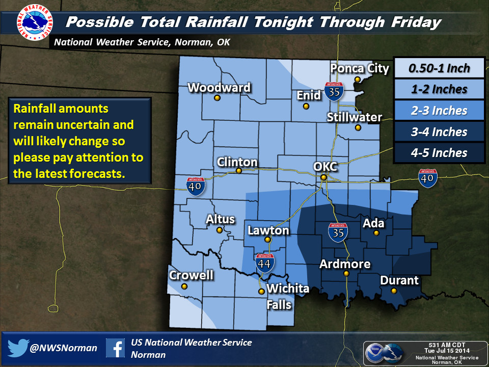
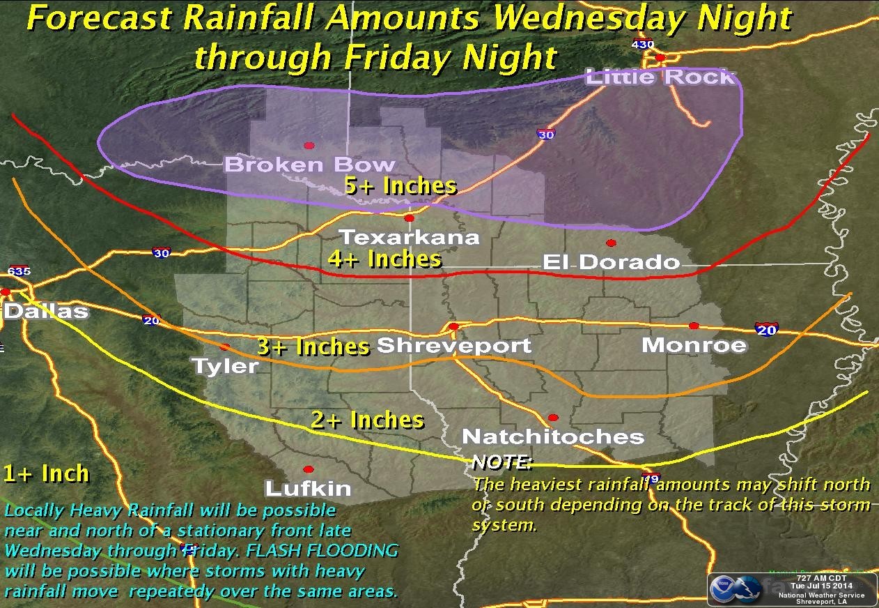
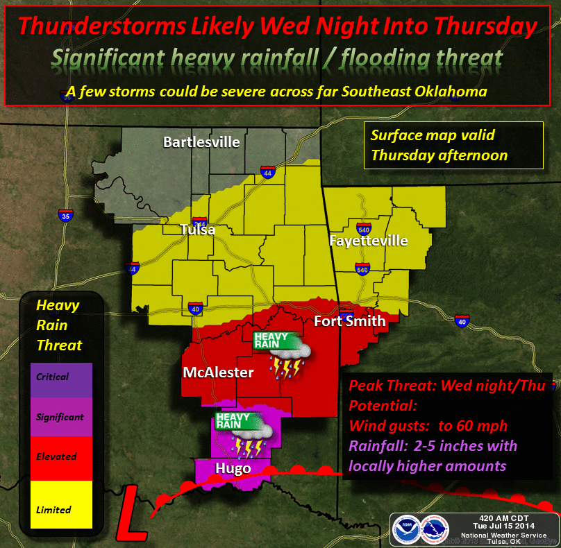
As mentioned in a couple of the graphics, the rainfall amounts over the next few
days are uncertain. It's summer, and there is a front about that is likely to
meander a bit, and then there will be all sorts of weird outflow boundaries
where storms could go up. Here is the rainfall forecast map, regardless.

So there you have it. Go get the firewood and the chili fixin's because it's
going to be a rough couple of days. Just have all the wood burned and chili
eaten by Friday or you're gonna have lots of leftovers.
How much you wanna bet it never feels like July this coming October? What a
ripoff! I'd welcome some Octoberly.
Gary McManus
State Climatologist
OCS/Oklahoma Mesonet
(405) 325-2253
gmcmanus@mesonet.org
July 15 in Mesonet History
| Record | Value | Station | Year |
|---|---|---|---|
| Maximum Temperature | 111°F | FREE | 2011 |
| Minimum Temperature | 52°F | FORA | 2014 |
| Maximum Rainfall | 3.28 inches | KENT | 2017 |
Mesonet records begin in 1994.
Search by Date
If you're a bit off, don't worry, because just like horseshoes, “almost” counts on the Ticker website!