Ticker for July 14, 2014
MESONET TICKER ... MESONET TICKER ... MESONET TICKER ... MESONET TICKER ...
July 14, 2014 July 14, 2014 July 14, 2014 July 14, 2014
Summer Interruptus
Yes, boys and girls, long before Christian Bale's gravelly voice graced the big
screen as Batman, Michael Keaton owned the role. And yes, boys and girls, there
was once an actor named "Michael Keaton" ("Beetlejuice"...maybe you've seen it
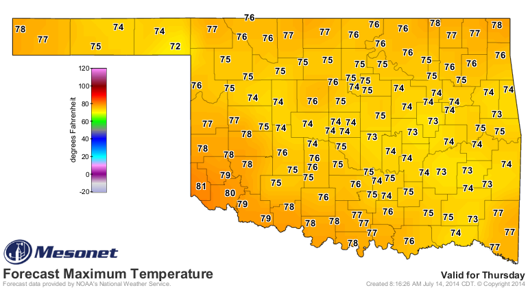
on the Oldies channel??). But nuts is the word (as opposed to "bird", speaking of
oldies) when you see a forecast high temperature map like this, WITH HIGH
TEMPERATURES ONLY RISING INTO THE NORMAL LOW TEMPERATURE TERRITORY!
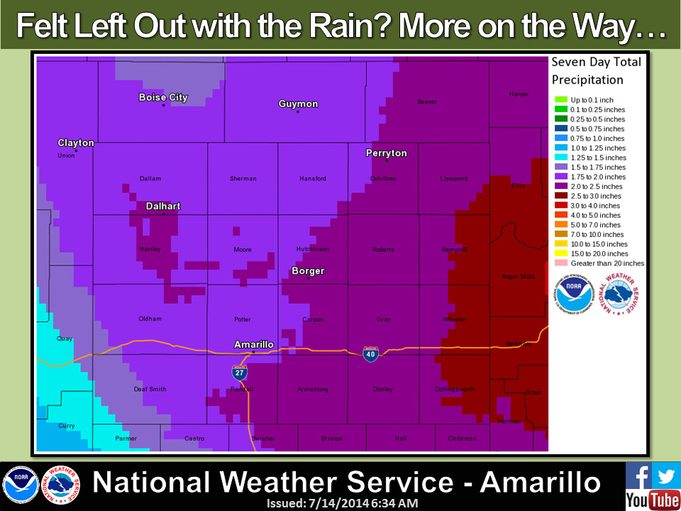
Are you kidding me? and the rain? Oh yeah, we're going to see enough rain to
strangle frogs, horny toads AND turtles.
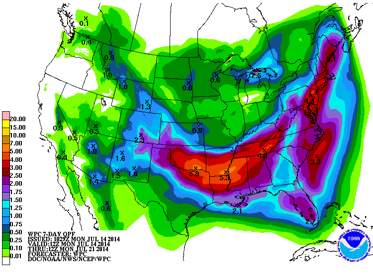
As usual, take that rainfall forecast with a grain of salt. Not every point on
that map will see the total generated for it. Some will see more, some will see
less, but the general pattern is for LOTS of rain. And we all know the more it
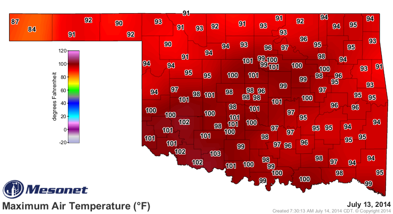
rains in the summer, the more mild that summer becomes. And it has been hot
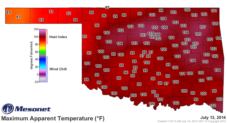
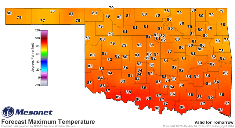
lately, as the Mesonet temperature maps indicate. The heat index rose as high
as 107 degrees up at Lake Carl Blackwell and Marshall.
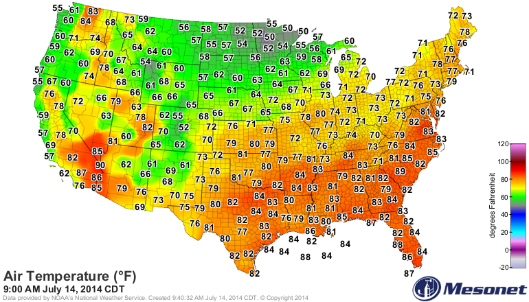
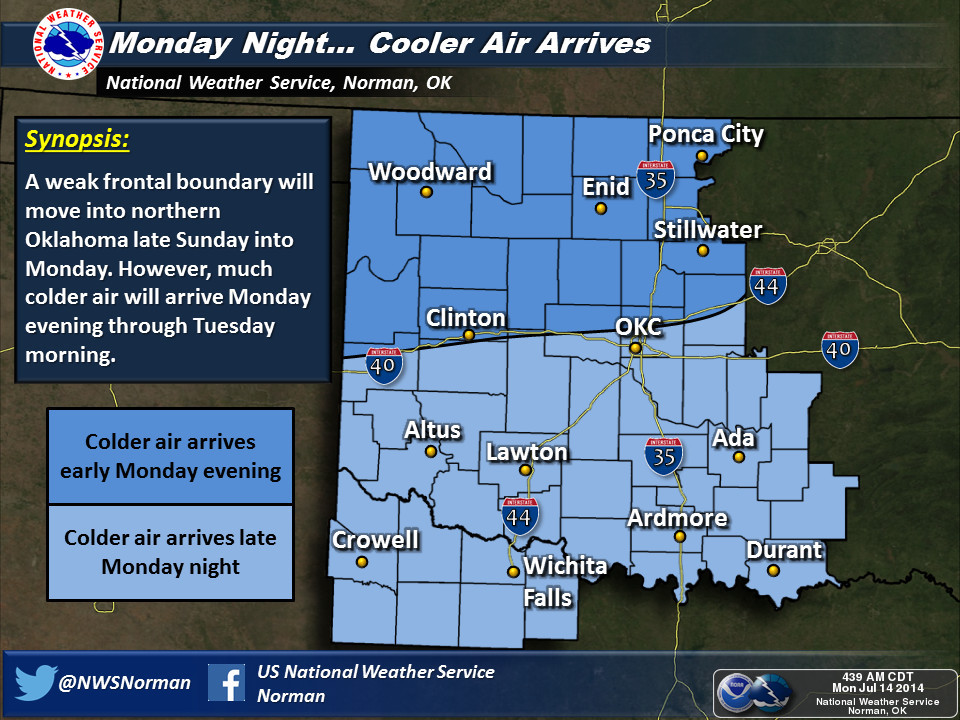
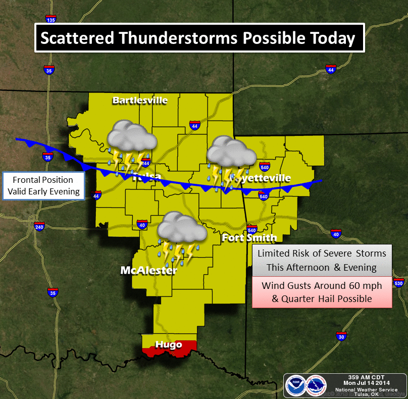
But for now, the cold front cometh, previewed by the U.S. temperature map as
well as the latest surface weather analysis. The front is indicated on that
map as the blue line with the southward-facing barbs. Hey, you're Okies, you
know all this!
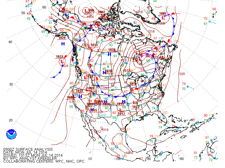
That analysis was from a few hours ago, so that front (and its Autumnal air)
is even closer. There will be a good cool down after that passes through with
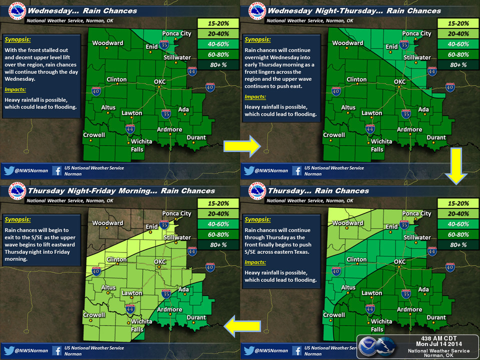
a chance of rain to boot, then sorta dry for a day or two then another storm
system will pass over Oklahoma and that stalled front and possibly generate
lakefulls of rain somewhere.
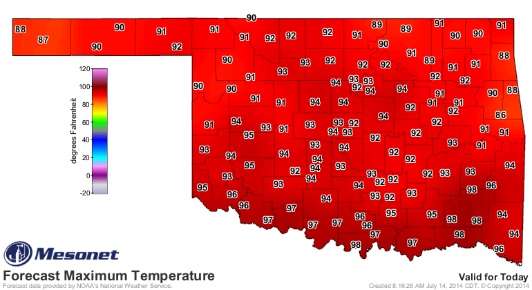
Here are the high temperature forecast maps from the NWS for the next several
days. Read 'em slow and enjoy. We still have a hot one today for most, but
as that front moves through, relief will ensue.


Here's the actual weather setup, in graphics, from our friends at the NWS.
So remain calm, enjoy the rain, turn around...don't drown, and by all means,
make that pot of chili while you still have the chance. Summer will surely
return in a steamy fashion before too long.
Gary McManus
State Climatologist
Oklahoma Mesonet
Oklahoma Climatological Survey
(405) 325-2253
gmcmanus@mesonet.org
July 14 in Mesonet History
| Record | Value | Station | Year |
|---|---|---|---|
| Maximum Temperature | 113°F | HOLL | 2020 |
| Minimum Temperature | 54°F | EVAX | 2019 |
| Maximum Rainfall | 5.94 inches | ANT2 | 2025 |
Mesonet records begin in 1994.
Search by Date
If you're a bit off, don't worry, because just like horseshoes, “almost” counts on the Ticker website!