Ticker for July 16, 2014
MESONET TICKER ... MESONET TICKER ... MESONET TICKER ... MESONET TICKER ...
July 16, 2014 July 16, 2014 July 16, 2014 July 16, 2014
Here comes the rain!
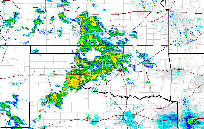
The first of a lot of it, at least. A first wave, if you will, although there have
already been fits and starts of rain over the last couple of days following our
friend, the July cold front. Here's what we have for totals thus far through that
period.
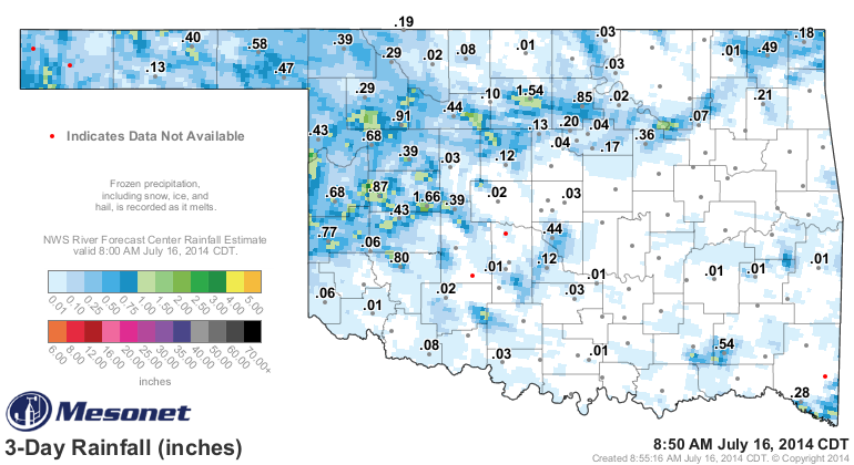
Sort of looks like rainfall acne, which in case means Breckinridge has the biggest
whitehead. Soon to be popped by some even larger moisture infections over the
next few days (gee, I hope you're not eating whilst you read this!).
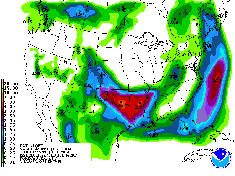
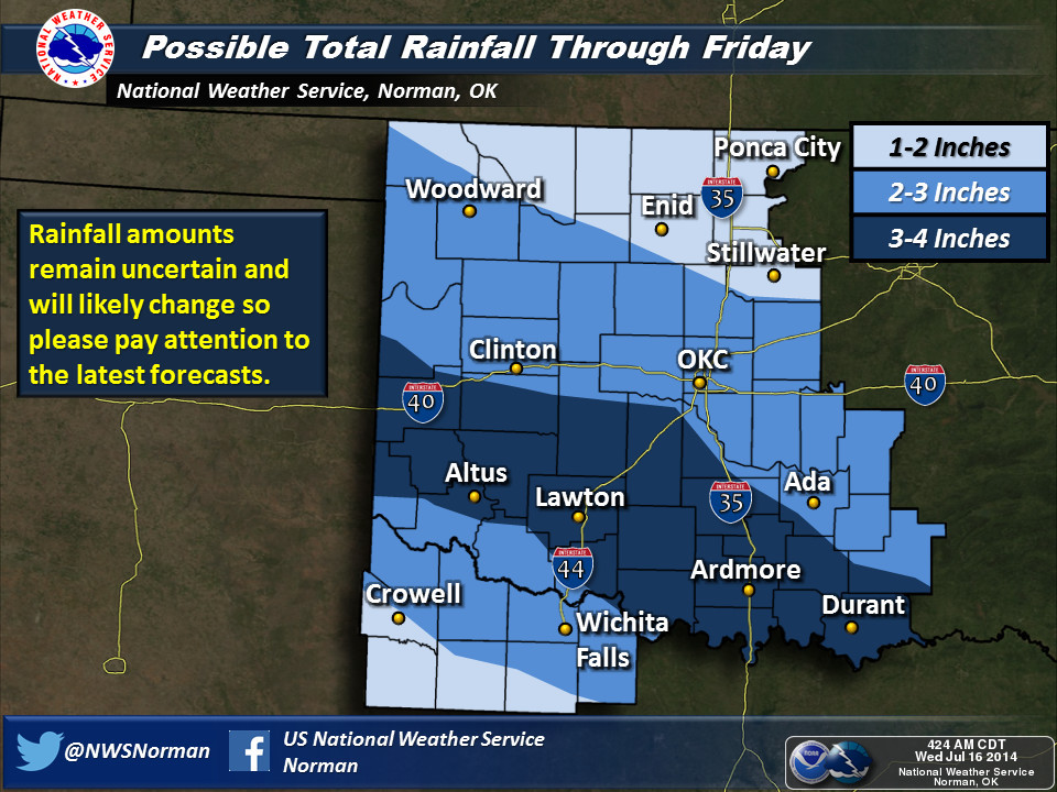
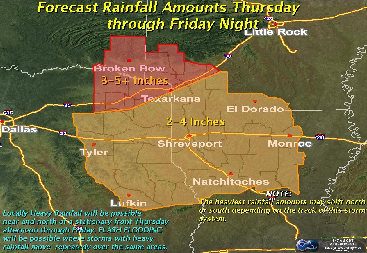
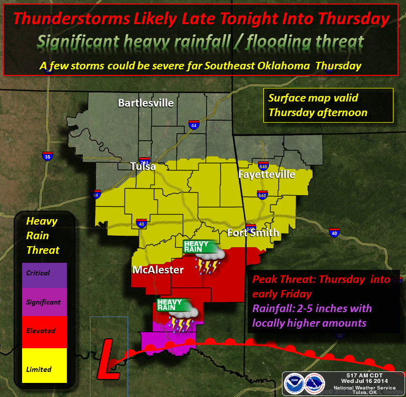
I hate to quote Shaggy here (you Daphne followers can insert "jeepers!", but
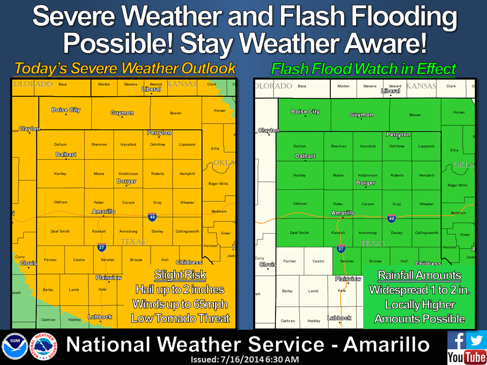
"zoinks!" That's a lot of rainfall for July. There will surely be flash flooding
if that type of rain falls, and that's exactly why much of the SW half of the
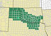
state is in a flash flood watch from the NWS. Even the Panhandle, for crying out
loud! Check out the dark green counties.
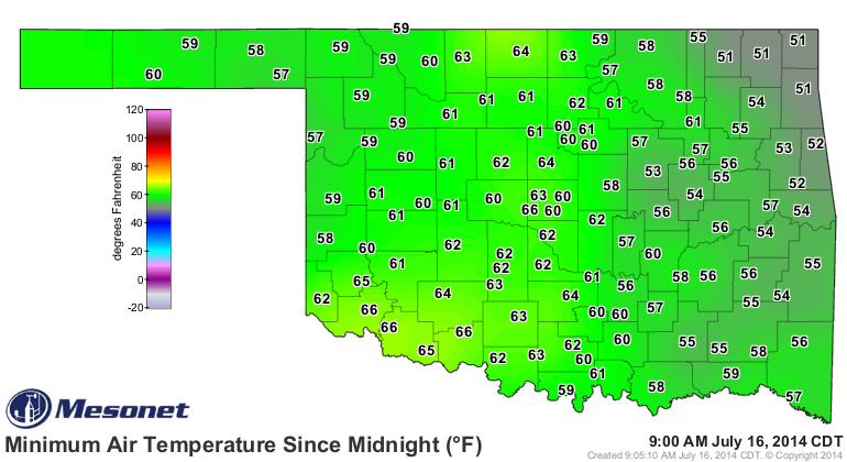
The temperatures plummeted this morning as promised, and surely some records
were broken up in the extreme eastern OK where temperatures dropped as low as
51 degrees.
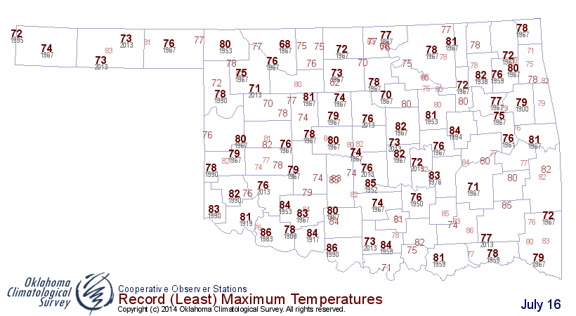
And we'll probably see plenty of record low maximum temperatures set today as
the cool air combined with the rain and clouds keep the thermometer down in
the 70s.

Tomorrow is going to be the coolest day of all, it appears.
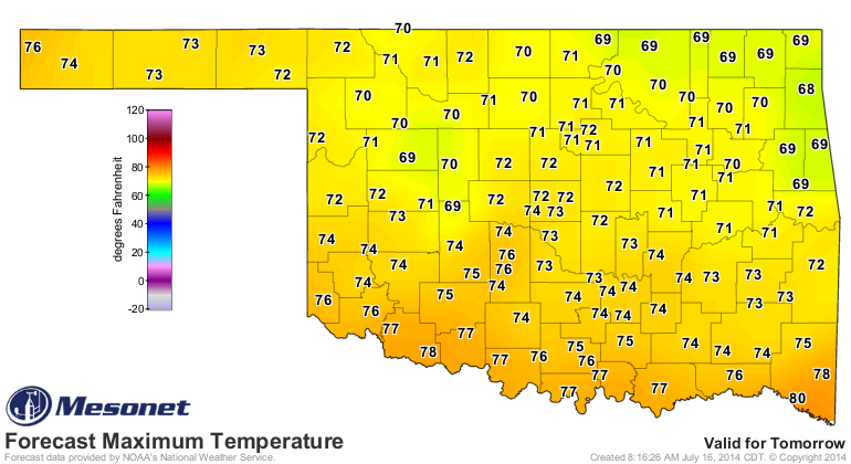
I sure wouldn't be shocked if we see some 60s for highs if the rain sticks
around in some places. But there are 60s forecast for the extreme NE, so it's
in the realm of possibilities.
Once again, we leave you with guidance from our local NWS offices. Keep tuned
to those folks and your favorite broadcast weather folks to be advised of any
flash flooding, river flooding, or even severe weather impacts.

This little break in summer is great, but when it returns ... it's gonna be
soupy around here! And clear to partly mosquito.
Gary McManus
State Climatologist
OCS/Oklahoma Mesonet
(405) 325-2253
gmcmanus@mesonet.org
July 16 in Mesonet History
| Record | Value | Station | Year |
|---|---|---|---|
| Maximum Temperature | 109°F | HOLL | 2001 |
| Minimum Temperature | 51°F | JAYX | 2014 |
| Maximum Rainfall | 3.82 inches | ALTU | 2014 |
Mesonet records begin in 1994.
Search by Date
If you're a bit off, don't worry, because just like horseshoes, “almost” counts on the Ticker website!