Ticker for July 10, 2014
MESONET TICKER ... MESONET TICKER ... MESONET TICKER ... MESONET TICKER ...
July 10, 2014 July 10, 2014 July 10, 2014 July 10, 2014
Drought status? Quo.
I'm not sure if that title actually works out gramatically, and I know that's not
how you spell grammatically, too. But we're not here to write good, we're here
to talk drought. And pump...you up!
Sorry, Saturday Night Live flashback there.
While there were some decent rains last week that could have lessened some drought
impacts, they were pretty hit and miss through the Tuesday morning deadline, so
we decided to go status quo on this week's U.S. Drought Monitor map.
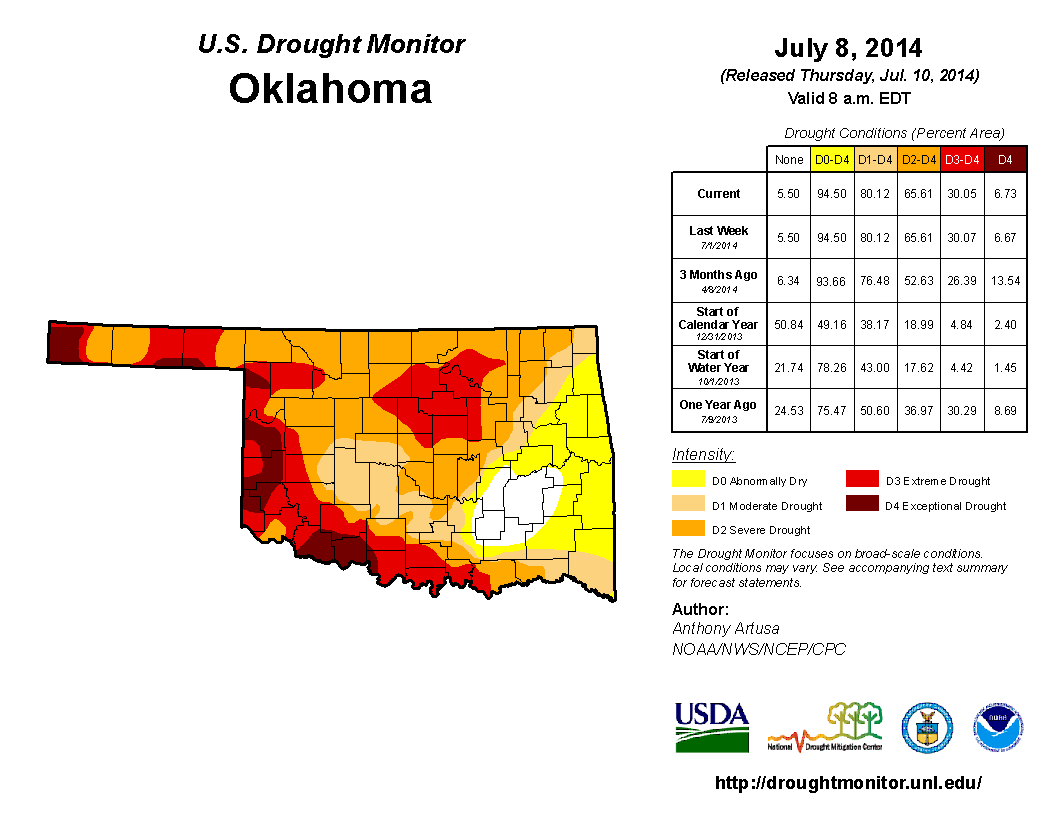
We're still at 80% of the state in some form of drought (D1-D4), and 66% in at
least severe drought. But we have had more substantial rains since the cutoff
point, which could at last point to more improvements on next weeks map.
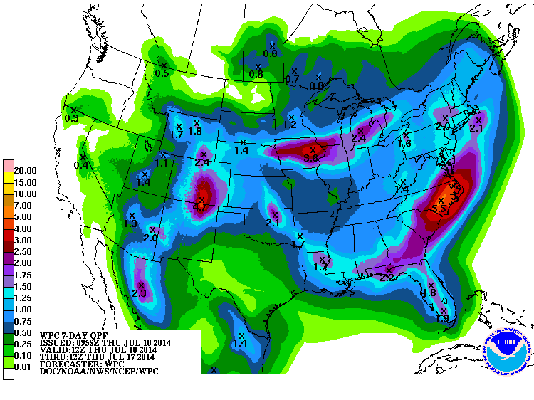
Here's the rain we've seen over the last couple of days, and then over the 10-day
period.
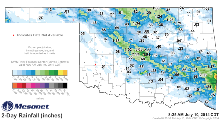
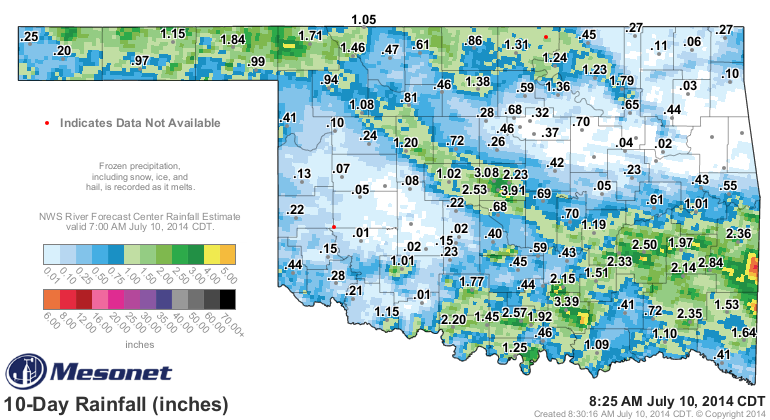
Central Oklahoma (Oklahoma county in particular) received 2-4 inches, and far
SE OK saw amounts up to and above 5 inches in some areas. So lot of rain over
the last 10 days, enough to make up some ground eventually. More importantly,
we're keeping the rainy spell going through the summer, at least for some
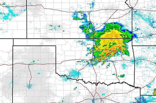
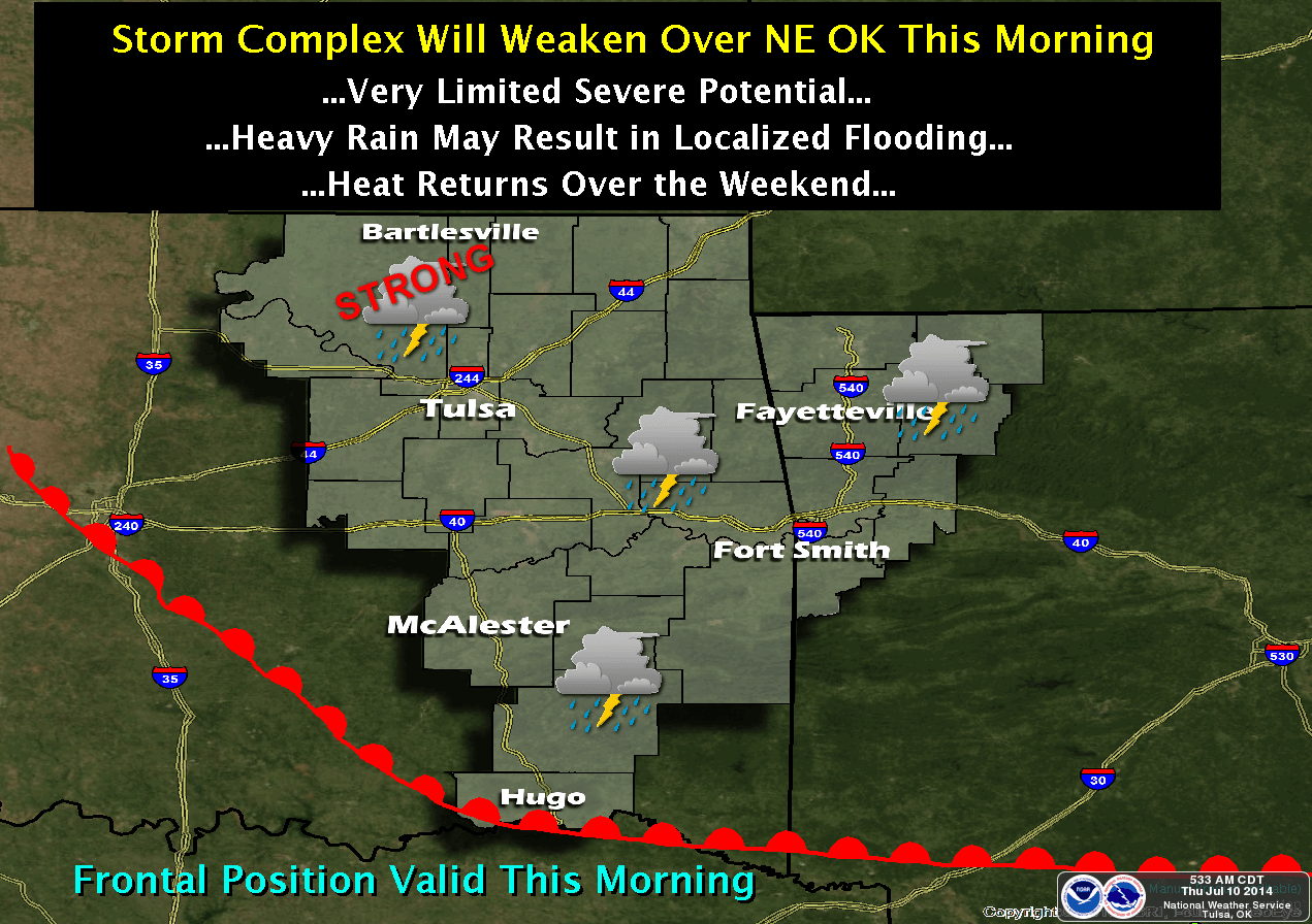
parts of the state. And the good news? It's still raining! We've had another
of those large complex of storms enter the NE third of the state overnight and
it continues to march to the south even as it spreads to the west.
You can see a loop of the radar for the entire U.S. at this link.
http://radar.weather.gov/Conus/full_loop.php
We still point back to that May 21 jumping-off point for the spring rains this
year, even though now they have bled over into summer. And these summer systems
are important. They keep us a bit milder than what we'd normally see, they keep
us green so the fire danger stays diminished, and they prevent escalation of
drought due to the normal summer evaporation spike.
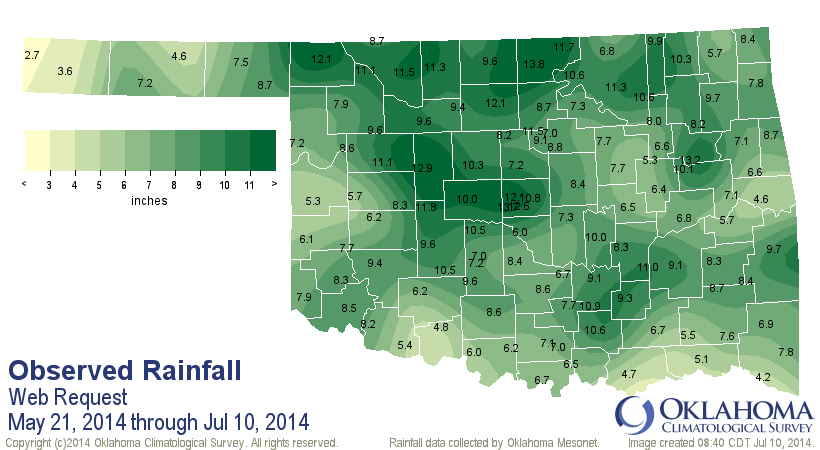
All the blues and greens on there are fantastic, beginning with Buffalo's 12.1
inches. The rest is, as they say, gravy. A very thin, watery gravy, but we'll
take it. But you can also get a glimpse of the harder-hit areas of the state
that we have pegged for drought intensification if they fail to see substantial
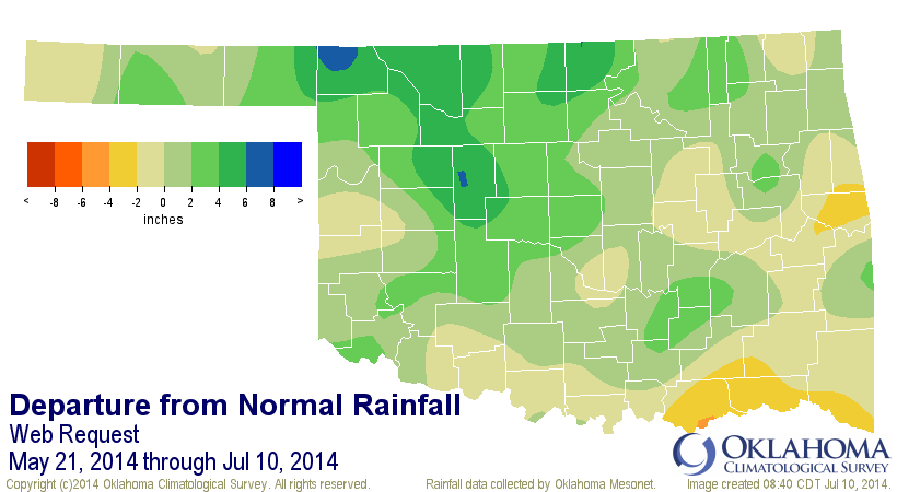
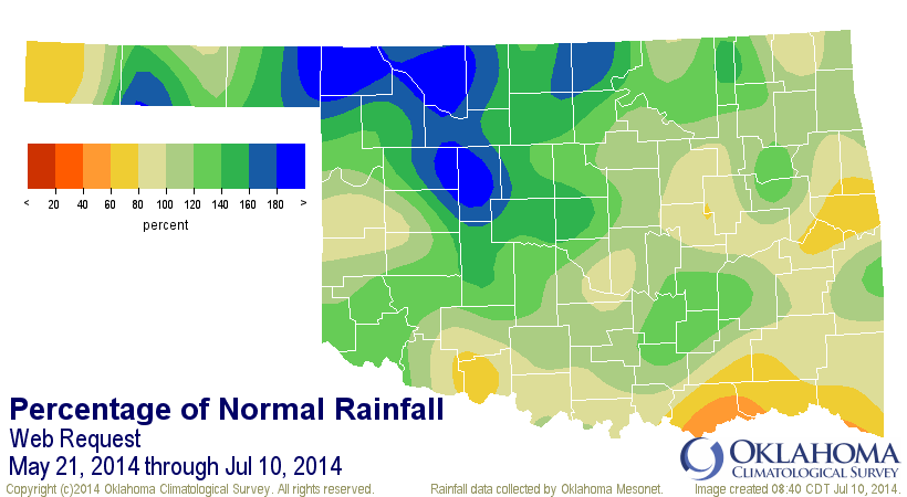
rains. The far western Panhandle and parts of southern Oklahoma are still from
40-80% below normal since that May 21 date.
Overall, the state has seen an average of 8.26" of rain since May 21 (through
about 8:30am this morning), 1.41" above normal and the 22nd wettest May 21-
July 10 since at least 1921. For NC Oklahoma, they've seen their 7th wettest
with 10.39", 3.94" above normal. Now we just need to see those rains start
heading a bit farther south. That's where we hope to get help from today's
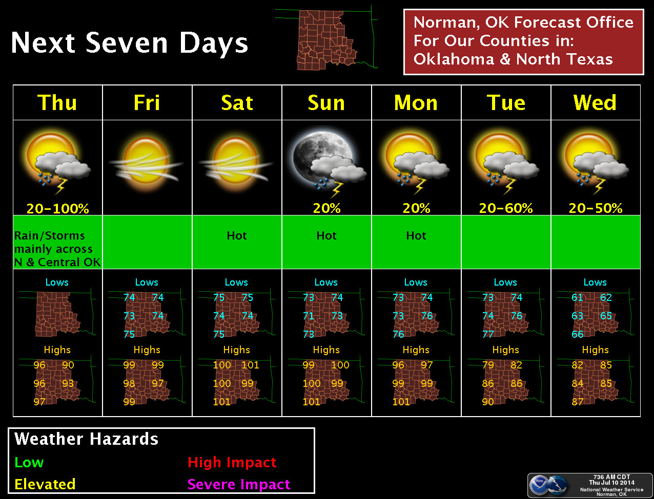
storm complex, if it can hold together that long. Then, we see more rain chances
(and a substantial cool down) for early next week with a pretty decent July
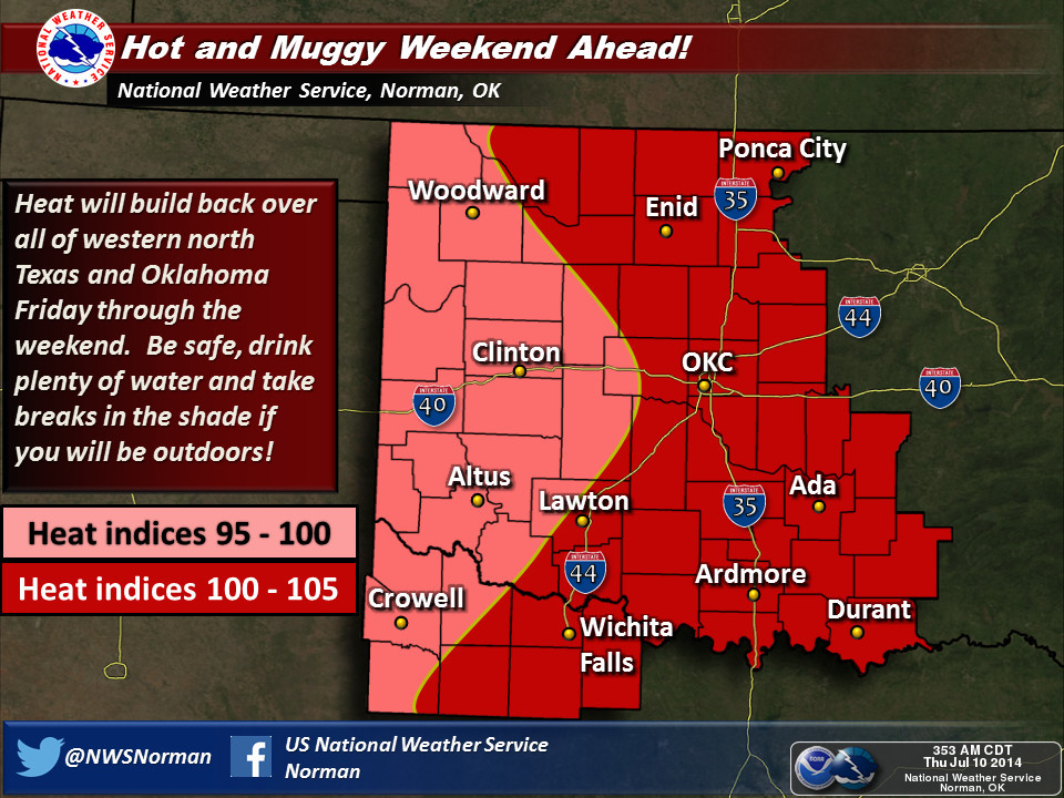
cool front. Until then, I'm afraid we're in for some July heat, with Sunday
being the hottest of the coming days (nut not much worse than Friday and
Saturday).
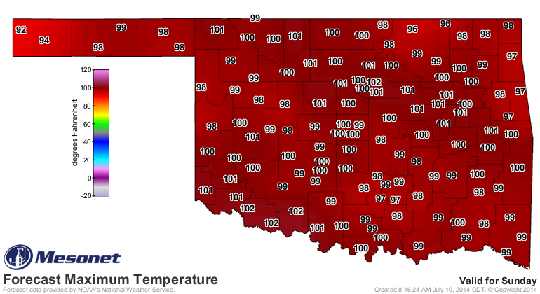
How do highs in the 80s sound for next week?
My grammar just got a whole lot gooder, didn't it. Yeah, I thought so!
Gary McManus
State Climatologist
Oklahoma Mesonet
Oklahoma Climatological Survey
(405) 325-2253
gmcmanus@mesonet.org
July 10 in Mesonet History
| Record | Value | Station | Year |
|---|---|---|---|
| Maximum Temperature | 114°F | FREE | 2009 |
| Minimum Temperature | 55°F | EVAX | 2024 |
| Maximum Rainfall | 4.44 inches | MINC | 1996 |
Mesonet records begin in 1994.
Search by Date
If you're a bit off, don't worry, because just like horseshoes, “almost” counts on the Ticker website!