Ticker for July 9, 2014
MESONET TICKER ... MESONET TICKER ... MESONET TICKER ... MESONET TICKER ...
July 9, 2014 July 9, 2014 July 9, 2014 July 9, 2014
It rained here. Not here or here so much, but right here

Come on, with my love of horrible movies, you knew a "Tommy Boy" quote was coming
sooner or later. But when I saw the rainfall map this morning, it had to happen.
We knew that front would generate some type of rainfall for the state, but the
thought that a narrow band would be the only benefactors was lost on us. Hence,
the thought that it "rained here ... not here or here so much, but right here."
And some of those areas have really gotten some good downpours.

There's a good inch or so from Major County all the way down through LeFlore and
McCurtain counties. Oklahoma County and the surrounding are got drenched with 2-4
inches thanks to some training thunderstorms. It is still raining, as you can
see from the radar, but unfortunately it doesn't seem to be shifting to the north
or south so much.

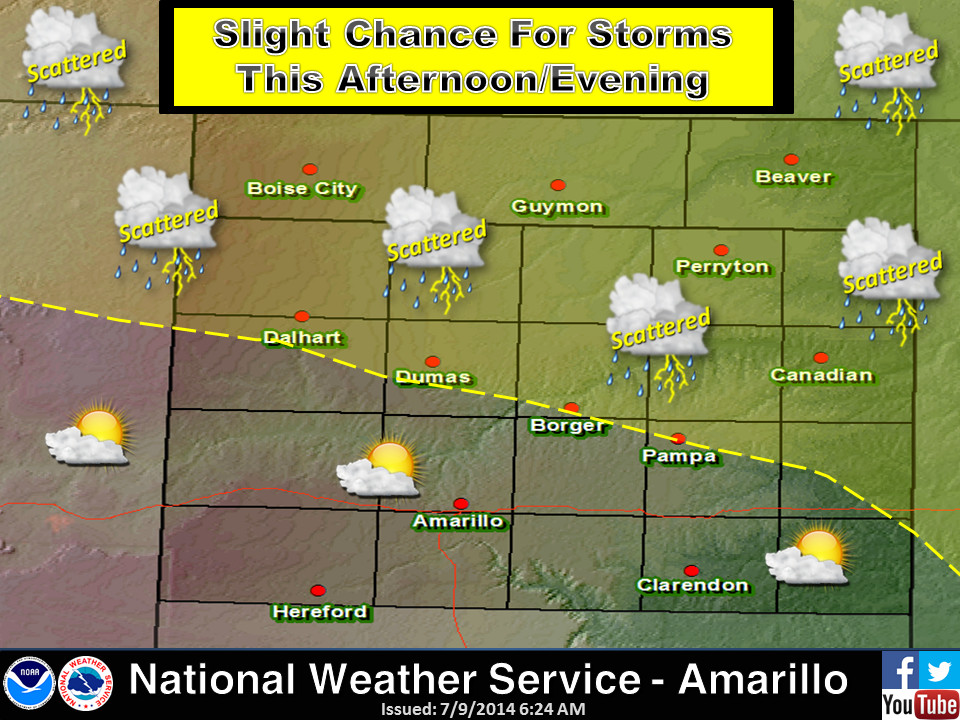
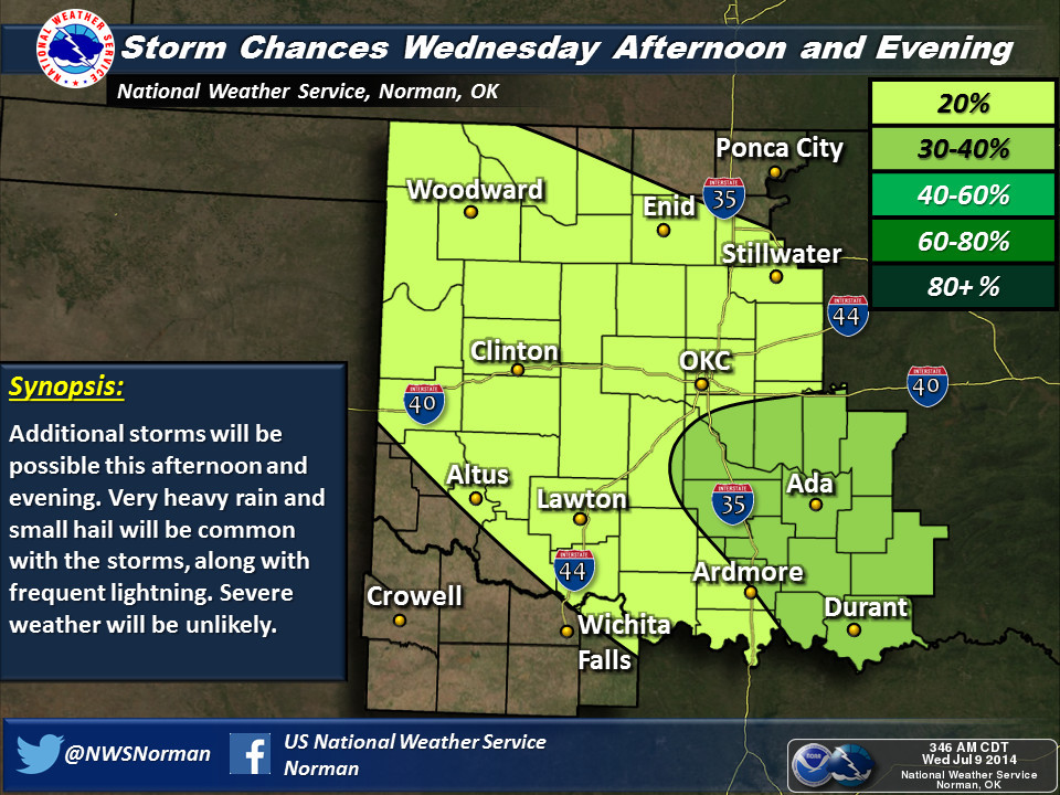
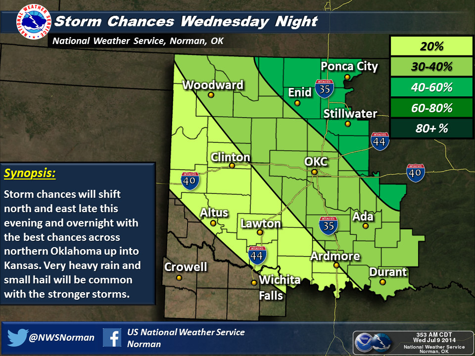
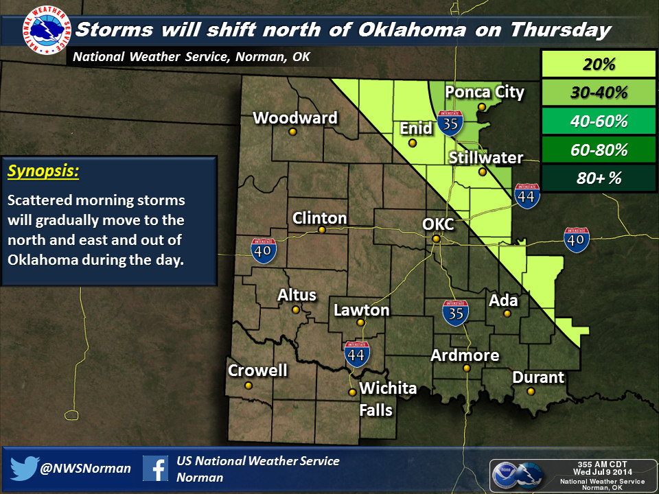
So as our friends in the NWS show us, don't expect much to the north and south
of that line this morning, at least until later today and tonight, when that
front down by the Red River starts to shift farther to the north. Additional
heating might allow for some showers farther west as well. Here's the NWS
take on the rainfall situation today and tomorrow.


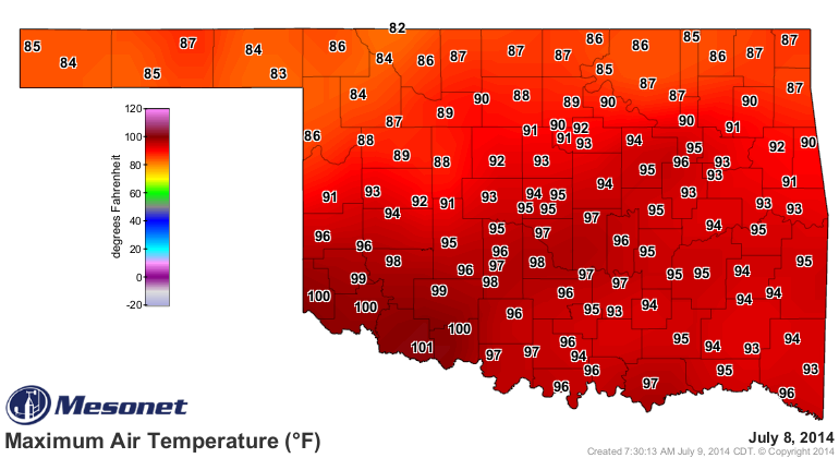
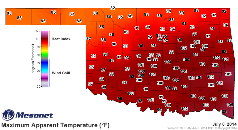
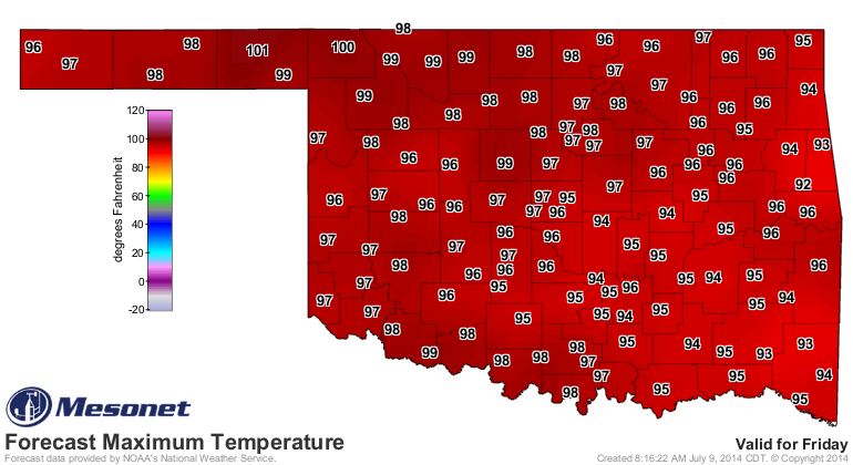
It was a hot day for most of the SE half of the state with mostly 90s and
some 100s, and the heat indices were even higher. The lucky folks across the
NW had great weather in the 80s.
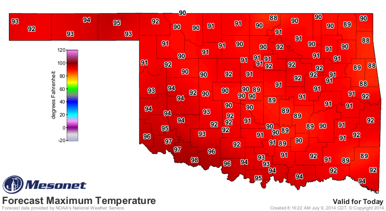
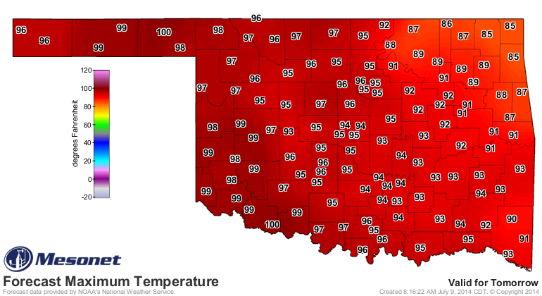
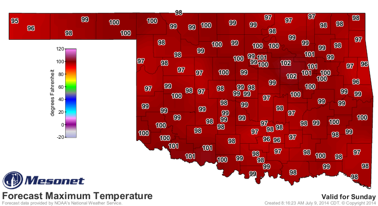
It's going to be a "little bit" hot today, but once this system moves on out
later today, we're back in the frying pan, I'm afraid. This weekend will be
one of those typical July-style Oklahoma scorchers!

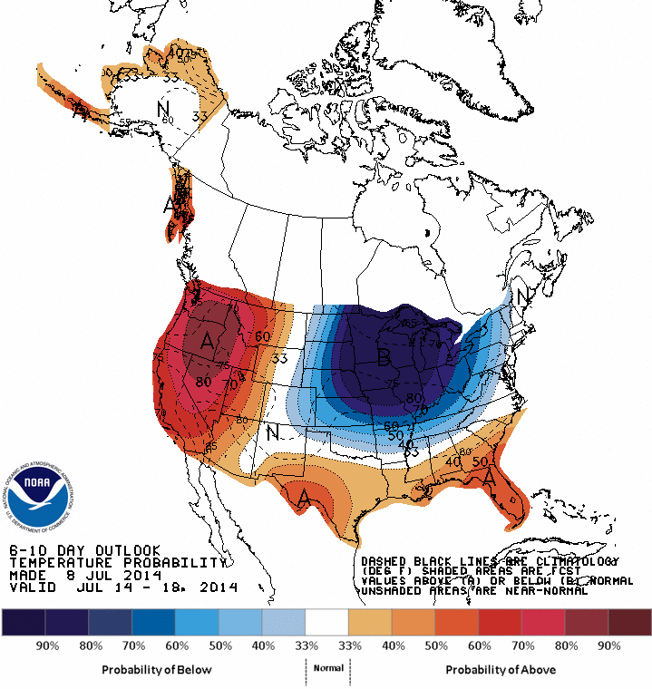
There is a hint that early next week, we could see a more substantial cold
front in here, at least for summer, and get some increased rain chances again.
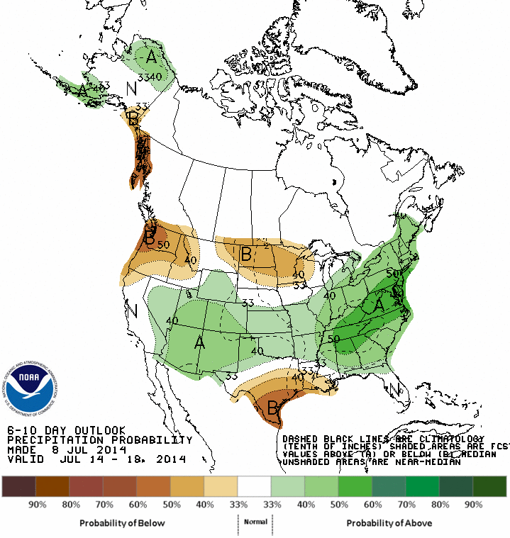
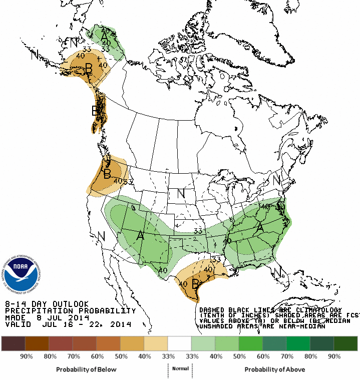
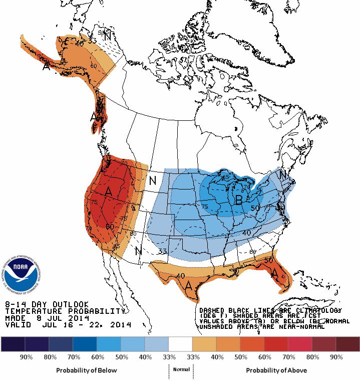
Check out the 6-10 and 8-14 day temp and precip outlooks from CPC with the
increased odds of below normal temps and above normal rainfall.
July 14-18 Outlooks
July 16-22 Outlooks
So if you can't stand the heat, just hold on for one (or 5) more day, and
things will go your way.
Ugh, not sure a Wilson Phillips quote really goes with "Tommy Boy."
Must be the heat. Forgive me.
Gary McManus
State Climatologist
Oklahoma Mesonet
Oklahoma Climatological Survey
(405) 325-2253
gmcmanus@mesonet.org
July 9 in Mesonet History
| Record | Value | Station | Year |
|---|---|---|---|
| Maximum Temperature | 115°F | BUFF | 2009 |
| Minimum Temperature | 55°F | KENT | 2015 |
| Maximum Rainfall | 3.91 inches | OKCE | 2014 |
Mesonet records begin in 1994.
Search by Date
If you're a bit off, don't worry, because just like horseshoes, “almost” counts on the Ticker website!