Ticker for July 7, 2014
MESONET TICKER ... MESONET TICKER ... MESONET TICKER ... MESONET TICKER ...
July 7, 2014 July 7, 2014 July 7, 2014 July 7, 2014
It hadda happen sooner or later
Well, we call that "summer." It's famously known by now that the longer it rains
into the summer, the more mild that summer will be. That correlates pretty well.
We had excellent, drought-quenching rains all the way through July 2nd-ish or
so, but now the "ridge of death" is upon us for awhile and so is the heat.
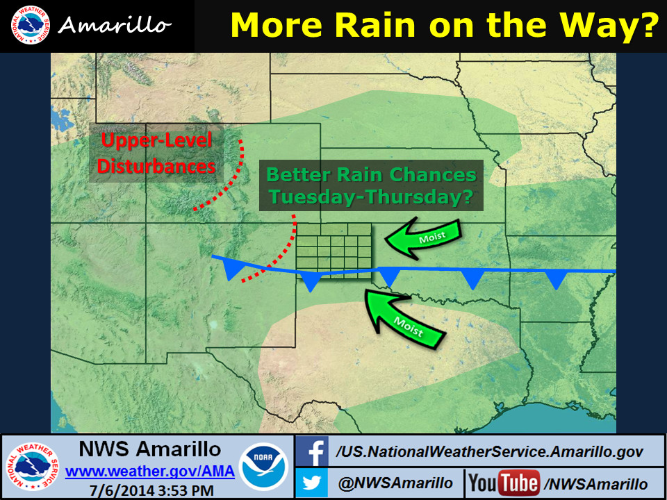
Chances for rain are now far reliant upon some weak cold fronts than can sneak
through over the top of that ridge, but the chances for heat are going to have
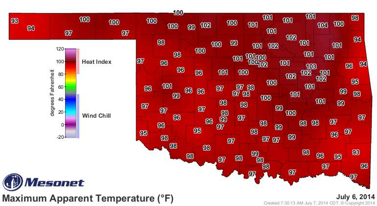
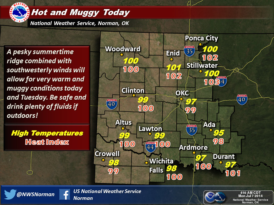
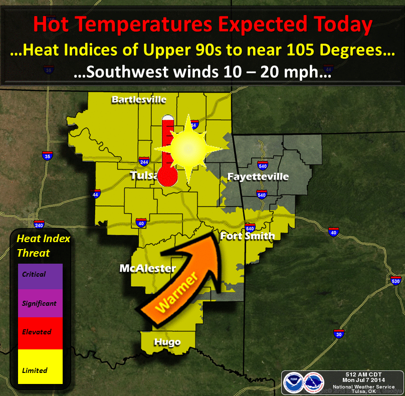
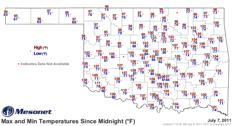
the advantage for awhile. Yesterday got us off on a grand start for summer with
highs in the 90s and 100s
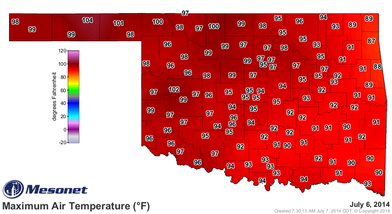
and even higher heat indices.
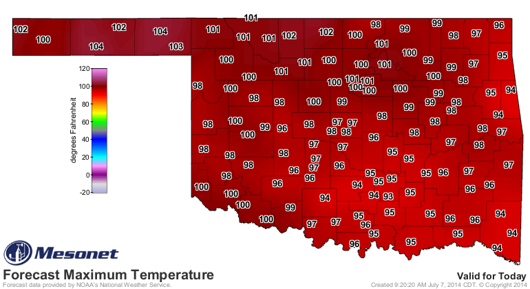
More heat is on track for today and tomorrow until a cool front sags into the
state from the northeast and ups the rain chances for a couple of days. Then,
back to the frying pan awaiting our next cool front, possibly next week.

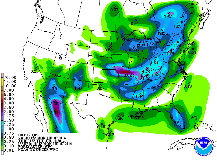
And a bit more about the aforementioned chances for rain, courtesy of the cool
front.
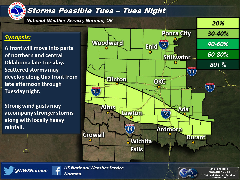
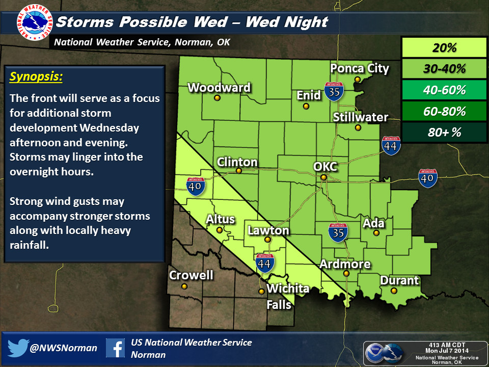
Don't expect the types of rain we had been seeing throughout June, however.
This is more of the summer hit-and-miss variety. Maybe some half-inch amounts
under the stronger storms, but mostly isolated.
In reality, we've gotten pretty lucky so far. Not a lot of big numbers on the
days at or above 100 degrees map just yet, and most of these came back before
the return of the spring rains in late May.
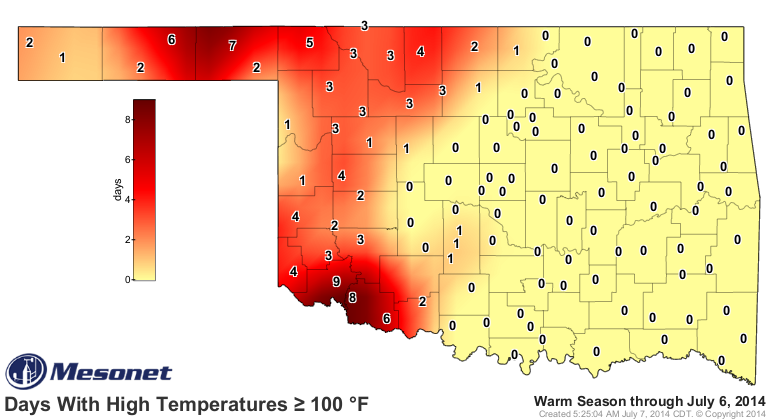
The rains across western and northern Oklahoma have really kept those numbers
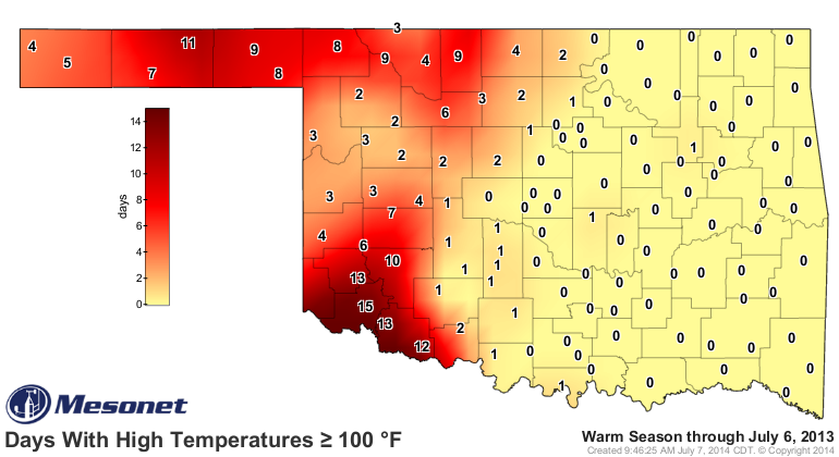
down. Remember last year, the rains had generally missed that same area and
the triple-digits had already begun to pile up through the same time period.
And the odd thing is even though the May-current period has been a bit warmer
this year across the state, that is largely due to higher minimum temperatures
rather than lots of extreme daytime highs. Again, that's thanks to the rain and
increased humidity (and cloudiness) which are known factors for keeping those
minimum temperatures a bit higher in the mornings.
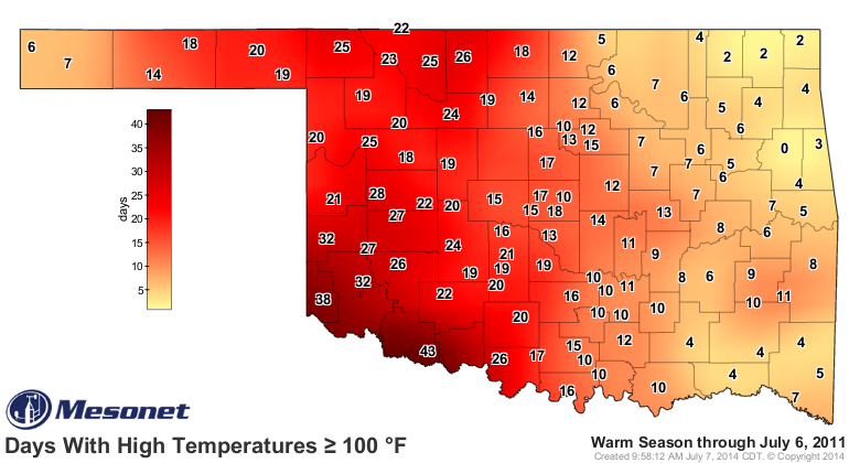
Okay, you want to be scared? Be thankful for this year and the rains, because
this is what the picture looked like back in 2011 through July 6. And we were
just getting started.
No reason to panic. It's just summer. It was bound to show up sooner or later.
But it's still better than this.
Gary McManus
State Climatologist
Oklahoma Mesonet
Oklahoma Climatological Survey
(405) 325-2253
gmcmanus@mesonet.org
July 7 in Mesonet History
| Record | Value | Station | Year |
|---|---|---|---|
| Maximum Temperature | 111°F | ALTU | 2011 |
| Minimum Temperature | 52°F | ANTL | 2006 |
| Maximum Rainfall | 5.20 inches | KIN2 | 2024 |
Mesonet records begin in 1994.
Search by Date
If you're a bit off, don't worry, because just like horseshoes, “almost” counts on the Ticker website!