Ticker for July 3, 2014
MESONET TICKER ... MESONET TICKER ... MESONET TICKER ... MESONET TICKER ...
July 3, 2014 July 3, 2014 July 3, 2014 July 3, 2014
The rain heard 'round the state
The date, May 21, 2014. Mired in a worsening drought, some areas over 3 years
strong, a slow-moving upper-level low pressure system approached Oklahoma from
the west. There it danced and pranced and sent out wave after wave of "energy"
(my meteorology professors will roast me for that one) over the state, generating
wave after wave of showers and storms. Then we entered into a particular upper-air
pattern that saw lots of moisture return from the Gulf and showers and storms
building in the High Plains. Those storms would then crash to the southeast,
enveloping OK and TX (and lots of drought). The rest, as they say, is history.
Here are the rainfall maps since that fateful May day when the first few stray
showers hit Beaver County. The rest, as they say, is, uhhhhh, something that
happened in the past (trying to not cliche my way through this whole Ticker).
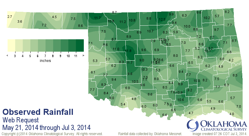
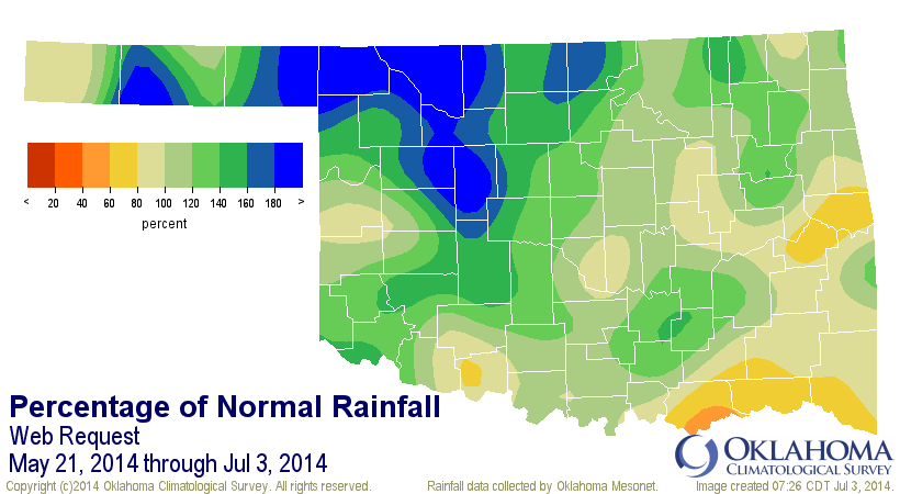
The Mesonet statistics show that this May 21-Jul 3 period is the 20th wettest
across the state going back to at least 1921.
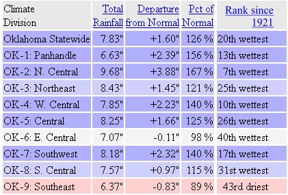
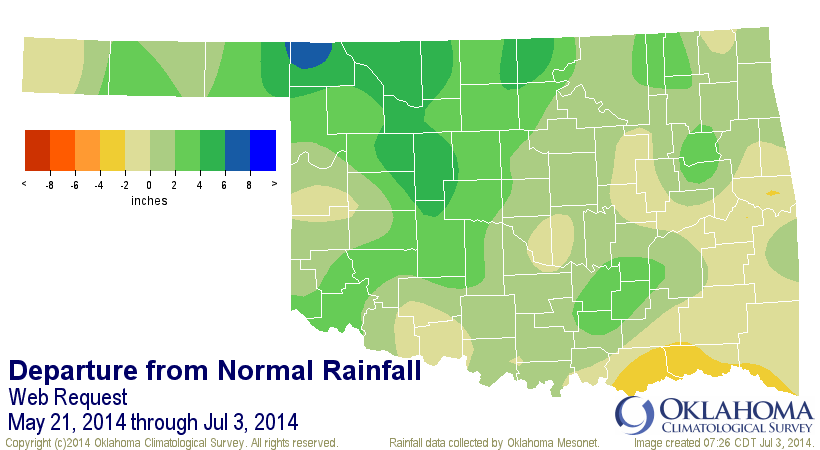
Look at NC OK there with it's 7th wettest, nearly 4 inches above normal! You
can also see that SE and EC OK Oklahoma haven't been getting the waves and
waves of rain, at least not the really heavy stuff. Southern Oklahoma was of
particular concern, especially from south central through extreme southeastern
Oklahoma. The SE is still hurting mightily, and is the focus for drought
intensification in the state. The same could be said for parts of east central
Oklahoma. The good news is that far south central OK finally got a good dose
of moisture a couple of nights ago thanks to a sagging cold front that gave us
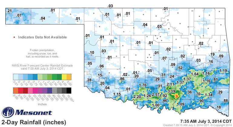
all this cool weather. Lots of 2-3 inch amounts down that way, and somebody
down in Johnston County got themselves a good 5-6 inches.
Unfortunately, that rain is not reflected on this week's U.S. Drought Monitor
map (remember, the cutoff for rains to be considered is Tuesday morning at 7
a.m., give or take a few hours, so that the national author can absorb the info
for all 50 states (and Puerto Rico).
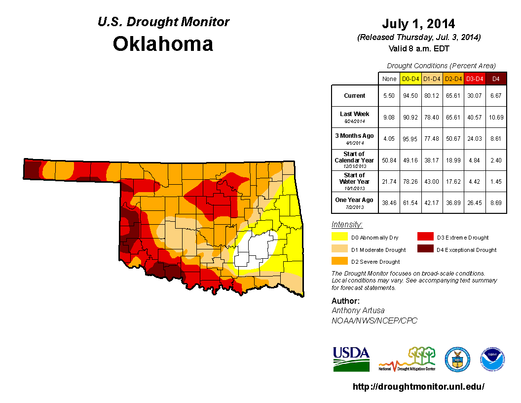
So we have drought (and abnormally dry (D0)) conditions spreading in the south
and east, and going away in central through northern Oklahoma. Still
a patch of Extreme (D3) to Exceptional (D4) drought here and there. Notice the
D4 out in far western Cimarron County at the edge of the Panhandle. Here is
what they've been going through, shared with us from the Cimarron County
Conservation District. It's linked through out Facebook page, if you haven't
"liked" our page there yet.
You can reach our facebook page here:
http://www.facebook.com/mesonet
And the video here:
http://tinyurl.com/dust-storm-video
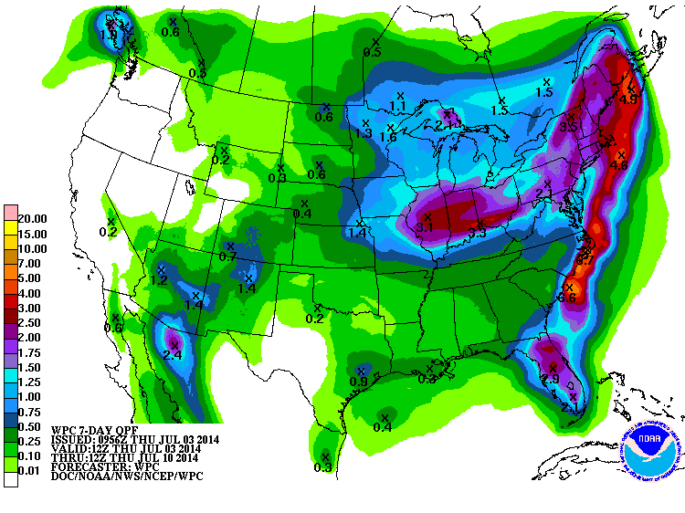
Unfortunately, it looks like the bigtime rains that extended into July (what a
gift!) are gone for awhile. There are chances for storms, of course. But we
don't see the inches and inches of rain like we did the past few weeks.
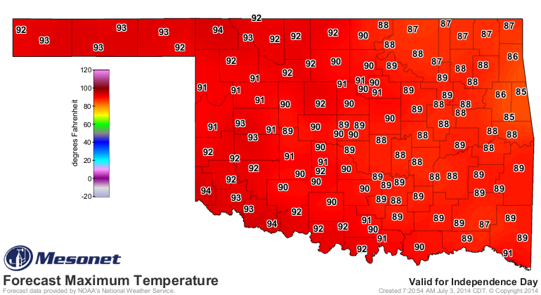
At least we have a couple of days more of somewhat cooler weather, including a
July 4th in the low 90s (that's workable!).

After that, it looks like a bit of a longer stretch of just plain old Oklahoma
summer. It had to happen sometime. Might as well be after Independence Day.
Have a great 4th!
Gary McManus
State Climatologist
Oklahoma Mesonet
Oklahoma Climatological Survey
(405) 325-2253
gmcmanus@mesonet.org
July 3 in Mesonet History
| Record | Value | Station | Year |
|---|---|---|---|
| Maximum Temperature | 106°F | KIN2 | 2011 |
| Minimum Temperature | 49°F | VINI | 2014 |
| Maximum Rainfall | 6.39 inches | NOWA | 2016 |
Mesonet records begin in 1994.
Search by Date
If you're a bit off, don't worry, because just like horseshoes, “almost” counts on the Ticker website!