Ticker for June 30, 2014
MESONET TICKER ... MESONET TICKER ... MESONET TICKER ... MESONET TICKER ...
June 30, 2014 June 30, 2014 June 30, 2014 June 30, 2014
A little pond runneth over
Many of you veteran Ticker readers know that I've used my favorite location in the
Universe, my best friend's family's pond about 8 miles south of Buffalo, as a
benchmark for the drought up in far northwestern Oklahoma. It is a spring-fed
pond, and before the current drought had never really been in danger of going
dry. That's not to say it was never low, of course ... especially during the
1995-96 drought. At that point you could cast a lure from bank to bank. But
sometime around 2010, it started to go dry and this time, it never stopped. It's
basically been a large hole in the ground with occasional mud puddles in it
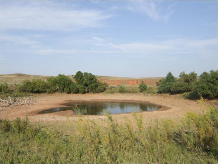
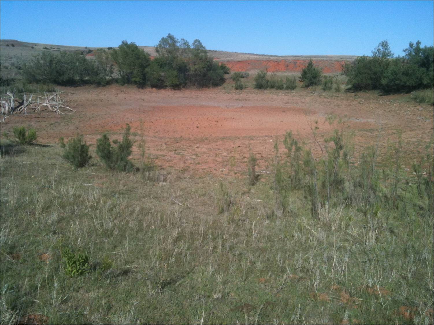
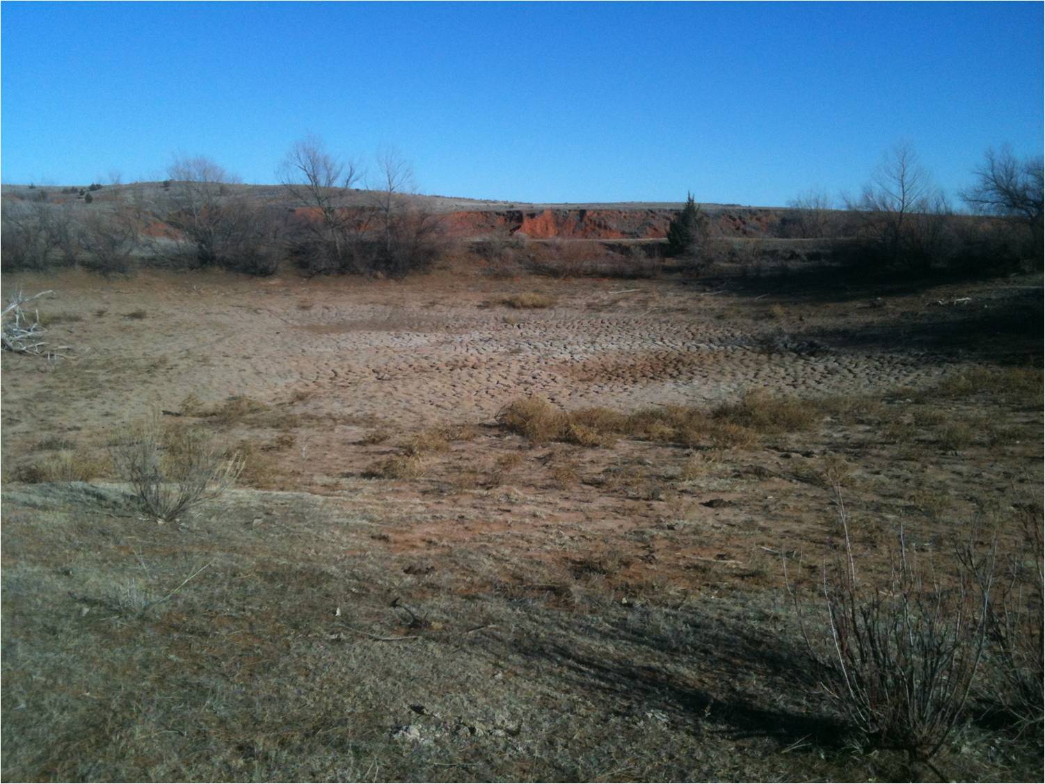
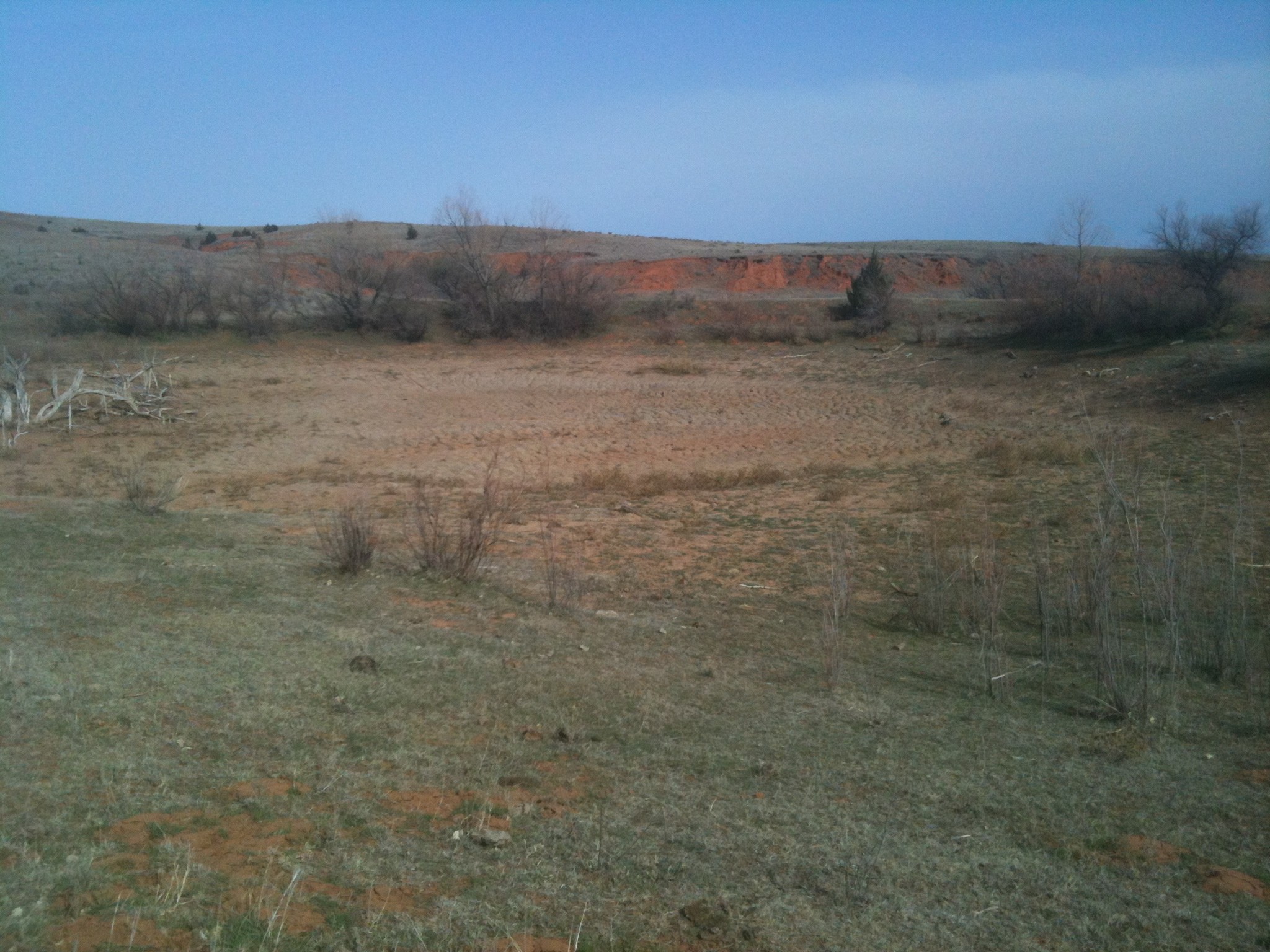
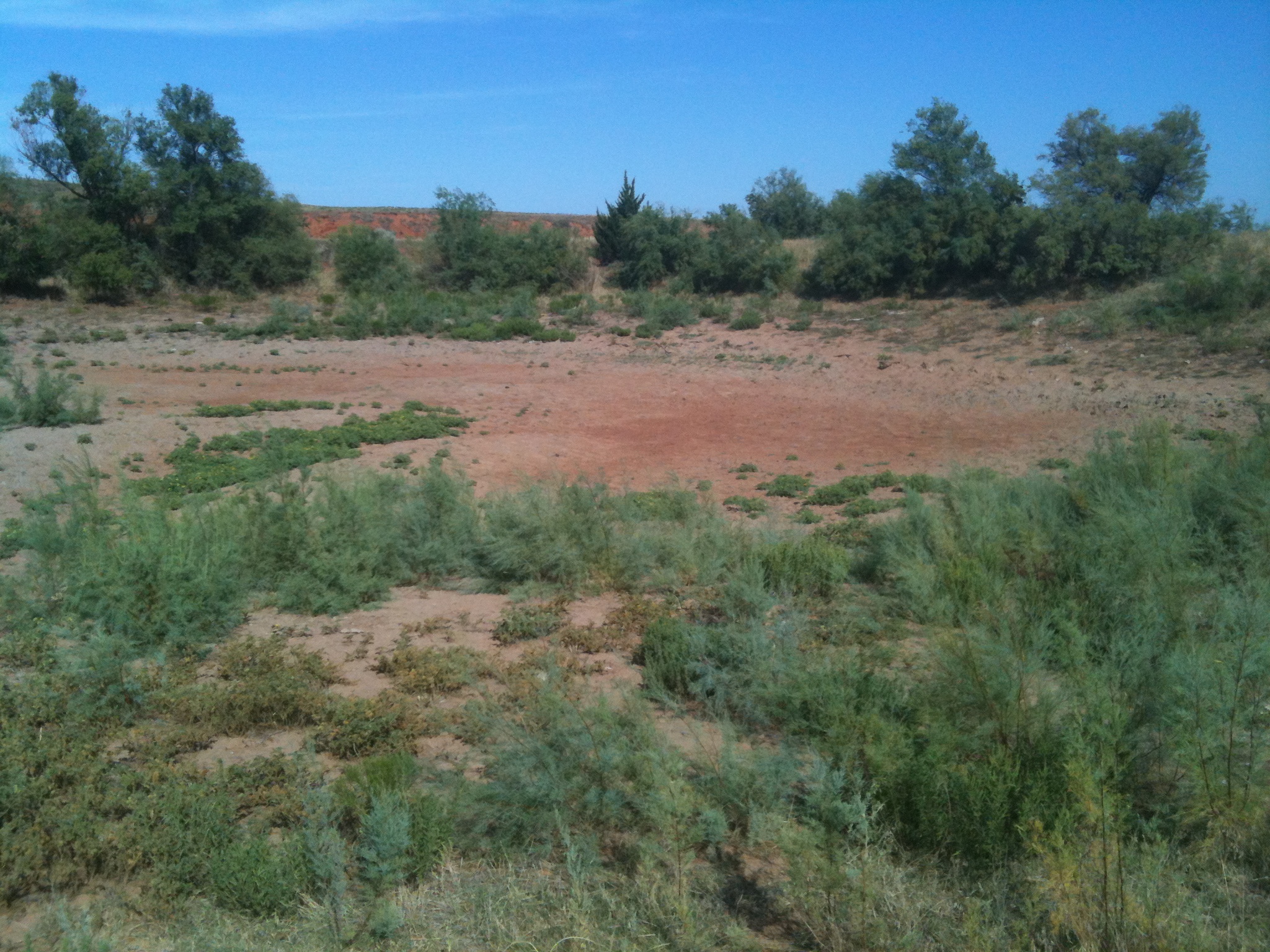
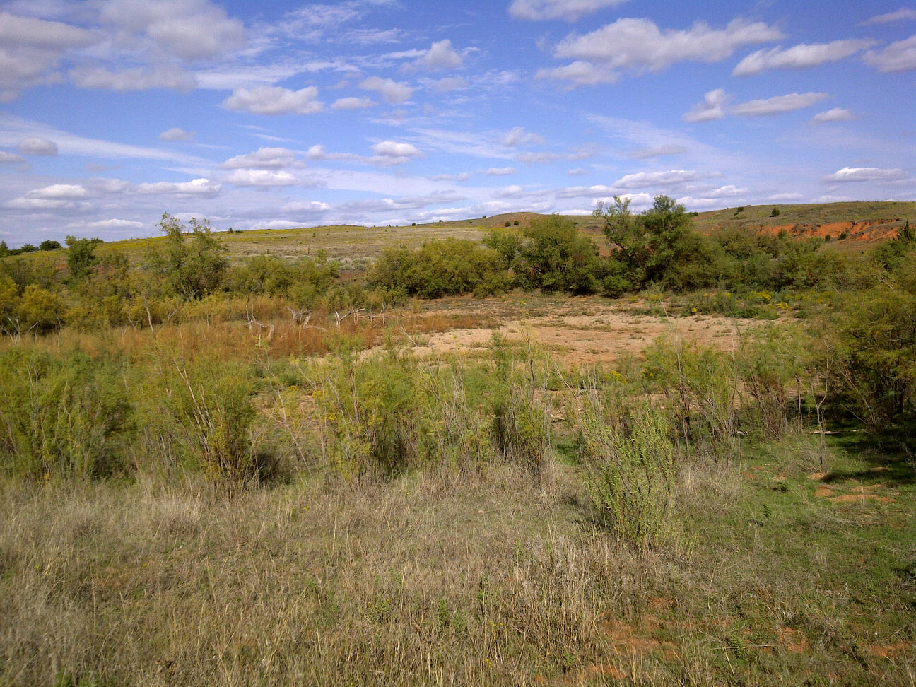
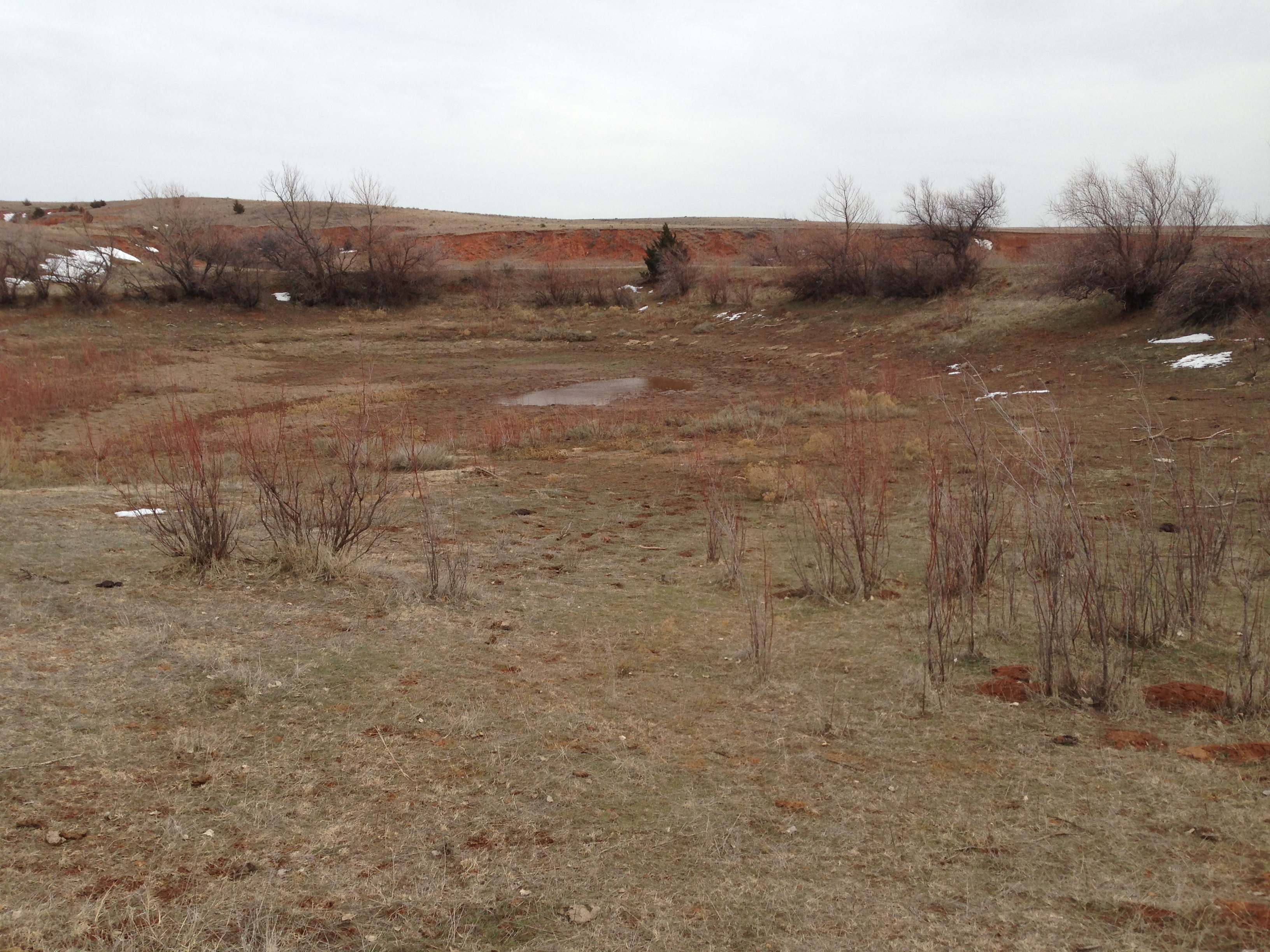
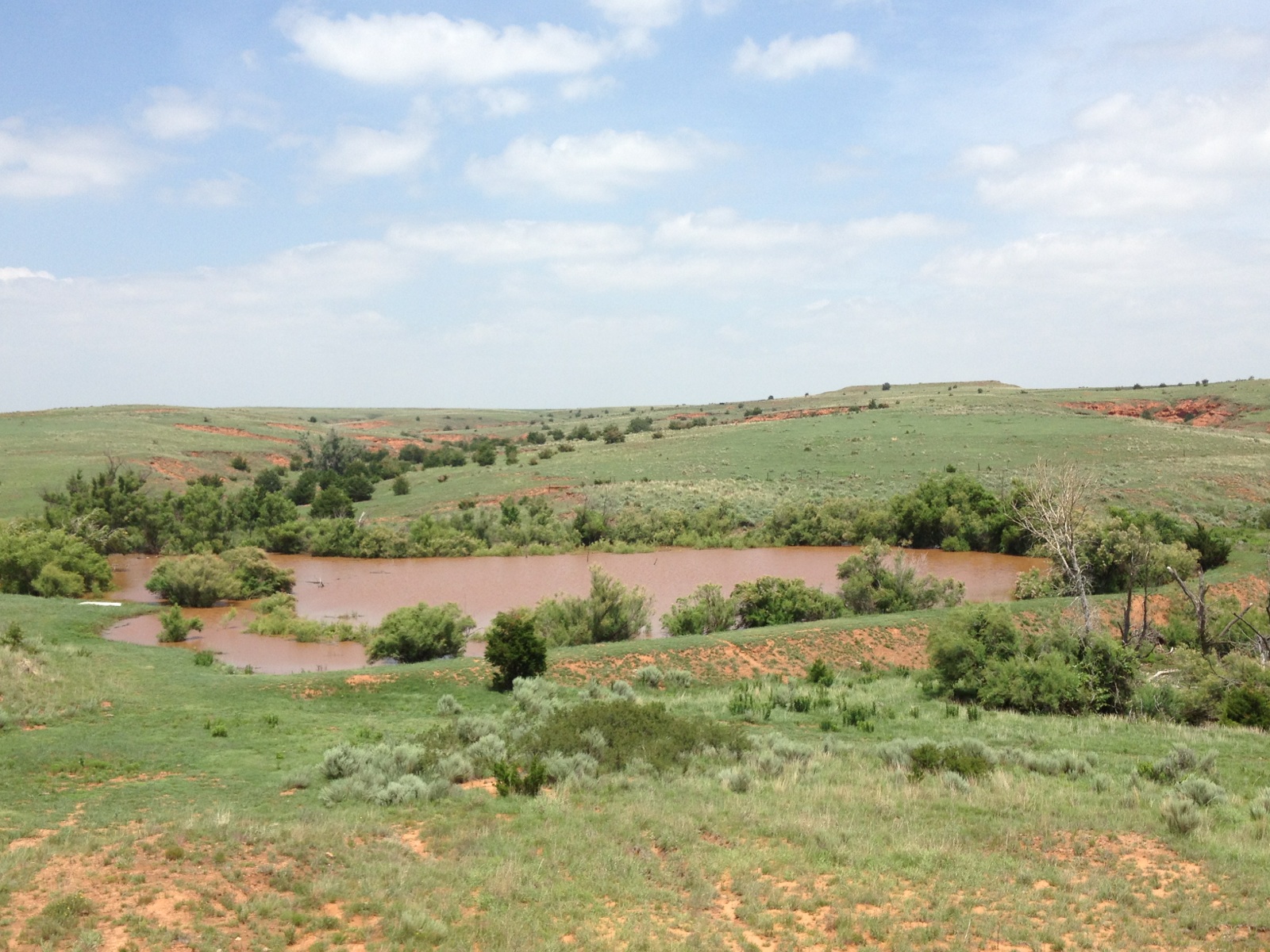
since late 2010. For a recap, beginning with a picture from May 2009 when it was
at its most lustrous glory, to a depressing baked-hard cracked mess in the summer
of 2011, and forward to a glorified mudhole in early 2014, check out the following
pictorial chronography. You'll notice some longer gaps in there later into
the account, generally because it became too depressing to visit at some point.
So naturally, hopes were dim that we'd ever catch another fish out of that
poor little pond. After decades of cherished memories (in fact, my kids and I
might have been the last ones to catch a fish out of there back in September
2010), hope was in short supply. Then, something miraculous happened.
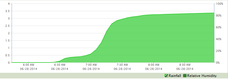
It began to rain. And it rained and then it rained some more. Finally, the little
pond that couldn't became the pond that did. The rains of the past 40 days or
so were enough to fill 'er up, and then Saturday happened. It started raining
around 6:25 a.m. and by 7:35 a.m. they had 3.04 inches. About an hour later
their total for the day was 3.37 inches. So basically they received 3 inches
of rain in about an hour. Here is their rainfall trace from our meteogram for
that morning.
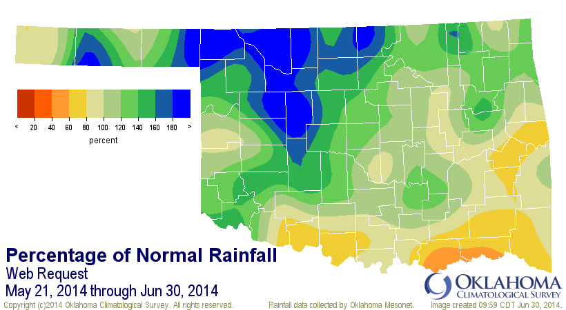
That is around a 50- to 100-year hourly rainfall event for that part of the
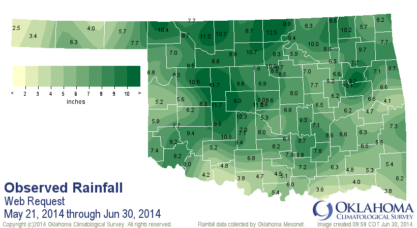
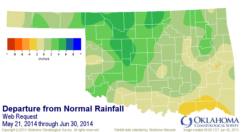
state, so a lot of rain in a hurry. Add that rain to what had already fallen
since our rainy season began on May 21 and you come up with a total of 10.4
inches, one of the wettest spots in the state.
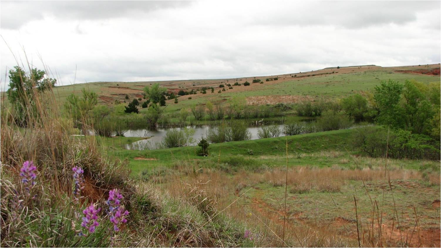
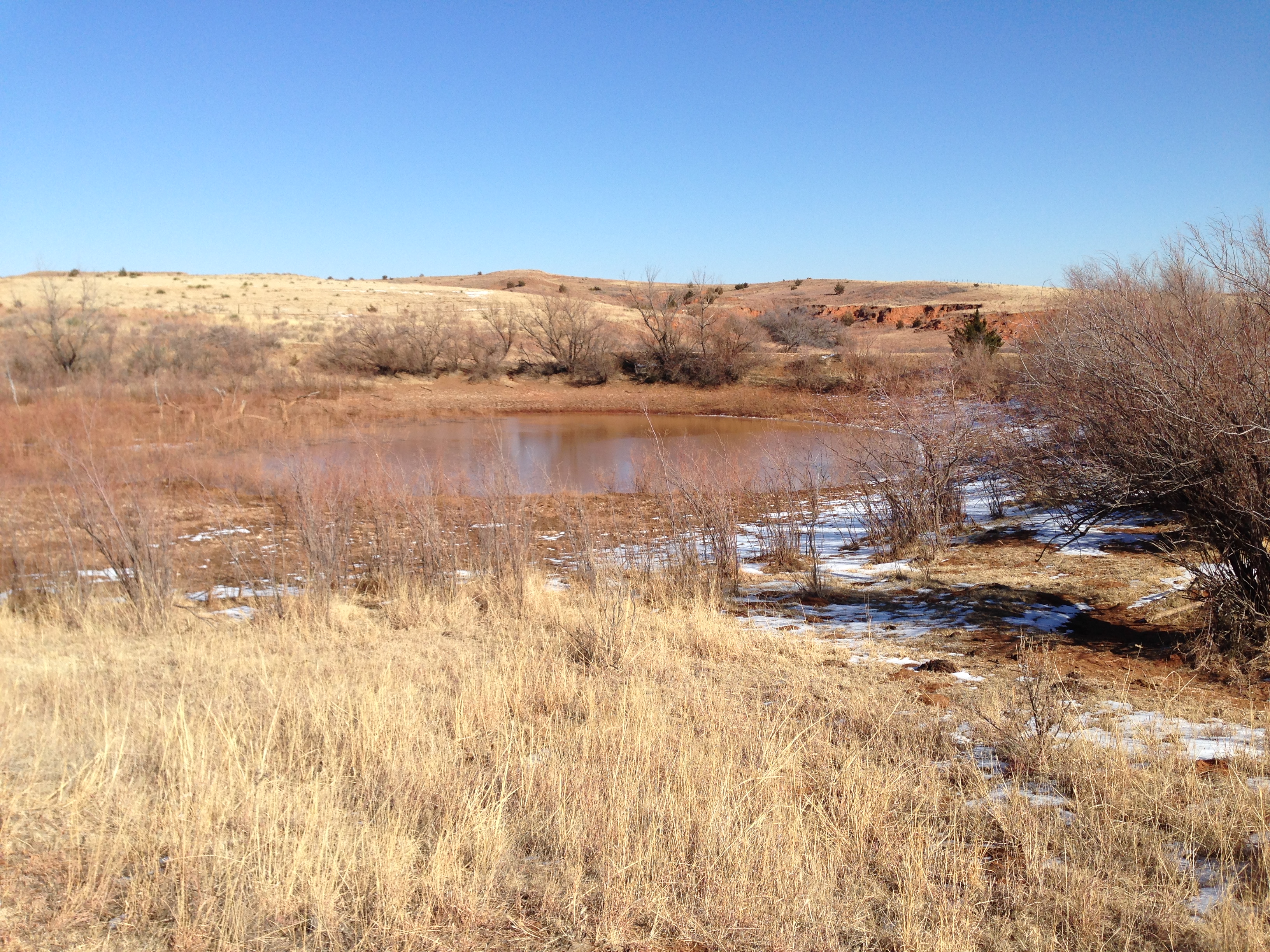
So the culmination of all that rain? A pond runneth over. Remember the chronology
above, now check out this picture from Saturday afternoon, after the deluge.
Now that may not look like a lot of water to you folks east of the 100th
meridian, but for the High Plains, that's a heckuva lot of water! So much it's
running over that earthen dam there in the foreground of the picture.
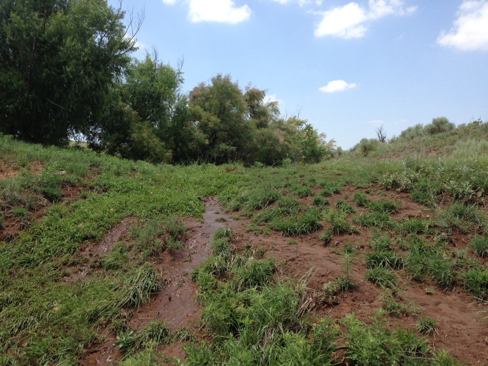
So there will be fishing again in the little pond that COULD!
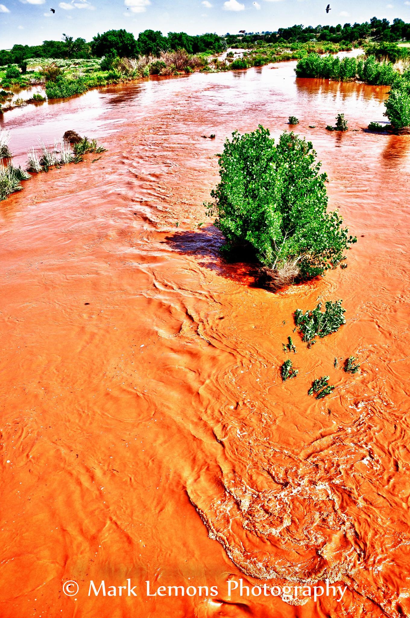
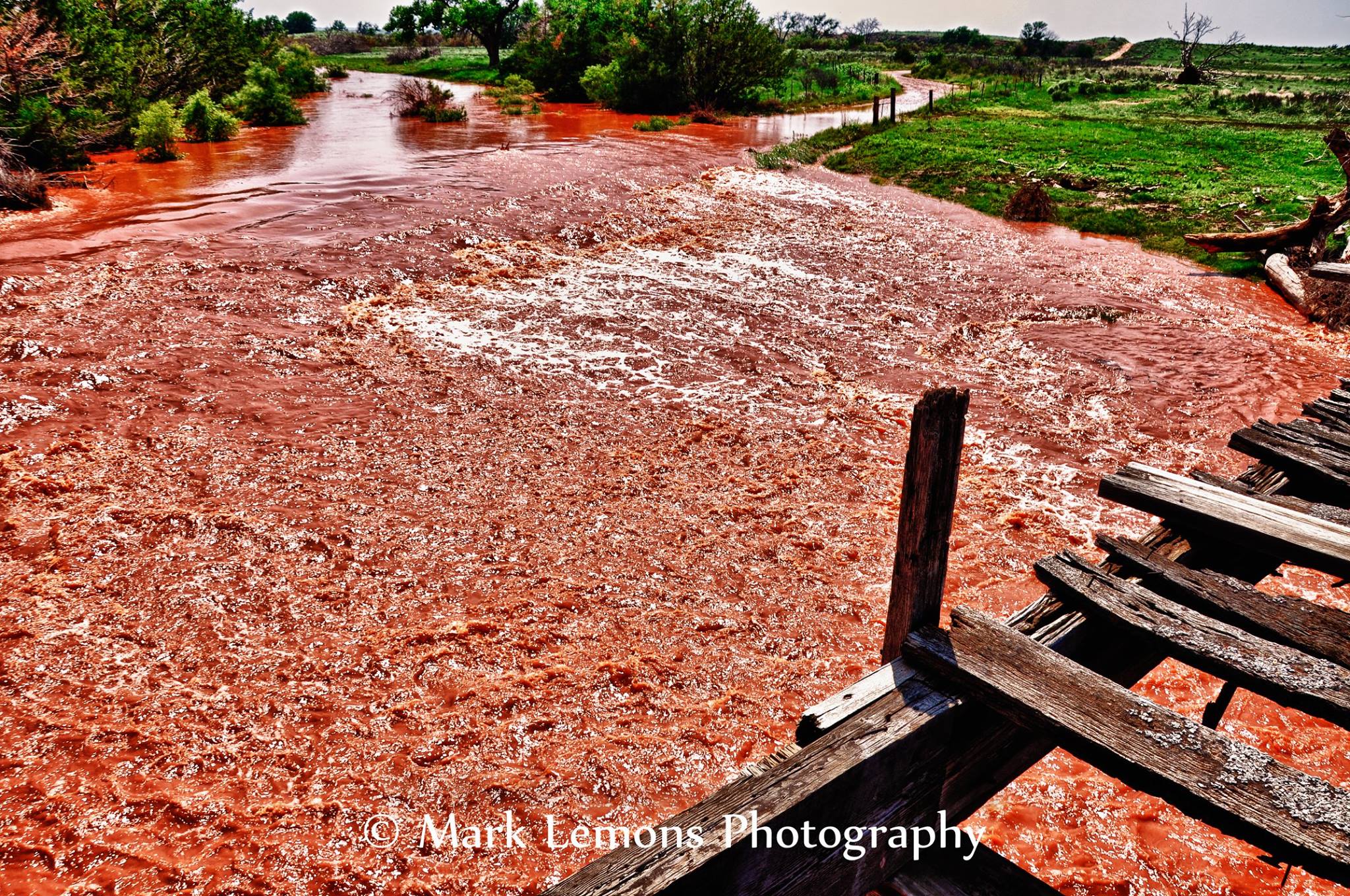
All that rain also prompted flash flood warning for the area. Buffalo Creek,
which runs from the west of Buffalo and then to the north and back to the south
as you get east of town became a raging torrent. I thought you would enjoy
these pictures because they're a great contrast in what happens when you combine
the beautiful red dirt of NW OK and flood waters. Keep in mind that Buffalo
Creek has actually been Buffalo weed bed for the last four years. I can't
remember this much water running in it for at least a couple of decades, since
the 1980s, but then again I haven't been back there this whole time. Locals
seemed to confirm that estimation, however. These pictures were taken by local
residents Mark Lemons (pics 1-3) and Karen Ives (pics 4-5).


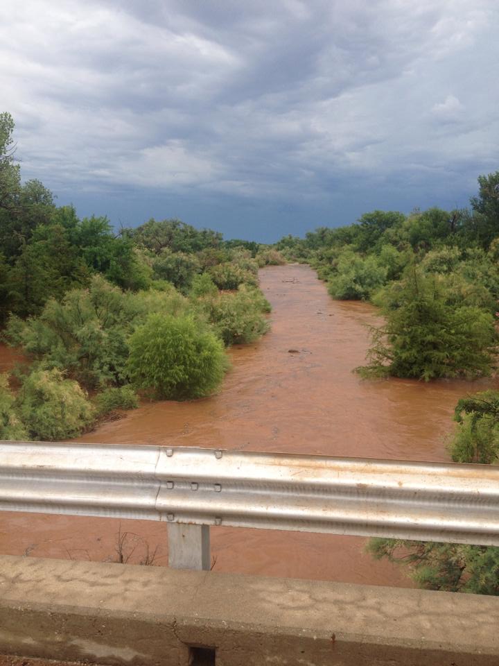
Picture #5 is from a bridge to the northwest of town, and was another spot where
I grew up fishing and exploring. You could catch bass and perch to the west of
the bridge, and to the east you could catch mudcats (catfish). There was also
a piece of machinery that housed a cantankerous old owl that you could try
and sneak up on, but that's another story.
So that probably brings to close the story of the little pond south of Buffalo
for a few years, at least as a drought indicator. I hope. Keep in mind that up
and down western Oklahoma, farm ponds are still dry and you can still see those
nasty looking scenes from my previous chronology throughout the area. Maybe
not around Buffalo anymore, and despite my attempts to make it the center of
the Universe, that ain't rightly so.
That pond might be seeing quite a bit more overflow if the rains that are
expected to occur over the next couple of days come to fruition.

Locals in Buffalo say "bring on more rain, we need it." If you can say that after
those flooding scenes, then you have REALLY been in a drought. Unfortunately,
looks like southern Oklahoma will miss out on the big totals once again, which
is the area we are looking at now for rapid drought intensification.
-------------------------------------------------------------------------------
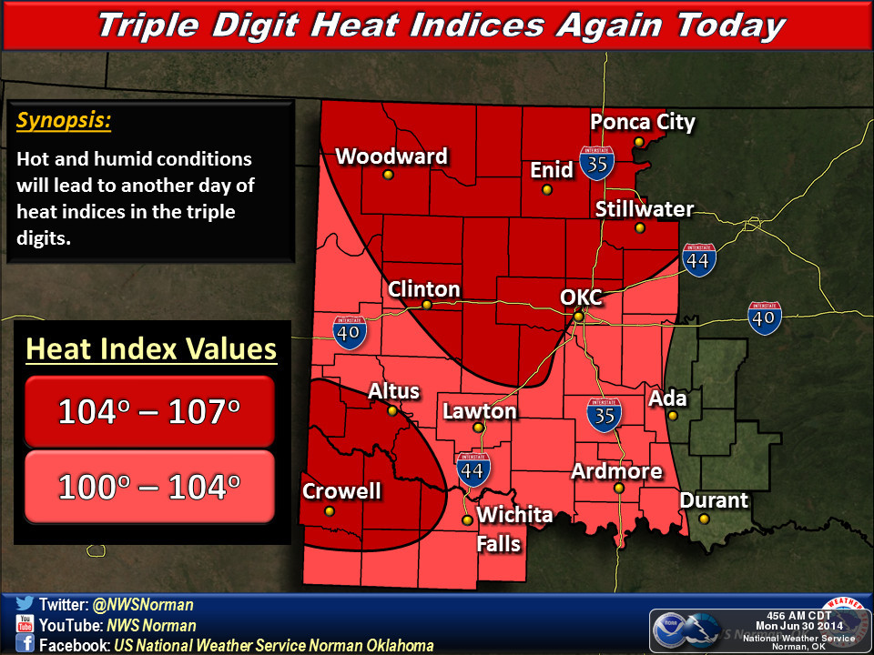
But it's a wet heat!
All this rain we've been having are mixing with a ridge of high pressure and
southerly flow from the Gulf to create a hot and sultry nightmare for the state.
Heat indices are up in the triple-digits and air temperatures are not that far
behind.
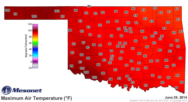

Dewpoints are already up into the mid-70s across northern Oklahoma.
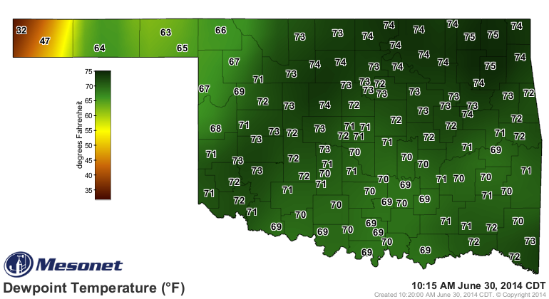
Combine those with highs expected up near 100 degrees
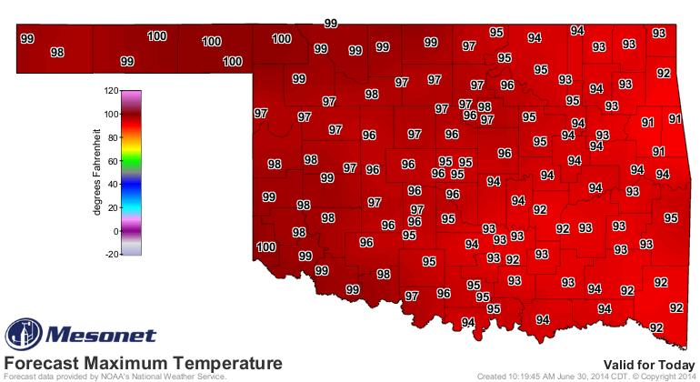
and you have the makings for some sultry weather.
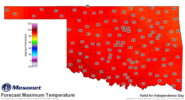
A cool front tomorrow will begin to chill things down in the north and then
over the next few days across the rest of the state (and bring those rain
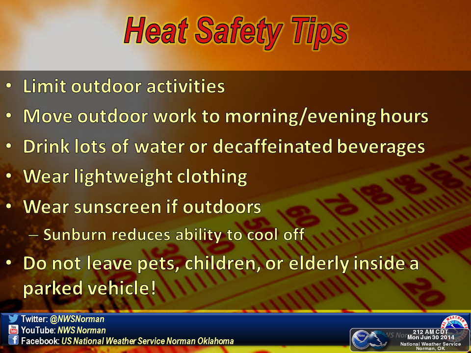
chances). Until then, follow your heat safety rules and do your best to beat
the heat!
It certainly doesn't appear that Independence Day this year will be as hot as
a firecracker.
Gary McManus
State Climatologist
Oklahoma Mesonet
Oklahoma Climatological Survey
(405) 325-2253
gmcmanus@mesonet.org
June 30 in Mesonet History
| Record | Value | Station | Year |
|---|---|---|---|
| Maximum Temperature | 109°F | HOOK | 2012 |
| Minimum Temperature | 55°F | SEIL | 2008 |
| Maximum Rainfall | 5.07 inches | BUFF | 1999 |
Mesonet records begin in 1994.
Search by Date
If you're a bit off, don't worry, because just like horseshoes, “almost” counts on the Ticker website!