Ticker for June 5, 2014
MESONET TICKER ... MESONET TICKER ... MESONET TICKER ... MESONET TICKER ...
June 5, 2014 June 5, 2014 June 5, 2014 June 5, 2014
Hey, it's raining!
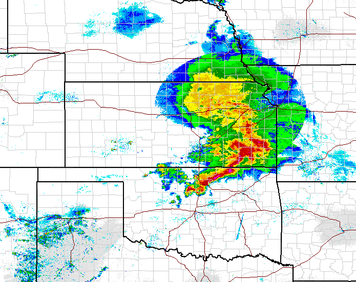
And it could be headed your way soon. As I mentioned yesterday, the 10-inch
bullseye up around Miami was probably a figment of the models' imaginations, but
there's still lots of rain to be had with this stalled frontal system over the
next several days. Again, don't take these amounts as gospel in every location,
just use them as a guide as to how much water is available to fall from the sky
here and there while the rest of us get some decent left-overs.
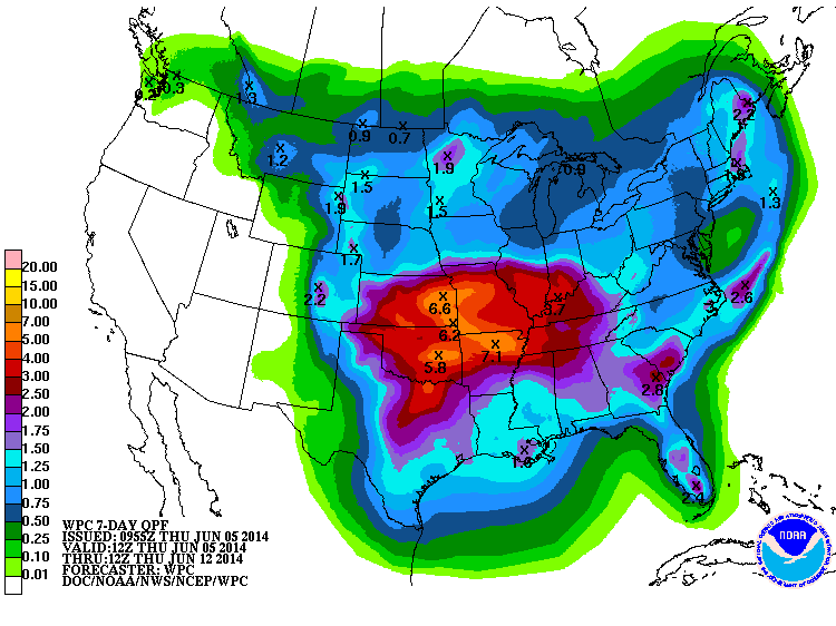
Still some goodly totals showing up for some areas, should you be lucky (or
unlucky) enough to end up under those storms moving over the same area
repeatedly. Again, here's the setup from our friends at the NWS offices.
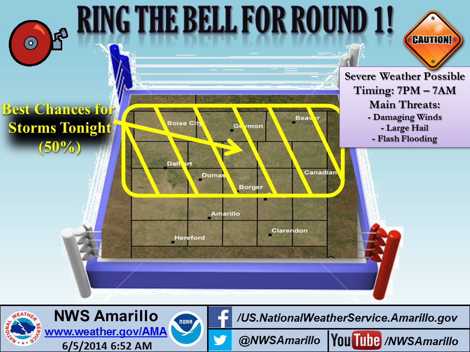

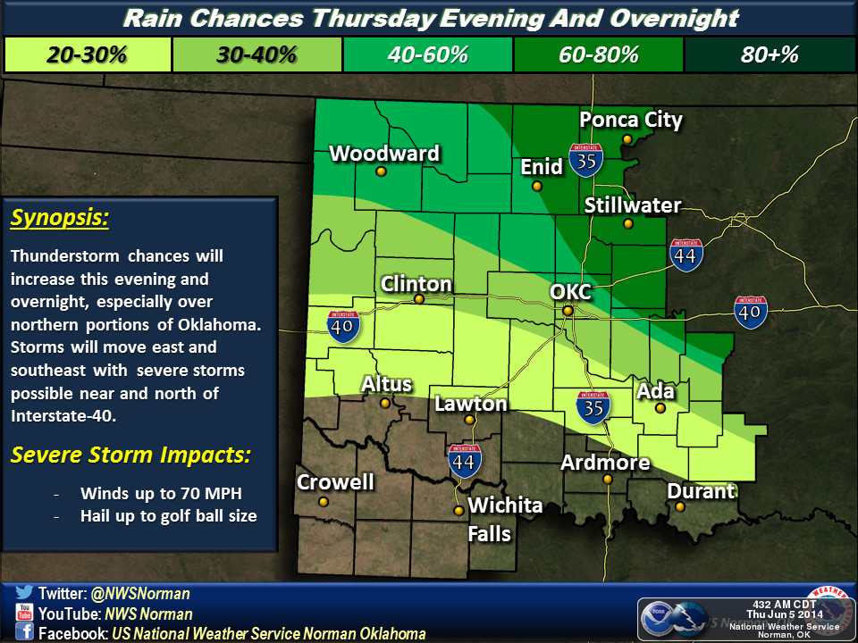
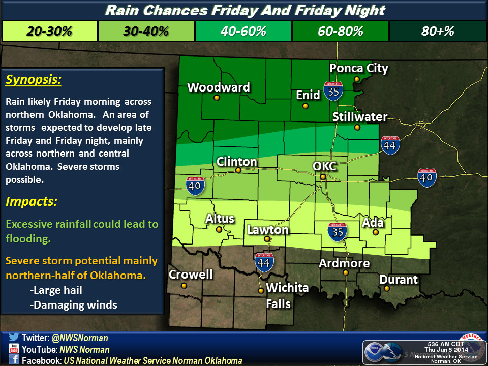
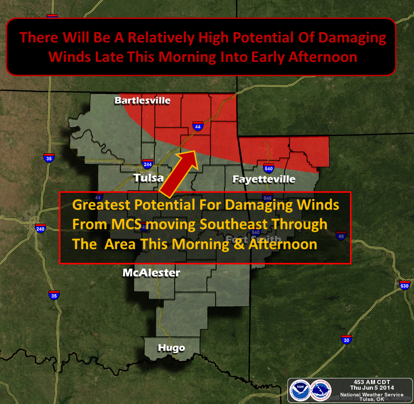
Much like last week's rains, this isn't going to be a "rain all day" type of
thing, but a series of showers and storms, sometimes severe, that will bring
the moisture. Until then, we still have some hot, humid days to get through.
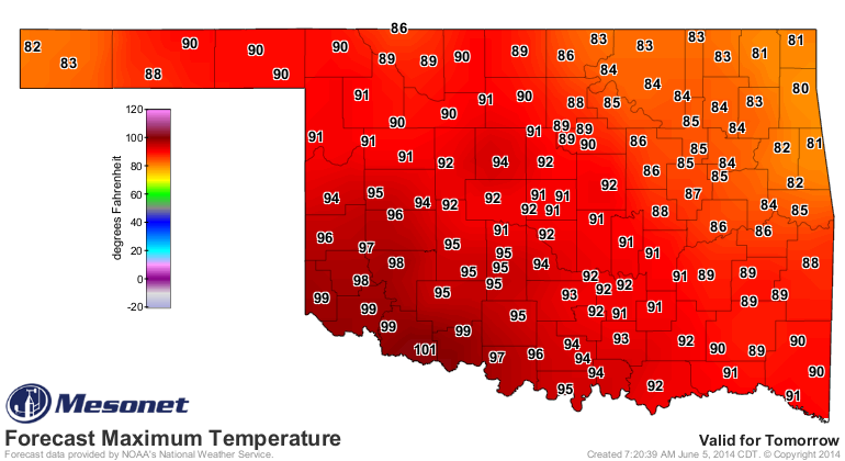

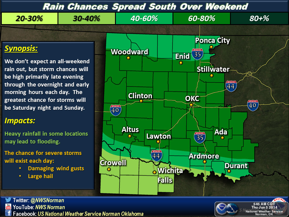
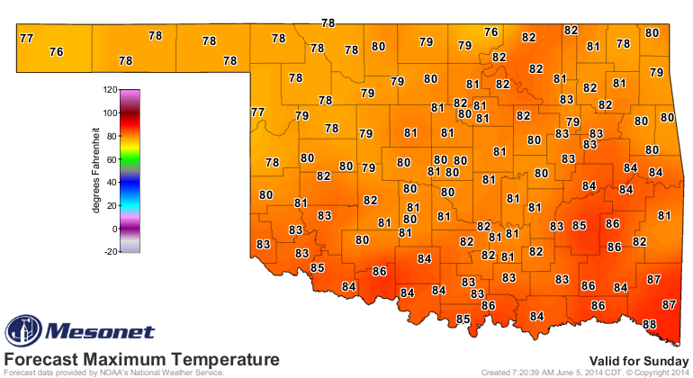
Then the big front comes through Saturday (you can see some of its influence on
Saturday) and we end up with a much cooler Sunday.
Now, with all that lovely moisture talk out of the way, let's see how last
week's rains impacted the U.S. Drought Monitor map.
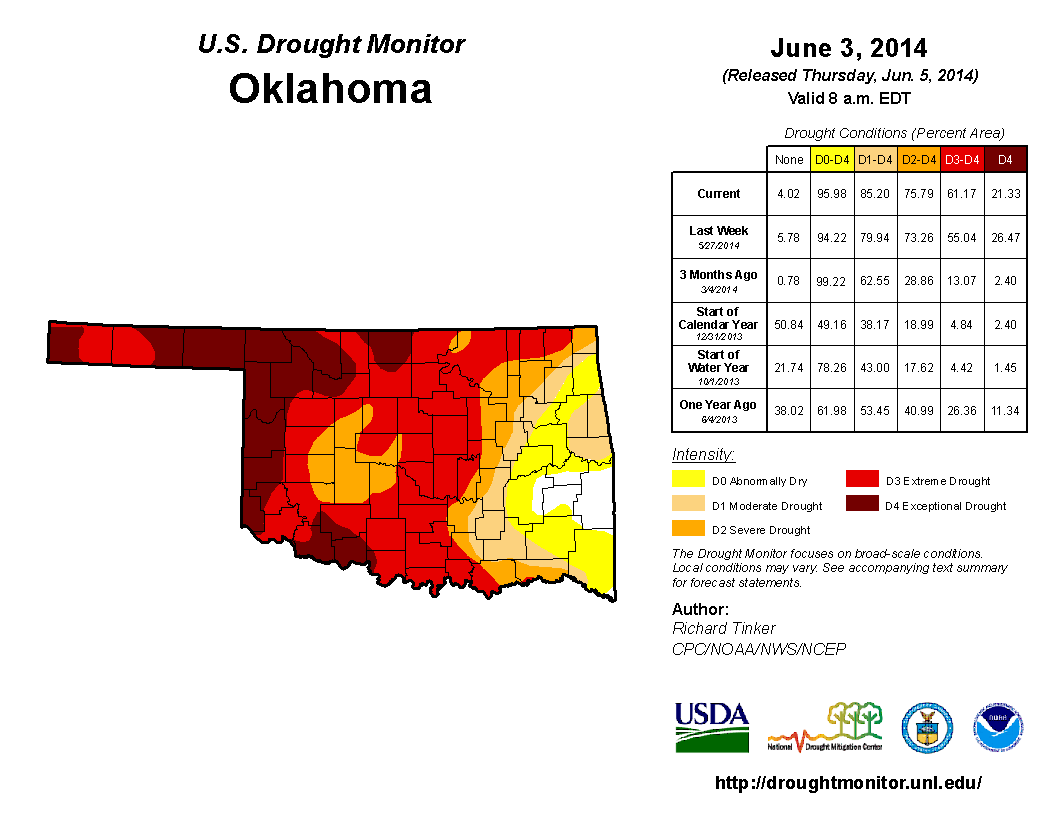
So more improvements across northern and eastern Oklahoma, but worsening drought
across southern Oklahoma. That's not a shock, of course, give the rainfall
patterns over the last few weeks. Southern Oklahoma is now in the crosshairs
of Mother Nature's fickle fortunes.

And as you can see, far northwestern Oklahoma isn't exactly drowning in rain
either. Woodward and Freedom have only had 0.54 inches of rain over the last
30 days, a pathetic total for this part of May and June.
So once again we await the rains. Some are already getting a head start ... the
rest of us will have to wait awhile. Hopefully not long.
Gary McManus
State Climatologist
Oklahoma Mesonet
Oklahoma Climatological Survey
(405) 325-2253
gmcmanus@mesonet.org
June 5 in Mesonet History
| Record | Value | Station | Year |
|---|---|---|---|
| Maximum Temperature | 106°F | ALTU | 2006 |
| Minimum Temperature | 42°F | BOIS | 1998 |
| Maximum Rainfall | 4.30 inches | LAHO | 2008 |
Mesonet records begin in 1994.
Search by Date
If you're a bit off, don't worry, because just like horseshoes, “almost” counts on the Ticker website!