Ticker for June 4, 2014
MESONET TICKER ... MESONET TICKER ... MESONET TICKER ... MESONET TICKER ...
June 4, 2014 June 4, 2014 June 4, 2014 June 4, 2014
It's about to seriously rain on our parade
Not sure if you have a parade scheduled in the next few days, but if so, prepare
for a bunch of soggy floats and band costumes. At least if the latest forecasts
pan out. Check out this forecast drenching from WPC over the next 7 days.
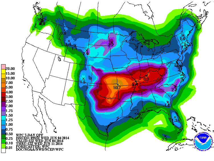
Wow! Chances of 10.7 inches in Miami, OK, are probably a bit slim, but it does
give you an idea of the potential rainfall across the entire state. The setup is
sort of a classic stalled-front scenario where a cold front moves in tonight, sort
of oscillates north and south but all the while seeing lots of moisture pumped
up from the Gulf to interact with it. You have to throw in a couple of shortwave
troughs to gum up the works and really prime the rainfall chances. Saturday will
see the biggest changes as a more robust cold front moves through and really
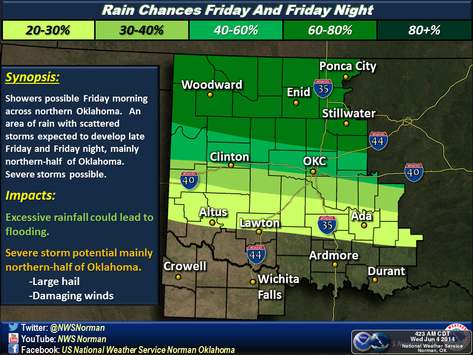
cools us down (and keeps the rain chances up). Here are the images from the
Norman NWS forecast offices better explaining the setup with the first entrance
of the cold front tonight up north.
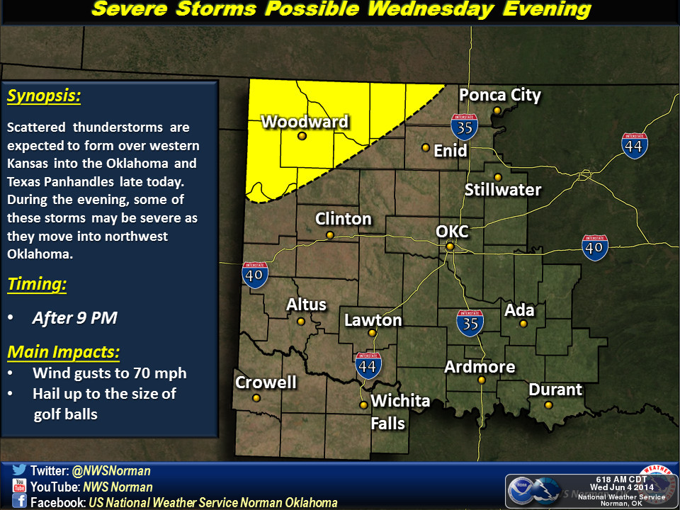
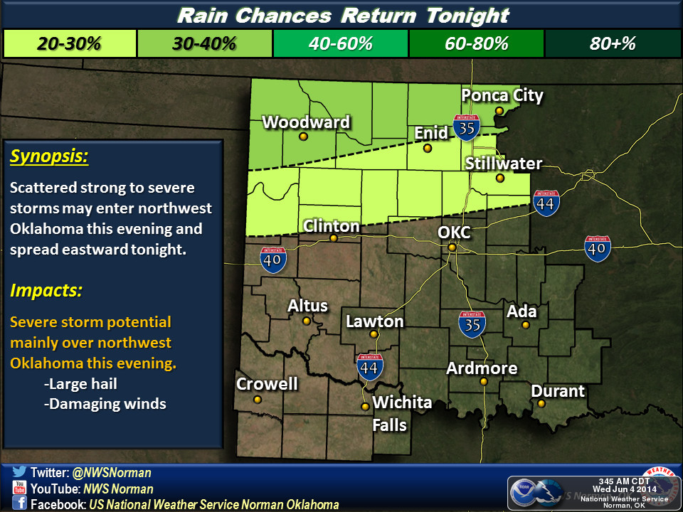
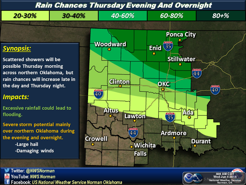
Now until we get to all the crashing and booming and the raining and the
flooding (that's intended to be sounded out in your mind in a Bill Cosby voice
... I was going to add something about pudding pops but that just didn't fit),
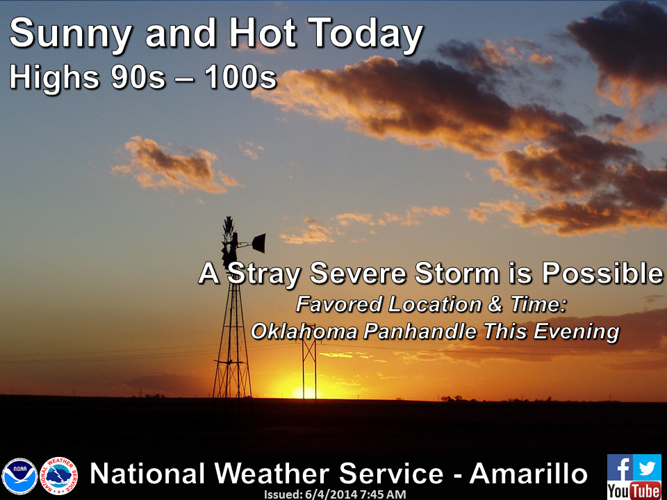
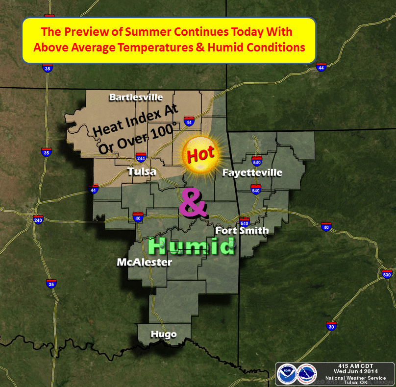
we have to go through a few more hot, steamy days. Here's more on that from
the local NWS offices.
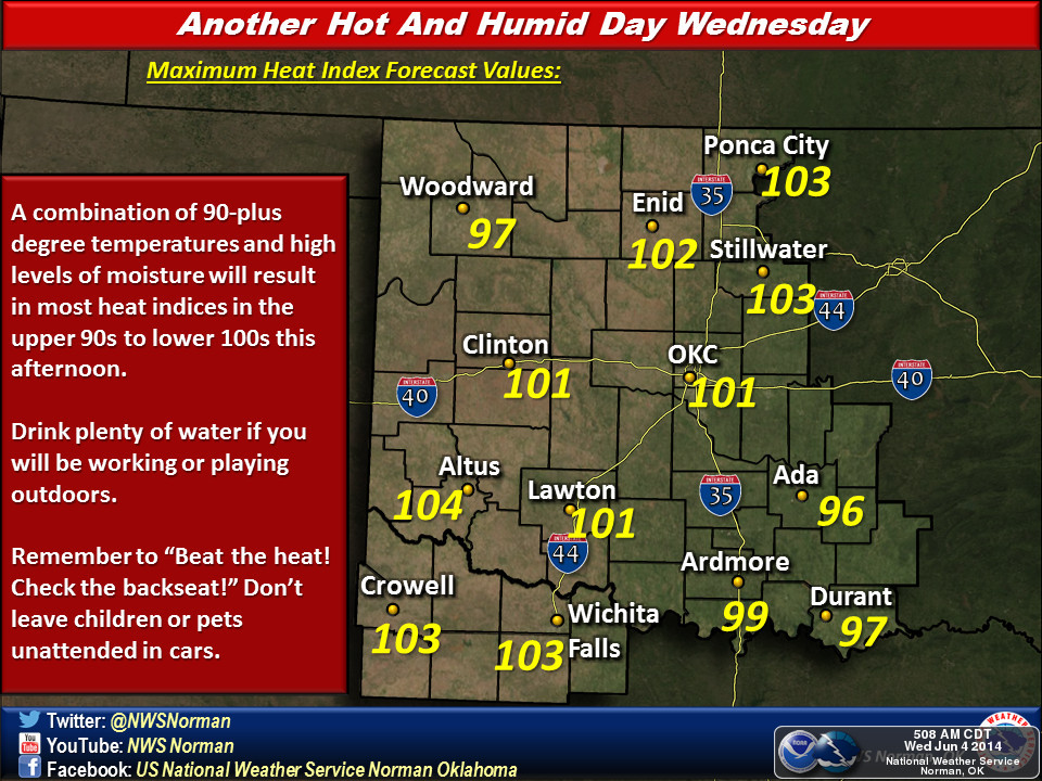
So it will feel like 100 out there or even hotter. Good day to stay indoors,
but if you have to get outside and work or whatever, best keep those heat safety
rules in mind. As luck (bad luck??) would have it, we just had an NWS "Beat
the Heat Day" a couple of weeks ago where they doled out all sorts of good
advice for just such an occasion.
http://nws.noaa.gov/os/heat/index.shtml
It doesn't look like we'll see any heat advisories over the next couple of days,
but the criteria will be close.
As you saw in the NWS graphics, there will be a chance for severe weather. It
appears that hail and high winds will be the primary threats. We should always
be on the lookout for the possibility of tornadoes, though, just in case.
So that's the look for the next few days ... hot, sultry with increasing rain
chances. Pudding pops aren't a bad idea, come to think of it!
Gary McManus
State Climatologist
Oklahoma Mesonet
Oklahoma Climatological Survey
(405) 325-2253
gmcmanus@mesonet.org
June 4 in Mesonet History
| Record | Value | Station | Year |
|---|---|---|---|
| Maximum Temperature | 107°F | GRA2 | 2014 |
| Minimum Temperature | 43°F | EVAX | 2025 |
| Maximum Rainfall | 8.23 inches | GRAN | 1995 |
Mesonet records begin in 1994.
Search by Date
If you're a bit off, don't worry, because just like horseshoes, “almost” counts on the Ticker website!