Ticker for June 3, 2014
MESONET TICKER ... MESONET TICKER ... MESONET TICKER ... MESONET TICKER ...
June 3, 2014 June 3, 2014 June 3, 2014 June 3, 2014
Welcome to the jungle...
We've got fun and games? No, we've got hot, steamy weather. Also, don't learn
your grammar from Guns N' Roses. All the rain we've had lately is going to start
evaporating in the early June sunshine and it's going to give us quite a load
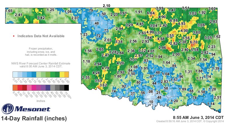
of sticky weather for a few days. A look at the rainfall maps for the last two
weeks shows a really nice load of moisture across much of the state, barring the
far NW and SC over into SE Oklahoma.
Throw in an upper-level ridge of high pressure and additional humidity from an
open channel to the Gulf and you have some real early summer-like weather on tap
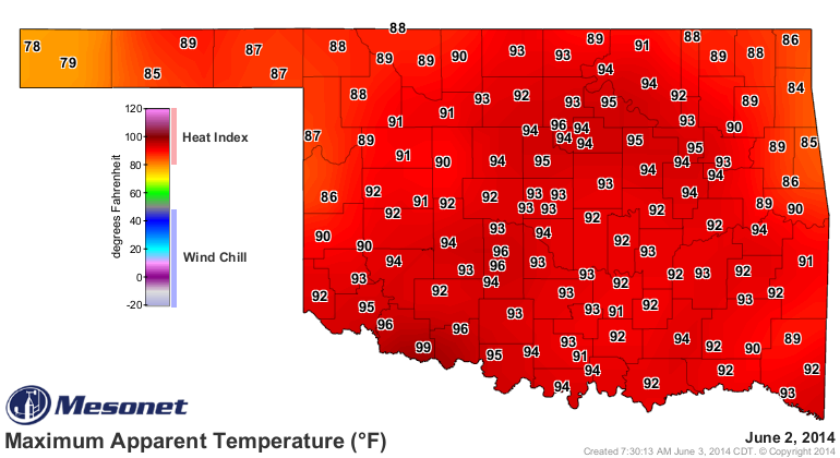
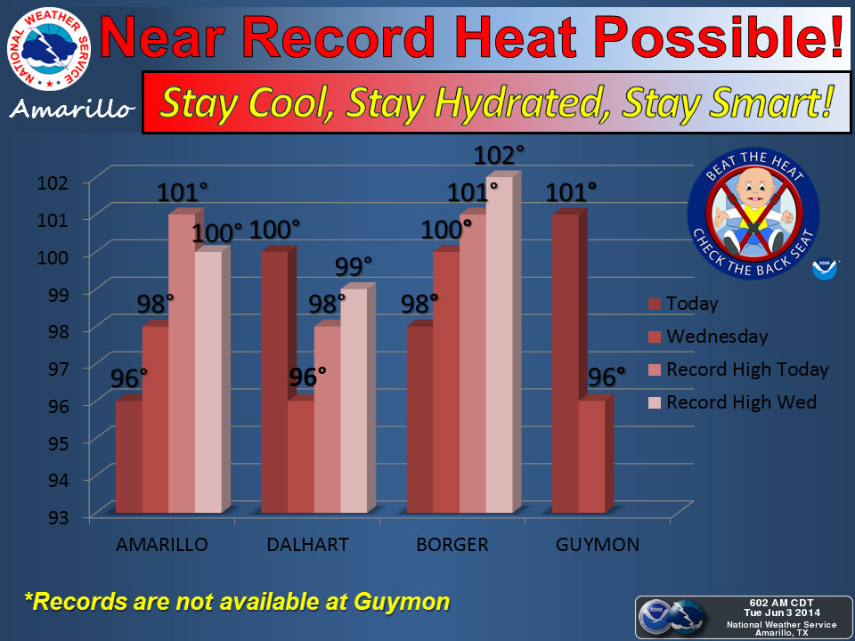
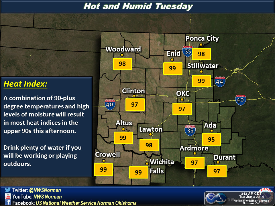
for the state. It started yesterday with highs in the 80s, mostly, although the
drought-ravaged SW still came in with some temps near 100 degrees.

Again, throw in the moisture and you end up with apparent temperatures (or the
heat index) up in the mid-90s.
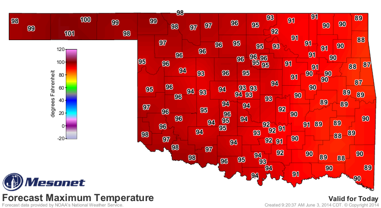
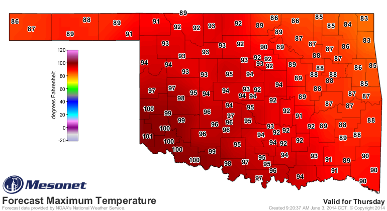
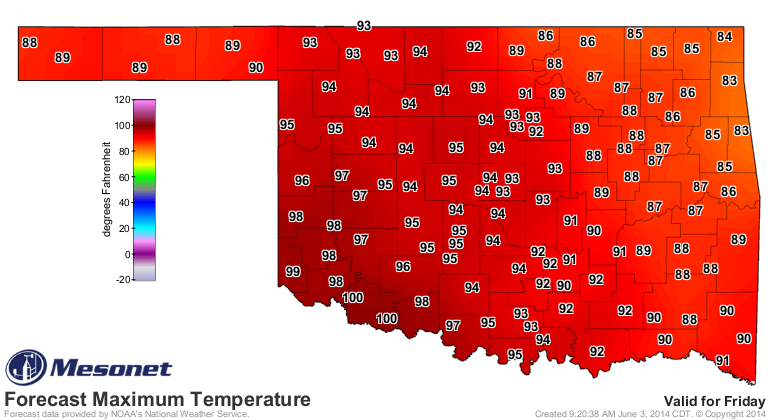
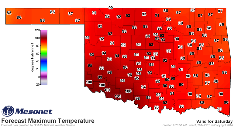
So yes, summer is hear, at least on the thermometer. Check out the NWS forecast
highs (WITHOUT the moisture thrown in) for the next five days.
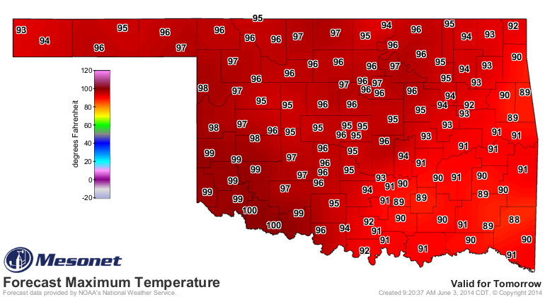
Our friends at the NWS offices covering the state tell us to expect more of
the same for a few days before rain chances (which aren't zero over the next
few days) go up at the end of the week.

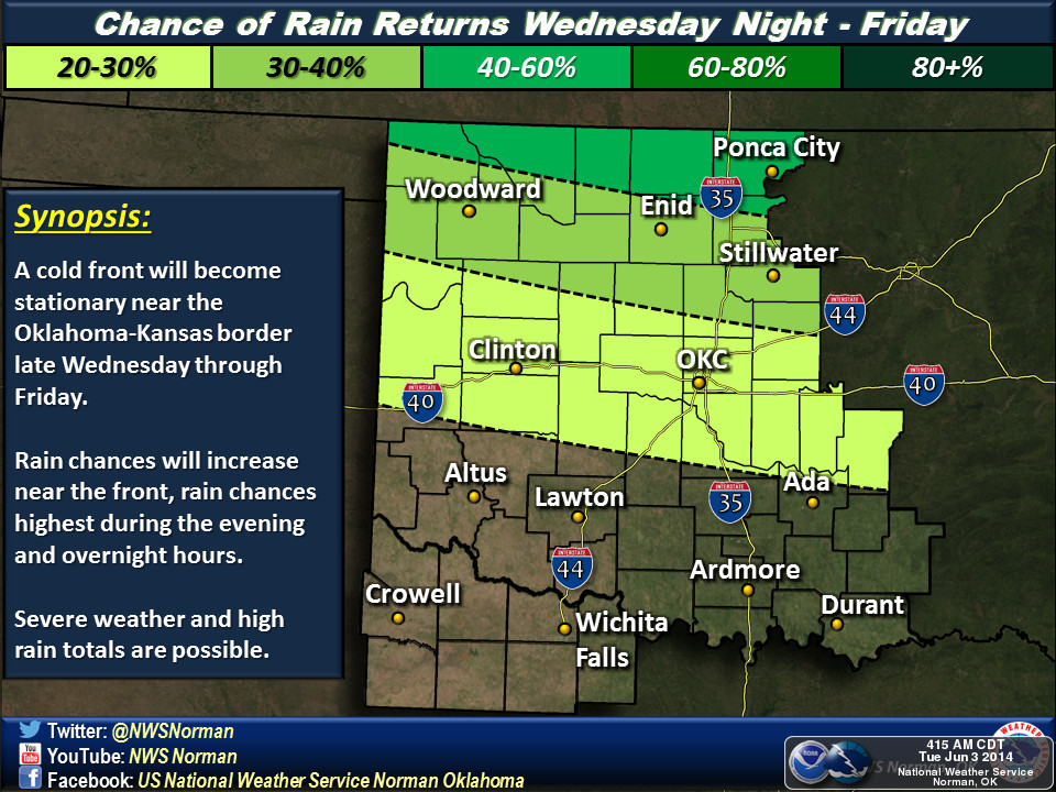


The rain chances will come from a cold front that will enter the state
tomorrow night and a small weather disturbance will move over the top of us
providing a chance for showers and storms. Severe weather will be a
possibility. Right now it appears to be mostly winds and large hail, but you
know the drill, springtime in Oklahoma, severe storms, the big baddie could
always make an appearance. The offending front will stall over the state and
wherever it stalls, that's probably where the highest rain chances will be.
And since we're getting later into June, there will be all sorts of outflow
boundaries coming into play with weird-moving storms about for the rest of
the week. But, it does appear northern Oklahoma is in the crosshairs for the
most part over the next few days, although the entire state has a chance for
moisture.
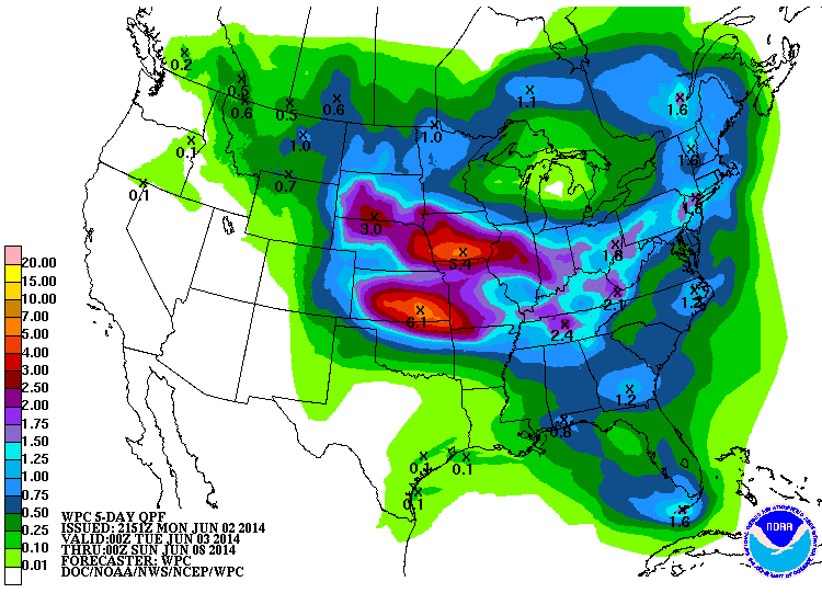
Those are some hefty totals up across N OK! The real bad severe weather should
stay farther to the north across NE, KS, IA and MO. But as you step outside
later today and feel the humidity, that will be a good reminder of why this last
storm system and the upcoming one are so important as the sun gets even higher
in the sky and the evaporation (and the VERY thirsty plants) start to go to work
on all available moisture.
It's a long time until September, after all.
-------------------------------------------------------------------------------
Happy birthday to the Ticker! It was 16 years ago yesterday that former
Oklahoma Associate State Climatologist (and former Acting State Climatologist
for awhile) Derek "Deke" Arndt started this monster that needs fed several
times a week. The Ticker from that date, June 2, 1998, shows that we were
dealing with some serious heat early on already.
http://ticker.mesonet.org/select.php?mo=06&da=02&yr=1998
So a happy (belated) 16th birthday to the Ticker! It's now old enough to drive,
so be careful if you see it coming at you on the road.
Gary McManus
State Climatologist
Oklahoma Mesonet
Oklahoma Climatological Survey
(405) 325-2253
gmcmanus@mesonet.org
June 3 in Mesonet History
| Record | Value | Station | Year |
|---|---|---|---|
| Maximum Temperature | 108°F | ALTU | 2008 |
| Minimum Temperature | 45°F | EVAX | 2018 |
| Maximum Rainfall | 5.20 inches | FTCB | 1995 |
Mesonet records begin in 1994.
Search by Date
If you're a bit off, don't worry, because just like horseshoes, “almost” counts on the Ticker website!