Ticker for May 28, 2014
MESONET TICKER ... MESONET TICKER ... MESONET TICKER ... MESONET TICKER ...
May 28, 2014       May 28, 2014       May 28, 2014       May 28, 2014


I'll take one drought relief, please...

hold the tornadoes?


Yes, I think we can now consider the big MEMORIAL DAY 2014 RAINMAGEDDON STORM
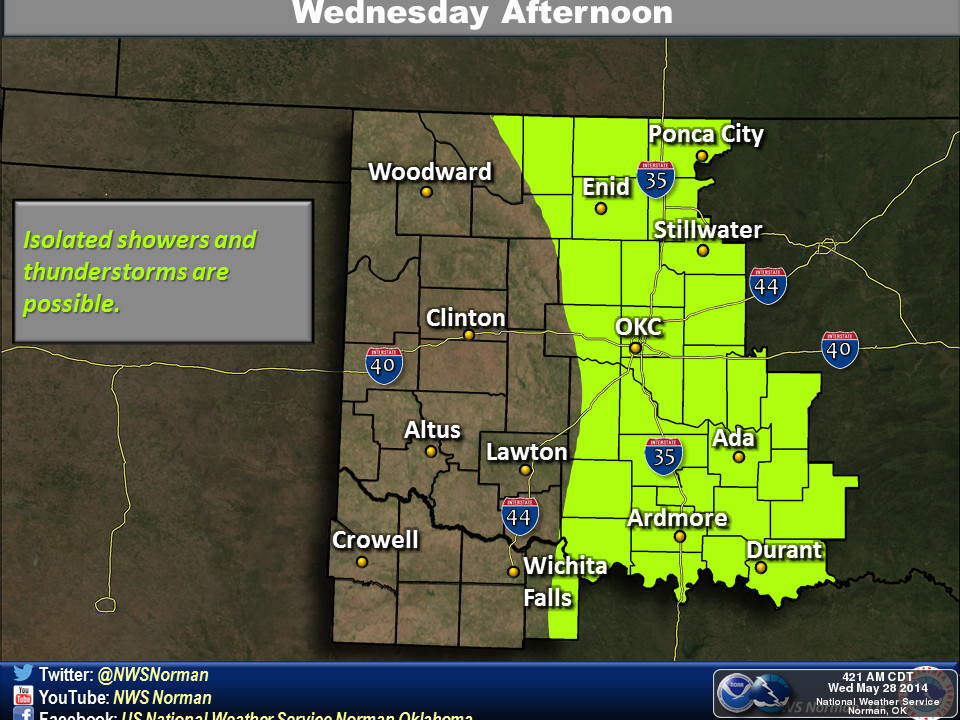
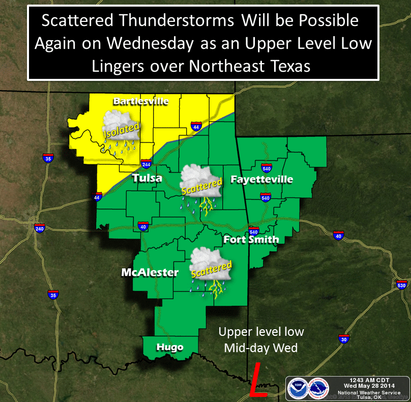
*mostly* over, although it will still provide the opportunity for some showers
and storms across eastern Oklahoma as it wanders around northeast Texas (and we
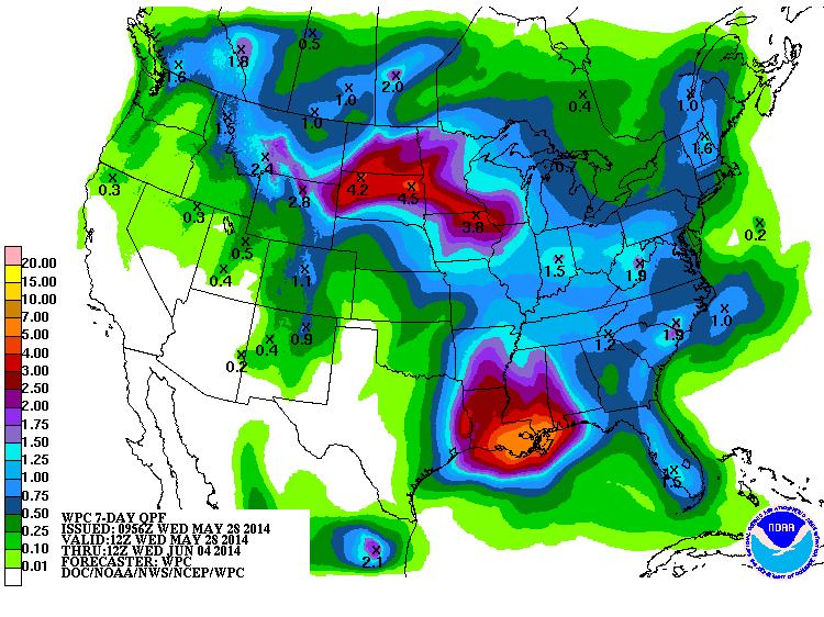
all know just how painful that can be). The rainfall forecast even out to 7
days doesn't show any massive totals either, at least not like what we saw the
last 7 days.


But again, let's just use the old "for all intents and purposes" phrase (or for
us Okies, "for all intensive purposes") and say it is 99% done with the state.
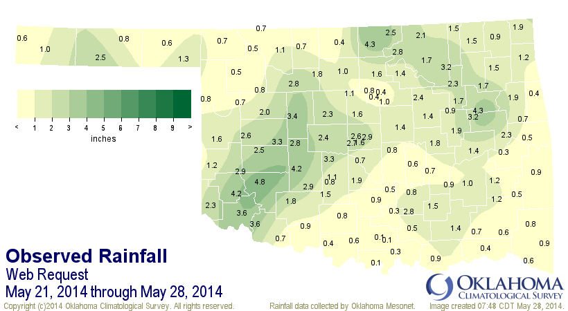
So here's what the near-final rainfall totals from the storm look like, then.
Widespread 3-5 inch amounts across southwestern Oklahoma, not-so-widespread 2-4
inch amounts across northeastern Oklahoma, and just a decent May rainstorm
across other parts. In fact, if you go back to the very first little trickle of
rain from this storm (a blip in Beaver County back on the 21st), you can see
that some folks just plain missed out on the moisture. Really? 0.08 inches,
Newport? A tenth, Burneyville??


-***-
Newport        0.08"             Waurika           0.37"
Burneyville    0.10"             Marena            0.42"
Ardmore        0.11"             Westville         0.42"
Stigler        0.28"             Stillwater        0.43"
Sulphur        0.33"             Byars             0.45"
Madill         0.34"             Tishomingo        0.46"
Medford        0.35"             Freedom           0.48"
Hugo           0.37"             Woodward          0.48"
-****-

Hobart still leads the pack at 4.79".

One of the more remarkable aspects of this storm was its summer-like aspect.
It's not often we see a cutoff low like that in May with the jet stream
retreated to the north leaving it to meander about with nowhere to go. We do
see it from time-to-time as we get later into June and even in the summer (hence
the jet stream northward retreat). Think back to June 2007 and this is the type
of pattern we saw for that entire month thanks to two cutoff low systems. So
very little in the way of severe weather with this storm, just lots of tropical
style rains.

And that leaves us with one of the most tornado-less Mays since accurate records
began back in 1950. So far, only 1 confirmed tornado has touched down in May,
at least according to preliminary NWS data. Now there is the chance that a
storm or two spawned a twister and are currently being investigated, but the
count for May ain't gonna go up much. This also assumes that we don't have some
big outbreak by Sunday, and that doesn't look to be the case. So other than the
big goose egg for May back in 2005, 2014 has seen the least thus far. If we do
add a tornado or two, then we start to look at 1988's 2 and 2012's 3. Several
years had 4.

-***-
Year   May
2005    0
2014    1
1988    2
2012    3
1958    4
2006    4
1967    4
2009    4
-****-

Furthermore, the year's total (again, preliminary) through May 28, and probably
through May itself, stands at 5. That would be the lowest total for January-
May on record. We would have to add two more to match 1988's January-May low
total of 7.

-***-
Year     Jan-May
2014        5
1988        7
1958       10
1989       10
1952       12
1970       13
2002       14
2005       15
1969       15
1974       15
1963       15
-****-

At this time last year, Oklahoma had already seen 45 tornadoes (or would after
the night was over), including a big honking EF5 that went a quarter-mile north
of my house! And by the end of May, 79 twisters had already touched down in
Oklahoma.

So while we deal with droughts and the such here in Oklahoma, this is a drought
I can definitely get behind.

Gary McManus
State Climatologist
Oklahoma Mesonet
Oklahoma Climatological Survey
(405) 325-2253
gmcmanus@mesonet.org
May 28 in Mesonet History
| Record | Value | Station | Year |
|---|---|---|---|
| Maximum Temperature | 105°F | BEAV | 2022 |
| Minimum Temperature | 39°F | KENT | 2016 |
| Maximum Rainfall | 4.53 inches | MANG | 2023 |
Mesonet records begin in 1994.
Search by Date
If you're a bit off, don't worry, because just like horseshoes, “almost” counts on the Ticker website!