Ticker for May 23, 2014
MESONET TICKER ... MESONET TICKER ... MESONET TICKER ... MESONET TICKER ...
May 23, 2014 May 23, 2014 May 23, 2014 May 23, 2014
Nice

Humans of an older variety (sigh) remember the old Oklahoma City TV weatherguy
Fred Norman (sorry, this is the best picture I could find of him).
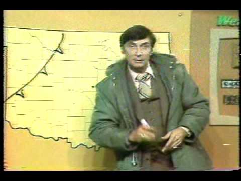
One of his favorite weather sayings was "preview of coming attractions." I'm
betting if he were alive today, he'd approve of that usage in looking at the 48-
hour rainfall accumulation map from the Mesonet.

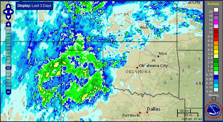
In fact, I think even if the rain went away right now, folks in the Panhandle
would be a little less cantankerous than they have been recently. It's been
fairly spotty down-state, but the Panhandle has received a pretty widespread
half-inch to as much as 2 inches from the looks of it.
Again, a preview of coming attractions. In fact, it's raining now across far
western Oklahoma, and that should continue until about Tuesday or so for the
state.
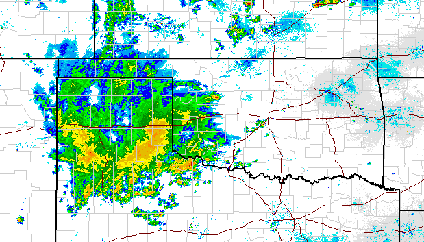
EGADS! What a blog of rainfall out in the Texas Panhandle. That's the type of
radar map we should start to see over Oklahoma as that meandering upper-level
low starts to pull to the east eventually. Just look at the totals they've had
out in the Texas Panhandle, with just a bit of bleed-over into Oklahoma to the
north and east, over the last few days. Those are widespread totals of 2-3
inches (and then some) out that way.
Well, there's still much more to come.
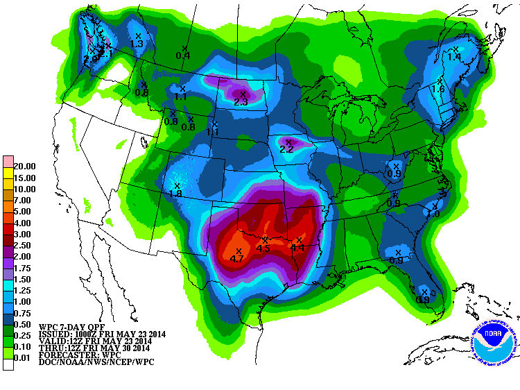
It may look like the highest totals will be down across northern Texas, but with
this synoptic situation, I wouldn't be too sure of that just yet. Even if that
map becomes reality, that still means 3-4 inches across much of Oklahoma.
Yes, this might ruin some Memorial Day plans, but those are the breaks. We need
the rain, and this storm system might be a summer-saver. Without it, our summer
was looking more and more like 2011 and 2012 with unbearable heat, fire danger
and desperately low lake levels. This storm gives us a chance to recharge a bit
and hopefully add some reinforcing rains over the next few weeks before out
typical summer weather sets in.
Sounds like a glorious holiday weekend to me. After all, that's why patios and
movie theaters were invented.
Gary McManus
State Climatologist
Oklahoma Mesonet
Oklahoma Climatological Survey
(405) 325-2253
gmcmanus@mesonet.org
May 23 in Mesonet History
| Record | Value | Station | Year |
|---|---|---|---|
| Maximum Temperature | 112°F | ALTU | 2000 |
| Minimum Temperature | 40°F | EVAX | 2017 |
| Maximum Rainfall | 9.67 inches | VINI | 2011 |
Mesonet records begin in 1994.
Search by Date
If you're a bit off, don't worry, because just like horseshoes, “almost” counts on the Ticker website!