Ticker for May 22, 2014
MESONET TICKER ... MESONET TICKER ... MESONET TICKER ... MESONET TICKER ...
May 22, 2014 May 22, 2014 May 22, 2014 May 22, 2014
Slapped-Out!

Well, we've been talking about it for a week and it's finally here. The "it" is
the large upper-level low bearing down on the Southern Plains, of course, and it
did generate showers and storms last night across the High Plains. One storm
moved up through the Texas Panhandle and scored a direct hit with about a half-
inch of rain at Slapout in Beaver County.

This little storm took Slapout from a statewide maximum of 214 consecutive days
without at least a quarter-inch of rainfall
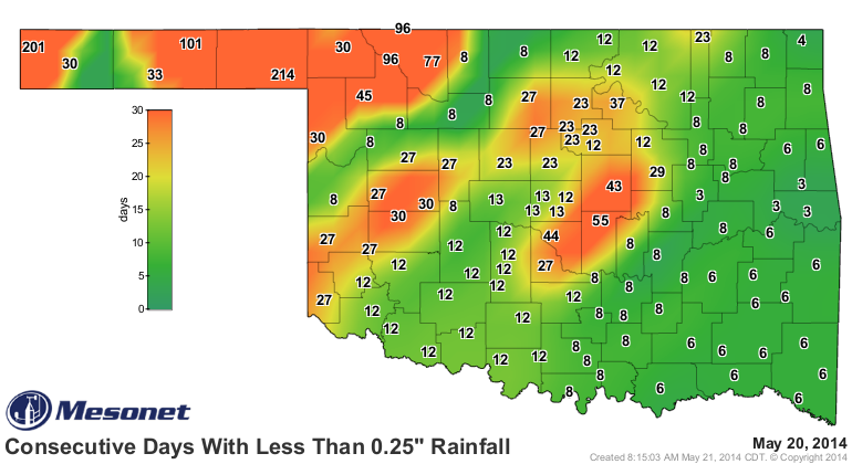
to a statewide minimum of 0 days!
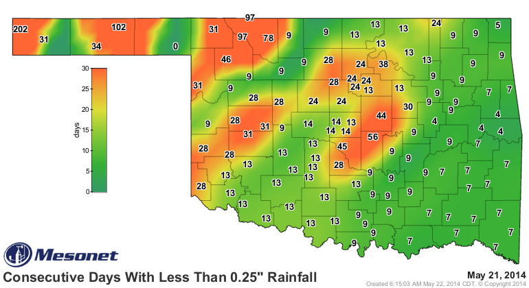
As you can see, though, still plenty of large numbers on that map just waiting
to get eradicated. Kenton's 201 days should be, uhhhhhh, numbered, starting today,
at least according to the rainfall forecasts.
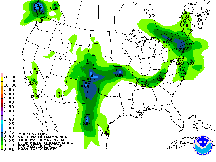
As that big upper-level low lumbers to the east, relatively gargantuan amounts
of rainfall are still being forecast across most of western Oklahoma.
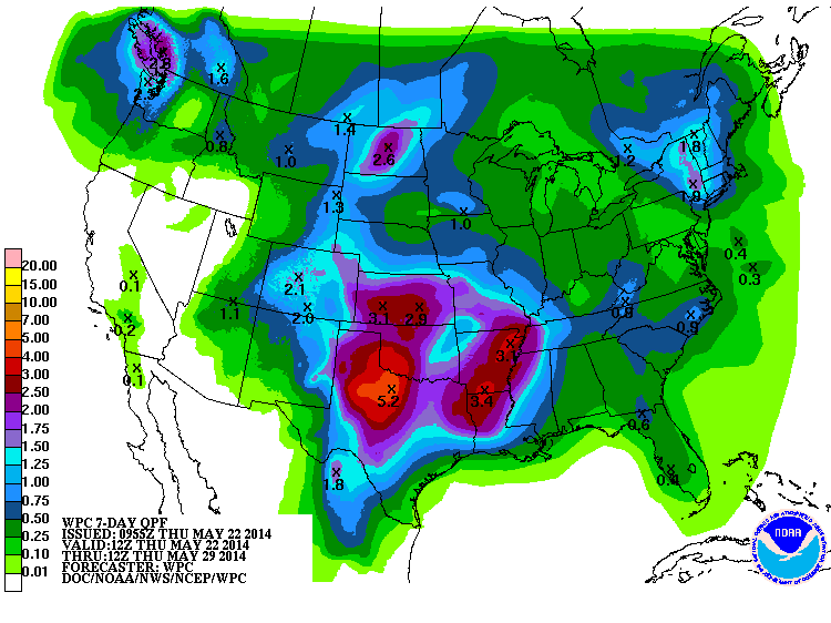
If those rainfall amounts come anywhere close to fruition, it will double (or
more than double) total rainfall amounts since the beginning of the year.
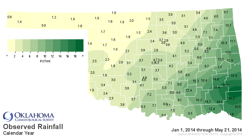
Last night's rain was even more widespread throughout the Texas Panhandle.
Radar/gauge estimated amounts appear to have reached as much as 4 inches east
of Amarillo.
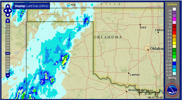
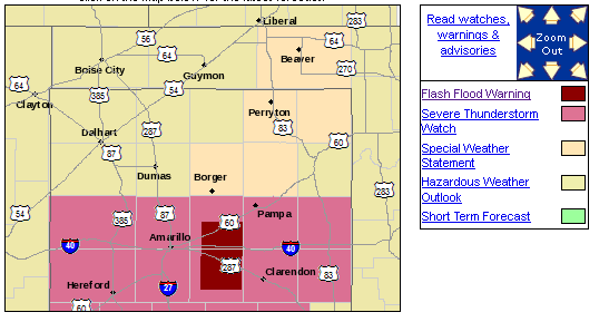
Heck, there were even flash flood warnings out that way last night.
All this rain comes too late to make improvements on this week's U.S. Drought
Monitor map. In fact, with the return of hot, windy weather and the lack of
any moisture, the map actually got worse this week. Remember, we can't look at
forecasts in determining the map. You make the map with what you received (or
didn't) through Tuesday mornings.
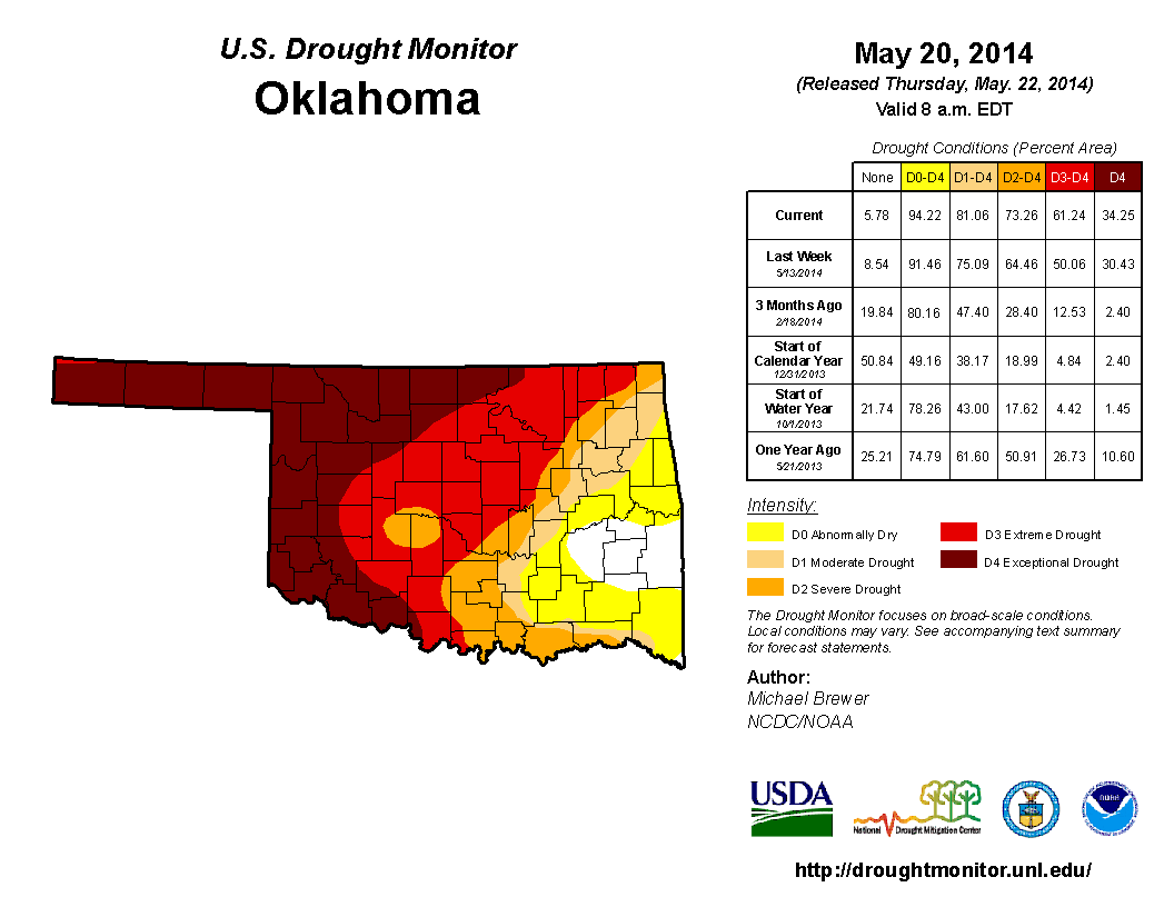
With the record year-to-date dryness across southwestern through northeastern
Oklahoma, the return of dry, hot weather and a destroyed wheat and canola crop
(2 parts drought, maybe 3 ... 1 part late freeze), we had no choice but to
expand each category of drought farther to the east. We now have 61% of the
state covered by at least Extreme (D3) drought, with 34% of that being
Exceptional (D4) drought. Over 81% of the state is in at least Moderate (D1)
drought.
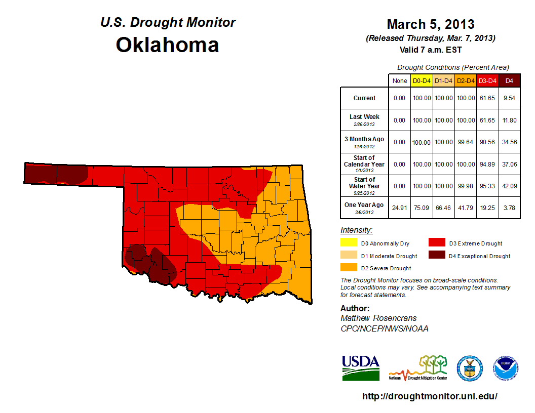
That 61% of at least D3 drought is the highest total in the state since March
5, 2013, as the horribly dry conditions of May 2012-January 2013 were starting
to fade with heavy rainfall.
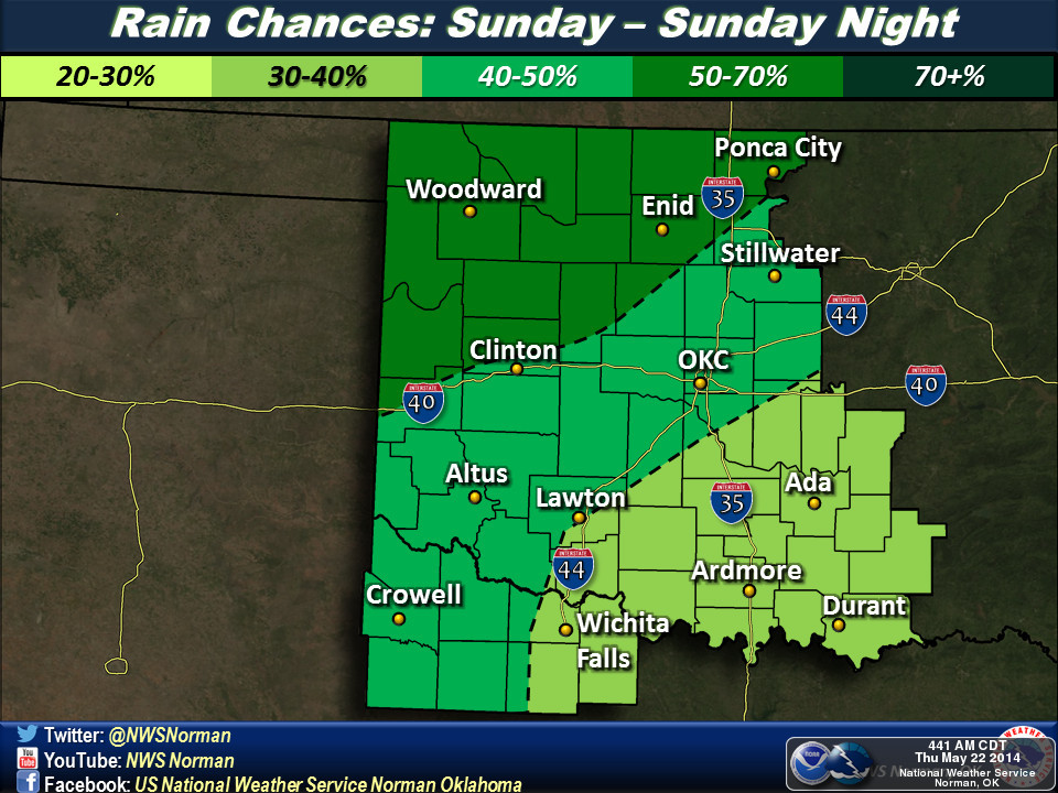
Now we sit back and await the lovely rainfall, which I all but jinxed yesterday
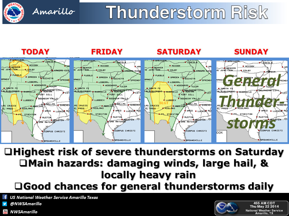
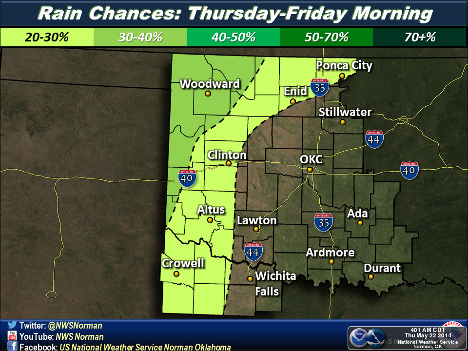
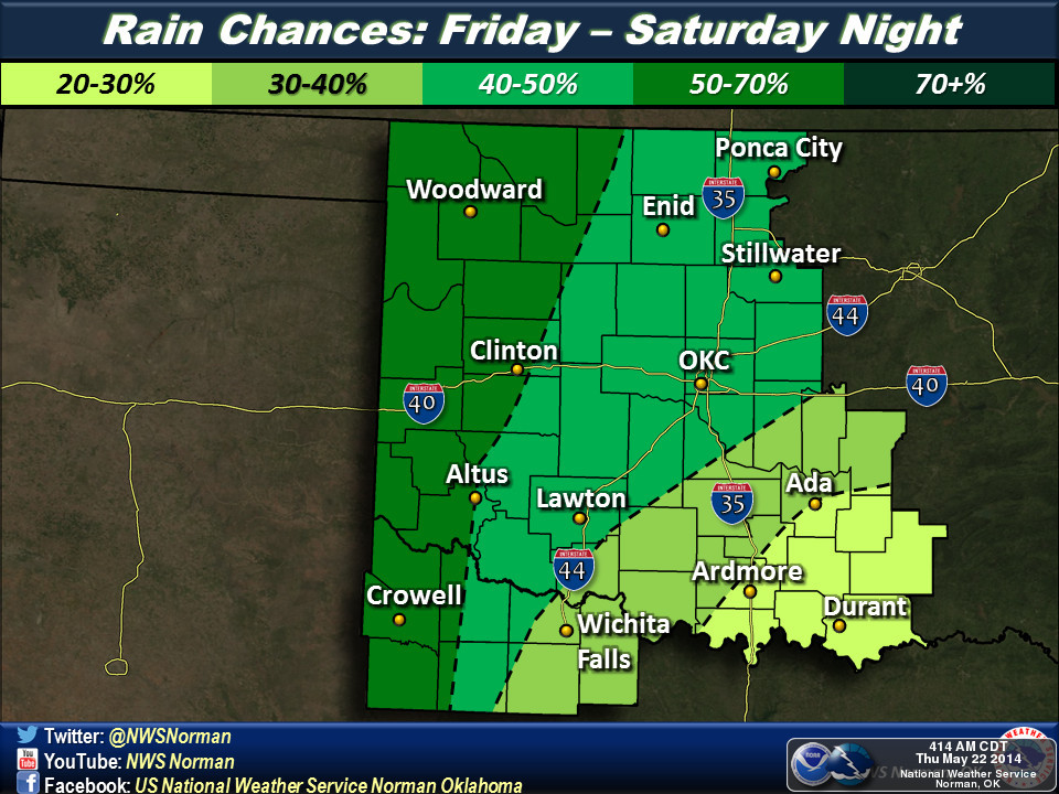
by calling it a sure thing. Here's what our friends at the local NWS offices
are thinking for the event, both short- and medium-term.


That all looks lovely, but so does this. According to the 6-10 day outlook from
the Climate Prediction Center, we might be wet again late into next week as
well!
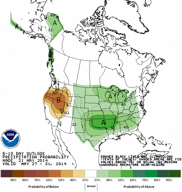
Drought? What drought? Oh, and we might want to cancel that El Nino for next
fall as well. We don't want any flooding problems.
There, how's that for optimism?
Gary McManus
State Climatologist
Oklahoma Mesonet
Oklahoma Climatological Survey
(405) 325-2253
gmcmanus@mesonet.org
May 22 in Mesonet History
| Record | Value | Station | Year |
|---|---|---|---|
| Maximum Temperature | 104°F | ALTU | 2000 |
| Minimum Temperature | 32°F | EVAX | 2019 |
| Maximum Rainfall | 3.92 inches | HOLL | 2016 |
Mesonet records begin in 1994.
Search by Date
If you're a bit off, don't worry, because just like horseshoes, “almost” counts on the Ticker website!